Lampeter is an unincorporated community and census-designated place (CDP) in West Lampeter Township, Lancaster County, Pennsylvania, United States. As of the 2010 census, it had a population of 1,669. It is a suburb of Lancaster and has a ZIP code of 17537. The community was named after Lampeter, in Wales.
| Name: | Lampeter CDP |
|---|---|
| LSAD Code: | 57 |
| LSAD Description: | CDP (suffix) |
| State: | Pennsylvania |
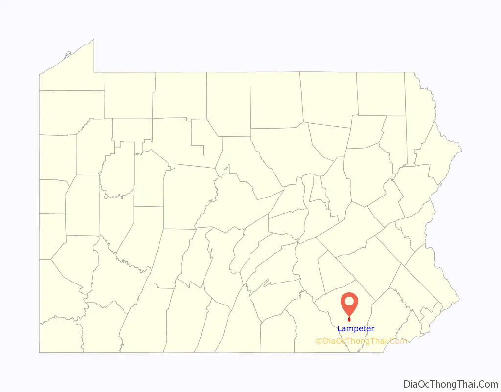
| County: | Lancaster County |
| Elevation: | 407 ft (124 m) |
| Total Area: | 1.72 sq mi (4.45 km²) |
| Land Area: | 1.72 sq mi (4.44 km²) |
| Water Area: | 0.00 sq mi (0.00 km²) |
| Total Population: | 1,737 |
| Population Density: | 1,012.83/sq mi (390.98/km²) |
| ZIP code: | 17537 |
| Area code: | 717 |
| FIPS code: | 4241192 |
| GNISfeature ID: | 1203977 |
Online Interactive Map
Click on ![]() to view map in "full screen" mode.
to view map in "full screen" mode.
Lampeter location map. Where is Lampeter CDP?

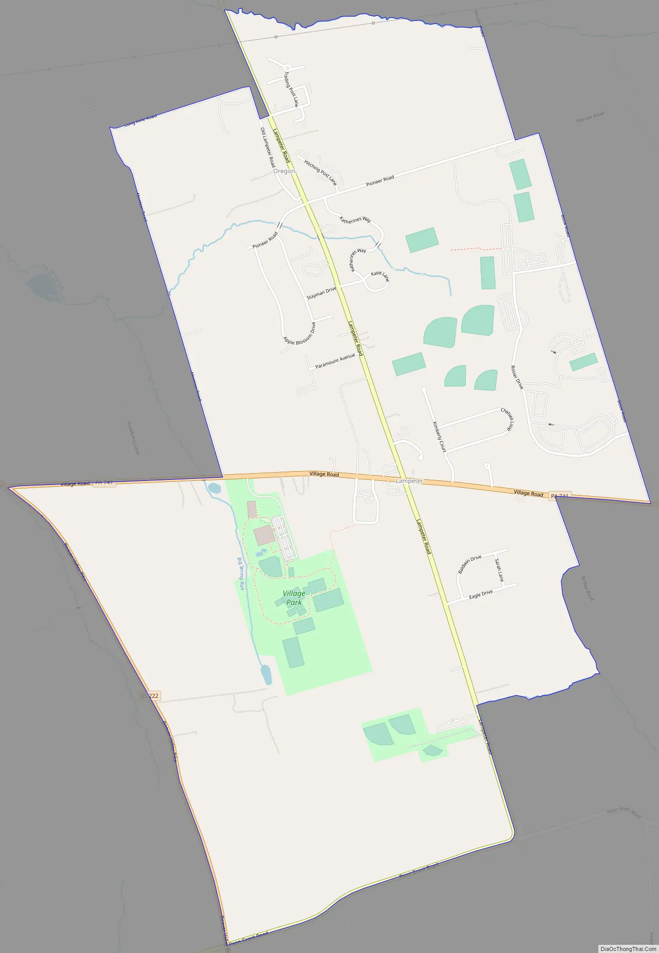
Lampeter Road Map
Lampeter city Satellite Map

Geography
Lampeter is in central Lancaster County, in the eastern part of West Lampeter Township. It is bordered to the west by the Willow Street CDP. Lampeter is 5 miles (8 km) southeast of the center of Lancaster, the county seat. Pennsylvania Route 741 passes through the center of the community, leading east 3 miles (5 km) to Strasburg. U.S. Route 222 forms the western edge of Lampeter, separating it from Willow Street; US 222 leads north into the center of Lancaster and southeast 9 miles (14 km) to Quarryville.
According to the U.S. Census Bureau, the Lampeter CDP has a total area of 1.7 square miles (4.4 km), of which 0.9 acres (3,600 m), or 0.08%, are water. The community drains north via Big Spring Run to Mill Creek, a tributary of the Conestoga River, and south via unnamed streams to Pequea Creek. Both the Conestoga River and Pequea Creek are tributaries of the Susquehanna River.
See also
Map of Pennsylvania State and its subdivision:- Adams
- Allegheny
- Armstrong
- Beaver
- Bedford
- Berks
- Blair
- Bradford
- Bucks
- Butler
- Cambria
- Cameron
- Carbon
- Centre
- Chester
- Clarion
- Clearfield
- Clinton
- Columbia
- Crawford
- Cumberland
- Dauphin
- Delaware
- Elk
- Erie
- Fayette
- Forest
- Franklin
- Fulton
- Greene
- Huntingdon
- Indiana
- Jefferson
- Juniata
- Lackawanna
- Lancaster
- Lawrence
- Lebanon
- Lehigh
- Luzerne
- Lycoming
- Mc Kean
- Mercer
- Mifflin
- Monroe
- Montgomery
- Montour
- Northampton
- Northumberland
- Perry
- Philadelphia
- Pike
- Potter
- Schuylkill
- Snyder
- Somerset
- Sullivan
- Susquehanna
- Tioga
- Union
- Venango
- Warren
- Washington
- Wayne
- Westmoreland
- Wyoming
- York
- Alabama
- Alaska
- Arizona
- Arkansas
- California
- Colorado
- Connecticut
- Delaware
- District of Columbia
- Florida
- Georgia
- Hawaii
- Idaho
- Illinois
- Indiana
- Iowa
- Kansas
- Kentucky
- Louisiana
- Maine
- Maryland
- Massachusetts
- Michigan
- Minnesota
- Mississippi
- Missouri
- Montana
- Nebraska
- Nevada
- New Hampshire
- New Jersey
- New Mexico
- New York
- North Carolina
- North Dakota
- Ohio
- Oklahoma
- Oregon
- Pennsylvania
- Rhode Island
- South Carolina
- South Dakota
- Tennessee
- Texas
- Utah
- Vermont
- Virginia
- Washington
- West Virginia
- Wisconsin
- Wyoming


