Willow Street is an unincorporated community and census-designated place (CDP) in Lancaster County, Pennsylvania, United States. The population was 7,578 at the 2010 census. In the early part of the 20th century, the main thoroughfare in town was lined with willow trees on both sides for the length of the town, hence the community’s name. As time passed and the town grew, the road was widened and sidewalks were installed, which required the trees be removed. Only a few of the original trees remain to this day.
It is the location of the Hans Herr House, the oldest homestead in Lancaster County, and also the Martin Meylin Gunshop, where the long rifle was first made.
| Name: | Willow Street CDP |
|---|---|
| LSAD Code: | 57 |
| LSAD Description: | CDP (suffix) |
| State: | Pennsylvania |
| County: | Lancaster County |
| Elevation: | 482 ft (147 m) |
| Total Area: | 5.46 sq mi (14.14 km²) |
| Land Area: | 5.43 sq mi (14.07 km²) |
| Water Area: | 0.03 sq mi (0.07 km²) |
| Total Population: | 7,578 |
| Population Density: | 1,395/sq mi (538.5/km²) |
| ZIP code: | 17584 |
| Area code: | 717 |
| FIPS code: | 4285464 |
| GNISfeature ID: | 1191509 |
Online Interactive Map
Click on ![]() to view map in "full screen" mode.
to view map in "full screen" mode.
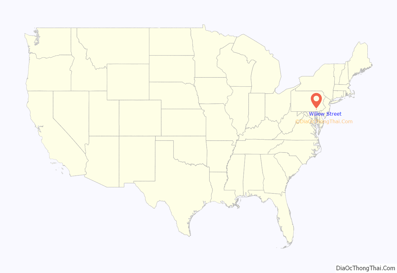
Willow Street location map. Where is Willow Street CDP?

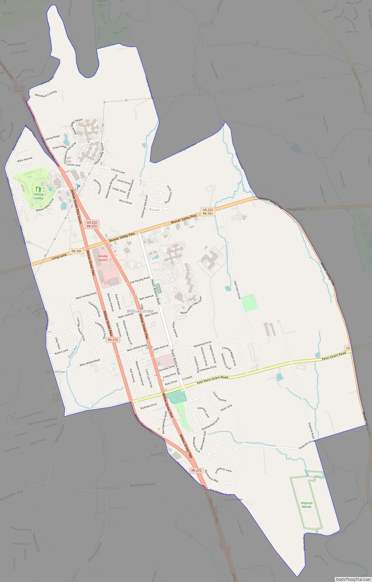
Willow Street Road Map
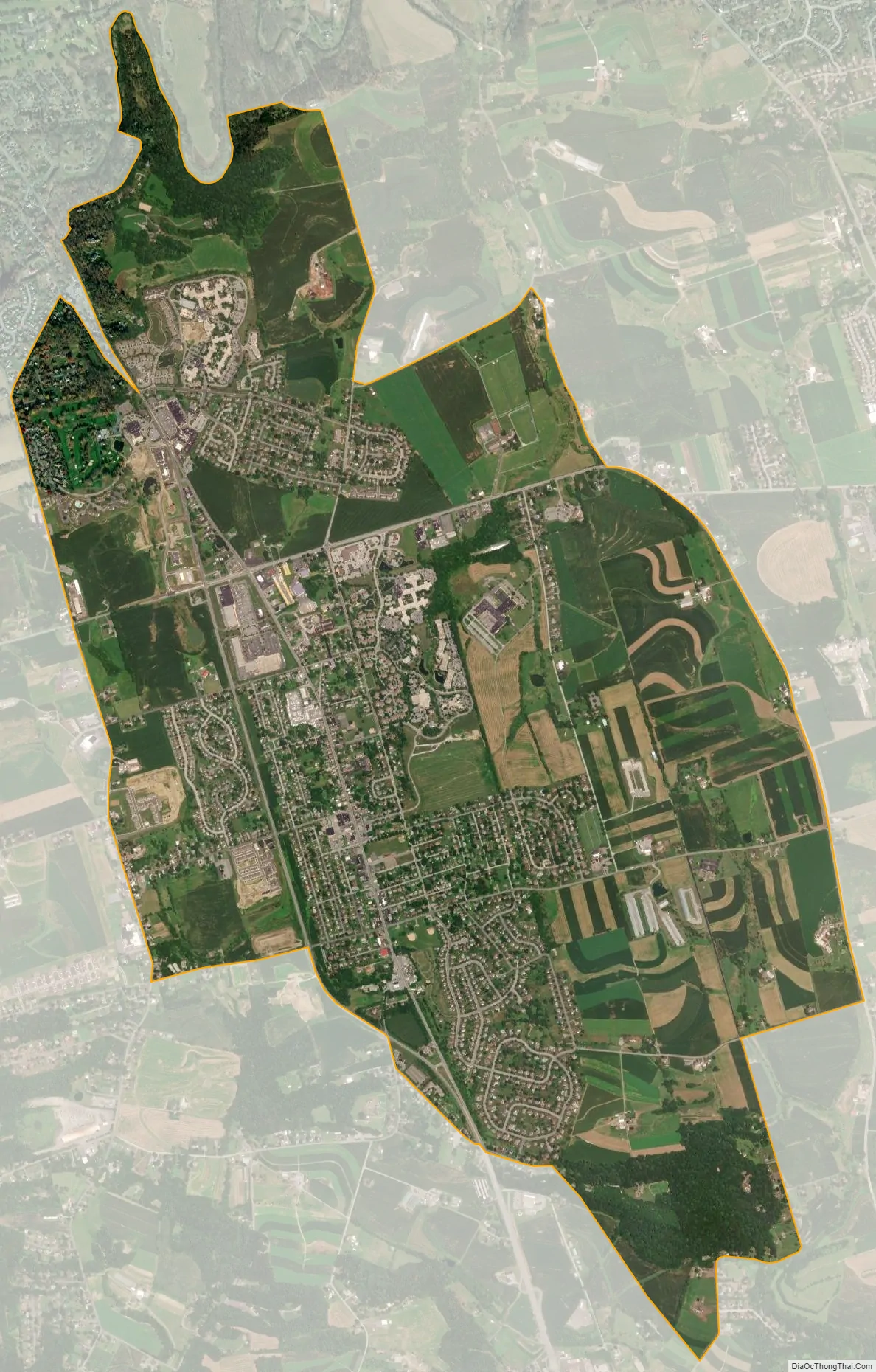
Willow Street city Satellite Map
Geography
Willow Street is located in central Lancaster County at 39°58′41″N 76°16′28″W / 39.977932°N 76.274395°W / 39.977932; -76.274395. It is primarily in West Lampeter Township, with a portion extending west into Pequea Township. It is bordered to the east by the village of Lampeter.
Pennsylvania Route 272 (Willow Street Pike) is the main highway through the community. It is split into two one-way streets, with the northbound lanes following the original main street through the town, and the southbound lanes running four blocks to the west. PA 272 leads north 4 miles (6 km) to the center of Lancaster, the county seat, and south 15 miles (24 km) to Wakefield. U.S. Route 222 joins PA 272 in the north part of the CDP (shown as “Mylin Corners” on USGS topographic maps) and leads north into Lancaster but southeast 10 miles (16 km) to Quarryville.
According to the United States Census Bureau, the CDP has a total area of 5.4 square miles (14.1 km), of which 0.03 square miles (0.07 km), or 0.47%, are water. The community primarily drains north to Mill Creek, a tributary of the Conestoga River, but the southern part of the community drains south to Pequea Creek. The Conestoga and Pequea are both southwest-flowing tributaries of the Susquehanna River.
See also
Map of Pennsylvania State and its subdivision:- Adams
- Allegheny
- Armstrong
- Beaver
- Bedford
- Berks
- Blair
- Bradford
- Bucks
- Butler
- Cambria
- Cameron
- Carbon
- Centre
- Chester
- Clarion
- Clearfield
- Clinton
- Columbia
- Crawford
- Cumberland
- Dauphin
- Delaware
- Elk
- Erie
- Fayette
- Forest
- Franklin
- Fulton
- Greene
- Huntingdon
- Indiana
- Jefferson
- Juniata
- Lackawanna
- Lancaster
- Lawrence
- Lebanon
- Lehigh
- Luzerne
- Lycoming
- Mc Kean
- Mercer
- Mifflin
- Monroe
- Montgomery
- Montour
- Northampton
- Northumberland
- Perry
- Philadelphia
- Pike
- Potter
- Schuylkill
- Snyder
- Somerset
- Sullivan
- Susquehanna
- Tioga
- Union
- Venango
- Warren
- Washington
- Wayne
- Westmoreland
- Wyoming
- York
- Alabama
- Alaska
- Arizona
- Arkansas
- California
- Colorado
- Connecticut
- Delaware
- District of Columbia
- Florida
- Georgia
- Hawaii
- Idaho
- Illinois
- Indiana
- Iowa
- Kansas
- Kentucky
- Louisiana
- Maine
- Maryland
- Massachusetts
- Michigan
- Minnesota
- Mississippi
- Missouri
- Montana
- Nebraska
- Nevada
- New Hampshire
- New Jersey
- New Mexico
- New York
- North Carolina
- North Dakota
- Ohio
- Oklahoma
- Oregon
- Pennsylvania
- Rhode Island
- South Carolina
- South Dakota
- Tennessee
- Texas
- Utah
- Vermont
- Virginia
- Washington
- West Virginia
- Wisconsin
- Wyoming


