Ohioville is a borough in western Beaver County, Pennsylvania, United States. The population was 3,345 at the 2020 census. It is part of the Pittsburgh metropolitan area.
| Name: | Ohioville borough |
|---|---|
| LSAD Code: | 21 |
| LSAD Description: | borough (suffix) |
| State: | Pennsylvania |
| County: | Beaver County |
| Incorporated: | 1860 |
| Elevation: | 1,253 ft (382 m) |
| Total Area: | 23.69 sq mi (61.36 km²) |
| Land Area: | 23.34 sq mi (60.44 km²) |
| Water Area: | 0.35 sq mi (0.92 km²) |
| Total Population: | 3,349 |
| Population Density: | 143.51/sq mi (55.41/km²) |
| Area code: | 724 |
| FIPS code: | 4256432 |
| Website: | ohiovilleboro.org |
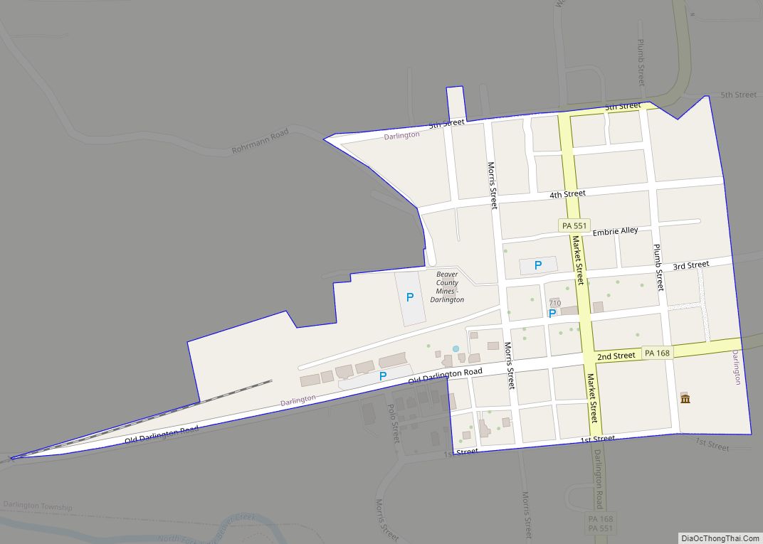
Online Interactive Map
Click on ![]() to view map in "full screen" mode.
to view map in "full screen" mode.
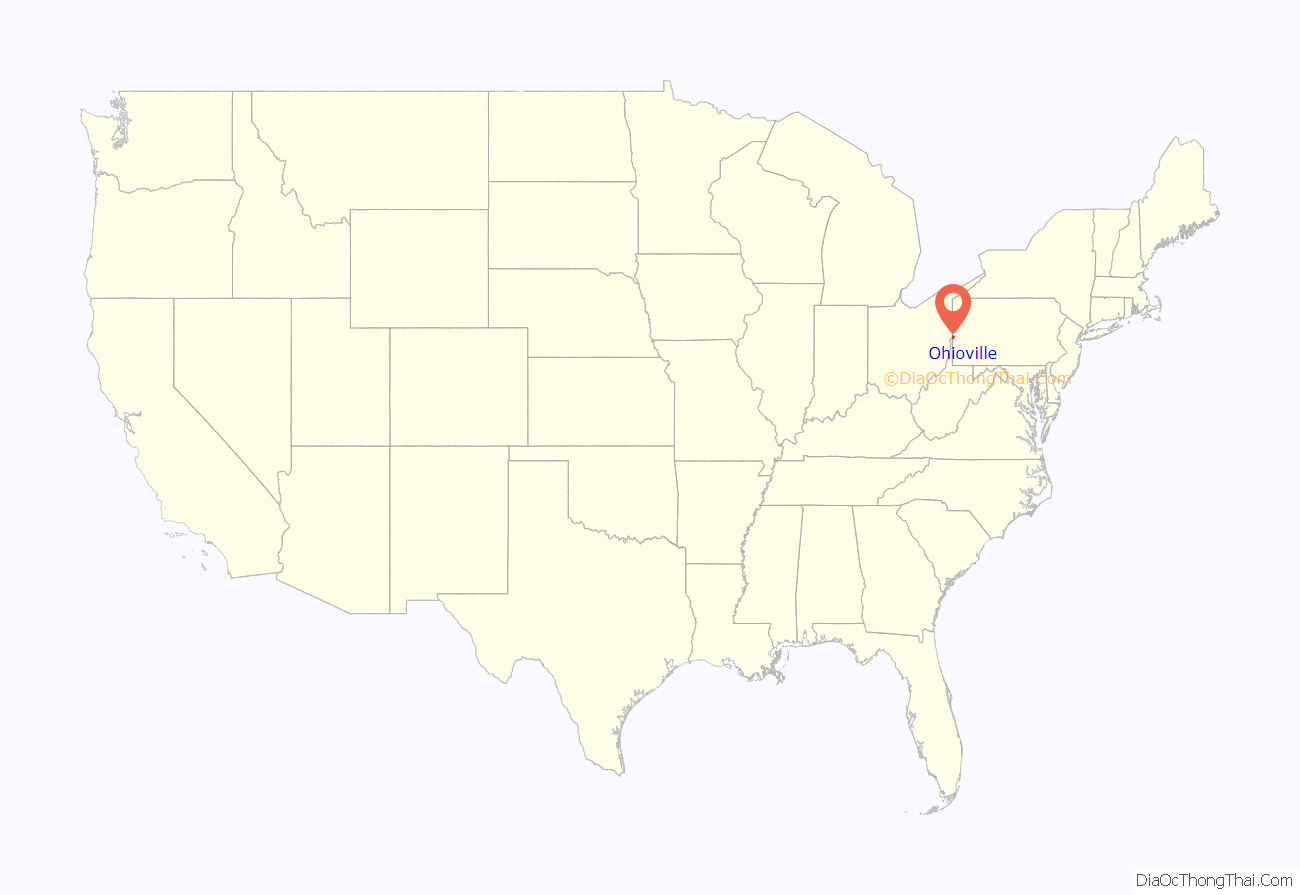
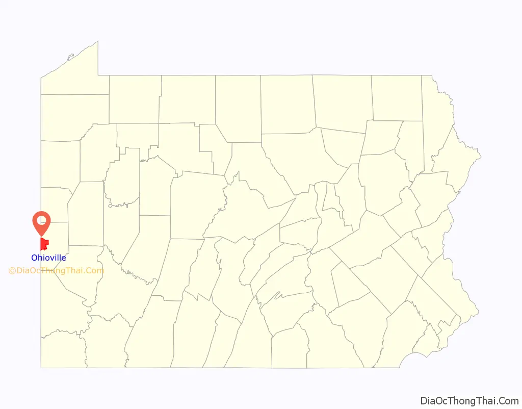
Ohioville location map. Where is Ohioville borough?
History
Ohioville was originally Ohio Township, formed in 1805 from parts of South Beaver Township. The region had, in years past, been home to numerous tribes of Native Americans, most notably the Archaic and Woodland periods, of Iroquionian extraction. Prior to William Penn’s arrival in eastern Pennsylvania, the Iroquois tribe of the Five Nations used the region for hunting.
Ohio Township was once home to a ferry run by Maryland native Thomas Smith. This ferry transported passengers from the north side of the Ohio to the south, and back again. Near the ferry, a spring of “bituminous oil” arose that would play a crucial role in the township’s development. At one time there were also several Indian pictographs. (These are currently underwater.)
Early communities
Blackhawk village was a small community on the South Beaver Township line. Its first post office was established sometime after 1837. Even earlier, the New Salem United Presbyterian Church was established circa 1798, around the same time as Big Beaver’s Mount Pleasant Church.
In 1811, Four Mile United Presbyterian Church was founded. Located on Tuscarawas Road (whose name derives from the old Tuscarora hunting trail), the church was originally named Four Mile Square Church.
In 1816, Ohioville lost some of its territory to Brighton Township. With the establishment of Glasgow borough (1854), Industry Township (1856), and Midland (1906), even more land was lost.
In 1960, Ohio Township was incorporated as Ohioville Borough.
Ohioville Road Map
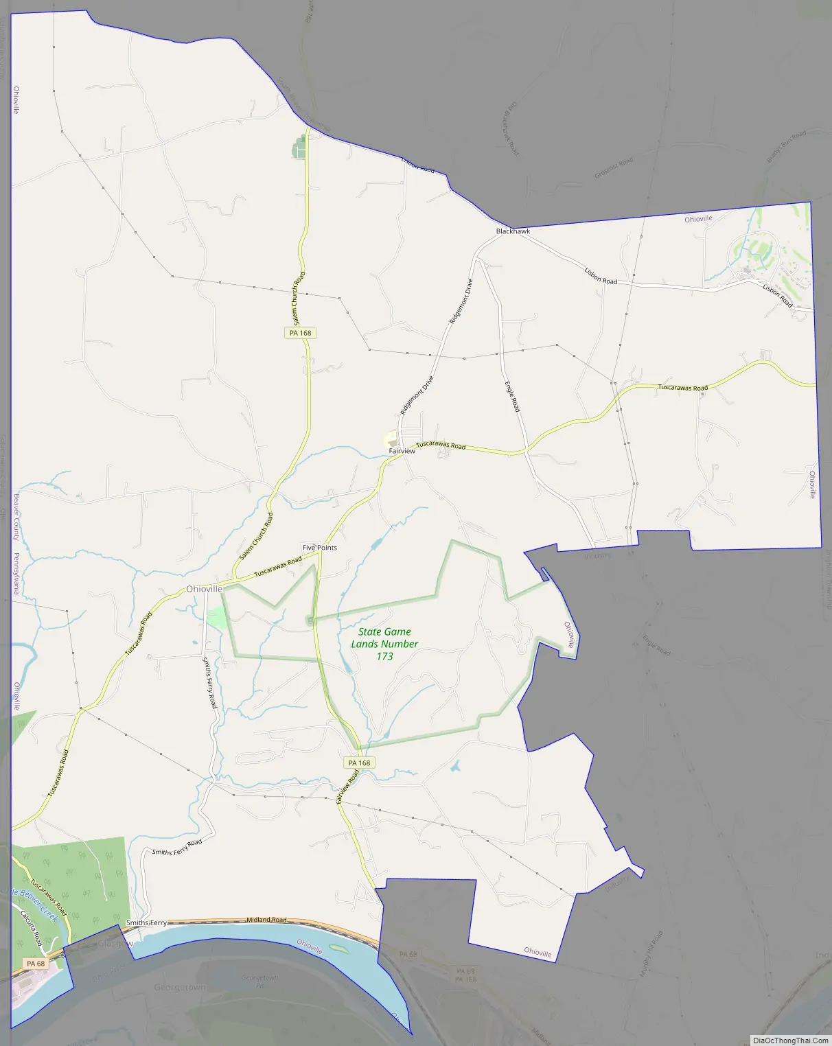
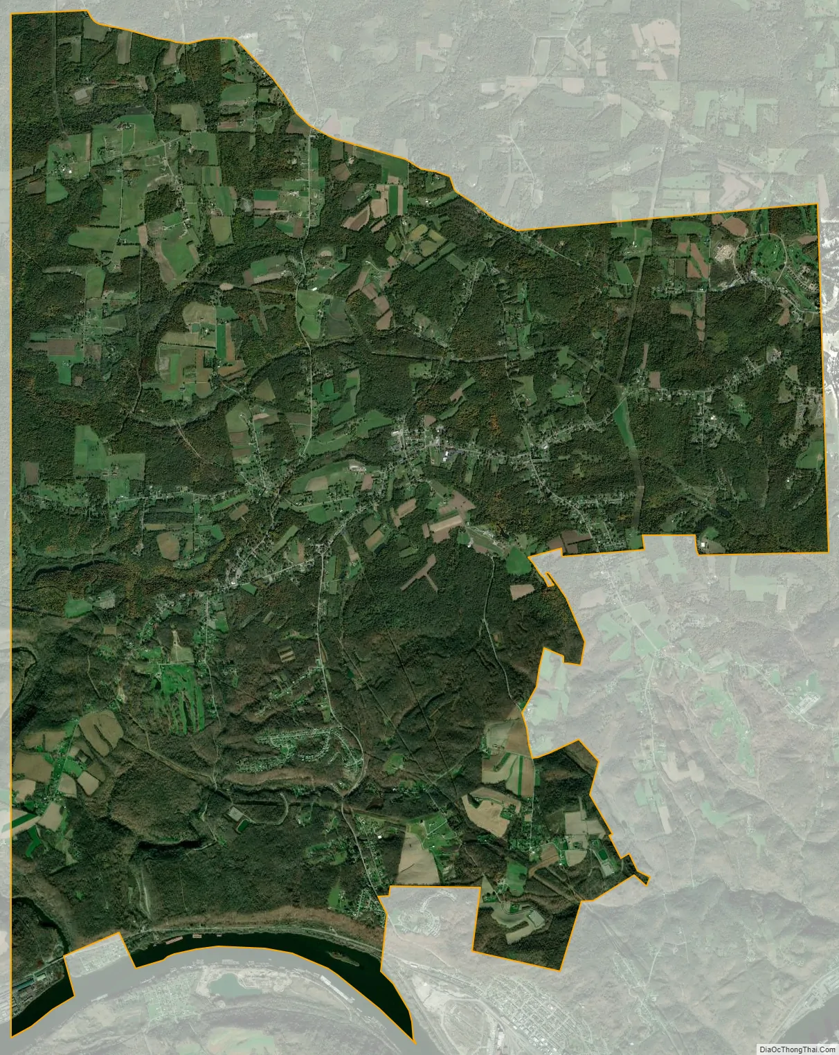
Ohioville city Satellite Map
Geography
Ohioville is located in western Beaver County at 40°40′46″N 80°28′17″W / 40.67944°N 80.47139°W / 40.67944; -80.47139 (40.679398, -80.471512), in part along the Ohio River.
Pennsylvania Route 168 is the main road through the township, running south into Midland and north to Darlington and New Galilee. Pennsylvania Route 68 runs along the Ohio River in the southern part of the borough, between Midland to the east and Glasgow, Pennsylvania, and East Liverpool, Ohio, to the west.
According to the United States Census Bureau, the borough has a total area of 23.7 square miles (61.4 km), of which 23.3 square miles (60.4 km) is land and 0.35 square miles (0.9 km), or 1.50%, is water.
Surrounding neighborhoods
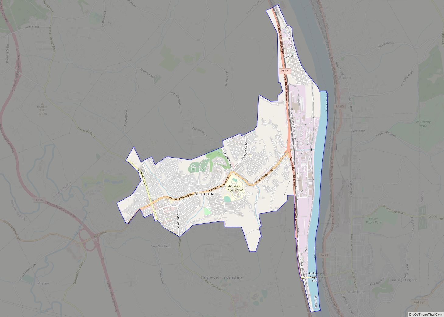
Ohioville has nine land borders, including South Beaver Township to the north, Brighton Township to the east, Industry to the southeast, Midland to the south Glasgow to the south-southwest, and the Columbiana County, Ohio neighborhoods of East Liverpool and Liverpool Township to the southwest, St. Clair Township to the west, and Middleton Township to the northwest.
Across the Ohio River to the south, Ohioville runs adjacent with Georgetown and Greene Township.
See also
Map of Pennsylvania State and its subdivision:- Adams
- Allegheny
- Armstrong
- Beaver
- Bedford
- Berks
- Blair
- Bradford
- Bucks
- Butler
- Cambria
- Cameron
- Carbon
- Centre
- Chester
- Clarion
- Clearfield
- Clinton
- Columbia
- Crawford
- Cumberland
- Dauphin
- Delaware
- Elk
- Erie
- Fayette
- Forest
- Franklin
- Fulton
- Greene
- Huntingdon
- Indiana
- Jefferson
- Juniata
- Lackawanna
- Lancaster
- Lawrence
- Lebanon
- Lehigh
- Luzerne
- Lycoming
- Mc Kean
- Mercer
- Mifflin
- Monroe
- Montgomery
- Montour
- Northampton
- Northumberland
- Perry
- Philadelphia
- Pike
- Potter
- Schuylkill
- Snyder
- Somerset
- Sullivan
- Susquehanna
- Tioga
- Union
- Venango
- Warren
- Washington
- Wayne
- Westmoreland
- Wyoming
- York
- Alabama
- Alaska
- Arizona
- Arkansas
- California
- Colorado
- Connecticut
- Delaware
- District of Columbia
- Florida
- Georgia
- Hawaii
- Idaho
- Illinois
- Indiana
- Iowa
- Kansas
- Kentucky
- Louisiana
- Maine
- Maryland
- Massachusetts
- Michigan
- Minnesota
- Mississippi
- Missouri
- Montana
- Nebraska
- Nevada
- New Hampshire
- New Jersey
- New Mexico
- New York
- North Carolina
- North Dakota
- Ohio
- Oklahoma
- Oregon
- Pennsylvania
- Rhode Island
- South Carolina
- South Dakota
- Tennessee
- Texas
- Utah
- Vermont
- Virginia
- Washington
- West Virginia
- Wisconsin
- Wyoming