Strasburg is a borough in Lancaster County, Pennsylvania, United States. It developed as a linear village stretching approximately 2 miles (3 km) along the Great Conestoga Road, later known as the Strasburg Road. The population was 3,117 at the 2020 census.
The town was named after the French city of Strasbourg, the native home of an early settler. The town is often called “Train Town USA” because of the many railroad attractions in and around town, including the Strasburg Rail Road and the Railroad Museum of Pennsylvania. Much of the movie Witness was filmed on a farm nearby. Much of the borough was listed as a historic district by the National Register of Historic Places in 1983.
| Name: | Strasburg borough |
|---|---|
| LSAD Code: | 21 |
| LSAD Description: | borough (suffix) |
| State: | Pennsylvania |
| County: | Lancaster County |
| Elevation: | 463 ft (141 m) |
| Total Area: | 0.96 sq mi (2.49 km²) |
| Land Area: | 0.96 sq mi (2.48 km²) |
| Water Area: | 0.00 sq mi (0.01 km²) |
| Total Population: | 3,117 |
| Population Density: | 3,257.05/sq mi (1,256.98/km²) |
| ZIP code: | 17579 |
| Area code: | 717 and 223 |
| FIPS code: | 4274712 |
| Website: | strasburgboro.org |
Online Interactive Map
Click on ![]() to view map in "full screen" mode.
to view map in "full screen" mode.
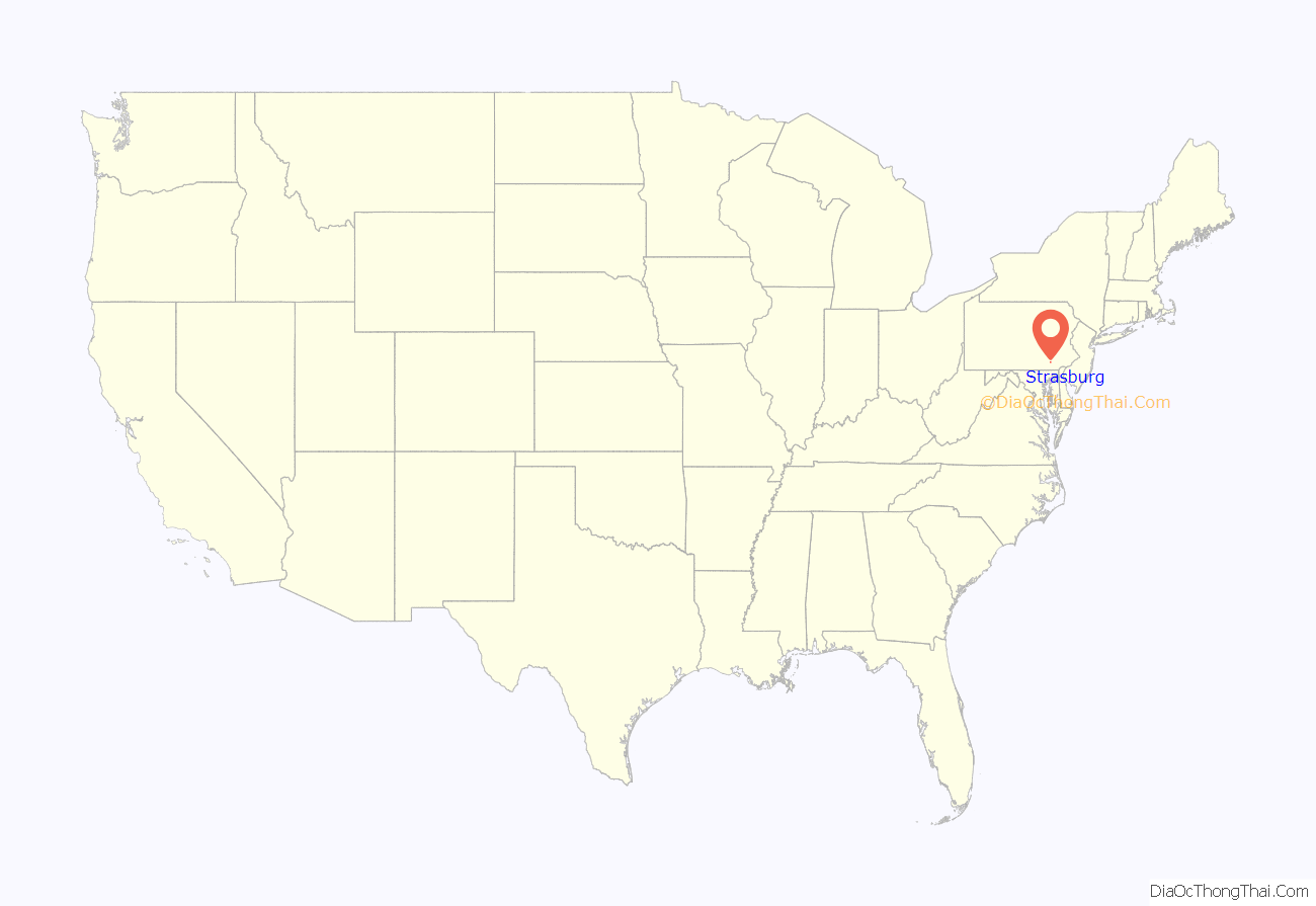
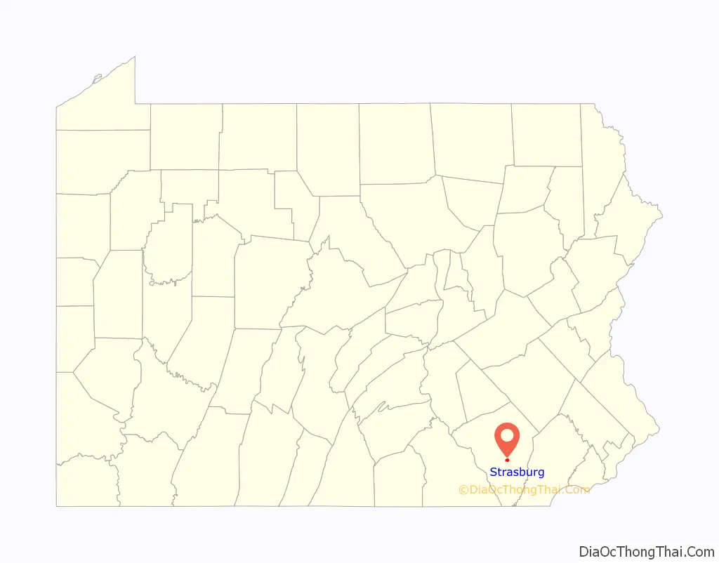
Strasburg location map. Where is Strasburg borough?
History
The Old Conestoga Road was in use by 1714, and by 1750 a tavern and some log houses were built near the current site of Strasburg. The community grew as regional trade with Philadelphia grew. By 1759, there were 32 taxable properties in the town, including about ten hotels. Many early settlers were Huguenots or Swiss or German Mennonites, and several church congregations of various faiths formed during the 1760s. The first church was built in 1807 by Methodists.
The Old Conestoga Road was the main path connecting Philadelphia with areas to the west, but in 1792 the new Philadelphia and Lancaster Turnpike was built, bypassing Strasburg 4 miles (6 km) to the north. However, in 1793 construction on the new Strasburg Road started, roughly following the old road, passing through West Chester on the way to Philadelphia. It attracted traffic because it was not a toll road, unlike the Philadelphia Turnpike. This road later developed into Pennsylvania Route 741.
By 1815, there were 90 houses in Strasburg, about half of which were two stories, indicating a relatively well-off population. There were 53 log, 29 brick, and four limestone houses. About half of the log houses survive today, as well as 12 of the brick houses and all four of the stone houses. About 150 other houses stand in the historic district, nearly all built before 1900.
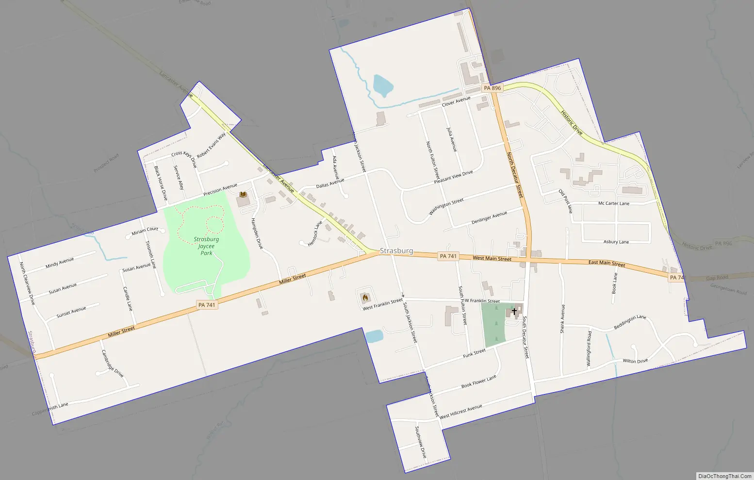
Strasburg Road Map
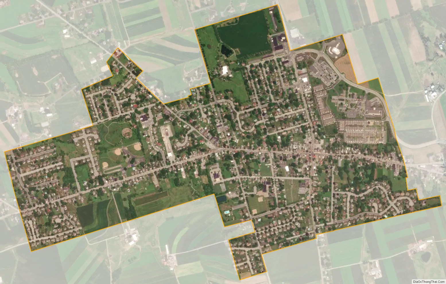
Strasburg city Satellite Map
Geography
Strasburg is located in central Lancaster County at 39°58′56″N 76°10′58″W / 39.98222°N 76.18278°W / 39.98222; -76.18278 (39.982300, -76.182713). Pennsylvania Route 741 (Main Street) passes through the center of the borough, leading east 9 miles (14 km) to Gap and west 5.5 miles (8.9 km) to Willow Street. Pennsylvania Route 896 crosses the northeast side of Strasburg; it leads north 3 miles (5 km) to U.S. Route 30 and southeast 20 miles (32 km) to U.S. Route 1. Lancaster, the county seat, is 8 miles (13 km) northwest of Strasburg.
According to the United States Census Bureau, the borough has a total area of 1.0 square mile (2.6 km), of which 0.003 square miles (0.008 km), or 0.31%, are water. Strasburg is in the watershed of Pequea Creek, which flows southwest to the Susquehanna River.
See also
Map of Pennsylvania State and its subdivision:- Adams
- Allegheny
- Armstrong
- Beaver
- Bedford
- Berks
- Blair
- Bradford
- Bucks
- Butler
- Cambria
- Cameron
- Carbon
- Centre
- Chester
- Clarion
- Clearfield
- Clinton
- Columbia
- Crawford
- Cumberland
- Dauphin
- Delaware
- Elk
- Erie
- Fayette
- Forest
- Franklin
- Fulton
- Greene
- Huntingdon
- Indiana
- Jefferson
- Juniata
- Lackawanna
- Lancaster
- Lawrence
- Lebanon
- Lehigh
- Luzerne
- Lycoming
- Mc Kean
- Mercer
- Mifflin
- Monroe
- Montgomery
- Montour
- Northampton
- Northumberland
- Perry
- Philadelphia
- Pike
- Potter
- Schuylkill
- Snyder
- Somerset
- Sullivan
- Susquehanna
- Tioga
- Union
- Venango
- Warren
- Washington
- Wayne
- Westmoreland
- Wyoming
- York
- Alabama
- Alaska
- Arizona
- Arkansas
- California
- Colorado
- Connecticut
- Delaware
- District of Columbia
- Florida
- Georgia
- Hawaii
- Idaho
- Illinois
- Indiana
- Iowa
- Kansas
- Kentucky
- Louisiana
- Maine
- Maryland
- Massachusetts
- Michigan
- Minnesota
- Mississippi
- Missouri
- Montana
- Nebraska
- Nevada
- New Hampshire
- New Jersey
- New Mexico
- New York
- North Carolina
- North Dakota
- Ohio
- Oklahoma
- Oregon
- Pennsylvania
- Rhode Island
- South Carolina
- South Dakota
- Tennessee
- Texas
- Utah
- Vermont
- Virginia
- Washington
- West Virginia
- Wisconsin
- Wyoming


