Brentwood is a city in Williamson County, Tennessee, United States. The population was 45,373 as of the 2020 United States census. It is a suburb of Nashville and included in the Nashville metropolitan area.
| Name: | Brentwood city |
|---|---|
| LSAD Code: | 25 |
| LSAD Description: | city (suffix) |
| State: | Tennessee |
| County: | Williamson County |
| Incorporated: | 1969 |
| Elevation: | 745 ft (227 m) |
| Total Area: | 41.52 sq mi (107.53 km²) |
| Land Area: | 41.47 sq mi (107.41 km²) |
| Water Area: | 0.04 sq mi (0.11 km²) |
| Total Population: | 45,373 |
| Population Density: | 1,094.04/sq mi (422.41/km²) |
| Area code: | 615/629 |
| FIPS code: | 4708280 |
| GNISfeature ID: | 1278282 |
| Website: | www.brentwoodtn.gov |
Online Interactive Map
Click on ![]() to view map in "full screen" mode.
to view map in "full screen" mode.
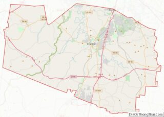
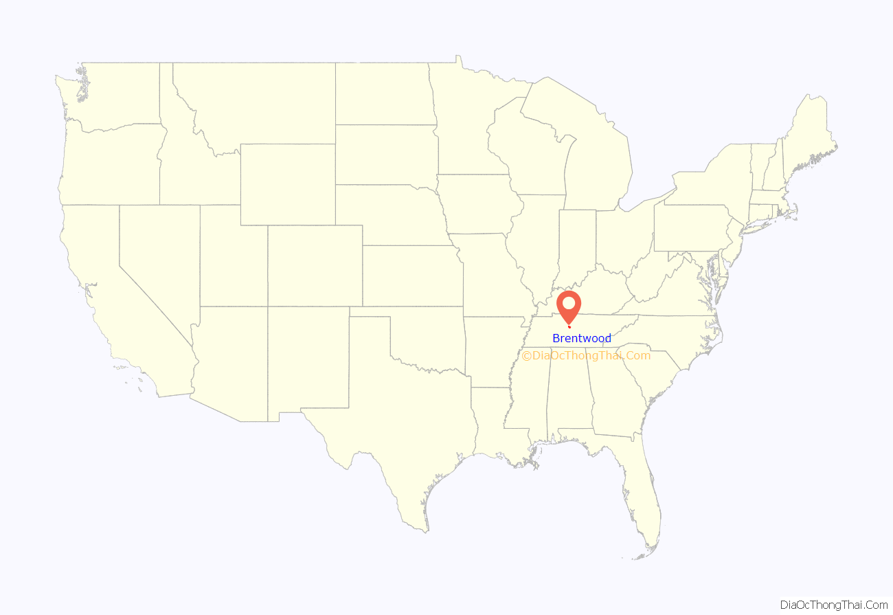
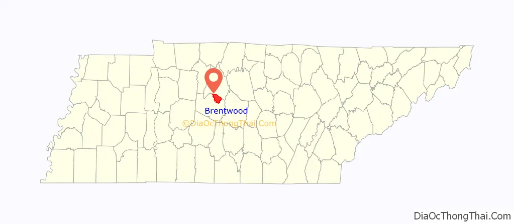
Brentwood location map. Where is Brentwood city?
History
Successive cultures of prehistoric Native Americans occupied this area for thousands of years. In the first millennium of the Common Era (CE), Mississippian culture people, known locally as the Mound Indians or Stone Box Indians, built complex earthwork mounds topped with ceremonial buildings. Their settlement was part of a culture that throughout the Mississippi Valley and its major tributaries, and traded with other groups across the continent.
Artifacts and mounds of the Mississippian culture have been found during development in the Meadowlake subdivision, and at the library site on Concord Road. Primm Historic Park contains and preserves the largest of the earthwork mounds, which is still visible today. By 1300 these people had largely abandoned this settlement; archeologists have struggled to determine the reasons. There may have been epidemic disease, environmental problems, or warfare with other tribes.
European-American settlement
When early European-American settlers arrived in this area in the late 1700s from east of the Appalachian Mountains, it was largely being used as a hunting ground by Native American tribes from Georgia and Alabama. This resulted in many conflicts as the whites encroached on their territory and competed for their resources. In 1786, soon after the United States gained independence, Creek or Cherokee warriors raided the Mayfield family fort, at a site that is now the intersection of Wilson Pike and Old Smyrna Road. Southerland Mayfield and two other men were killed, and the boy George Mayfield was taken captive. One of the Creek families adopted him, as was their practice with war captives. Most Native American tribes adopted young captives to replace individuals they had lost to illness or warfare. After ten years, George Mayfield was returned to European-American society.
Some of the first European-American families here were those headed by James Sneed, Robert Irvin Moore, Thomas Hardeman, Gersham Hunt, Samuel and Andrew Crockett, and John Edmondson, who arrived well before 1800. The Holts, Herberts, Frosts, Hadleys, Hightowers, McGavocks, and Owens soon followed. Many of these families had received land grants in this area because of the men’s service in the Virginia or North Carolina militia during the Revolutionary War. Many of these families’ historic homes have been preserved and may be seen in the 21st century.
What is now called the Cool Springs House in Crockett Park, was first owned by Dr. Robert Carothers and his wife Martha Crockett. They built it at where the intersection of Mallory Lane and Cool Springs Boulevard is now located. Through the years, it passed through numerous owners and renovations. In 1974, the city of Brentwood moved the house to its current location of Crockett Park. Its former site was in an area of rapid growth and development that threatened preservation of the historic asset.
The Frost place on Old Smyrna Road was a center of frontier businesses, with a general store, grist mill, and post office soon developed located there. Settlers planted churches, predominately Methodist, and built up community life. When the railroad was constructed through this area, it established a depot in the town. The city realigned around the depot, which was the link to the newest form of transportation. It became the center of commerce for the present downtown area. The village of Brentwood thrived as the area was developed for cotton plantations.
Civil War
During the American Civil War, on March 25, 1863, Confederate Brig. Gen. Nathan Bedford Forrest led a column of men into Union-controlled Brentwood, intent on recapturing this section of the Nashville & Decatur Railroad. Forrest performed a quick sneak attack on Union Lt. Col. Edward Bloodgood. Forrest had cut the telegraph wires, isolating Bloodgood as he brought in heavy artillery. Bloodgood surrendered Brentwood that day, which was a significant loss for the Federals. Overall, there were 305 Union and 6 Confederate casualties. Much of Brentwood was destroyed in the battle.
After the Civil War, many of the large plantations were sold or had plots leased to freedmen sharecroppers and tenant farmers. Smaller farms dotted the countryside. Tobacco became the commodity crop of choice. The population was stable for almost 100 years.
20th century to present
In the 1930s, even during the Great Depression, Brentwood began to rebound. One by one, businessmen and merchants from Nashville bought the former plantation houses. They began to revive fox hunting on their estates and raise quality horses.
On April 15, 1969, Brentwood incorporated as a city. That same year the interstate was built through the area, ushering a new period of residential and commercial growth. It made commuting easier for people who worked in Nashville and wanted to live in newer housing. The Maryland Farms office complex was built a few years later on what was once an American Saddle Horse farm and race track. The Brentwood Derby was run there until the mid 1970s.
Development has continued as Nashville has expanded its economy. In August 2016, developers announced a $270 million project in the Cool Springs area. It was to include commercial, hotel and retail development.
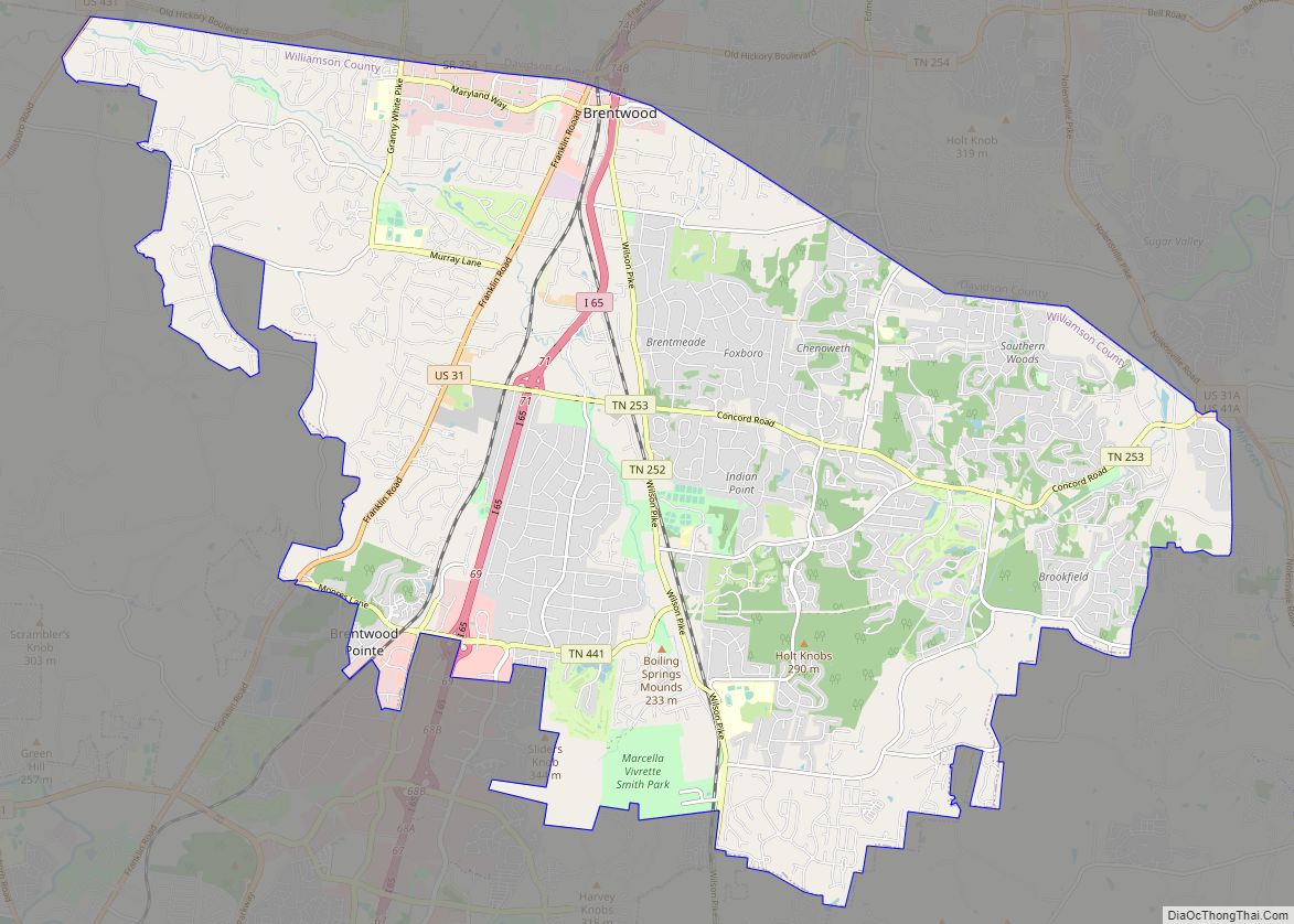
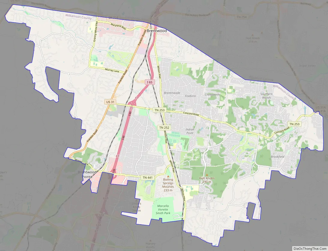
Brentwood Road Map
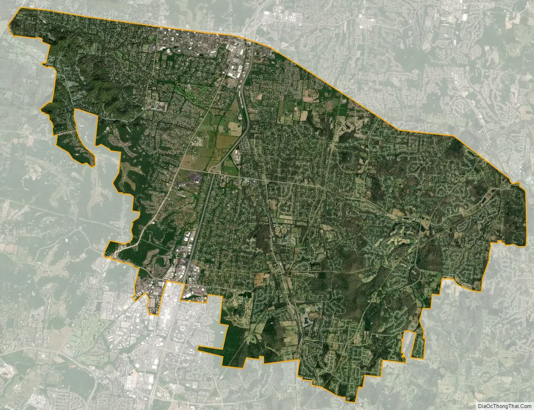
Brentwood city Satellite Map
Geography
As of the 2000 census, Brentwood had a land area of 35.4 square miles (92 km), but an annexation in 2001 increased the area to 40.8 square miles (106 km). In 2010, it was found that Brentwood had a population density of 899.9 per square mile.
See also
Map of Tennessee State and its subdivision:- Anderson
- Bedford
- Benton
- Bledsoe
- Blount
- Bradley
- Campbell
- Cannon
- Carroll
- Carter
- Cheatham
- Chester
- Claiborne
- Clay
- Cocke
- Coffee
- Crockett
- Cumberland
- Davidson
- Decatur
- DeKalb
- Dickson
- Dyer
- Fayette
- Fentress
- Franklin
- Gibson
- Giles
- Grainger
- Greene
- Grundy
- Hamblen
- Hamilton
- Hancock
- Hardeman
- Hardin
- Hawkins
- Haywood
- Henderson
- Henry
- Hickman
- Houston
- Humphreys
- Jackson
- Jefferson
- Johnson
- Knox
- Lake
- Lauderdale
- Lawrence
- Lewis
- Lincoln
- Loudon
- Macon
- Madison
- Marion
- Marshall
- Maury
- McMinn
- McNairy
- Meigs
- Monroe
- Montgomery
- Moore
- Morgan
- Obion
- Overton
- Perry
- Pickett
- Polk
- Putnam
- Rhea
- Roane
- Robertson
- Rutherford
- Scott
- Sequatchie
- Sevier
- Shelby
- Smith
- Stewart
- Sullivan
- Sumner
- Tipton
- Trousdale
- Unicoi
- Union
- Van Buren
- Warren
- Washington
- Wayne
- Weakley
- White
- Williamson
- Wilson
- Alabama
- Alaska
- Arizona
- Arkansas
- California
- Colorado
- Connecticut
- Delaware
- District of Columbia
- Florida
- Georgia
- Hawaii
- Idaho
- Illinois
- Indiana
- Iowa
- Kansas
- Kentucky
- Louisiana
- Maine
- Maryland
- Massachusetts
- Michigan
- Minnesota
- Mississippi
- Missouri
- Montana
- Nebraska
- Nevada
- New Hampshire
- New Jersey
- New Mexico
- New York
- North Carolina
- North Dakota
- Ohio
- Oklahoma
- Oregon
- Pennsylvania
- Rhode Island
- South Carolina
- South Dakota
- Tennessee
- Texas
- Utah
- Vermont
- Virginia
- Washington
- West Virginia
- Wisconsin
- Wyoming