Byrdstown is a town in Pickett County, Tennessee, United States. The population was 798 at the 2020 census. It is the county seat of Pickett County.
| Name: | Byrdstown town |
|---|---|
| LSAD Code: | 43 |
| LSAD Description: | town (suffix) |
| State: | Tennessee |
| County: | Pickett County |
| Founded: | 1879 |
| Incorporated: | 1917 |
| Elevation: | 1,037 ft (316 m) |
| Total Area: | 1.49 sq mi (3.85 km²) |
| Land Area: | 1.49 sq mi (3.85 km²) |
| Water Area: | 0.00 sq mi (0.00 km²) |
| Total Population: | 798 |
| Population Density: | 536.29/sq mi (207.10/km²) |
| ZIP code: | 38549 |
| Area code: | 931 |
| FIPS code: | 4710180 |
| GNISfeature ID: | 1279260 |
| Website: | www.townofbyrdstown.com |
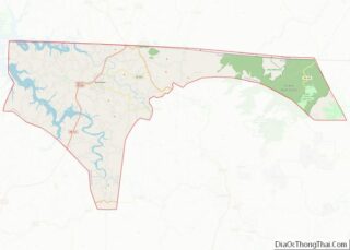
Online Interactive Map
Click on ![]() to view map in "full screen" mode.
to view map in "full screen" mode.
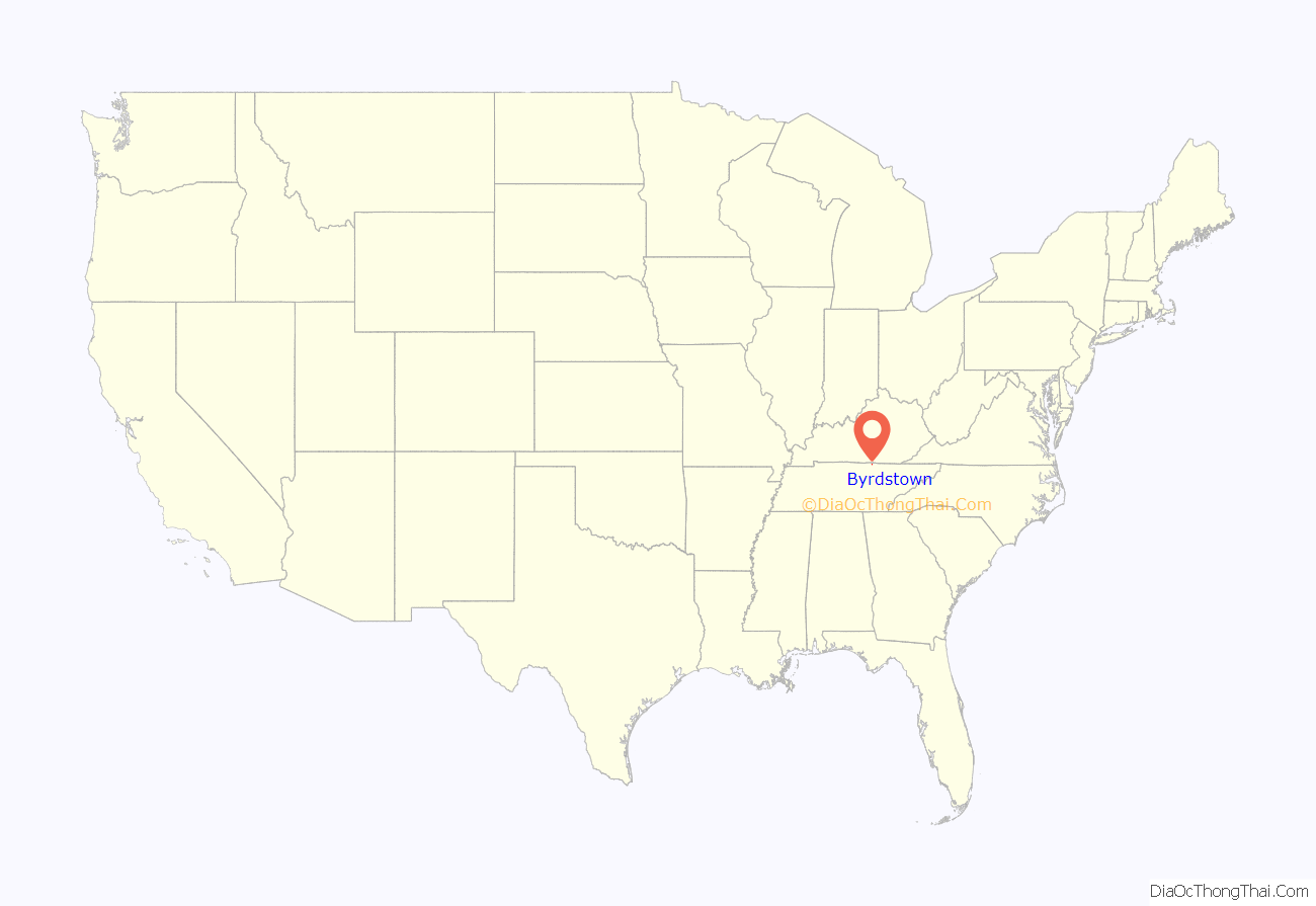
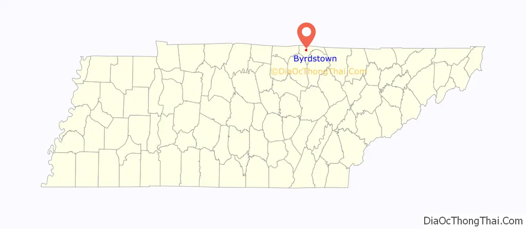
Byrdstown location map. Where is Byrdstown town?
History
Byrdstown was established in 1879 as a county seat for the newly formed Pickett County. The town, where several families already lived, was named for Colonel Robert K. Byrd, a state senator whose district included the new county. Byrdstown was officially incorporated in 1917.
Former Secretary of State Cordell Hull (1871–1955)— who played a pivotal role in the creation of the United Nations— was born just west of Byrdstown. The Pickett County Courthouse, built in 1935, and the Cordell Hull Birthplace are both listed on the National Register of Historic Places. Other historical sites include the Amonett House at the junction of TN-325 and TN-111.
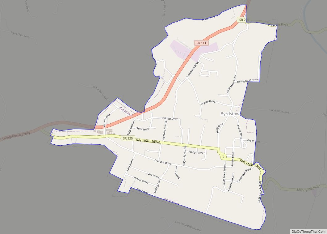
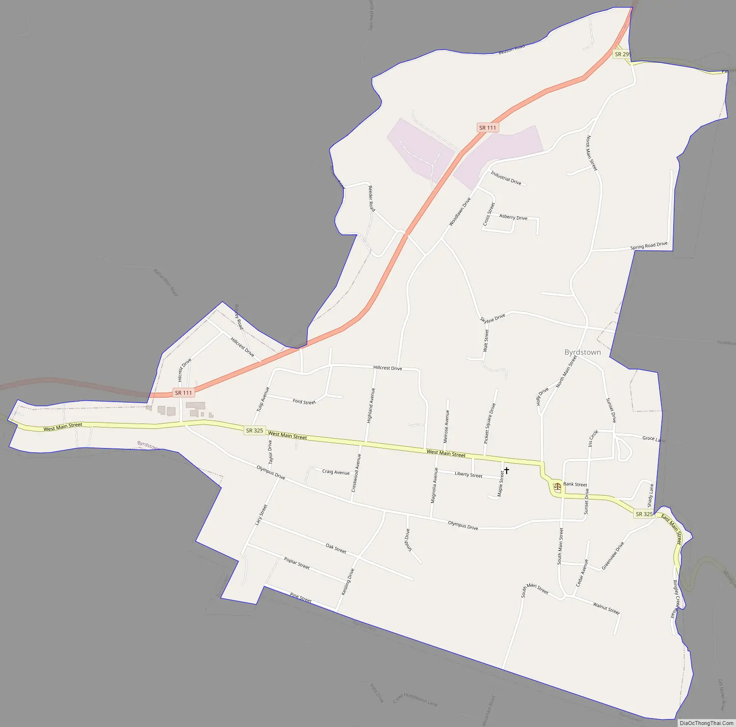
Byrdstown Road Map
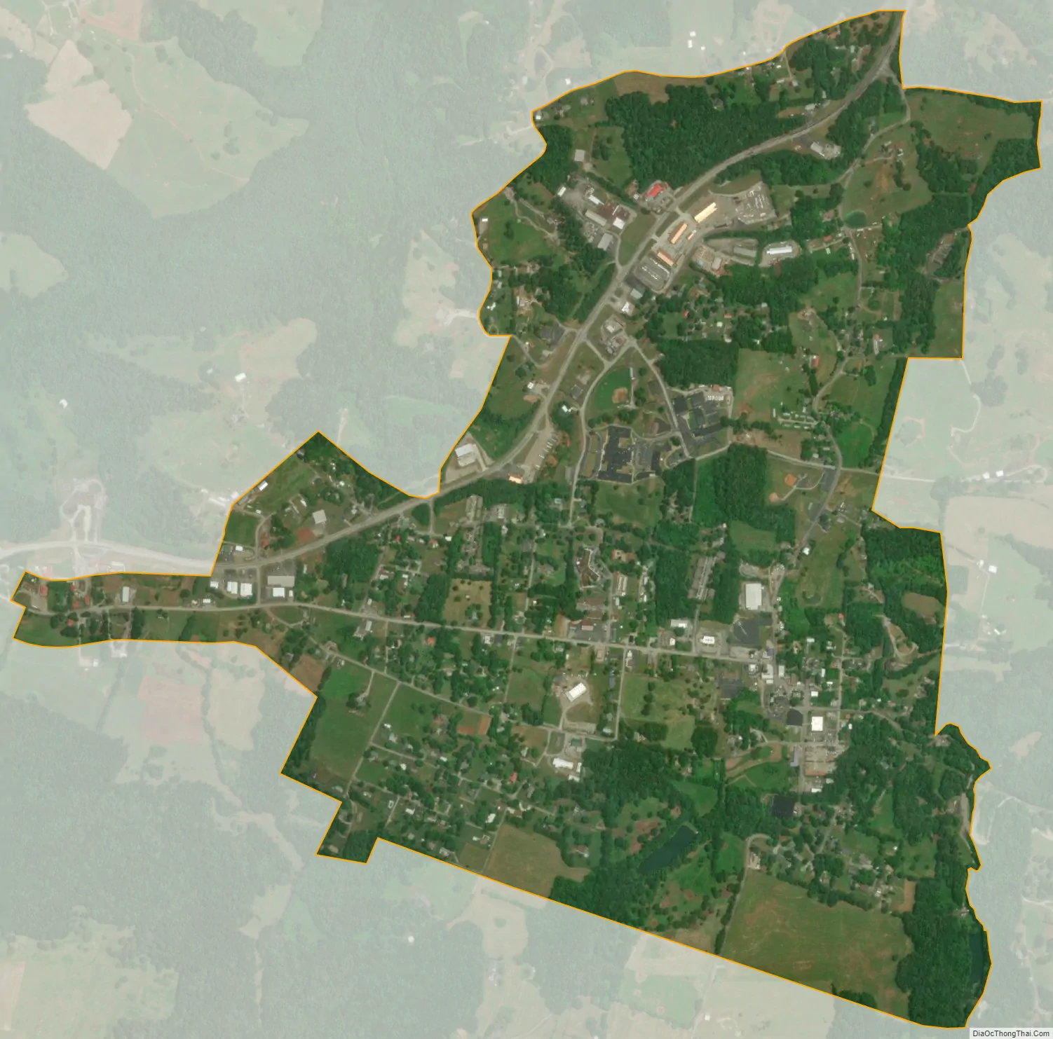
Byrdstown city Satellite Map
Geography
Byrdstown is located at 36°34′21″N 85°8′14″W / 36.57250°N 85.13722°W / 36.57250; -85.13722 (36.572585, -85.137088). The town is situated in a hilly area on the Highland Rim, a few miles south of the Kentucky state line. Byrdstown lies south of the Wolf River, north of the Obey River, and east of Dale Hollow Lake, where the two rivers converge.
Tennessee State Route 325 traverses Byrdstown from west to east, mostly following West Main Street and East Main Street. This highway connects Byrdstown with the Dale Hollow Lake and Cordell Hull Birthplace State Park areas to the west, and the rural parts of central Pickett County to the east. Tennessee State Route 111, which intersects SR 325 in western Byrdstown, connects the town with Livingston to the southwest, and Static at the state line to the north. At Static, the highway terminates at an intersection with U.S. Route 127, with the latter continuing northward to Albany, Kentucky.
According to the United States Census Bureau, the town has a total area of 1.5 square miles (3.9 km), all of it land.
Climate
See also
Map of Tennessee State and its subdivision:- Anderson
- Bedford
- Benton
- Bledsoe
- Blount
- Bradley
- Campbell
- Cannon
- Carroll
- Carter
- Cheatham
- Chester
- Claiborne
- Clay
- Cocke
- Coffee
- Crockett
- Cumberland
- Davidson
- Decatur
- DeKalb
- Dickson
- Dyer
- Fayette
- Fentress
- Franklin
- Gibson
- Giles
- Grainger
- Greene
- Grundy
- Hamblen
- Hamilton
- Hancock
- Hardeman
- Hardin
- Hawkins
- Haywood
- Henderson
- Henry
- Hickman
- Houston
- Humphreys
- Jackson
- Jefferson
- Johnson
- Knox
- Lake
- Lauderdale
- Lawrence
- Lewis
- Lincoln
- Loudon
- Macon
- Madison
- Marion
- Marshall
- Maury
- McMinn
- McNairy
- Meigs
- Monroe
- Montgomery
- Moore
- Morgan
- Obion
- Overton
- Perry
- Pickett
- Polk
- Putnam
- Rhea
- Roane
- Robertson
- Rutherford
- Scott
- Sequatchie
- Sevier
- Shelby
- Smith
- Stewart
- Sullivan
- Sumner
- Tipton
- Trousdale
- Unicoi
- Union
- Van Buren
- Warren
- Washington
- Wayne
- Weakley
- White
- Williamson
- Wilson
- Alabama
- Alaska
- Arizona
- Arkansas
- California
- Colorado
- Connecticut
- Delaware
- District of Columbia
- Florida
- Georgia
- Hawaii
- Idaho
- Illinois
- Indiana
- Iowa
- Kansas
- Kentucky
- Louisiana
- Maine
- Maryland
- Massachusetts
- Michigan
- Minnesota
- Mississippi
- Missouri
- Montana
- Nebraska
- Nevada
- New Hampshire
- New Jersey
- New Mexico
- New York
- North Carolina
- North Dakota
- Ohio
- Oklahoma
- Oregon
- Pennsylvania
- Rhode Island
- South Carolina
- South Dakota
- Tennessee
- Texas
- Utah
- Vermont
- Virginia
- Washington
- West Virginia
- Wisconsin
- Wyoming