Charlotte is a town in Dickson County, Tennessee, United States. The population was 1,656 at the 2020 census. It is the county seat of Dickson County. This town is part of the Nashville metropolitan area.
| Name: | Charlotte town |
|---|---|
| LSAD Code: | 43 |
| LSAD Description: | town (suffix) |
| State: | Tennessee |
| County: | Dickson County |
| Founded: | 1808 |
| Incorporated: | 1817 |
| Elevation: | 650 ft (200 m) |
| Total Area: | 4.06 sq mi (10.51 km²) |
| Land Area: | 4.06 sq mi (10.51 km²) |
| Water Area: | 0.00 sq mi (0.00 km²) |
| Total Population: | 1,656 |
| Population Density: | 408.08/sq mi (157.55/km²) |
| ZIP code: | 37036 |
| Area code: | 615 |
| FIPS code: | 4713080 |
| GNISfeature ID: | 1305868 |
Online Interactive Map
Click on ![]() to view map in "full screen" mode.
to view map in "full screen" mode.
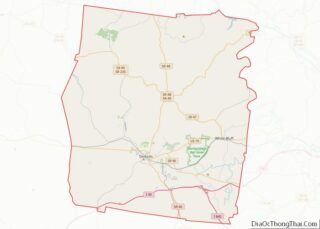
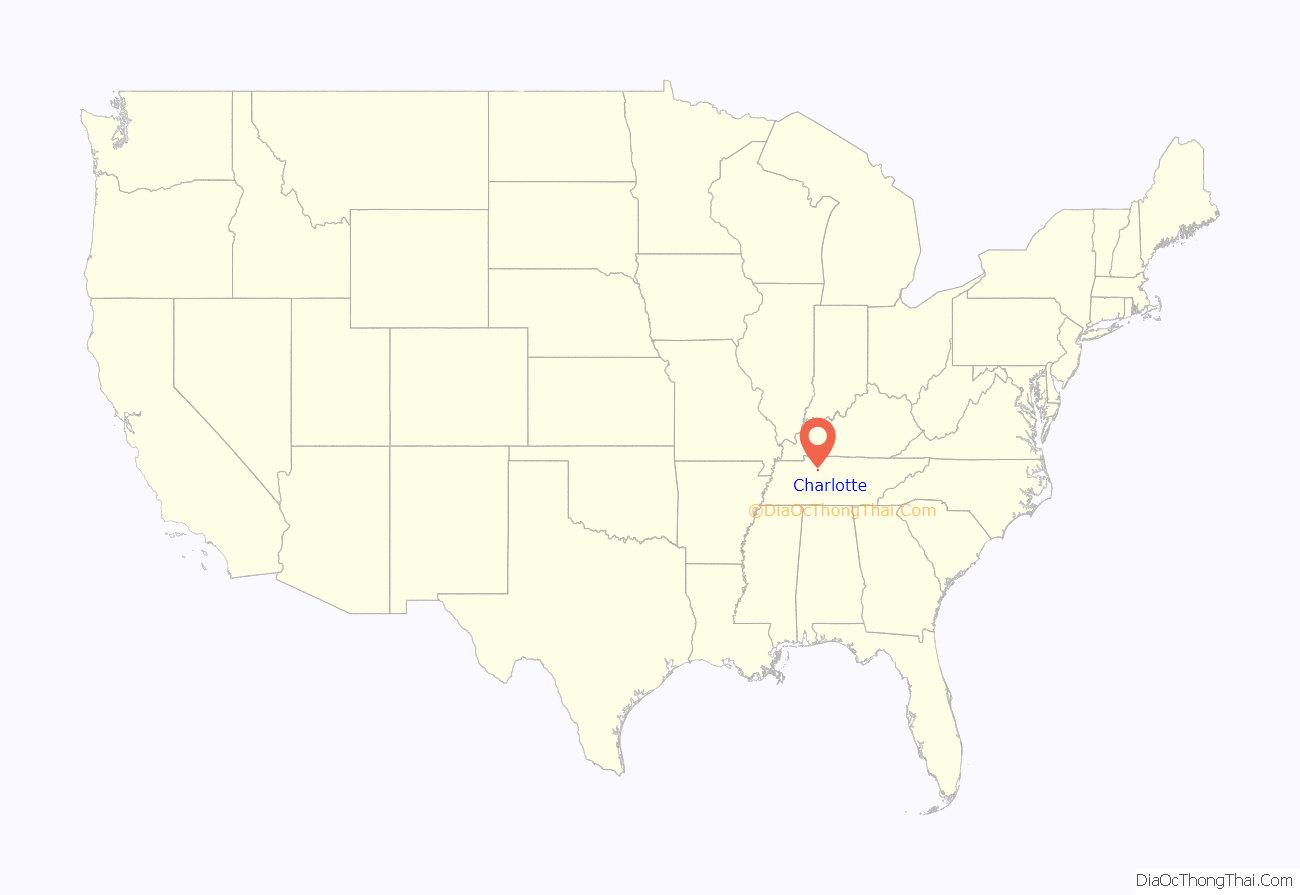
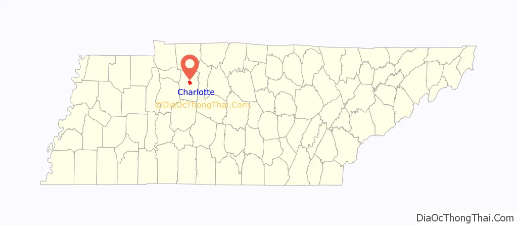
Charlotte location map. Where is Charlotte town?
History
Charlotte was established in 1804 by an act of the state legislature as the county seat for Dickson County, which had been created in 1803. The town was named for Charlotte Reeves Robertson, the wife of General James Robertson, who played prominent roles in the settlement of Middle Tennessee. Charlotte was officially incorporated in 1837.
On May 30, 1830, a tornado destroyed most of downtown Charlotte. The roof of the courthouse was found 13 miles (21 km) away, and most of the county’s early records were permanently lost. A new courthouse was completed in 1833, and still stands as the oldest functioning courthouse in the state of Tennessee. While Charlotte thrived as a stage coach hub for much of the 19th-century, the arrival of the railroad in the latter half of the century shifted the area’s industrial focus to Dickson, several miles to the southwest.
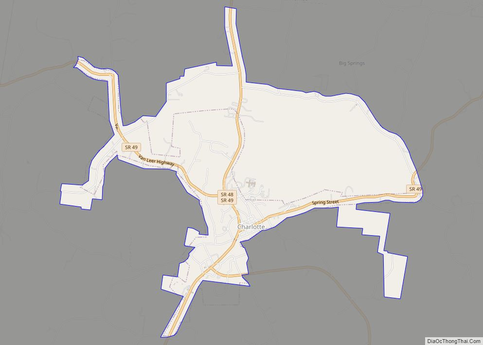
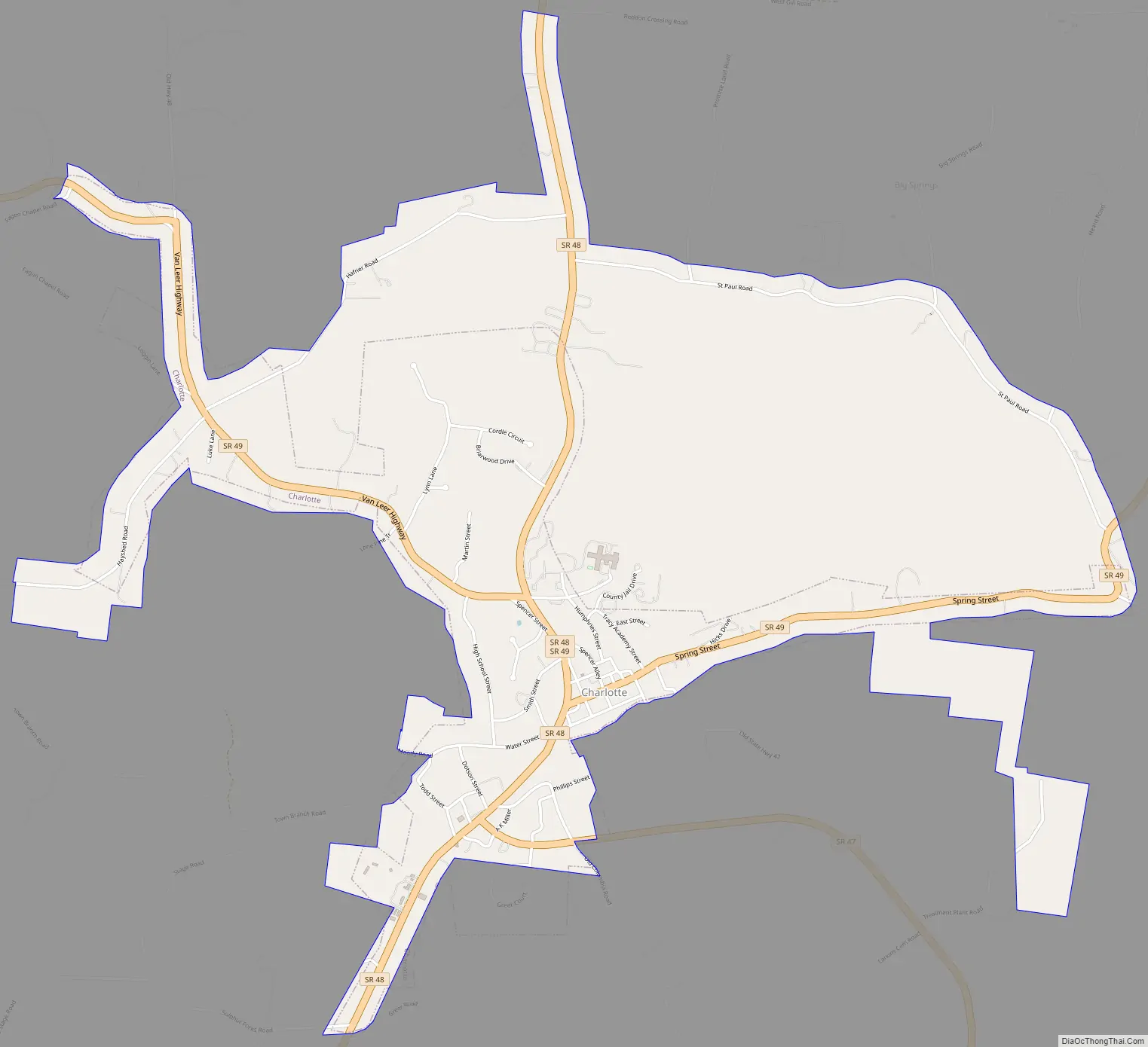
Charlotte Road Map
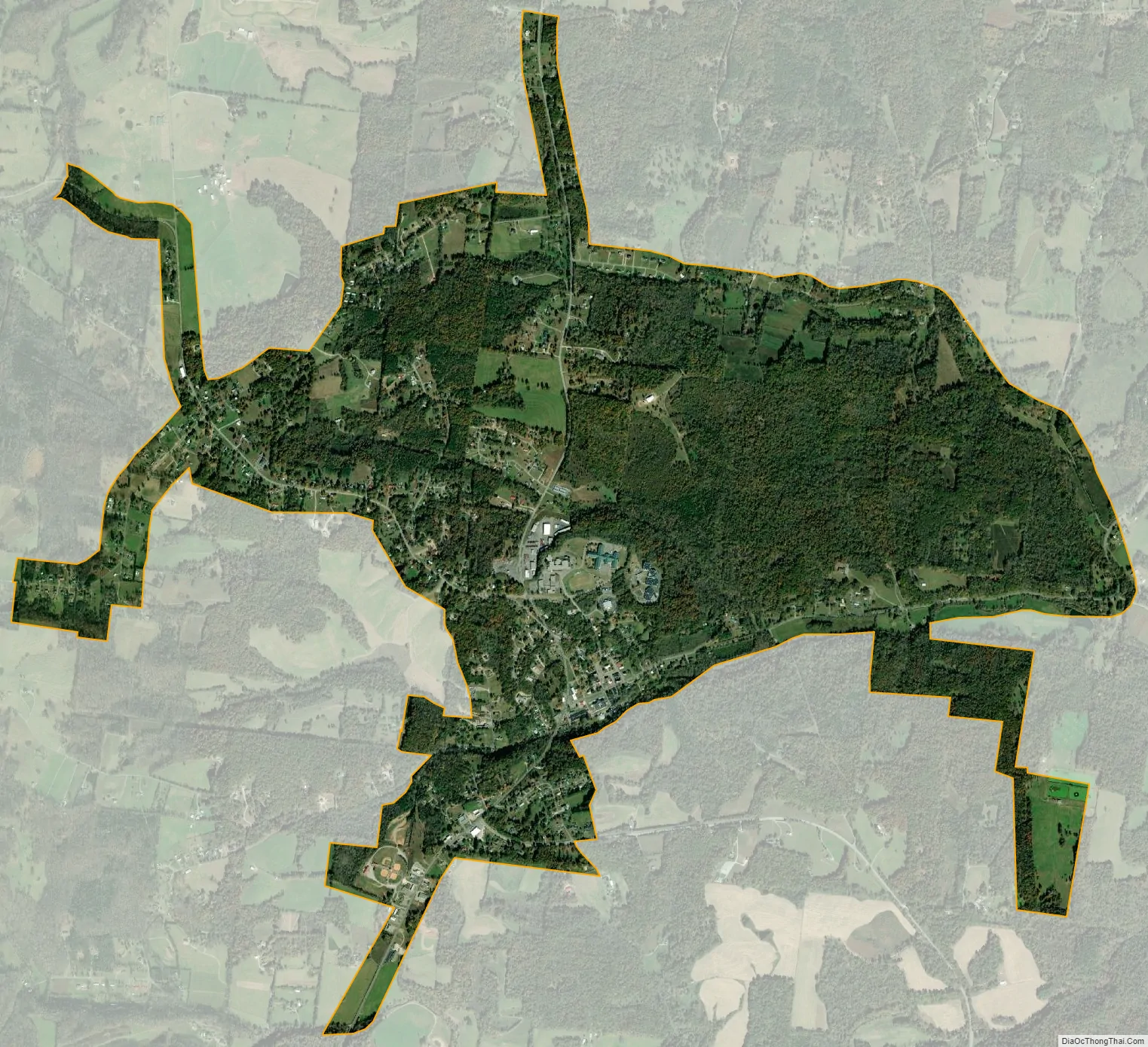
Charlotte city Satellite Map
Geography
Charlotte is located at 36°10′44″N 87°20′39″W / 36.17889°N 87.34417°W / 36.17889; -87.34417 (36.178784, -87.344304). The town is situated amidst the hills that comprise part of the western section of the Highland Rim, nearly halfway between Dickson and Ashland City. A small stream known as Town Branch, which is part of the Cumberland River watershed, flows through Charlotte from west to east.
Charlotte is centered around the junction of State Route 49, which connects Charlotte with Ashland City and Kentucky to the northeast and upper West Tennessee to the northwest, and State Route 48, which connects the town to Dickson and U.S. Route 70 to the southwest and Clarksville to the north. These road intersections are just west of the court square.
According to the United States Census Bureau, the town has a total area of 1.7 square miles (4.4 km), all land.
Climate
The climate in this area is characterized by hot, humid summers and generally mild to cool winters. According to the Köppen Climate Classification system, Charlotte has a humid subtropical climate, abbreviated “Cfa” on climate maps.
See also
Map of Tennessee State and its subdivision:- Anderson
- Bedford
- Benton
- Bledsoe
- Blount
- Bradley
- Campbell
- Cannon
- Carroll
- Carter
- Cheatham
- Chester
- Claiborne
- Clay
- Cocke
- Coffee
- Crockett
- Cumberland
- Davidson
- Decatur
- DeKalb
- Dickson
- Dyer
- Fayette
- Fentress
- Franklin
- Gibson
- Giles
- Grainger
- Greene
- Grundy
- Hamblen
- Hamilton
- Hancock
- Hardeman
- Hardin
- Hawkins
- Haywood
- Henderson
- Henry
- Hickman
- Houston
- Humphreys
- Jackson
- Jefferson
- Johnson
- Knox
- Lake
- Lauderdale
- Lawrence
- Lewis
- Lincoln
- Loudon
- Macon
- Madison
- Marion
- Marshall
- Maury
- McMinn
- McNairy
- Meigs
- Monroe
- Montgomery
- Moore
- Morgan
- Obion
- Overton
- Perry
- Pickett
- Polk
- Putnam
- Rhea
- Roane
- Robertson
- Rutherford
- Scott
- Sequatchie
- Sevier
- Shelby
- Smith
- Stewart
- Sullivan
- Sumner
- Tipton
- Trousdale
- Unicoi
- Union
- Van Buren
- Warren
- Washington
- Wayne
- Weakley
- White
- Williamson
- Wilson
- Alabama
- Alaska
- Arizona
- Arkansas
- California
- Colorado
- Connecticut
- Delaware
- District of Columbia
- Florida
- Georgia
- Hawaii
- Idaho
- Illinois
- Indiana
- Iowa
- Kansas
- Kentucky
- Louisiana
- Maine
- Maryland
- Massachusetts
- Michigan
- Minnesota
- Mississippi
- Missouri
- Montana
- Nebraska
- Nevada
- New Hampshire
- New Jersey
- New Mexico
- New York
- North Carolina
- North Dakota
- Ohio
- Oklahoma
- Oregon
- Pennsylvania
- Rhode Island
- South Carolina
- South Dakota
- Tennessee
- Texas
- Utah
- Vermont
- Virginia
- Washington
- West Virginia
- Wisconsin
- Wyoming