Burns is a town in Dickson County, Tennessee, in the United States. It is part of the Nashville-Davidson–Murfreesboro–Franklin Metropolitan Statistical Area. The population was 1,468 at the 2010 census.
| Name: | Burns town |
|---|---|
| LSAD Code: | 43 |
| LSAD Description: | town (suffix) |
| State: | Tennessee |
| County: | Dickson County |
| Elevation: | 801 ft (244 m) |
| Total Area: | 3.39 sq mi (8.77 km²) |
| Land Area: | 3.38 sq mi (8.76 km²) |
| Water Area: | 0.01 sq mi (0.01 km²) |
| Total Population: | 1,573 |
| Population Density: | 465.25/sq mi (179.62/km²) |
| ZIP code: | 37029 |
| Area code: | 615 |
| FIPS code: | 4709880 |
| GNISfeature ID: | 1305550 |
| Website: | http://townofburnstn.net |
Online Interactive Map
Click on ![]() to view map in "full screen" mode.
to view map in "full screen" mode.
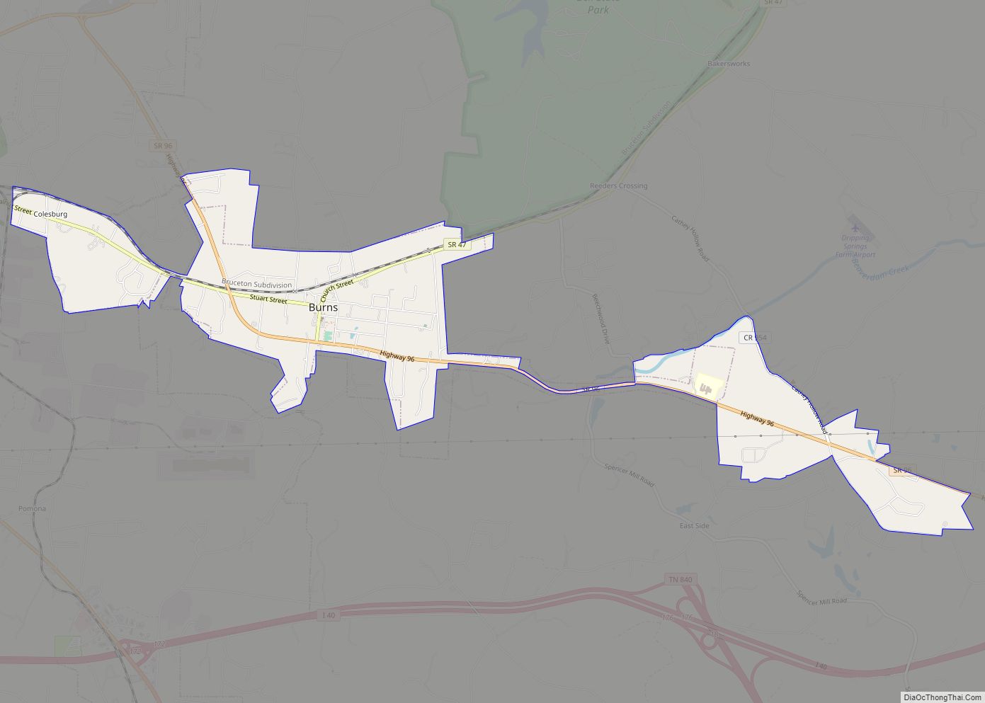
Burns location map. Where is Burns town?


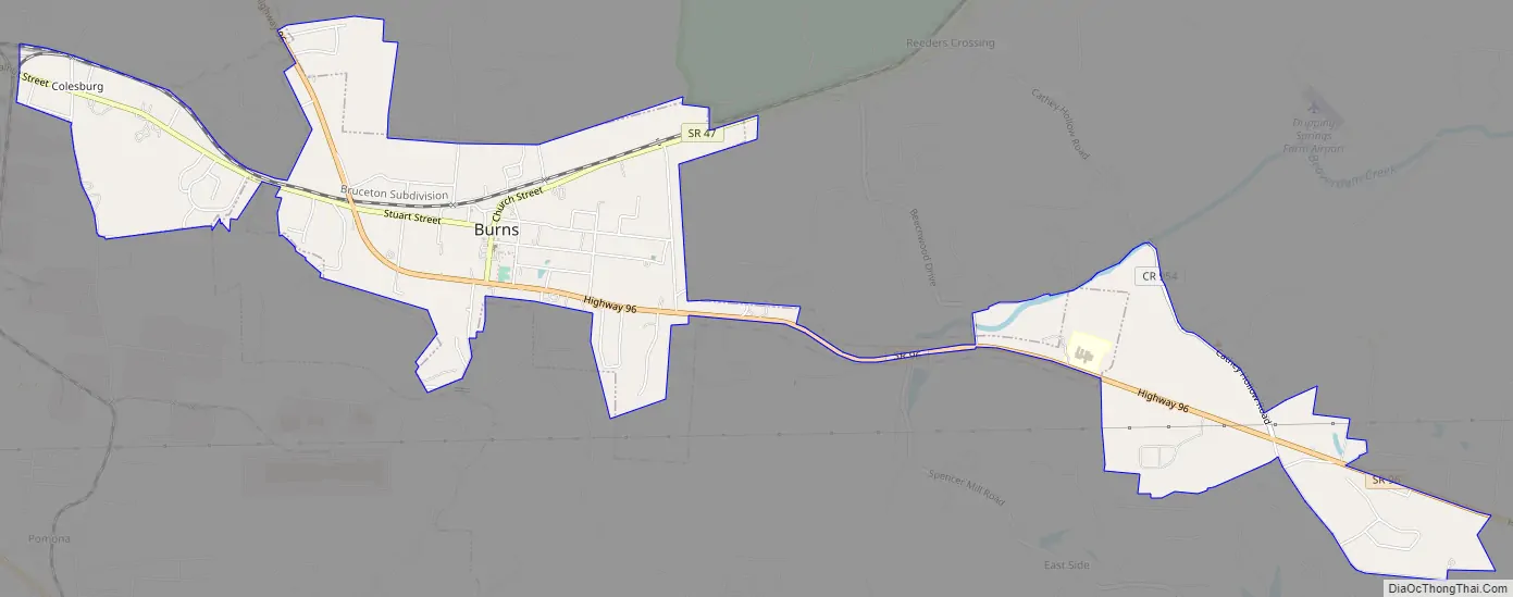
Burns Road Map
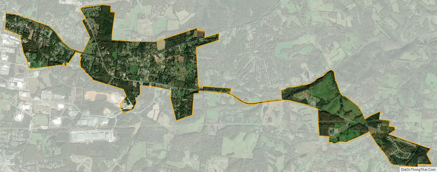
Burns city Satellite Map
Geography
Burns is located in southeastern Dickson County at 36°3′15″N 87°18′58″W / 36.05417°N 87.31611°W / 36.05417; -87.31611 (36.054264, -87.315978). It is bordered to the southwest, west, and northwest by the city of Dickson. Tennessee State Route 47 passes through the center of the town, leading west 5 miles (8 km) to the center of Dickson and northeast 7 miles (11 km) to White Bluff. Tennessee State Route 96 passes through the town west and south of its center; it leads northwest 2.5 miles (4.0 km) to U.S. Route 70 and southeast 8 miles (13 km) to Interstate 40 within the city limits of Fairview.
According to the United States Census Bureau, Burns has a total area of 3.7 square miles (9.7 km), of which 0.01 square miles (0.02 km), or 0.16%, is water.
See also
Map of Tennessee State and its subdivision:- Anderson
- Bedford
- Benton
- Bledsoe
- Blount
- Bradley
- Campbell
- Cannon
- Carroll
- Carter
- Cheatham
- Chester
- Claiborne
- Clay
- Cocke
- Coffee
- Crockett
- Cumberland
- Davidson
- Decatur
- DeKalb
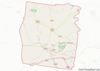
- Dickson
- Dyer
- Fayette
- Fentress
- Franklin
- Gibson
- Giles
- Grainger
- Greene
- Grundy
- Hamblen
- Hamilton
- Hancock
- Hardeman
- Hardin
- Hawkins
- Haywood
- Henderson
- Henry
- Hickman
- Houston
- Humphreys
- Jackson
- Jefferson
- Johnson
- Knox
- Lake
- Lauderdale
- Lawrence
- Lewis
- Lincoln
- Loudon
- Macon
- Madison
- Marion
- Marshall
- Maury
- McMinn
- McNairy
- Meigs
- Monroe
- Montgomery
- Moore
- Morgan
- Obion
- Overton
- Perry
- Pickett
- Polk
- Putnam
- Rhea
- Roane
- Robertson
- Rutherford
- Scott
- Sequatchie
- Sevier
- Shelby
- Smith
- Stewart
- Sullivan
- Sumner
- Tipton
- Trousdale
- Unicoi
- Union
- Van Buren
- Warren
- Washington
- Wayne
- Weakley
- White
- Williamson
- Wilson
- Alabama
- Alaska
- Arizona
- Arkansas
- California
- Colorado
- Connecticut
- Delaware
- District of Columbia
- Florida
- Georgia
- Hawaii
- Idaho
- Illinois
- Indiana
- Iowa
- Kansas
- Kentucky
- Louisiana
- Maine
- Maryland
- Massachusetts
- Michigan
- Minnesota
- Mississippi
- Missouri
- Montana
- Nebraska
- Nevada
- New Hampshire
- New Jersey
- New Mexico
- New York
- North Carolina
- North Dakota
- Ohio
- Oklahoma
- Oregon
- Pennsylvania
- Rhode Island
- South Carolina
- South Dakota
- Tennessee
- Texas
- Utah
- Vermont
- Virginia
- Washington
- West Virginia
- Wisconsin
- Wyoming