Crump is a city in Hardin County, Tennessee, United States. The population was 1,428 at the 2010 census, and 1,594 at the 2020 census.
| Name: | Crump city |
|---|---|
| LSAD Code: | 25 |
| LSAD Description: | city (suffix) |
| State: | Tennessee |
| County: | Hardin County |
| Elevation: | 456 ft (139 m) |
| Total Area: | 12.69 sq mi (32.87 km²) |
| Land Area: | 12.68 sq mi (32.84 km²) |
| Water Area: | 0.01 sq mi (0.03 km²) |
| Total Population: | 1,594 |
| Population Density: | 125.70/sq mi (48.53/km²) |
| ZIP code: | 38327 |
| Area code: | 731 |
| FIPS code: | 4718620 |
| GNISfeature ID: | 1281766 |
Online Interactive Map
Click on ![]() to view map in "full screen" mode.
to view map in "full screen" mode.
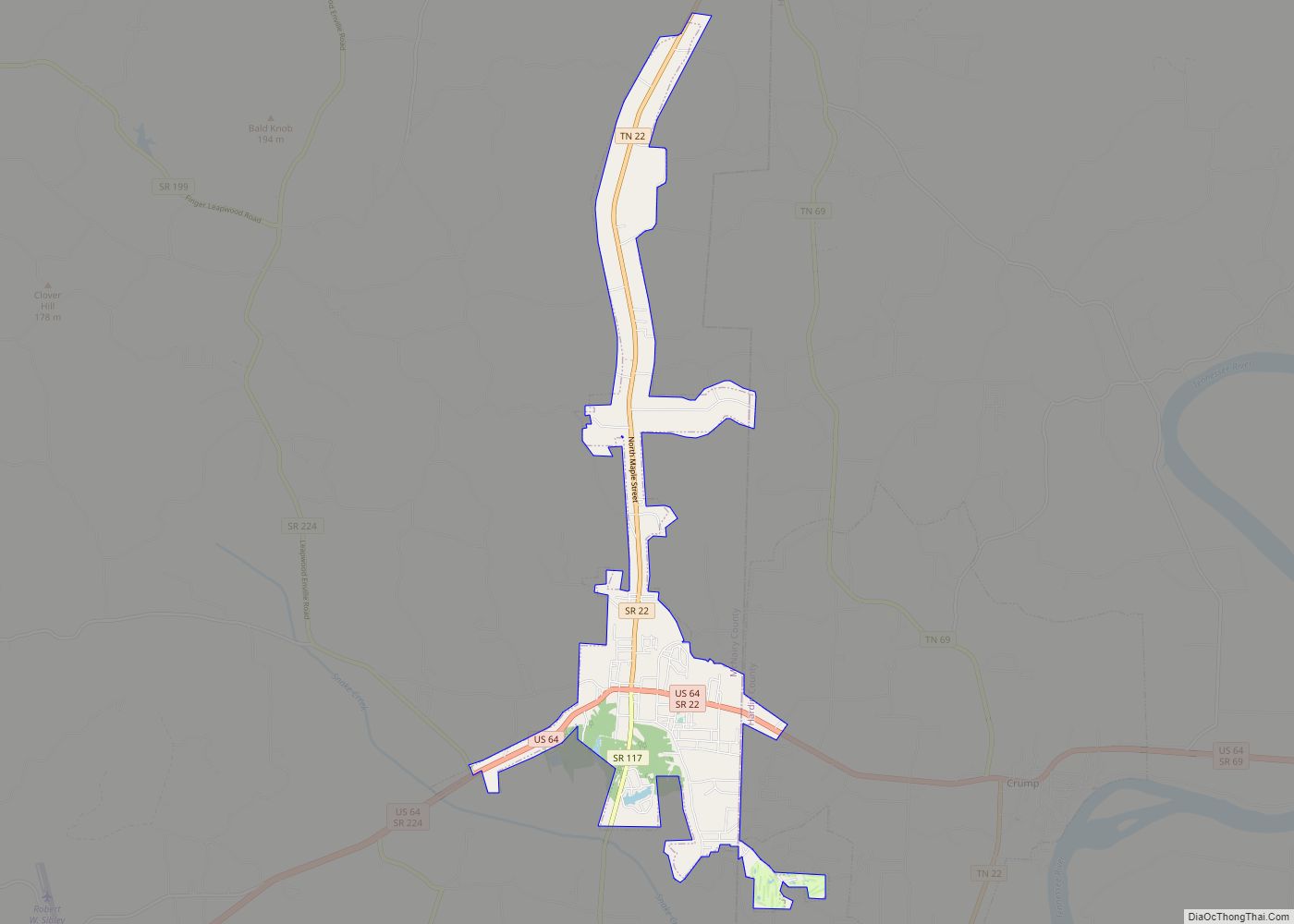
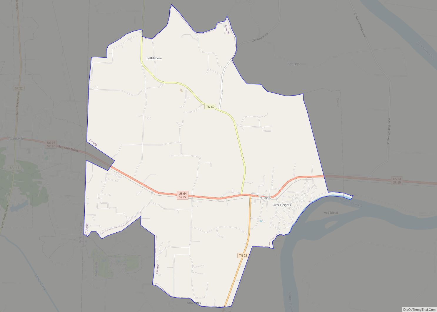
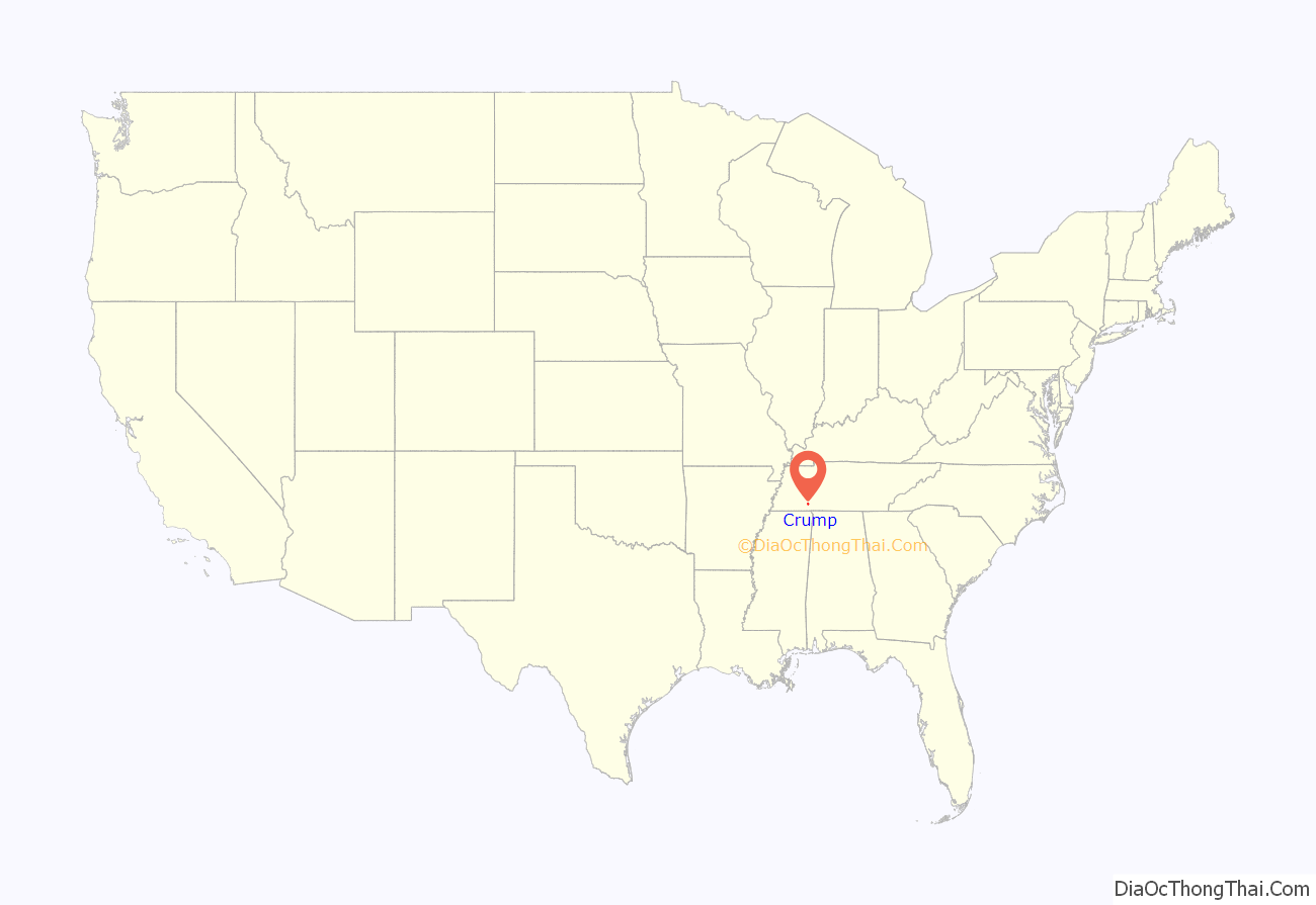
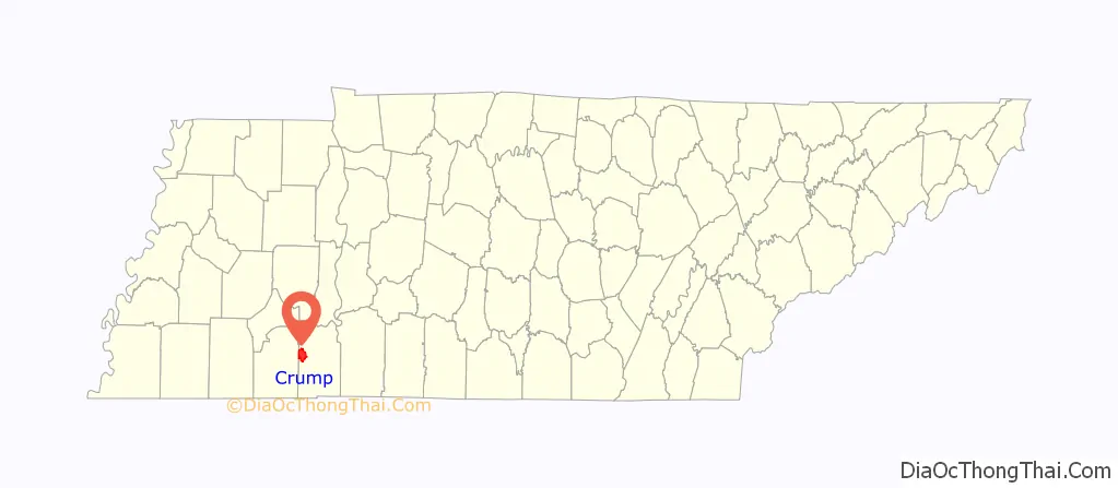
Crump location map. Where is Crump city?
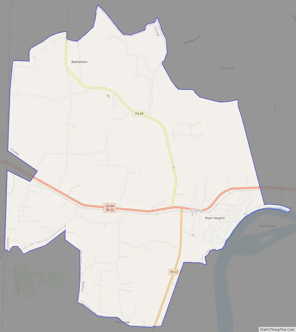
Crump Road Map
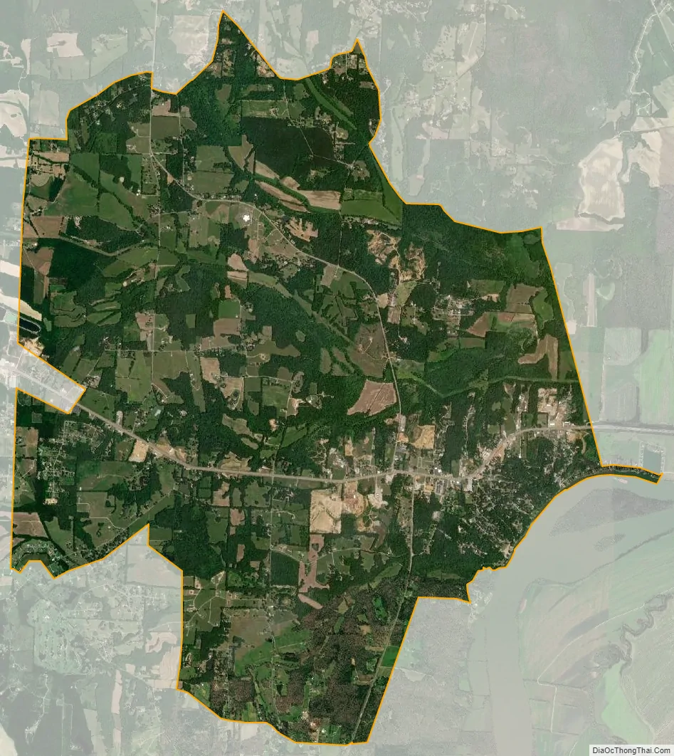
Crump city Satellite Map
Geography
Crump is located in western Hardin County at 35°13′57″N 88°20′10″W / 35.23250°N 88.33611°W / 35.23250; -88.33611 (35.232480, -88.336037). It is bordered to the west by the town Adamsville in McNairy County. U.S. Route 64 crosses Crump, leading east 4 miles (6 km) to Savannah and west the same distance to the center of Adamsville. Tennessee State Route 22 runs south from Crump 5 miles (8 km) to Shiloh National Military Park and 15 miles (24 km) to Michie, and State Route 69 leads north 11 miles (18 km) to Milledgeville.
According to the United States Census Bureau, the city has a total area of 13.4 square miles (34.6 km), of which 1.5 acres (6,208 m), or 0.02%, are water. The community sits on high ground on the west side of the Tennessee River.
See also
Map of Tennessee State and its subdivision:- Anderson
- Bedford
- Benton
- Bledsoe
- Blount
- Bradley
- Campbell
- Cannon
- Carroll
- Carter
- Cheatham
- Chester
- Claiborne
- Clay
- Cocke
- Coffee
- Crockett
- Cumberland
- Davidson
- Decatur
- DeKalb
- Dickson
- Dyer
- Fayette
- Fentress
- Franklin
- Gibson
- Giles
- Grainger
- Greene
- Grundy
- Hamblen
- Hamilton
- Hancock
- Hardeman
- Hardin
- Hawkins
- Haywood
- Henderson
- Henry
- Hickman
- Houston
- Humphreys
- Jackson
- Jefferson
- Johnson
- Knox
- Lake
- Lauderdale
- Lawrence
- Lewis
- Lincoln
- Loudon
- Macon
- Madison
- Marion
- Marshall
- Maury
- McMinn
- McNairy
- Meigs
- Monroe
- Montgomery
- Moore
- Morgan
- Obion
- Overton
- Perry
- Pickett
- Polk
- Putnam
- Rhea
- Roane
- Robertson
- Rutherford
- Scott
- Sequatchie
- Sevier
- Shelby
- Smith
- Stewart
- Sullivan
- Sumner
- Tipton
- Trousdale
- Unicoi
- Union
- Van Buren
- Warren
- Washington
- Wayne
- Weakley
- White
- Williamson
- Wilson
- Alabama
- Alaska
- Arizona
- Arkansas
- California
- Colorado
- Connecticut
- Delaware
- District of Columbia
- Florida
- Georgia
- Hawaii
- Idaho
- Illinois
- Indiana
- Iowa
- Kansas
- Kentucky
- Louisiana
- Maine
- Maryland
- Massachusetts
- Michigan
- Minnesota
- Mississippi
- Missouri
- Montana
- Nebraska
- Nevada
- New Hampshire
- New Jersey
- New Mexico
- New York
- North Carolina
- North Dakota
- Ohio
- Oklahoma
- Oregon
- Pennsylvania
- Rhode Island
- South Carolina
- South Dakota
- Tennessee
- Texas
- Utah
- Vermont
- Virginia
- Washington
- West Virginia
- Wisconsin
- Wyoming