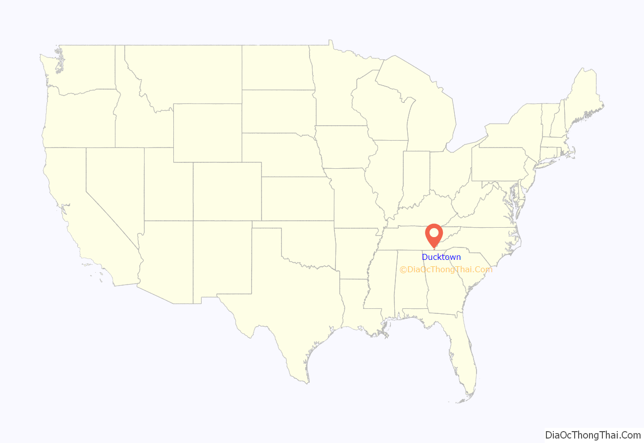
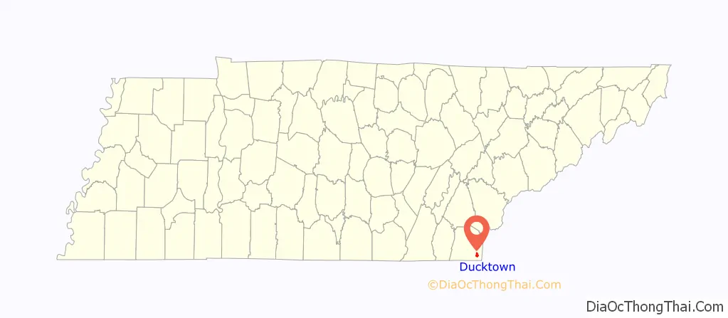
Ducktown (Cherokee: ᎦᏬᏅᏱ, romanized: Gawonvyi) is a city in Polk County, Tennessee, United States. The population was 461 at the 2020 census and 475 at the 2010 census. It is included in the Cleveland Metropolitan Statistical Area.
| Name: | Ducktown city |
|---|---|
| LSAD Code: | 25 |
| LSAD Description: | city (suffix) |
| State: | Tennessee |
| County: | Polk County |
| Incorporated: | 1951 |
| Elevation: | 1,732 ft (528 m) |
| Total Area: | 2.64 sq mi (6.84 km²) |
| Land Area: | 2.64 sq mi (6.84 km²) |
| Water Area: | 0.00 sq mi (0.00 km²) |
| Total Population: | 461 |
| Population Density: | 174.56/sq mi (67.39/km²) |
| ZIP code: | 37326 |
| Area code: | 423 |
| FIPS code: | 4721740 |
| GNISfeature ID: | 1283051 |
| Website: | www.cityofducktown.com |
Online Interactive Map
Click on ![]() to view map in "full screen" mode.
to view map in "full screen" mode.
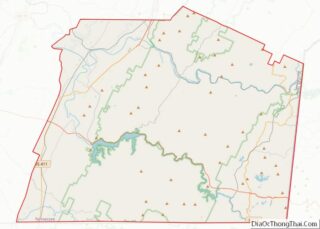
Ducktown location map. Where is Ducktown city?
History
Ducktown is located in a geological region known as the Copper Basin, and was the center of a major copper-mining district from 1847 until 1987. The district also produced iron, sulfur and zinc as byproducts. Ducktown was the birthplace of Rockabilly Hall of Famer, Stan Beaver.
Literary historian Ben Harris McClary suggests that a Ducktown-area farmer named William “Sut” Miller (d. 1858) was the inspiration for the George Washington Harris character, Sut Lovingood. Ducktown and several Ducktown-area features, such as Big Frog Mountain and the Ocoee River (“Oconee”), are mentioned in the Sut Lovingood tales.
The pre-mining period
The Cherokee inhabited the Copper Basin as early as the late 18th century, well before the arrival of the first Euro-American settlers. Their territory extended into northern Georgia. The Cherokee village of Gawonvyi (also known as Kawana)— which means “duck place” in English— is believed to have been located at the confluence of the Ocoee River and Tumbling Creek. The village’s name was recorded on Cherokee annuity distribution rolls as “Ducktown” in 1799. According to tradition, Ducktown was named after a Cherokee leader named Chief Duck.
In 1836, the Cherokee relinquished control of the Copper Basin to the U.S. government as part of lands they ceded in Tennessee and Georgia in the Treaty of New Echota. Although the U.S. removed many of the basin’s Cherokee inhabitants in the march to Indian Territory, some avoided the roundup by hiding out in the surrounding mountains. They would later help build the Old Copper Road (now part of US U.S. Route 64). In the 1840s and 1850s, Ducktown was called Hiwassee or Hiawassee, after the Cherokee name for a major river in the area. This name was subsequently adopted for the city’s first major mining operation.
Early mining years
The copper was discovered in 1843 by a prospector, presumably panning for gold, who found nuggets of native copper. The first shipment of copper ore was taken out on muleback in 1847. More than 30 mining companies were incorporated between 1852 and 1855 to mine copper at Ducktown. Development was accelerated by a road built in 1853 connecting the area with Cleveland, Tennessee. The first smelter was built in the Ducktown district in 1854.
Mining ceased when Union troops destroyed the copper refinery and mill at Cleveland, Tennessee in 1863. Mining resumed in 1866, and continued until 1878, when the mines had exhausted the shallow high-grade copper ores.
Later years
By 1906, the Tennessee Copper Company had begun constructing an acid reclamation plant near Copperhill, Tennessee to recover most of the sulfur in the form of sulfuric acid rather than releasing it to the atmosphere. Froth flotation was added in the 1920s.
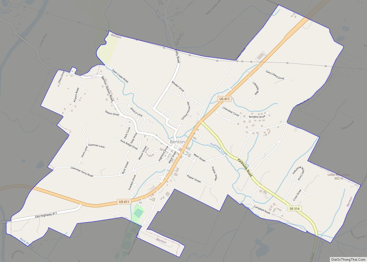
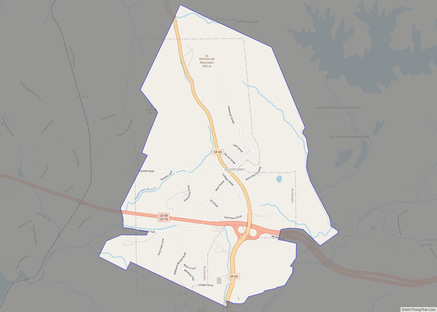
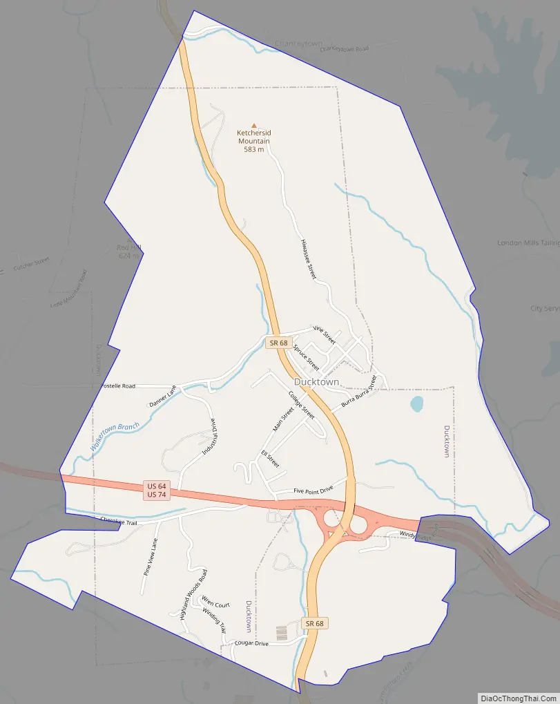
Ducktown Road Map
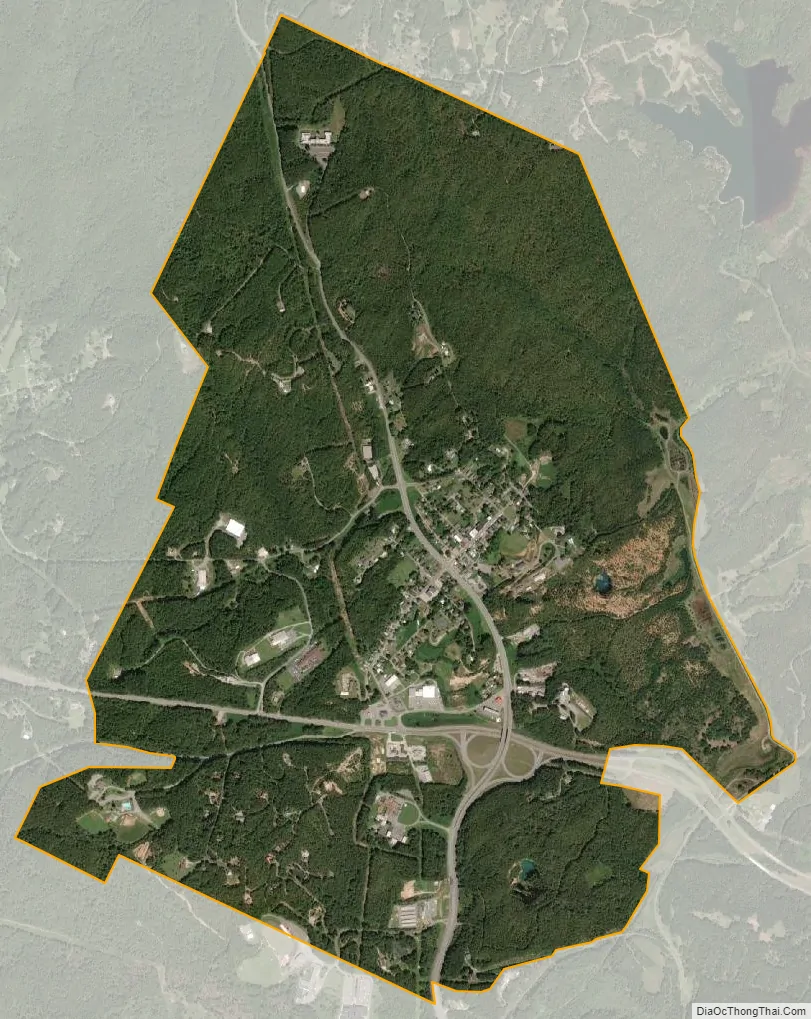
Ducktown city Satellite Map
Geography
Ducktown is situated at the center of the Copper Basin (sometimes called the Ducktown Basin), a broad valley located in the southern Appalachian Mountains near the intersection of Tennessee, Georgia, and North Carolina. The Ducktown area is part of the Ocoee River watershed (which hosted the Canoe slalom events for the 1996 Summer Olympics in Atlanta), which passes through the Copper Basin a few miles southwest of Ducktown before entering its gorge. Ducktown is centered just north of the junction of Tennessee State Route 68, which connects the city to Madisonville to the north and Copperhill to the south, and U.S. Route 64, which connects the city to Cleveland (via the Ocoee River Gorge) to the west and Murphy, North Carolina to the east.
According to the United States Census Bureau, the city has a total area of 1.9 square miles (4.9 km), all land.
The Ducktown Basin Museum, located on the site of the Burra Burra Mine in Ducktown, chronicles the geology and history of the mining activities in the basin.
See also
Map of Tennessee State and its subdivision:- Anderson
- Bedford
- Benton
- Bledsoe
- Blount
- Bradley
- Campbell
- Cannon
- Carroll
- Carter
- Cheatham
- Chester
- Claiborne
- Clay
- Cocke
- Coffee
- Crockett
- Cumberland
- Davidson
- Decatur
- DeKalb
- Dickson
- Dyer
- Fayette
- Fentress
- Franklin
- Gibson
- Giles
- Grainger
- Greene
- Grundy
- Hamblen
- Hamilton
- Hancock
- Hardeman
- Hardin
- Hawkins
- Haywood
- Henderson
- Henry
- Hickman
- Houston
- Humphreys
- Jackson
- Jefferson
- Johnson
- Knox
- Lake
- Lauderdale
- Lawrence
- Lewis
- Lincoln
- Loudon
- Macon
- Madison
- Marion
- Marshall
- Maury
- McMinn
- McNairy
- Meigs
- Monroe
- Montgomery
- Moore
- Morgan
- Obion
- Overton
- Perry
- Pickett
- Polk
- Putnam
- Rhea
- Roane
- Robertson
- Rutherford
- Scott
- Sequatchie
- Sevier
- Shelby
- Smith
- Stewart
- Sullivan
- Sumner
- Tipton
- Trousdale
- Unicoi
- Union
- Van Buren
- Warren
- Washington
- Wayne
- Weakley
- White
- Williamson
- Wilson
- Alabama
- Alaska
- Arizona
- Arkansas
- California
- Colorado
- Connecticut
- Delaware
- District of Columbia
- Florida
- Georgia
- Hawaii
- Idaho
- Illinois
- Indiana
- Iowa
- Kansas
- Kentucky
- Louisiana
- Maine
- Maryland
- Massachusetts
- Michigan
- Minnesota
- Mississippi
- Missouri
- Montana
- Nebraska
- Nevada
- New Hampshire
- New Jersey
- New Mexico
- New York
- North Carolina
- North Dakota
- Ohio
- Oklahoma
- Oregon
- Pennsylvania
- Rhode Island
- South Carolina
- South Dakota
- Tennessee
- Texas
- Utah
- Vermont
- Virginia
- Washington
- West Virginia
- Wisconsin
- Wyoming