Fairview is a city located in Williamson County, Tennessee. It is part of the Nashville metropolitan area. The population was 9,357 at the 2020 census, . In the communities just outside Fairview, there are an additional 4,100 people, for a total of over 13,457 people living within the Fairview area.
| Name: | Fairview city |
|---|---|
| LSAD Code: | 25 |
| LSAD Description: | city (suffix) |
| State: | Tennessee |
| County: | Williamson County |
| Elevation: | 823 ft (251 m) |
| Total Area: | 17.96 sq mi (46.51 km²) |
| Land Area: | 17.93 sq mi (46.43 km²) |
| Water Area: | 0.03 sq mi (0.08 km²) |
| Total Population: | 9,357 |
| Population Density: | 521.92/sq mi (201.52/km²) |
| ZIP code: | 37062 |
| Area code: | 615/629 |
| FIPS code: | 4725440 |
| GNISfeature ID: | 1303452 |
| Website: | www.fairview-tn.org |
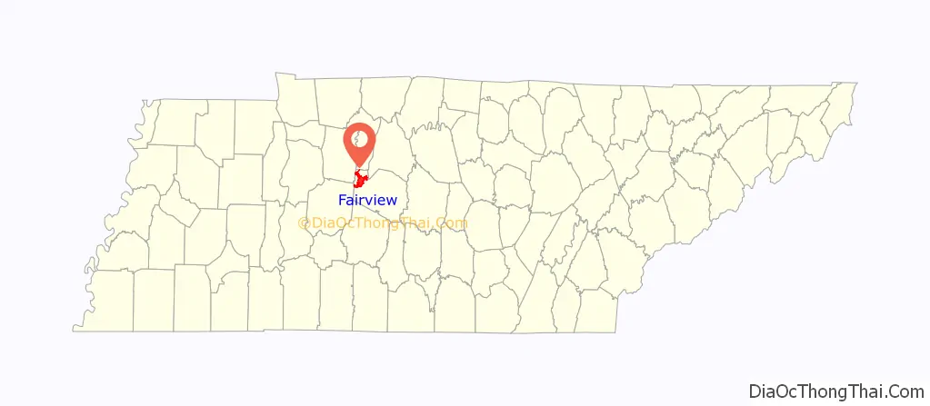
Online Interactive Map
Click on ![]() to view map in "full screen" mode.
to view map in "full screen" mode.
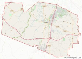
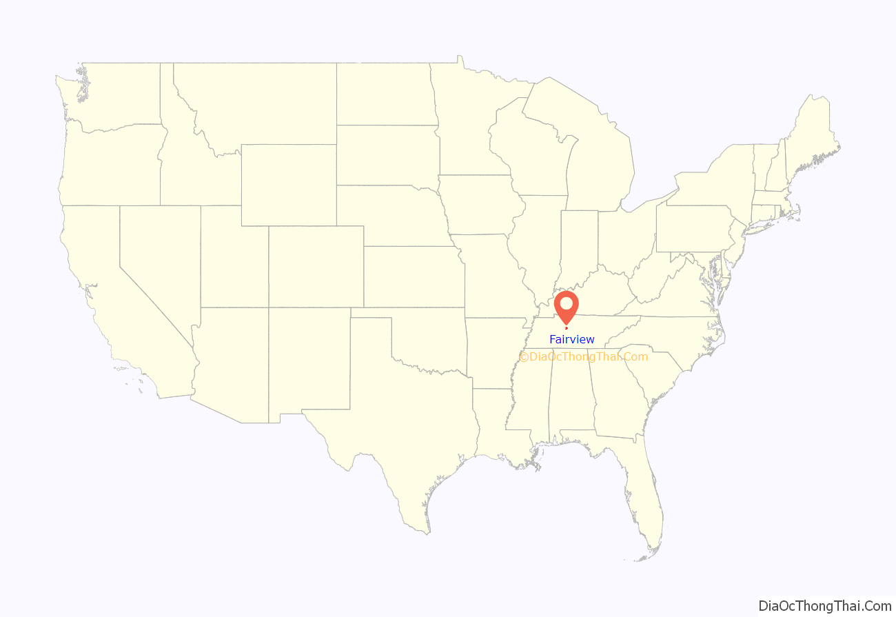
Fairview location map. Where is Fairview city?
History
Fairview was incorporated on July 28, 1959, under the Uniform City Manager-Commission Charter as set out in the Tennessee Code Annotated. Fairview city limits are located about one mile (1.6 km) southwest from the Nashville-Davidson County line and has two interstates passing through it (I-40 & I-840). With an average elevation of 800 feet (240 m) above sea level, Fairview is about 150 feet (46 m) higher than Nashville and surrounding suburbs, which gives Fairview the advantage of being less flood prone.
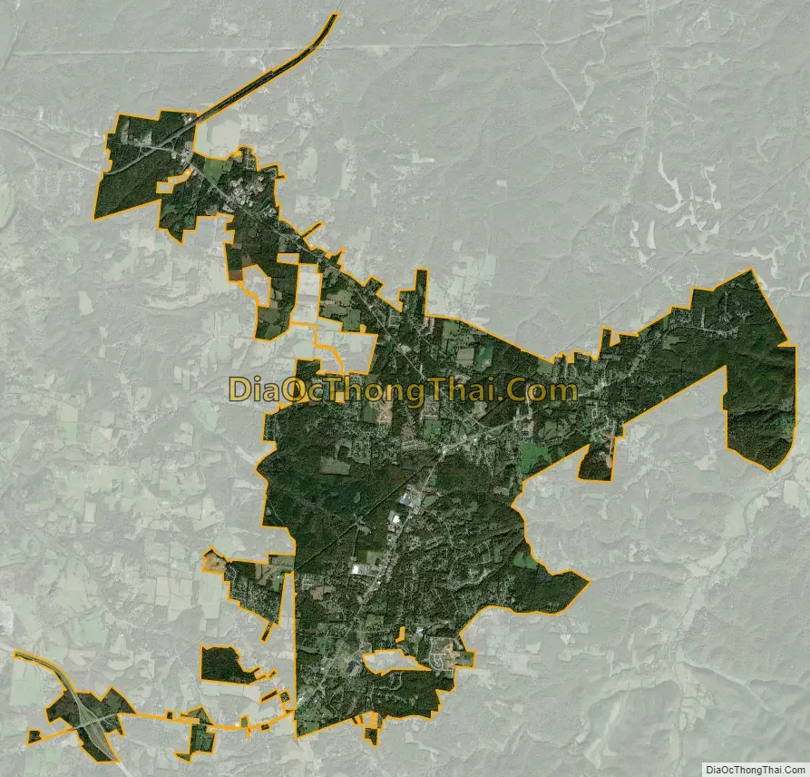
It is home to Bowie Nature Park which, at approximately 722 acres (2.92 km), is one of the largest city-managed parks in the state of Tennessee. As a comparison, New York’s Central Park is 843 acres (3.41 km). Fairview has two Elementary Schools, Fairview, and Westwood serving over 1,000 students with grades K-5. Fairview Middle has an enrollment of 800 plus and is home to grades 6th-8th. FVHS serves over 1000 students, and Fairview High School was listed as one of the top 1,000 High Schools in the US according to Newsweek Magazine. Fairview schools are part of the Williamson County School system (www.WCS.edu).
It has a recreation center that is part of Williamson County Parks and Recreation system. The center offers civic meeting rooms, WAVES org, exercise classes, a gym with free weights and machines and a large outdoor swimming pool. There is also a full size basketball court that is open for free play.
Fairview Ball Park has been open since 1982. In the spring and early summer, the youth of Fairview play softball and baseball in the local recreation leagues. In the fall, the park is home to an adult softball league. There are four fields located at the park, Field 1 for senior league baseball, Field 2 for tee ball, and softball, Field 3 for age groups up to 12 playing baseball, and Field 4 which is primarily a softball field.
The camp scenes in Ernest Goes to Camp were filmed at Camp Marymount, which is a 340-acre retreat/summer camp owned by the Catholic Church, established in the summer of 1946.
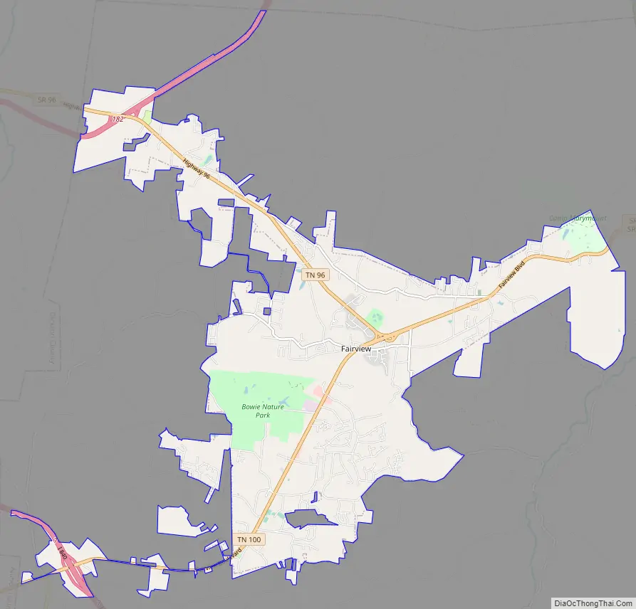
The city is twenty-five miles from downtown Nashville, and is located along State Highway 100 in the NW section of Williamson County.
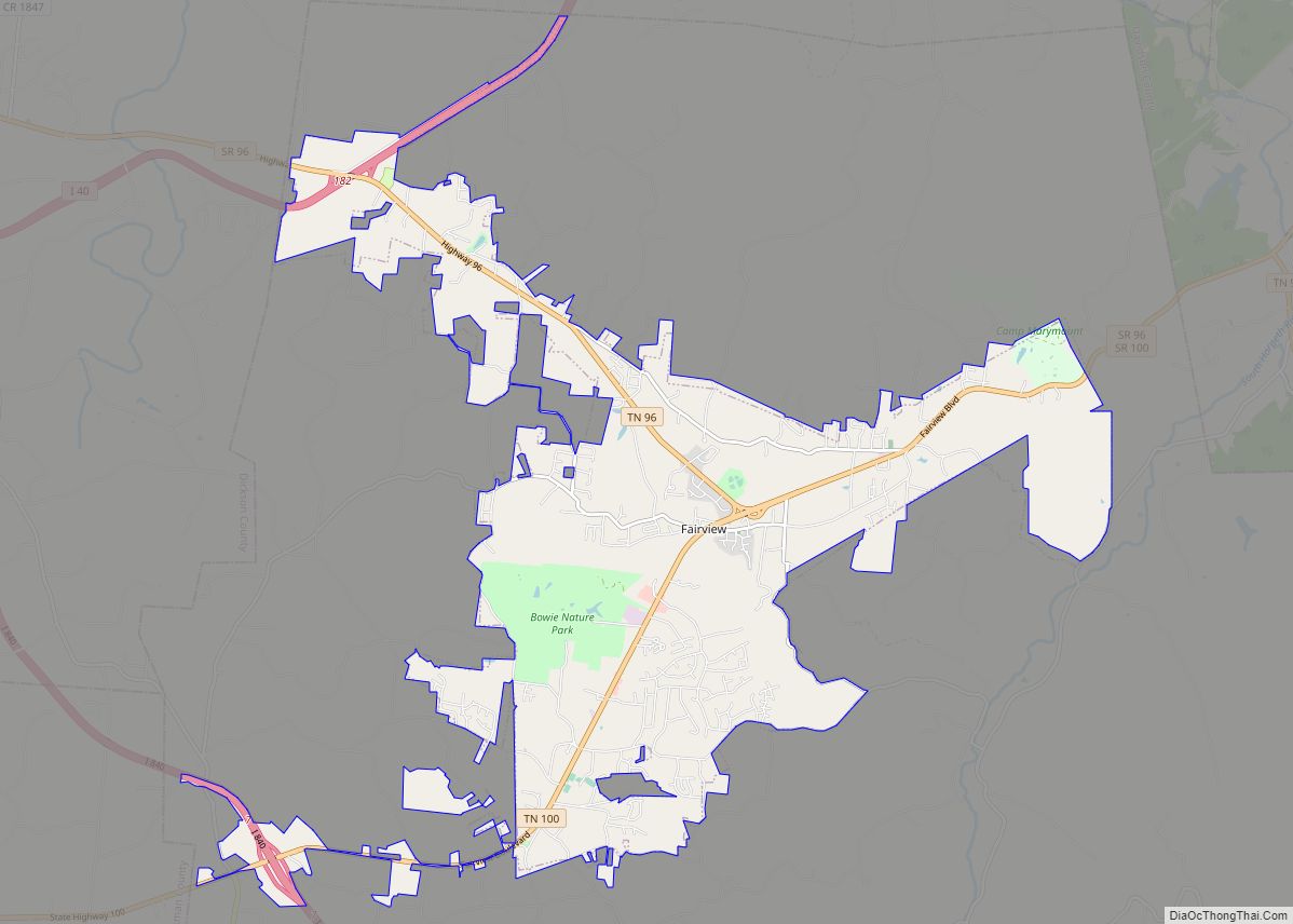
Fairview Road Map
Fairview city Satellite Map
Geography
Fairview is located at 35°58′55″N 87°7′45″W / 35.98194°N 87.12917°W / 35.98194; -87.12917 (35.982071, -87.129133).
According to the United States Census Bureau, the city has a total area of 14.1 square miles (37 km), of which 14.1 square miles (37 km) is land and 0.04 square miles (0.10 km) (0.21%) is water.
See also
Map of Tennessee State and its subdivision:- Anderson
- Bedford
- Benton
- Bledsoe
- Blount
- Bradley
- Campbell
- Cannon
- Carroll
- Carter
- Cheatham
- Chester
- Claiborne
- Clay
- Cocke
- Coffee
- Crockett
- Cumberland
- Davidson
- Decatur
- DeKalb
- Dickson
- Dyer
- Fayette
- Fentress
- Franklin
- Gibson
- Giles
- Grainger
- Greene
- Grundy
- Hamblen
- Hamilton
- Hancock
- Hardeman
- Hardin
- Hawkins
- Haywood
- Henderson
- Henry
- Hickman
- Houston
- Humphreys
- Jackson
- Jefferson
- Johnson
- Knox
- Lake
- Lauderdale
- Lawrence
- Lewis
- Lincoln
- Loudon
- Macon
- Madison
- Marion
- Marshall
- Maury
- McMinn
- McNairy
- Meigs
- Monroe
- Montgomery
- Moore
- Morgan
- Obion
- Overton
- Perry
- Pickett
- Polk
- Putnam
- Rhea
- Roane
- Robertson
- Rutherford
- Scott
- Sequatchie
- Sevier
- Shelby
- Smith
- Stewart
- Sullivan
- Sumner
- Tipton
- Trousdale
- Unicoi
- Union
- Van Buren
- Warren
- Washington
- Wayne
- Weakley
- White
- Williamson
- Wilson
- Alabama
- Alaska
- Arizona
- Arkansas
- California
- Colorado
- Connecticut
- Delaware
- District of Columbia
- Florida
- Georgia
- Hawaii
- Idaho
- Illinois
- Indiana
- Iowa
- Kansas
- Kentucky
- Louisiana
- Maine
- Maryland
- Massachusetts
- Michigan
- Minnesota
- Mississippi
- Missouri
- Montana
- Nebraska
- Nevada
- New Hampshire
- New Jersey
- New Mexico
- New York
- North Carolina
- North Dakota
- Ohio
- Oklahoma
- Oregon
- Pennsylvania
- Rhode Island
- South Carolina
- South Dakota
- Tennessee
- Texas
- Utah
- Vermont
- Virginia
- Washington
- West Virginia
- Wisconsin
- Wyoming