Gadsden is a town in Crockett County, Tennessee, United States. The population was 470 at the 2010 census. It is the birthplace of Hall of Fame rock guitarist Scotty Moore, who played with Elvis Presley and Ricky Nelson.
| Name: | Gadsden town |
|---|---|
| LSAD Code: | 43 |
| LSAD Description: | town (suffix) |
| State: | Tennessee |
| County: | Crockett County |
| Elevation: | 413 ft (126 m) |
| Total Area: | 1.12 sq mi (2.90 km²) |
| Land Area: | 1.12 sq mi (2.90 km²) |
| Water Area: | 0.00 sq mi (0.00 km²) |
| Total Population: | 469 |
| Population Density: | 418.75/sq mi (161.64/km²) |
| ZIP code: | 38337 |
| Area code: | 731 |
| FIPS code: | 4728380 |
| GNISfeature ID: | 1285062 |
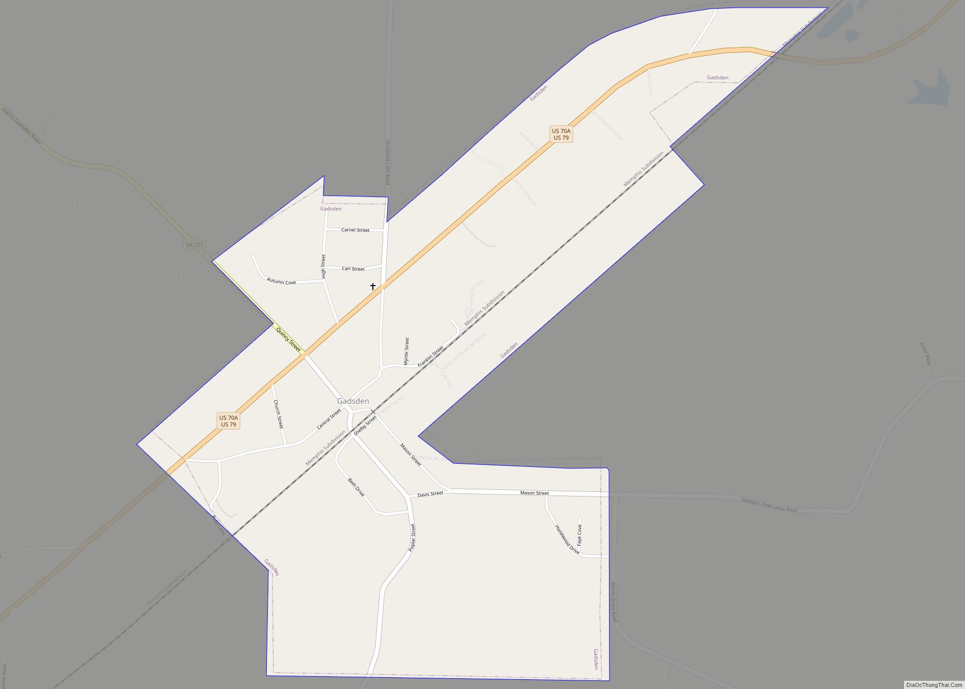
Online Interactive Map
Click on ![]() to view map in "full screen" mode.
to view map in "full screen" mode.
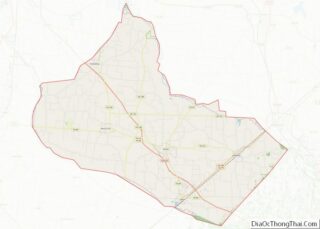
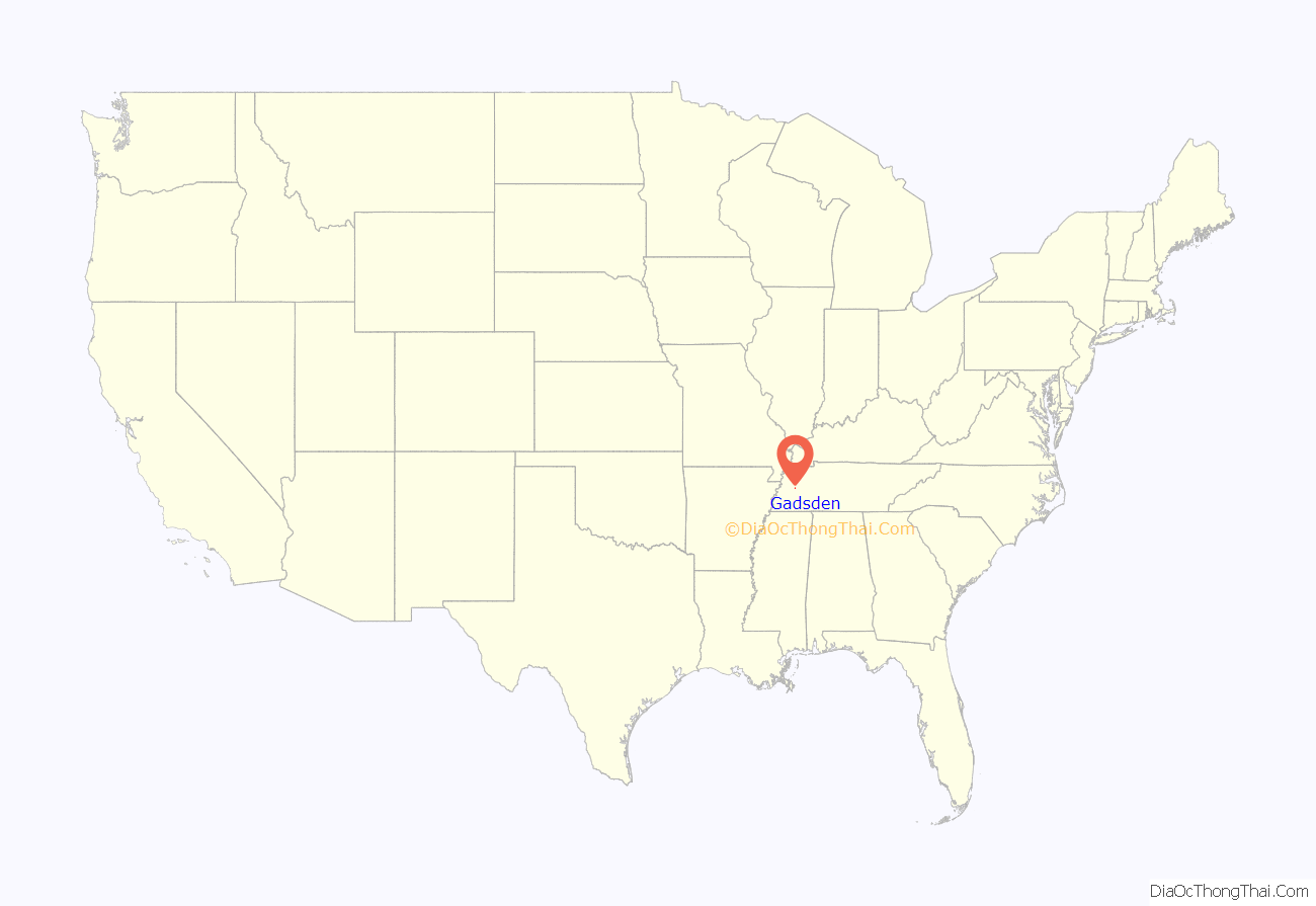
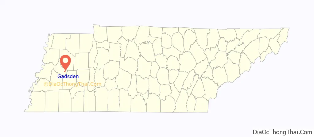
Gadsden location map. Where is Gadsden town?
History
Gadsden was established in the mid-19th century as a stop along the Memphis, Clarksville and Louisville Railroad. It was named for prominent U.S. diplomat James Gadsden (1788–1858), who was responsible for the Gadsden Purchase.
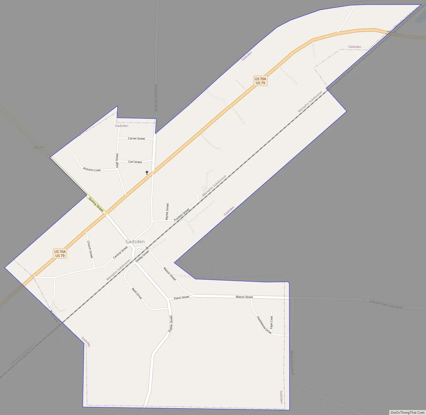
Gadsden Road Map
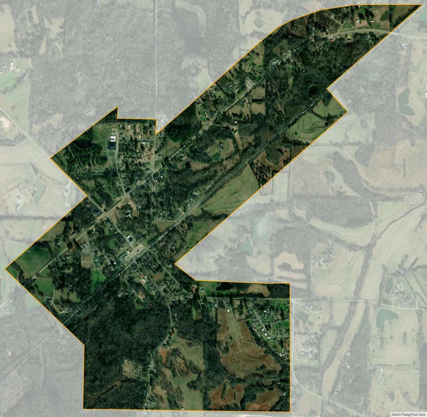
Gadsden city Satellite Map
Geography
Gadsden is located at 35°46′38″N 88°59′26″W / 35.77722°N 88.99056°W / 35.77722; -88.99056 (35.777300, -88.990442). The town lies northeast of Jackson along a congruent stretch of U.S. Route 70 and U.S. Route 79. Tennessee State Route 221 intersects this highway toward the center of town. Humboldt lies to the northeast along US 79, and Bells lies to the southwest.
According to the United States Census Bureau, the town has a total area of 1.1 square miles (2.8 km), all land.
See also
Map of Tennessee State and its subdivision:- Anderson
- Bedford
- Benton
- Bledsoe
- Blount
- Bradley
- Campbell
- Cannon
- Carroll
- Carter
- Cheatham
- Chester
- Claiborne
- Clay
- Cocke
- Coffee
- Crockett
- Cumberland
- Davidson
- Decatur
- DeKalb
- Dickson
- Dyer
- Fayette
- Fentress
- Franklin
- Gibson
- Giles
- Grainger
- Greene
- Grundy
- Hamblen
- Hamilton
- Hancock
- Hardeman
- Hardin
- Hawkins
- Haywood
- Henderson
- Henry
- Hickman
- Houston
- Humphreys
- Jackson
- Jefferson
- Johnson
- Knox
- Lake
- Lauderdale
- Lawrence
- Lewis
- Lincoln
- Loudon
- Macon
- Madison
- Marion
- Marshall
- Maury
- McMinn
- McNairy
- Meigs
- Monroe
- Montgomery
- Moore
- Morgan
- Obion
- Overton
- Perry
- Pickett
- Polk
- Putnam
- Rhea
- Roane
- Robertson
- Rutherford
- Scott
- Sequatchie
- Sevier
- Shelby
- Smith
- Stewart
- Sullivan
- Sumner
- Tipton
- Trousdale
- Unicoi
- Union
- Van Buren
- Warren
- Washington
- Wayne
- Weakley
- White
- Williamson
- Wilson
- Alabama
- Alaska
- Arizona
- Arkansas
- California
- Colorado
- Connecticut
- Delaware
- District of Columbia
- Florida
- Georgia
- Hawaii
- Idaho
- Illinois
- Indiana
- Iowa
- Kansas
- Kentucky
- Louisiana
- Maine
- Maryland
- Massachusetts
- Michigan
- Minnesota
- Mississippi
- Missouri
- Montana
- Nebraska
- Nevada
- New Hampshire
- New Jersey
- New Mexico
- New York
- North Carolina
- North Dakota
- Ohio
- Oklahoma
- Oregon
- Pennsylvania
- Rhode Island
- South Carolina
- South Dakota
- Tennessee
- Texas
- Utah
- Vermont
- Virginia
- Washington
- West Virginia
- Wisconsin
- Wyoming