Grimsley is an unincorporated community and census-designated place (CDP) in Fentress County, Tennessee, United States. Its population was 1,167 as of the 2010 census. Its ZIP code is 38565.
| Name: | Grimsley CDP |
|---|---|
| LSAD Code: | 57 |
| LSAD Description: | CDP (suffix) |
| State: | Tennessee |
| County: | Fentress County |
| Elevation: | 1,749 ft (533 m) |
| Total Area: | 10.89 sq mi (28.20 km²) |
| Land Area: | 10.89 sq mi (28.20 km²) |
| Water Area: | 0.00 sq mi (0.00 km²) |
| Total Population: | 1,219 |
| Population Density: | 111.98/sq mi (43.23/km²) |
| ZIP code: | 38565 |
| Area code: | 931 |
| FIPS code: | 4731420 |
| GNISfeature ID: | 1286299 |
Online Interactive Map
Click on ![]() to view map in "full screen" mode.
to view map in "full screen" mode.
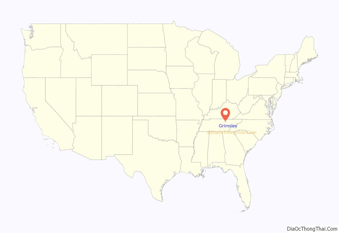
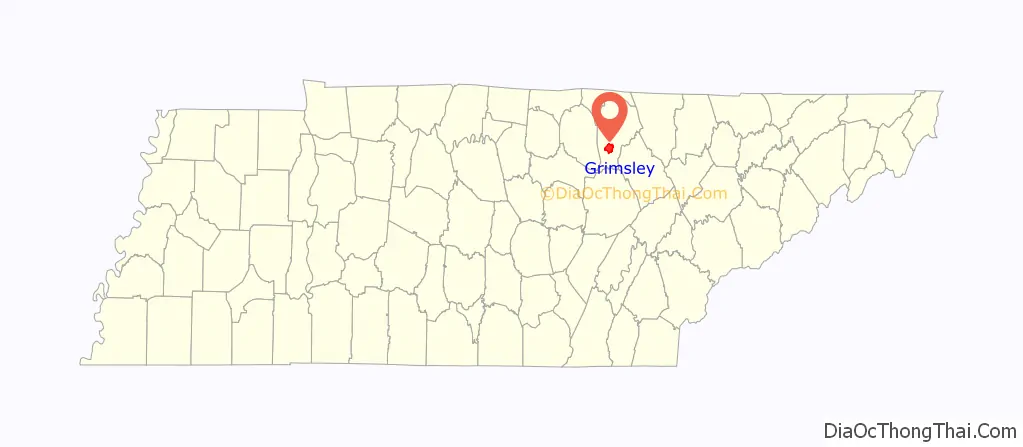
Grimsley location map. Where is Grimsley CDP?
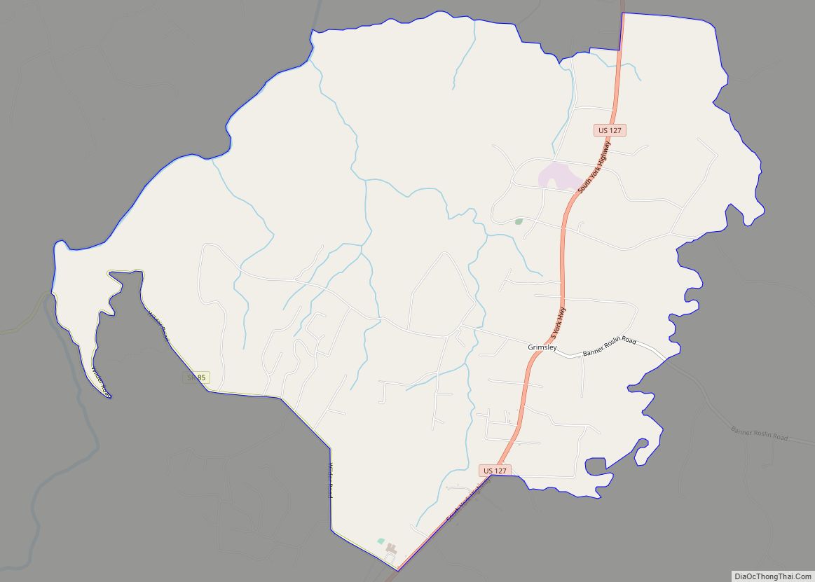
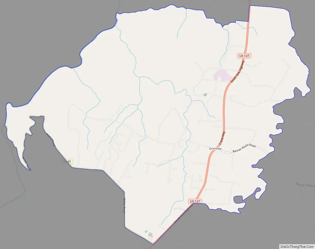
Grimsley Road Map
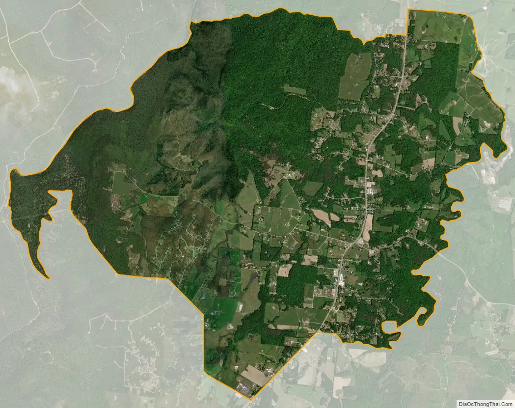
Grimsley city Satellite Map
Geography
The community is located in southern Fentress County on the Cumberland Plateau. The settled part is located on high ground in the center of the CDP, with elevations ranging from 1,700 to 1,800 feet (520 to 550 m). The west side of the CDP drops into the gorge of the East Fork of the Obey River, with a bottom elevation of 800 to 900 feet (240 to 270 m), and the east side follows the valley of the North Prong of Clear Fork, with an elevation of 1,600 feet (490 m). Both rivers are part of the Cumberland River watershed.
U.S. Route 127 is the main road through the community, leading north 12 miles (19 km) to Jamestown, the Fentress County seat, and south 6.5 miles (10.5 km) to Clarkrange. Tennessee State Route 85 forms the southwestern edge of the CDP, dropping by switchbacks into the gorge of the East Fork of the Obey and leading 33 miles (53 km) to Livingston.
According to the U.S. Census Bureau, the Grimsley CDP has an area of 10.9 square miles (28.2 km), all of it land.
See also
Map of Tennessee State and its subdivision:- Anderson
- Bedford
- Benton
- Bledsoe
- Blount
- Bradley
- Campbell
- Cannon
- Carroll
- Carter
- Cheatham
- Chester
- Claiborne
- Clay
- Cocke
- Coffee
- Crockett
- Cumberland
- Davidson
- Decatur
- DeKalb
- Dickson
- Dyer
- Fayette
- Fentress
- Franklin
- Gibson
- Giles
- Grainger
- Greene
- Grundy
- Hamblen
- Hamilton
- Hancock
- Hardeman
- Hardin
- Hawkins
- Haywood
- Henderson
- Henry
- Hickman
- Houston
- Humphreys
- Jackson
- Jefferson
- Johnson
- Knox
- Lake
- Lauderdale
- Lawrence
- Lewis
- Lincoln
- Loudon
- Macon
- Madison
- Marion
- Marshall
- Maury
- McMinn
- McNairy
- Meigs
- Monroe
- Montgomery
- Moore
- Morgan
- Obion
- Overton
- Perry
- Pickett
- Polk
- Putnam
- Rhea
- Roane
- Robertson
- Rutherford
- Scott
- Sequatchie
- Sevier
- Shelby
- Smith
- Stewart
- Sullivan
- Sumner
- Tipton
- Trousdale
- Unicoi
- Union
- Van Buren
- Warren
- Washington
- Wayne
- Weakley
- White
- Williamson
- Wilson
- Alabama
- Alaska
- Arizona
- Arkansas
- California
- Colorado
- Connecticut
- Delaware
- District of Columbia
- Florida
- Georgia
- Hawaii
- Idaho
- Illinois
- Indiana
- Iowa
- Kansas
- Kentucky
- Louisiana
- Maine
- Maryland
- Massachusetts
- Michigan
- Minnesota
- Mississippi
- Missouri
- Montana
- Nebraska
- Nevada
- New Hampshire
- New Jersey
- New Mexico
- New York
- North Carolina
- North Dakota
- Ohio
- Oklahoma
- Oregon
- Pennsylvania
- Rhode Island
- South Carolina
- South Dakota
- Tennessee
- Texas
- Utah
- Vermont
- Virginia
- Washington
- West Virginia
- Wisconsin
- Wyoming