Hendersonville is the largest city in Sumner County, Tennessee, on Old Hickory Lake. The population was 61,753 at the 2020 census.
Hendersonville is the fourth-largest city in the Nashville metropolitan area after Nashville, Murfreesboro, and Franklin and the 10th largest in Tennessee. Hendersonville is located 18 miles northeast of downtown Nashville. The city was settled around 1784 by Daniel Smith, whose house Rock Castle, completed in 1796, is maintained as an historic site.
The city is named for William Henderson, the first postmaster here.
Numerous 20th-century musicians in the Nashville area lived in Hendersonville, especially some associated with country music. These include Johnny Cash and his wife June Carter Cash, and Roy Orbison. The city’s main road, Johnny Cash Parkway, is named for the late singer.
Other notable past and present residents include Conway Twitty. (His home, Twitty City, was adapted as the Trinity Music City complex after his death in 1993.) In addition, Jean Shepard, Marty Stuart, Kelly Clarkson, Max T. Barnes, Taylor Swift, Young Buck, and Chris Henderson (3 Doors Down) have lived here.
| Name: | Hendersonville city |
|---|---|
| LSAD Code: | 25 |
| LSAD Description: | city (suffix) |
| State: | Tennessee |
| County: | Sumner County |
| Incorporated: | 1901 |
| Elevation: | 482 ft (147 m) |
| Total Area: | 38.18 sq mi (98.89 km²) |
| Land Area: | 31.68 sq mi (82.04 km²) |
| Water Area: | 6.50 sq mi (16.85 km²) |
| Total Population: | 61,753 |
| Population Density: | 1,949.58/sq mi (752.73/km²) |
| ZIP code: | 37075, 37077 |
| Area code: | 615 |
| FIPS code: | 4733280 |
| GNISfeature ID: | 1287389 |
| Website: | https://www.hvilletn.org/ |
Online Interactive Map
Click on ![]() to view map in "full screen" mode.
to view map in "full screen" mode.
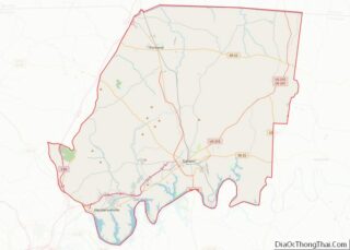
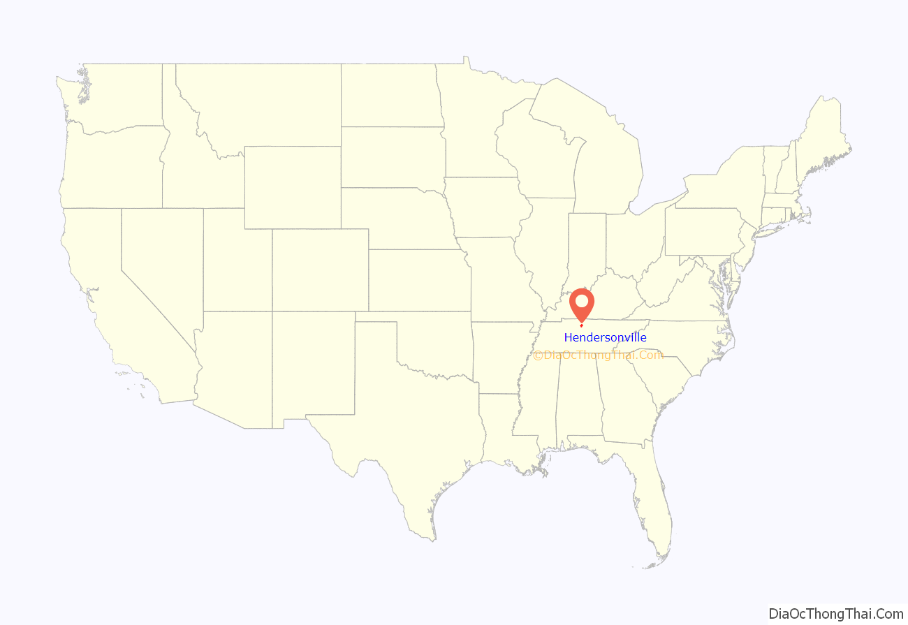
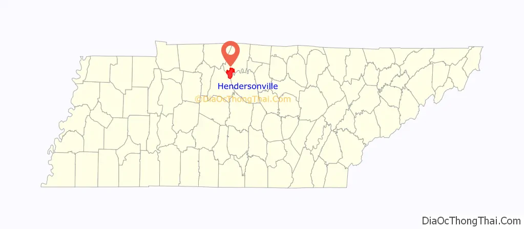
Hendersonville location map. Where is Hendersonville city?
History
In 1784 Daniel Smith received a land grant from the state of North Carolina in payment for surveying Middle Tennessee. (North Carolina at the time claimed its boundaries extended to this territory across the Appalachian Mountains.) He began work on his house later known as Rock Castle, but it was not completed until 1796. Due to his surveying trips, he frequently was gone on long journeys, and his wife supervised much of the construction.
In 1790, William Henderson settled in Sumner County and later became the namesake of the town. It was a trading center for the county, which was devoted to the production of tobacco and hemp as commodity crops, and blood livestock: both horses and cattle. During the Civil War, Monthaven was used by Union troops as a field hospital, as they occupied Middle Tennessee from 1862 to 1870. In the late 20th century, this historic home was listed on the National Register of Historic Places. Even before the Emancipation Proclamation of January 1863, refugee slaves with their families found their way to Union lines in the state in search of freedom. The Army established a contraband camp near Hendersonville, to offer shelter to the freedmen, help them with supplies and food, and sign them up to work for wages for the Army, often building defenses. Missionary societies helped teach both adults and children among the slaves.
The small city was not incorporated until 1969, as the area continued to be rural and devoted to agriculture and related activities. It then had roughly 250 residents and was led by L.H. “Dink” Newman. Since the late 20th and early 21st centuries, it has grown to become the largest city in the county.
With the completion of the Old Hickory Dam and an associated lake in 1954, Hendersonville started to develop more rapidly. The lake attracted sportsmen and people seeking recreation; some became residents or acquired second homes here. Since the late 20th century, it has become the most-populous city of Sumner County, and one of the most populous suburbs of Nashville, along with Franklin and Murfreesboro. The city contains around 0.7% of the population of Tennessee.
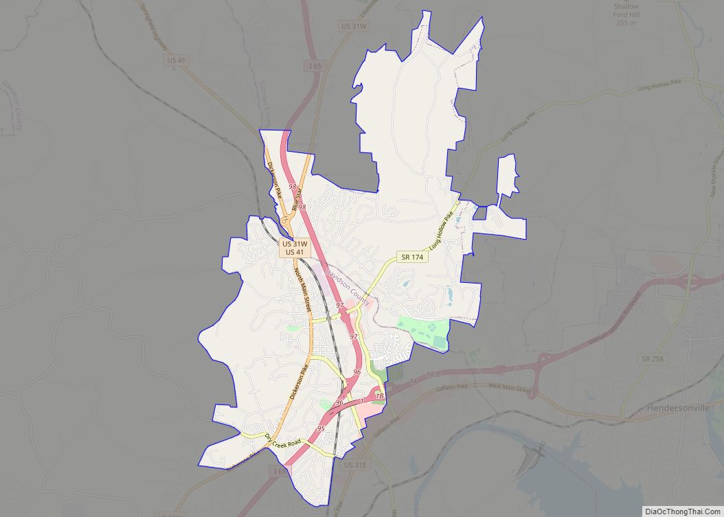
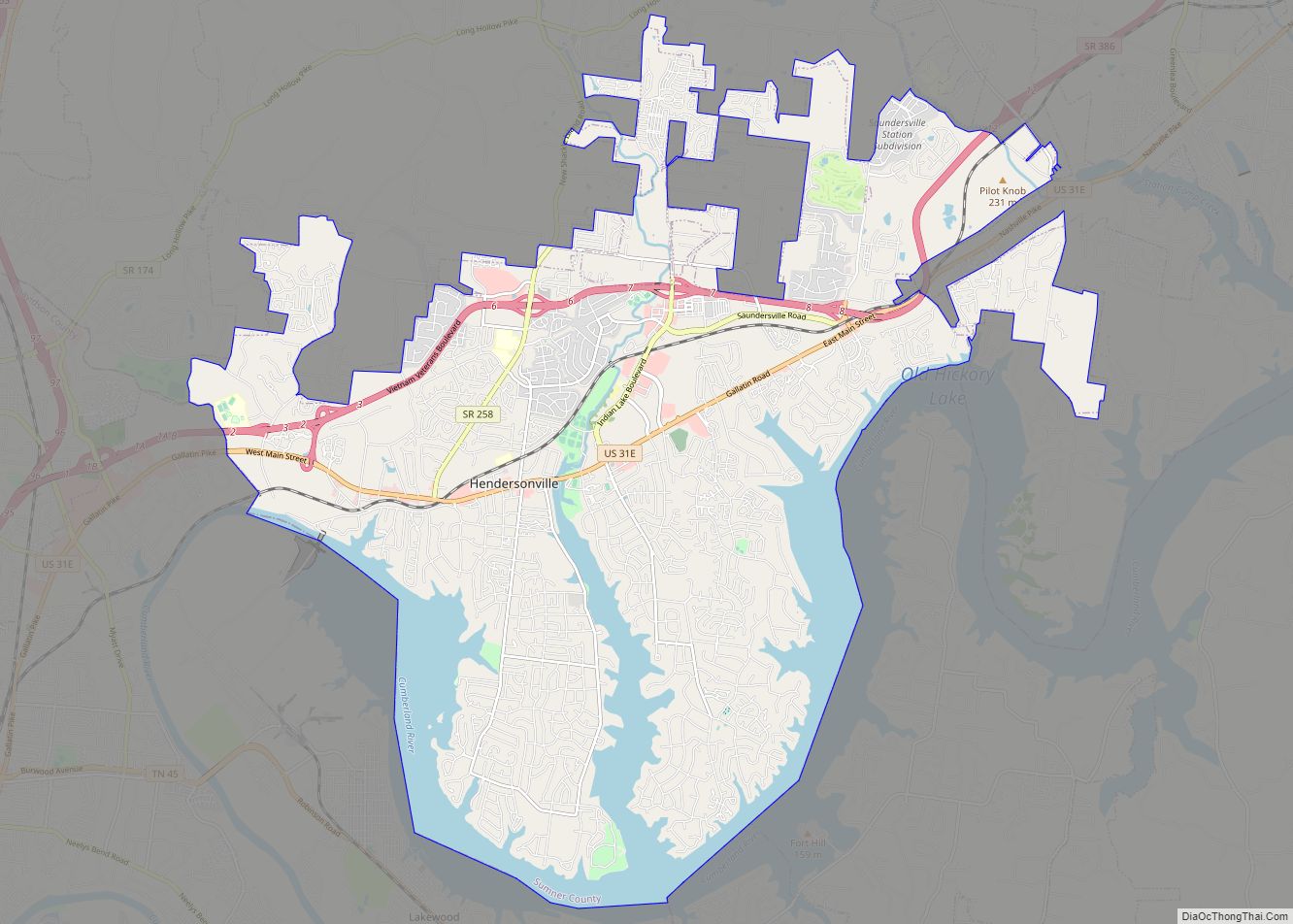
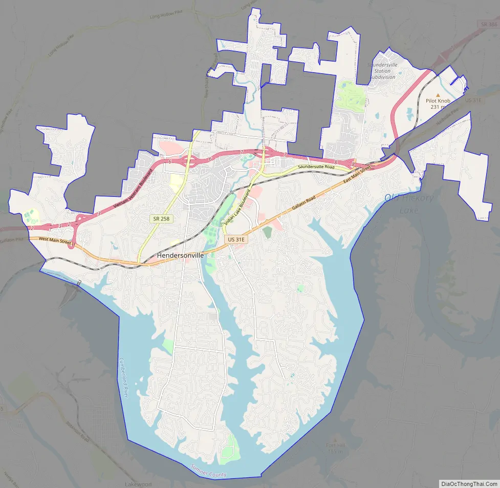
Hendersonville Road Map
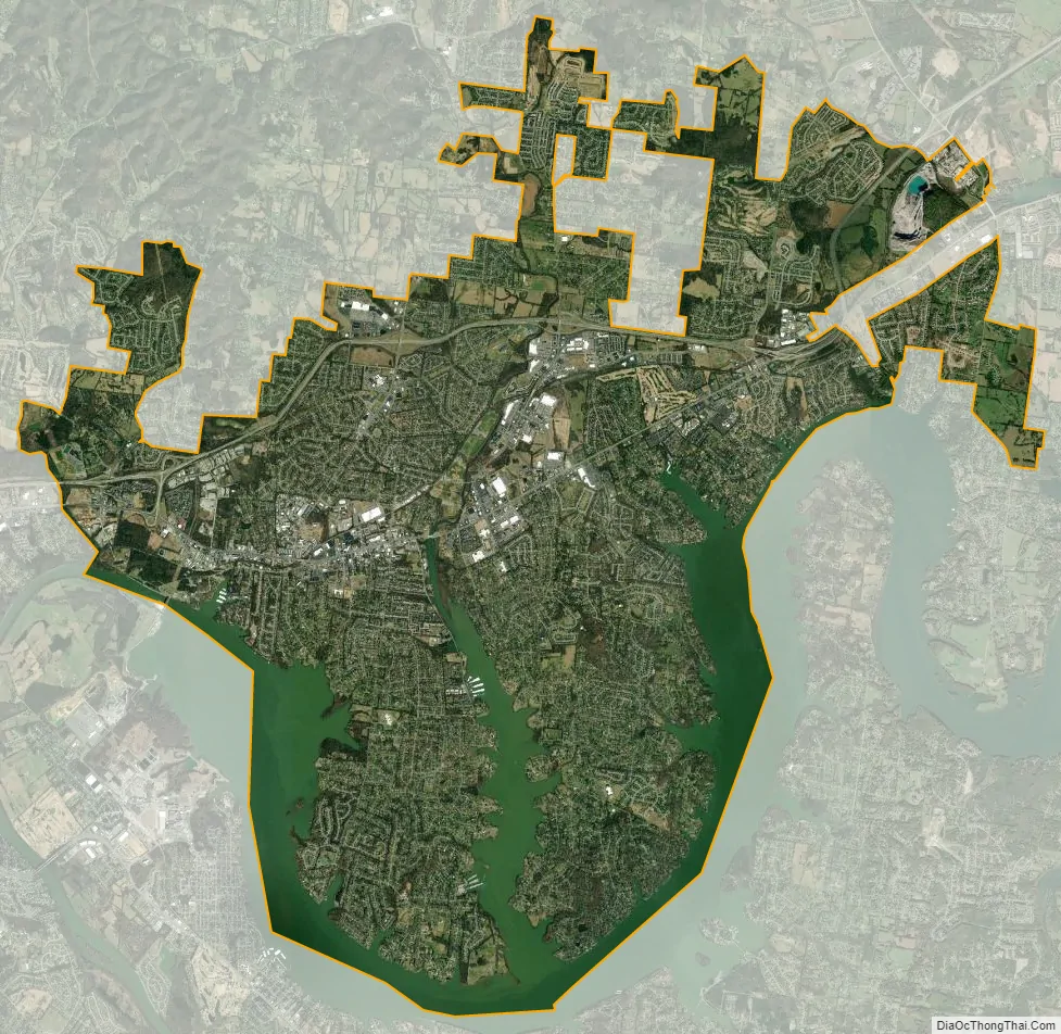
Hendersonville city Satellite Map
Geography
According to the United States Census Bureau, the city has a total area of 32.9 square miles (85 km), of which 27.3 square miles (71 km) is land and 5.6 square miles (15 km) (16.93%) is water, mostly parts of the Cumberland River.
Hendersonville is served by the freeway Tennessee State Route 386 and its parallel surface road U.S. Route 31E.
Climate
Hendersonville’s climate classifications are Köppen “Cfa” and Trewartha “DOak” due to very hot summers (three to four months average over 71.6 °F (22.0 °C)), mild winters (all months average over 32.0 °F (0.0 °C)), and mediocre (4–7 months) growing seasons (in this case seven months average over 50.0 °F (10.0 °C)).
See also
Map of Tennessee State and its subdivision:- Anderson
- Bedford
- Benton
- Bledsoe
- Blount
- Bradley
- Campbell
- Cannon
- Carroll
- Carter
- Cheatham
- Chester
- Claiborne
- Clay
- Cocke
- Coffee
- Crockett
- Cumberland
- Davidson
- Decatur
- DeKalb
- Dickson
- Dyer
- Fayette
- Fentress
- Franklin
- Gibson
- Giles
- Grainger
- Greene
- Grundy
- Hamblen
- Hamilton
- Hancock
- Hardeman
- Hardin
- Hawkins
- Haywood
- Henderson
- Henry
- Hickman
- Houston
- Humphreys
- Jackson
- Jefferson
- Johnson
- Knox
- Lake
- Lauderdale
- Lawrence
- Lewis
- Lincoln
- Loudon
- Macon
- Madison
- Marion
- Marshall
- Maury
- McMinn
- McNairy
- Meigs
- Monroe
- Montgomery
- Moore
- Morgan
- Obion
- Overton
- Perry
- Pickett
- Polk
- Putnam
- Rhea
- Roane
- Robertson
- Rutherford
- Scott
- Sequatchie
- Sevier
- Shelby
- Smith
- Stewart
- Sullivan
- Sumner
- Tipton
- Trousdale
- Unicoi
- Union
- Van Buren
- Warren
- Washington
- Wayne
- Weakley
- White
- Williamson
- Wilson
- Alabama
- Alaska
- Arizona
- Arkansas
- California
- Colorado
- Connecticut
- Delaware
- District of Columbia
- Florida
- Georgia
- Hawaii
- Idaho
- Illinois
- Indiana
- Iowa
- Kansas
- Kentucky
- Louisiana
- Maine
- Maryland
- Massachusetts
- Michigan
- Minnesota
- Mississippi
- Missouri
- Montana
- Nebraska
- Nevada
- New Hampshire
- New Jersey
- New Mexico
- New York
- North Carolina
- North Dakota
- Ohio
- Oklahoma
- Oregon
- Pennsylvania
- Rhode Island
- South Carolina
- South Dakota
- Tennessee
- Texas
- Utah
- Vermont
- Virginia
- Washington
- West Virginia
- Wisconsin
- Wyoming