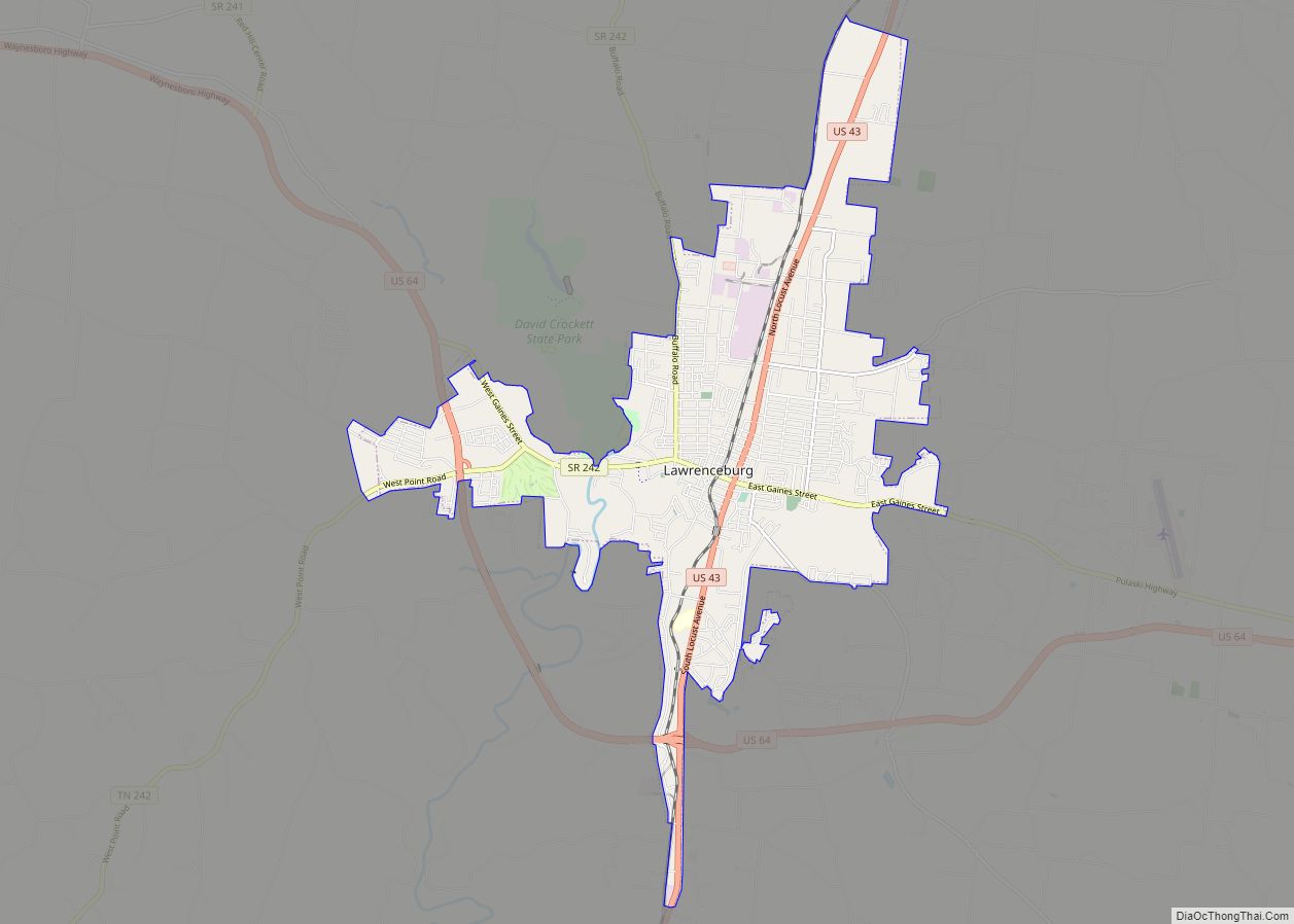
The city of Lawrenceburg is the county seat of Lawrence County, Tennessee, United States, The largest city on the state’s southern border between Chattanooga and Memphis, it lies on the banks of Shoal Creek. The population was 11,633 at the 2020 United States Census. The city is named after War of 1812 American Navy officer James Lawrence.
Located around 80 miles (130 km) southwest of Nashville at the junction of U.S. Routes 43 and 64, Lawrenceburg is called the “Crossroads of Dixie.”
| Name: | Lawrenceburg city |
|---|---|
| LSAD Code: | 25 |
| LSAD Description: | city (suffix) |
| State: | Tennessee |
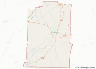
| County: | Lawrence County |
| Founded: | 1819 |
| Incorporated: | 1825 |
| Elevation: | 1,120+ feet 335+ meters ft (273 m) |
| Total Area: | 12.66 sq mi (32.80 km²) |
| Land Area: | 12.66 sq mi (32.80 km²) |
| Water Area: | 0.00 sq mi (0.00 km²) |
| Total Population: | 11,633 |
| Population Density: | 918.52/sq mi (354.64/km²) |
| ZIP code: | 38464 |
| Area code: | 931 |
| FIPS code: | 4741340 |
| GNISfeature ID: | 1290790 |
| Website: | www.lawrenceburgtn.gov |
Online Interactive Map
Click on ![]() to view map in "full screen" mode.
to view map in "full screen" mode.
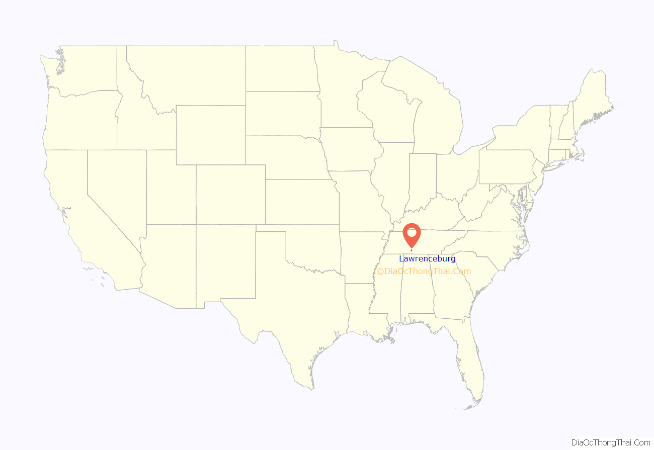
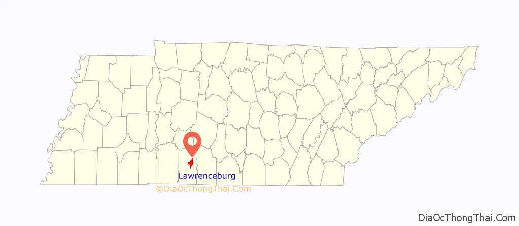
Lawrenceburg location map. Where is Lawrenceburg city?
History
According to a recent theory, the Lawrenceburg area is the likely site of “Chicasa”—the place where Spanish explorer Hernando de Soto and his men wintered in 1540–41 (though earlier theories have suggested this campsite to have been in northern Mississippi). The Chickasaw Nation sold the area to the US in 1816.
Upon moving from East Tennessee into the region around 1817, David Crockett served as a justice of the peace, a colonel of the militia, and a state representative. David Crockett established a powder mill on Shoal Creek originally called the Sycamore River. This area is now home to David Crockett State Park. Crockett was elected as a commissioner and served on the board that placed Lawrenceburg four miles (6 km) west of the geographic center of Lawrence County. Crockett was opposed to the city being located in its current location, largely out of fear of flooding. He and his family lived in Lawrenceburg for several years before moving to West Tennessee after a flood destroyed his mill.
After World War II, the Murray Ohio Manufacturing Company, a U.S. producer of bicycles and outdoor equipment, moved its manufacturing operations to Lawrenceburg, building a new factory and assembly plant. Over the next several decades, the Murray factory grew to be one of the largest in the United States: 42.7 acres (173,000 m) under roof.
A flood struck Lawrenceburg in July 1998, killing two people on Shoal Creek.
Following the flood, the city undertook a 10-year flood control project that dramatically reduced risk for major flooding that had plagued the town since the days of Davy Crockett.
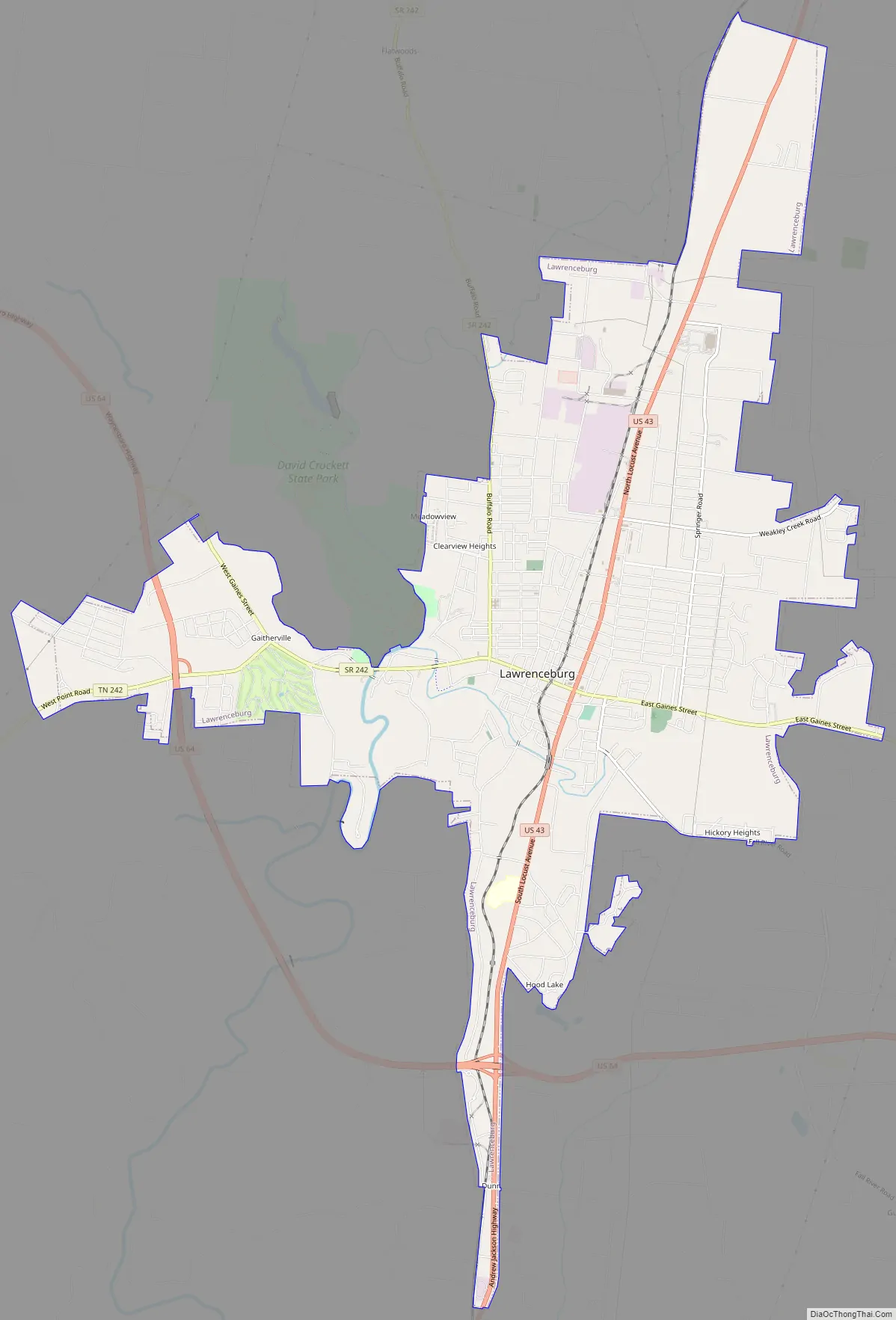
Lawrenceburg Road Map
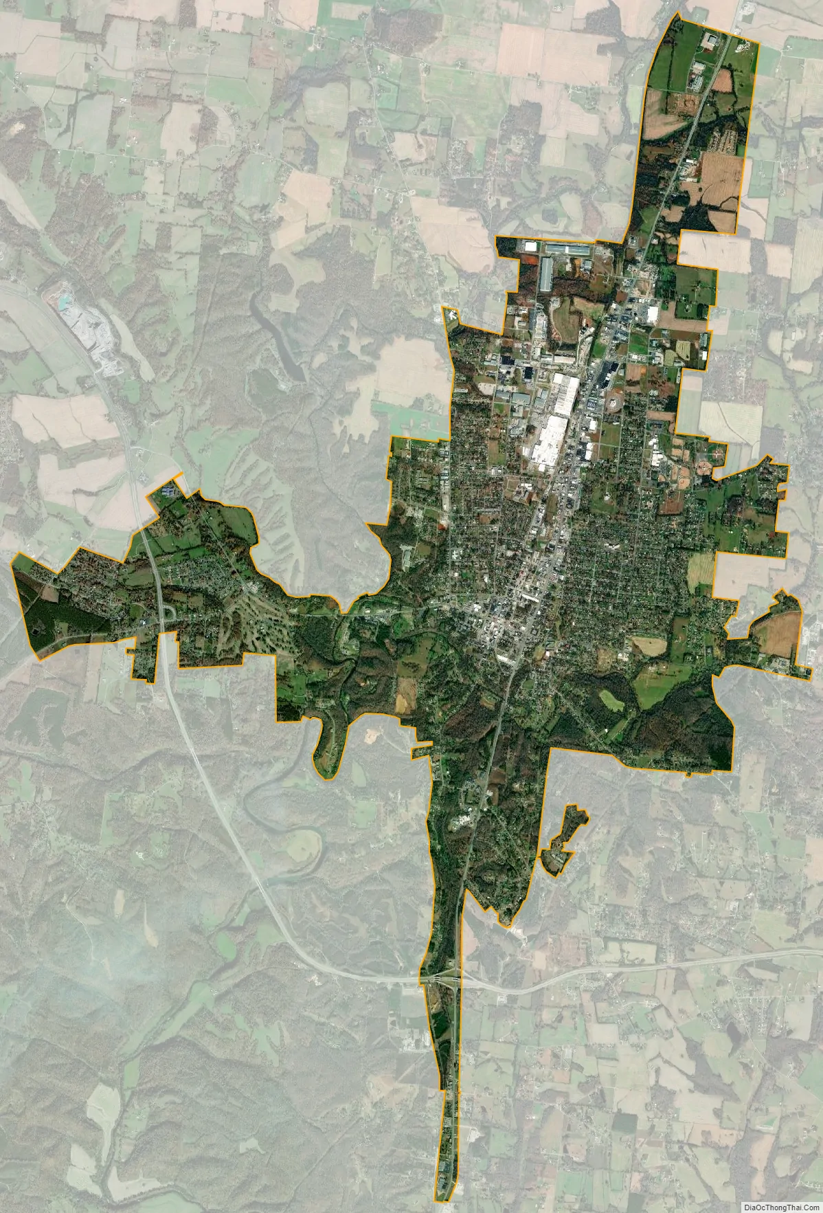
Lawrenceburg city Satellite Map
Geography
Lawrenceburg is located at 35°14′37″N 87°20′4″W / 35.24361°N 87.33444°W / 35.24361; -87.33444 (35.243491, −87.334563).
The city of Lawrenceburg has a total area of 12.6 square miles (33 km). It is the largest city on the state line between Chattanooga and Memphis. Located on the southern Highland Rim, Lawrence County and Lawrenceburg are set atop of a large mountain plateau of the Appalachian Mountain range with elevations ranging between 810 feet (250 m) to over 1,120 feet (340 m). Map of the Appalachian Mountain Range.
Climate
See also
Map of Tennessee State and its subdivision:- Anderson
- Bedford
- Benton
- Bledsoe
- Blount
- Bradley
- Campbell
- Cannon
- Carroll
- Carter
- Cheatham
- Chester
- Claiborne
- Clay
- Cocke
- Coffee
- Crockett
- Cumberland
- Davidson
- Decatur
- DeKalb
- Dickson
- Dyer
- Fayette
- Fentress
- Franklin
- Gibson
- Giles
- Grainger
- Greene
- Grundy
- Hamblen
- Hamilton
- Hancock
- Hardeman
- Hardin
- Hawkins
- Haywood
- Henderson
- Henry
- Hickman
- Houston
- Humphreys
- Jackson
- Jefferson
- Johnson
- Knox
- Lake
- Lauderdale
- Lawrence
- Lewis
- Lincoln
- Loudon
- Macon
- Madison
- Marion
- Marshall
- Maury
- McMinn
- McNairy
- Meigs
- Monroe
- Montgomery
- Moore
- Morgan
- Obion
- Overton
- Perry
- Pickett
- Polk
- Putnam
- Rhea
- Roane
- Robertson
- Rutherford
- Scott
- Sequatchie
- Sevier
- Shelby
- Smith
- Stewart
- Sullivan
- Sumner
- Tipton
- Trousdale
- Unicoi
- Union
- Van Buren
- Warren
- Washington
- Wayne
- Weakley
- White
- Williamson
- Wilson
- Alabama
- Alaska
- Arizona
- Arkansas
- California
- Colorado
- Connecticut
- Delaware
- District of Columbia
- Florida
- Georgia
- Hawaii
- Idaho
- Illinois
- Indiana
- Iowa
- Kansas
- Kentucky
- Louisiana
- Maine
- Maryland
- Massachusetts
- Michigan
- Minnesota
- Mississippi
- Missouri
- Montana
- Nebraska
- Nevada
- New Hampshire
- New Jersey
- New Mexico
- New York
- North Carolina
- North Dakota
- Ohio
- Oklahoma
- Oregon
- Pennsylvania
- Rhode Island
- South Carolina
- South Dakota
- Tennessee
- Texas
- Utah
- Vermont
- Virginia
- Washington
- West Virginia
- Wisconsin
- Wyoming