Manchester is a city in Coffee County, Tennessee, United States. The population was 12,213 at the 2020 census. It is the county seat of Coffee County. The city is located halfway between Nashville and Chattanooga on Interstate 24.
Manchester is part of the Tullahoma, Tennessee Micropolitan Statistical Area.
Since 2002, Manchester has been the host city for the annual Bonnaroo Music Festival. The city’s population swells to nearly 100,000 people for the four-day event, for which people travel across the country to camp and enjoy continuous and diverse music.
| Name: | Manchester city |
|---|---|
| LSAD Code: | 25 |
| LSAD Description: | city (suffix) |
| State: | Tennessee |
| County: | Coffee County |
| Elevation: | 1,060 ft (320 m) |
| Total Area: | 15.35 sq mi (39.75 km²) |
| Land Area: | 15.32 sq mi (39.69 km²) |
| Water Area: | 0.02 sq mi (0.06 km²) |
| Total Population: | 12,212 |
| Population Density: | 796.97/sq mi (307.71/km²) |
| ZIP code: | 37349, 37355 |
| Area code: | 931 |
| FIPS code: | 4745500 |
| GNISfeature ID: | 1292561 |
| Website: | www.cityofmanchestertn.com |
Online Interactive Map
Click on ![]() to view map in "full screen" mode.
to view map in "full screen" mode.
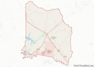
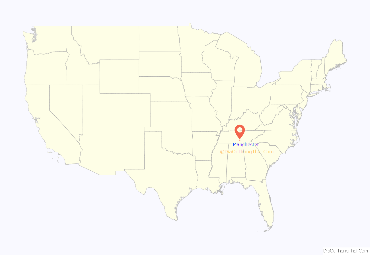
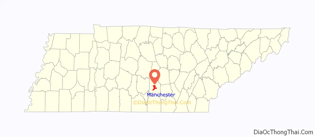
Manchester location map. Where is Manchester city?
History
A post office called Manchester has been in operation since 1817. The city was named after Manchester, in England. According to historians, “A small village, “Mitchellsville” was already in existence near the proposed site for the new county seat, but when the new county was formed, it was renamed “Manchester” after the industrial city of Manchester, England. Because of the abundance of water power, provided by the “Little Duck” & “Big Duck” Rivers, which flow through Manchester, it was hoped that it also would become a great industrial city.”
Long-time Mayor Lonnie J. Norman died of COVID-19 in 2020, during the COVID-19 pandemic.
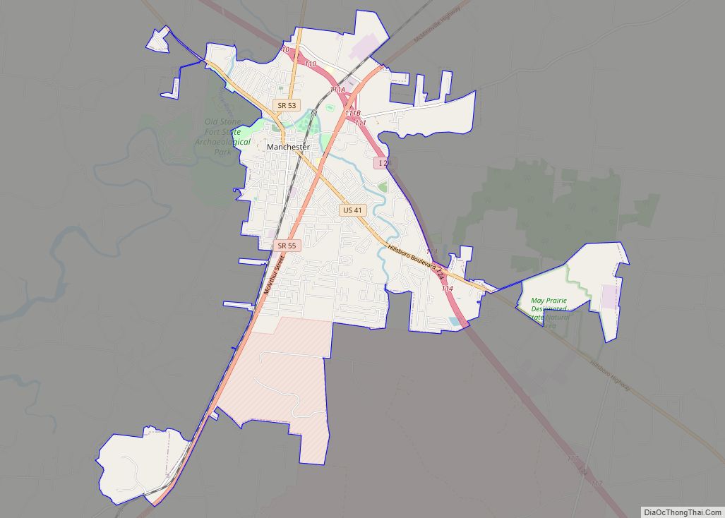
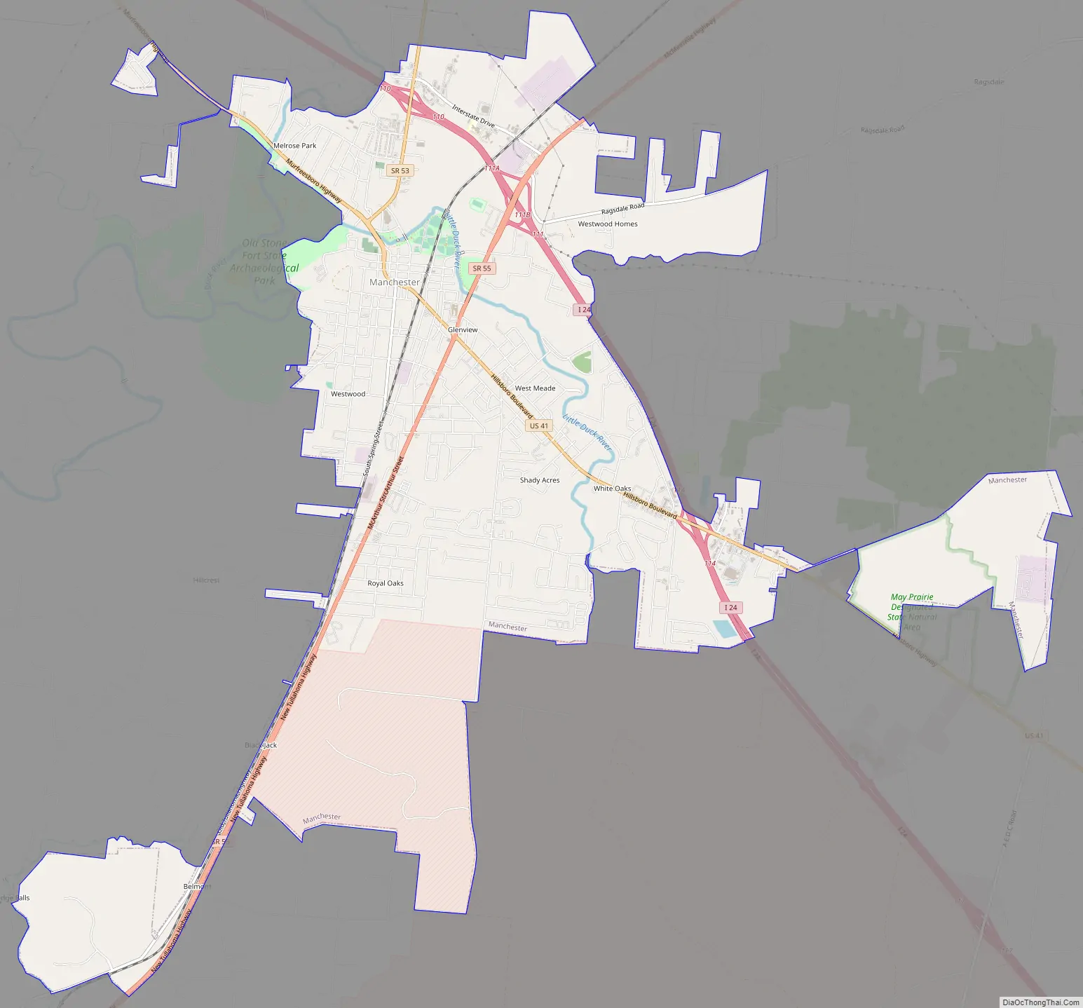
Manchester Road Map
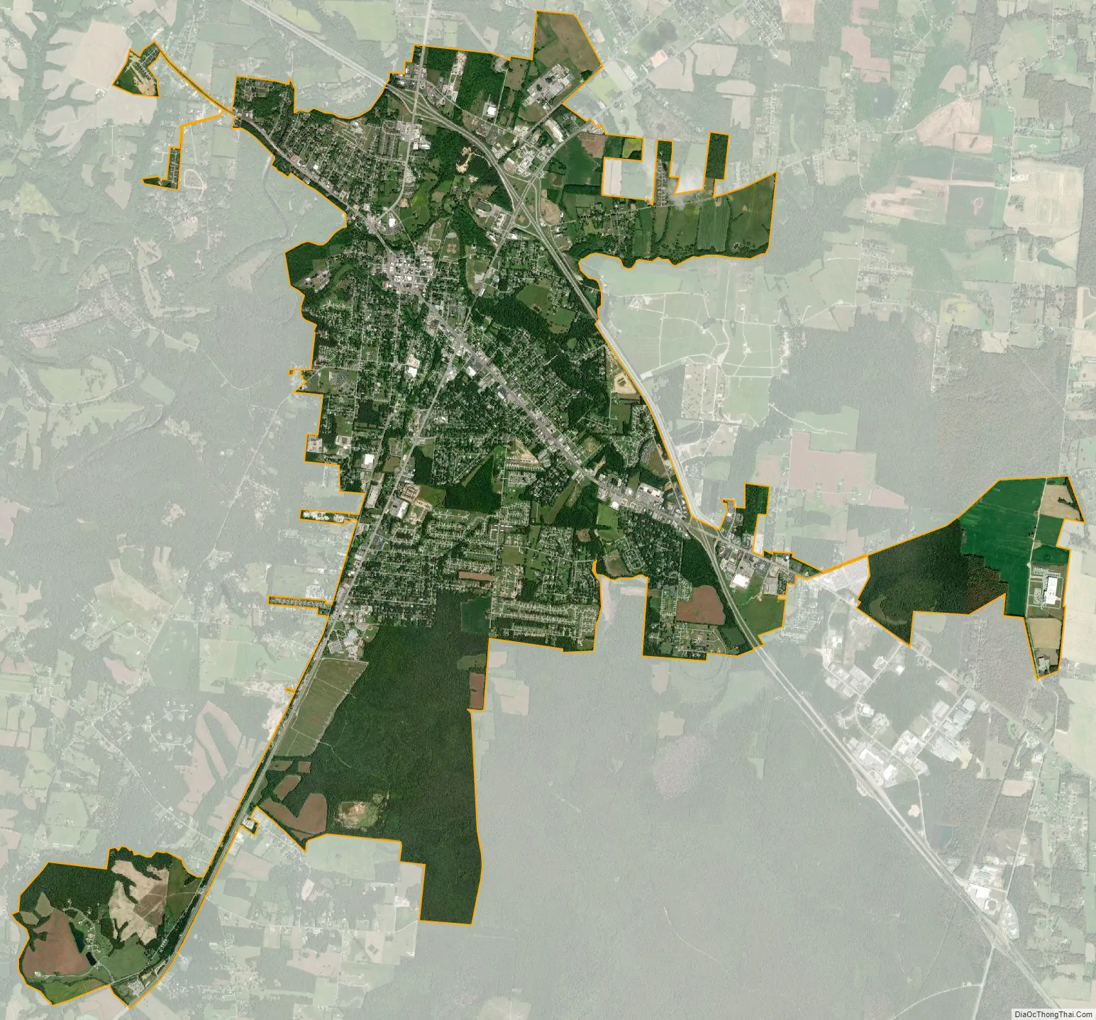
Manchester city Satellite Map
Geography
Manchester is located slightly south of the center of Coffee County at 35°28′24″N 86°5′8″W / 35.47333°N 86.08556°W / 35.47333; -86.08556 (35.473337, -86.085512). Interstate 24 passes through the northeast side of the city, with access from Exits 110, 111, and 114. Exit “112” was a “temporary exit” directly from the shoulder of I-24 into the Bonnaroo Music Festival site. From Exit 111 it is 68 miles (109 km) southeast to Chattanooga and 65 miles (105 km) northwest to Nashville. U.S. Route 41 passes through the center of town as Hillsboro Boulevard; US 41 runs parallel to I-24 and leads 8 miles (13 km) southeast to Hillsboro and northwest 5 miles (8 km) to I-24 Exit 105. Tennessee State Route 55 passes through the east side of Manchester as McArthur Street; it leads northeast 25 miles (40 km) to McMinnville and southwest 12 miles (19 km) to Tullahoma.
The Little Duck River begins at the confluence of Hunt Creek and Huckleberry Creek and passes through the city before joining the Duck River just west of the city limits. The Duck River, a tributary of the Tennessee River, passes through the northwest corner of the city. Both rivers drop over waterfalls above their confluence, within Old Stone Fort State Archaeological Park.
According to the United States Census Bureau, the city has a total area of 14.2 square miles (36.7 km), of which 14.1 square miles (36.6 km) is land and 0.04 square miles (0.1 km), or 0.24%, is water.
See also
Map of Tennessee State and its subdivision:- Anderson
- Bedford
- Benton
- Bledsoe
- Blount
- Bradley
- Campbell
- Cannon
- Carroll
- Carter
- Cheatham
- Chester
- Claiborne
- Clay
- Cocke
- Coffee
- Crockett
- Cumberland
- Davidson
- Decatur
- DeKalb
- Dickson
- Dyer
- Fayette
- Fentress
- Franklin
- Gibson
- Giles
- Grainger
- Greene
- Grundy
- Hamblen
- Hamilton
- Hancock
- Hardeman
- Hardin
- Hawkins
- Haywood
- Henderson
- Henry
- Hickman
- Houston
- Humphreys
- Jackson
- Jefferson
- Johnson
- Knox
- Lake
- Lauderdale
- Lawrence
- Lewis
- Lincoln
- Loudon
- Macon
- Madison
- Marion
- Marshall
- Maury
- McMinn
- McNairy
- Meigs
- Monroe
- Montgomery
- Moore
- Morgan
- Obion
- Overton
- Perry
- Pickett
- Polk
- Putnam
- Rhea
- Roane
- Robertson
- Rutherford
- Scott
- Sequatchie
- Sevier
- Shelby
- Smith
- Stewart
- Sullivan
- Sumner
- Tipton
- Trousdale
- Unicoi
- Union
- Van Buren
- Warren
- Washington
- Wayne
- Weakley
- White
- Williamson
- Wilson
- Alabama
- Alaska
- Arizona
- Arkansas
- California
- Colorado
- Connecticut
- Delaware
- District of Columbia
- Florida
- Georgia
- Hawaii
- Idaho
- Illinois
- Indiana
- Iowa
- Kansas
- Kentucky
- Louisiana
- Maine
- Maryland
- Massachusetts
- Michigan
- Minnesota
- Mississippi
- Missouri
- Montana
- Nebraska
- Nevada
- New Hampshire
- New Jersey
- New Mexico
- New York
- North Carolina
- North Dakota
- Ohio
- Oklahoma
- Oregon
- Pennsylvania
- Rhode Island
- South Carolina
- South Dakota
- Tennessee
- Texas
- Utah
- Vermont
- Virginia
- Washington
- West Virginia
- Wisconsin
- Wyoming