Oneida is a town in Scott County, Tennessee, United States. The population was 3,787 at the 2020 census.
Oneida is known for its proximity to the Big South Fork National River and Recreation Area. The town is named for Oneida, New York, the home of several railroad executives who helped develop the town in the late 19th century.
| Name: | Oneida town |
|---|---|
| LSAD Code: | 43 |
| LSAD Description: | town (suffix) |
| State: | Tennessee |
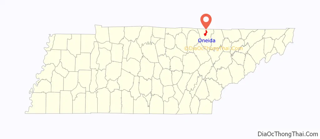
| County: | Scott County |
| Incorporated: | March 22, 1917 |
| Elevation: | 1,444 ft (440 m) |
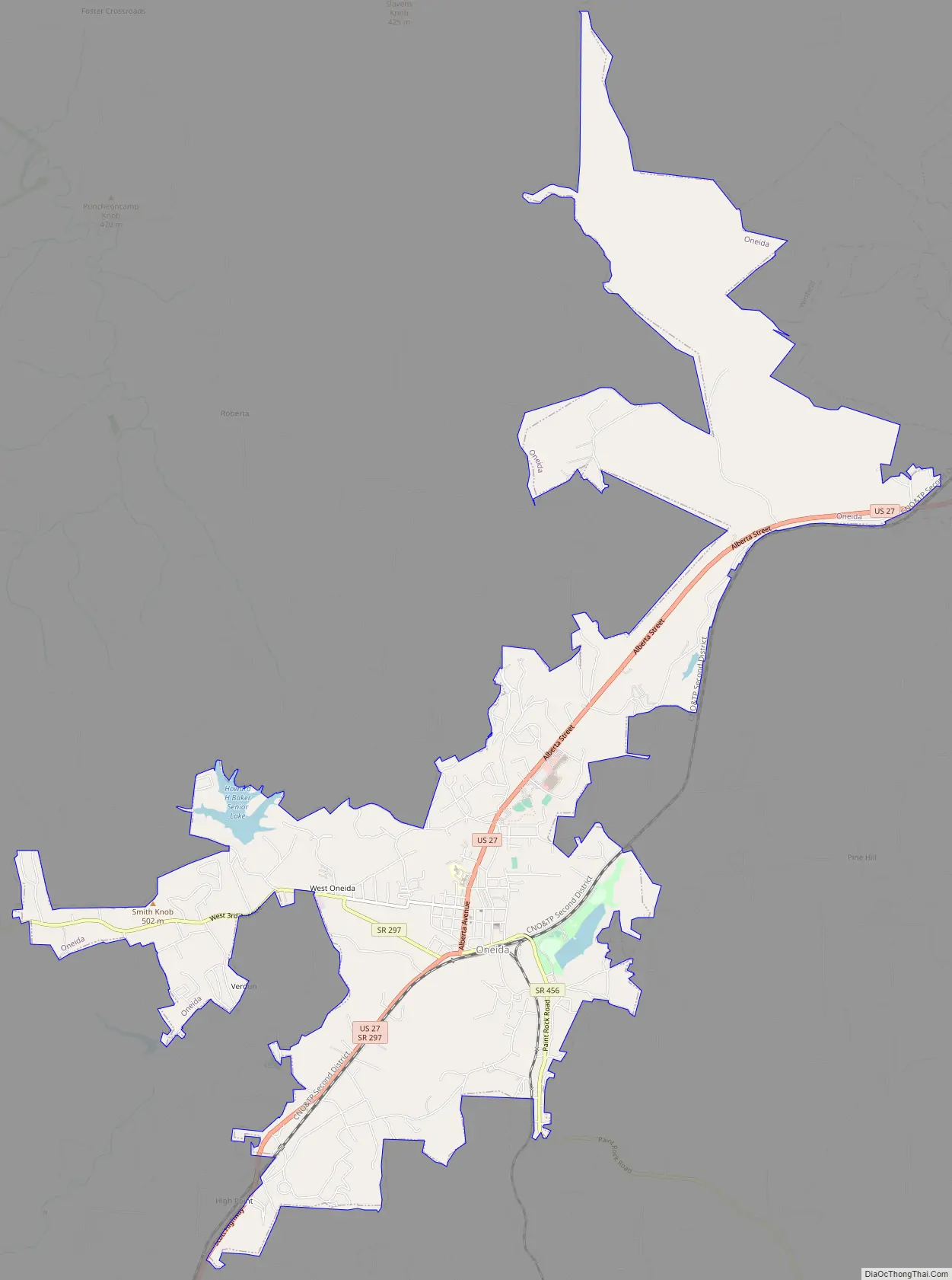
| Total Area: | 9.53 sq mi (24.69 km²) |
| Land Area: | 9.38 sq mi (24.31 km²) |
| Water Area: | 0.15 sq mi (0.38 km²) |
| Total Population: | 3,787 |
| Population Density: | 403.52/sq mi (155.79/km²) |
| ZIP code: | 37841 |
| Area code: | 423 |
| FIPS code: | 4755860 |
| GNISfeature ID: | 1329062 |
| Website: | www.townofoneida.com |
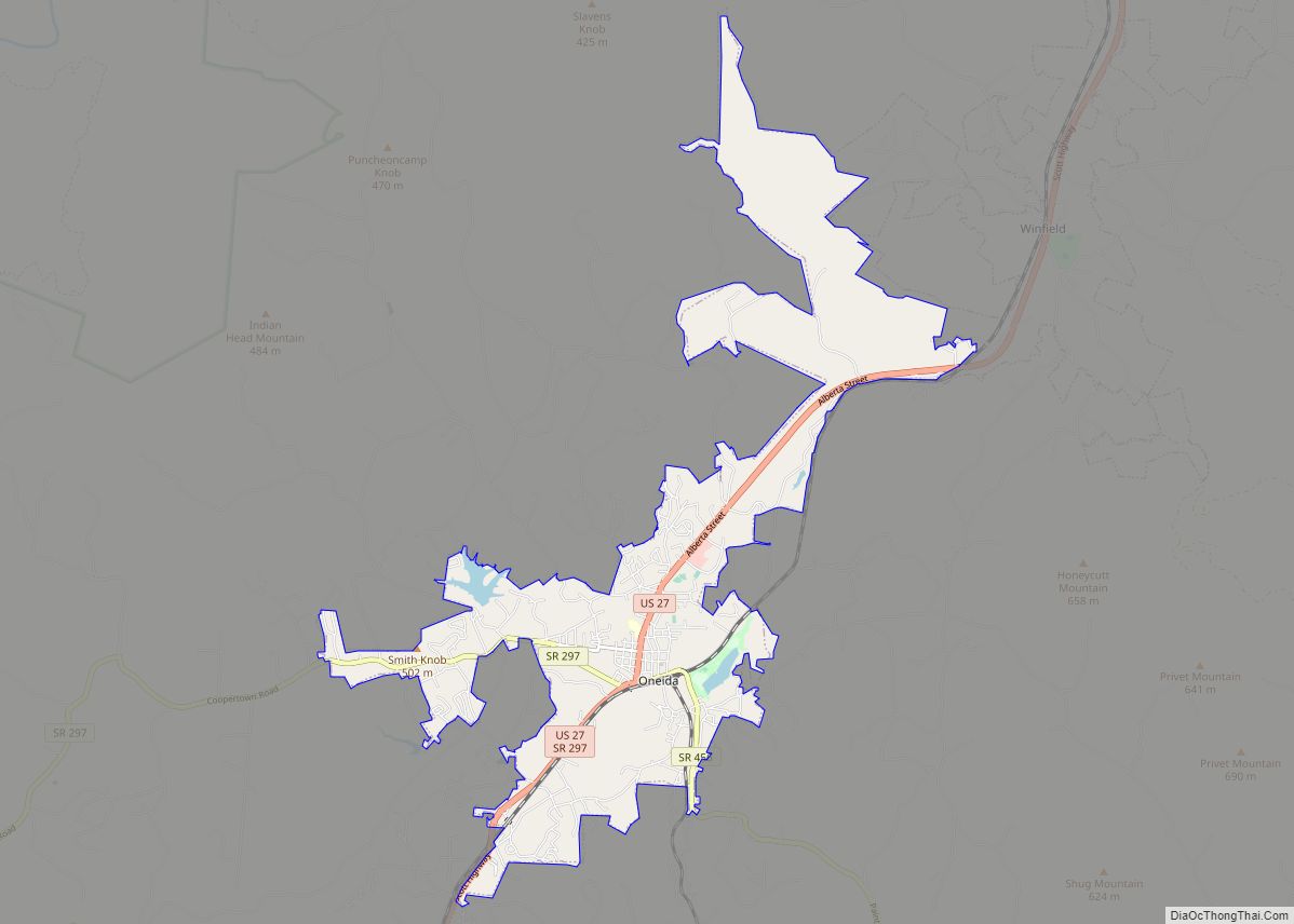
Online Interactive Map
Click on ![]() to view map in "full screen" mode.
to view map in "full screen" mode.
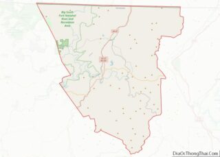
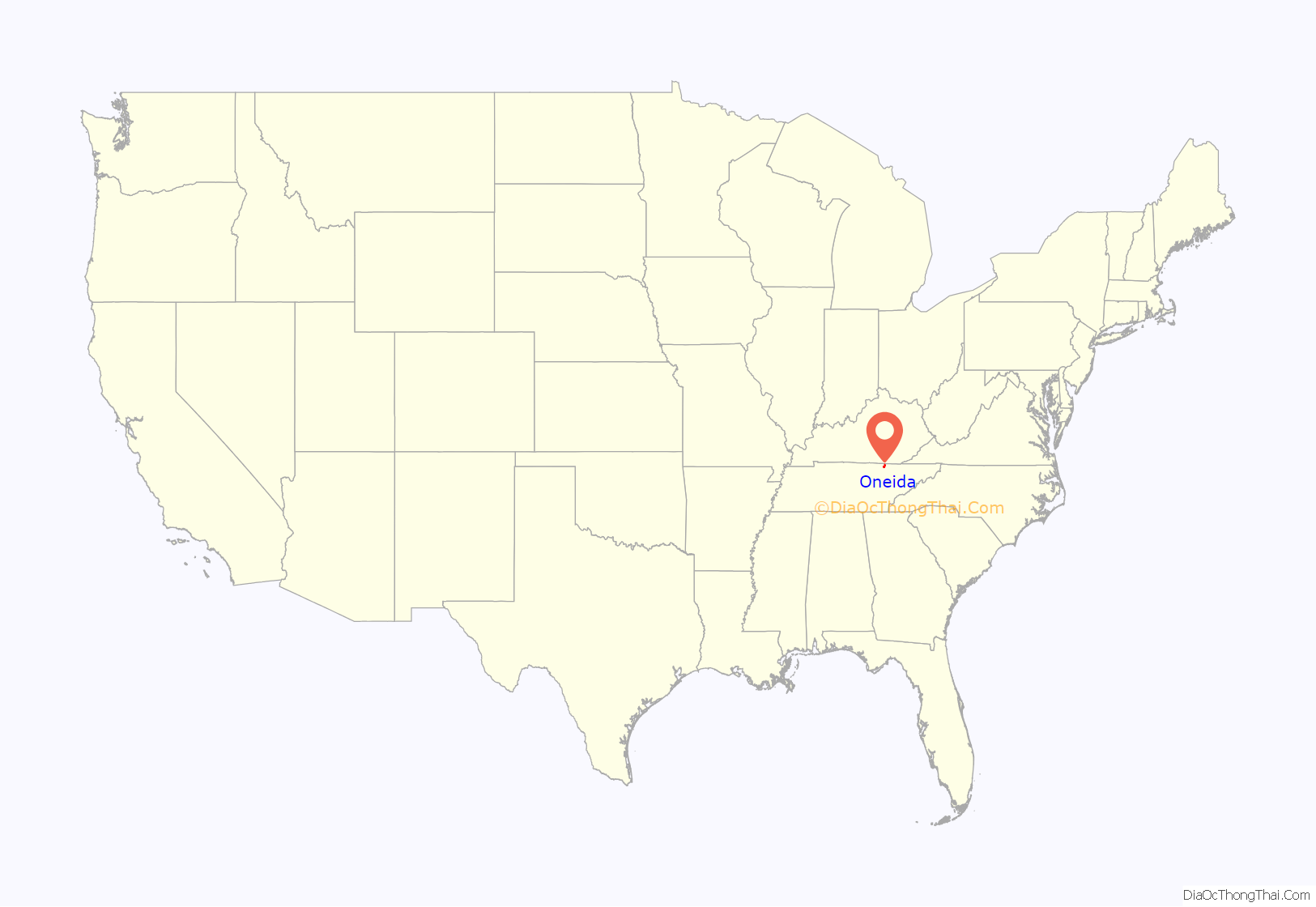
Oneida location map. Where is Oneida town?
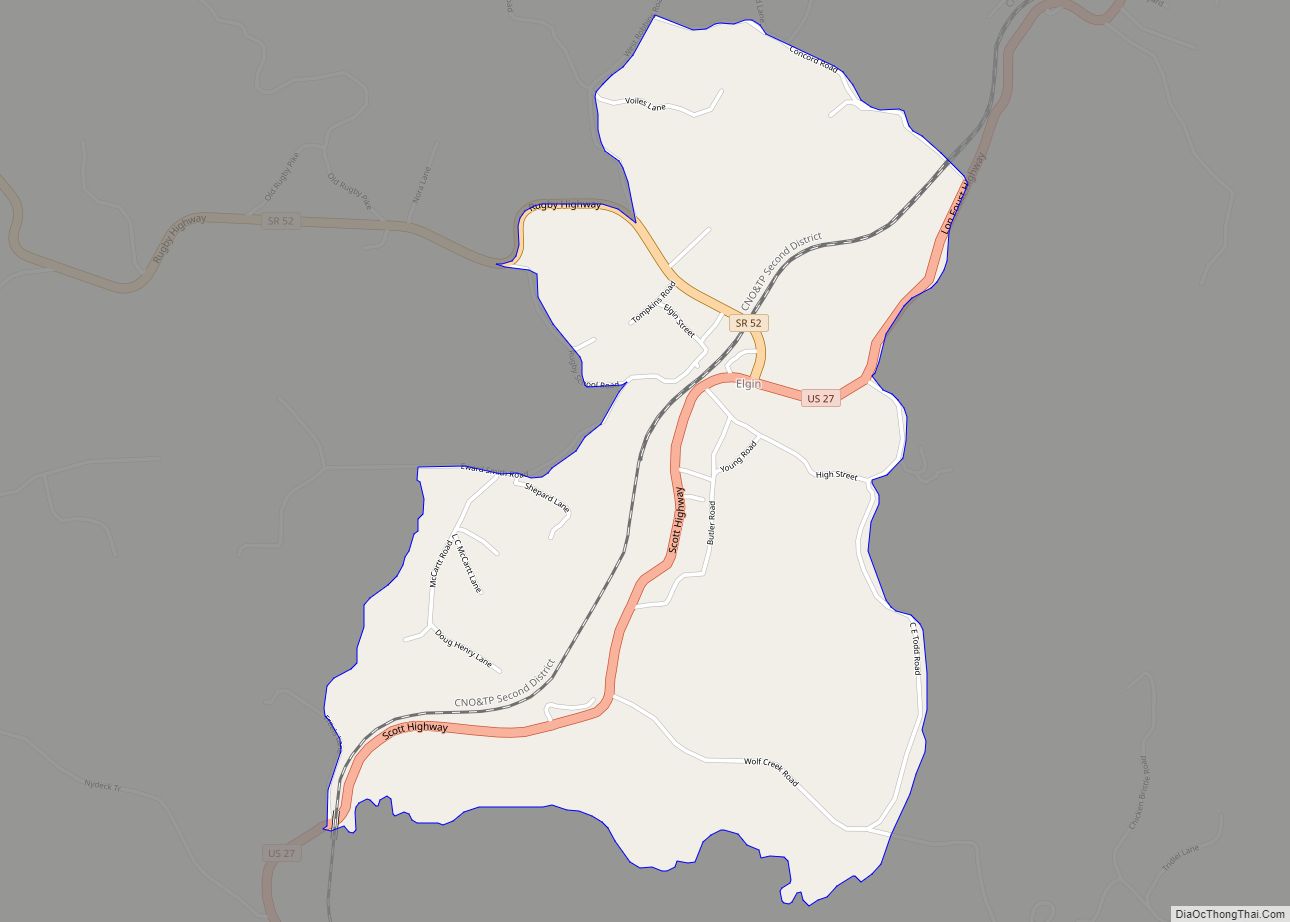
Oneida Road Map
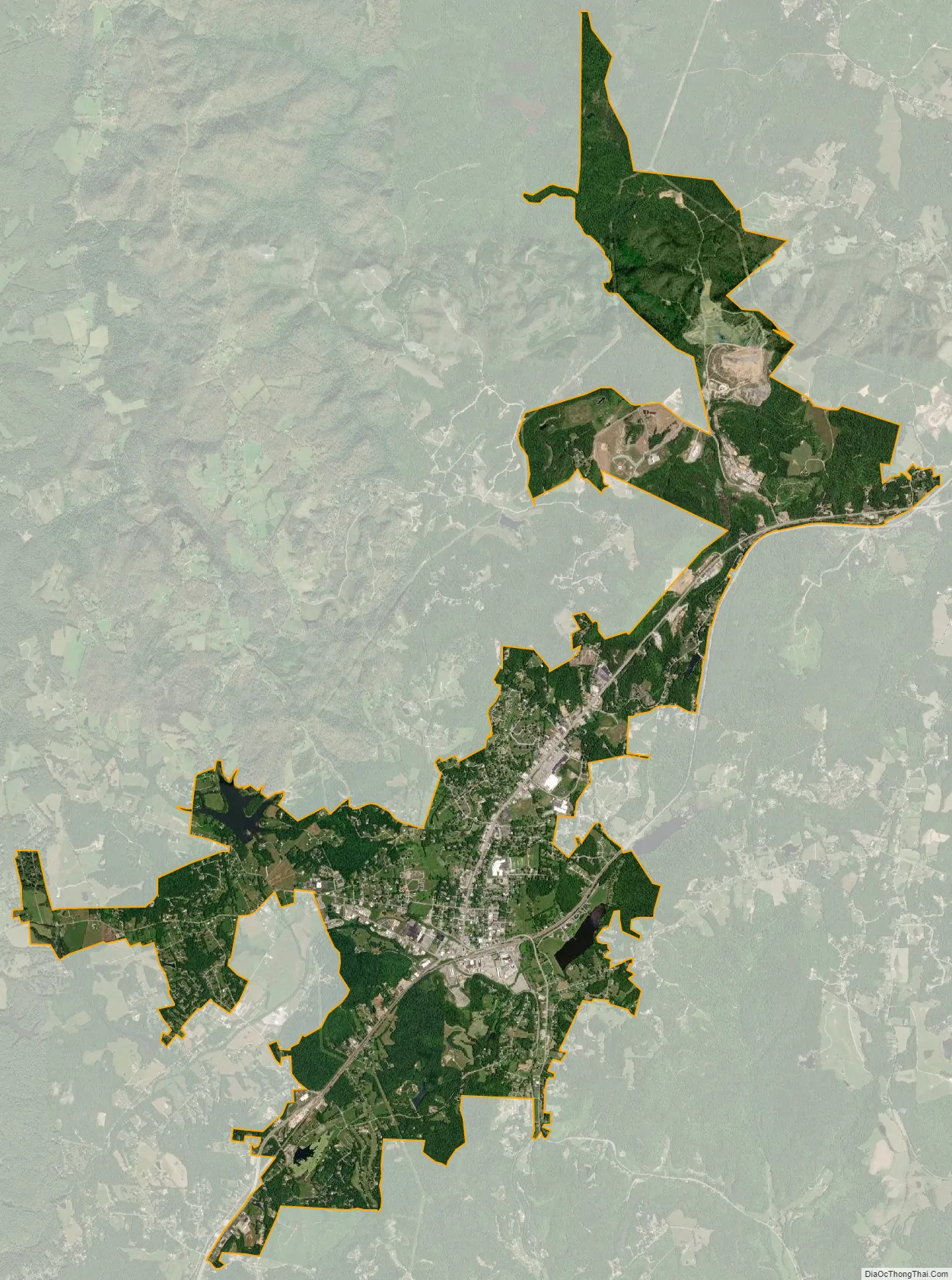
Oneida city Satellite Map
Geography
Oneida is located at 36°30′2″N 84°31′0″W / 36.50056°N 84.51667°W / 36.50056; -84.51667 (36.500535, -84.516553).
According to the United States Census Bureau, the town has a total area of 10.3 square miles (27 km), of which 10.2 square miles (26 km) is land and 0.1 square miles (0.26 km) (1.36%) is water.
Climate
See also
Map of Tennessee State and its subdivision:- Anderson
- Bedford
- Benton
- Bledsoe
- Blount
- Bradley
- Campbell
- Cannon
- Carroll
- Carter
- Cheatham
- Chester
- Claiborne
- Clay
- Cocke
- Coffee
- Crockett
- Cumberland
- Davidson
- Decatur
- DeKalb
- Dickson
- Dyer
- Fayette
- Fentress
- Franklin
- Gibson
- Giles
- Grainger
- Greene
- Grundy
- Hamblen
- Hamilton
- Hancock
- Hardeman
- Hardin
- Hawkins
- Haywood
- Henderson
- Henry
- Hickman
- Houston
- Humphreys
- Jackson
- Jefferson
- Johnson
- Knox
- Lake
- Lauderdale
- Lawrence
- Lewis
- Lincoln
- Loudon
- Macon
- Madison
- Marion
- Marshall
- Maury
- McMinn
- McNairy
- Meigs
- Monroe
- Montgomery
- Moore
- Morgan
- Obion
- Overton
- Perry
- Pickett
- Polk
- Putnam
- Rhea
- Roane
- Robertson
- Rutherford
- Scott
- Sequatchie
- Sevier
- Shelby
- Smith
- Stewart
- Sullivan
- Sumner
- Tipton
- Trousdale
- Unicoi
- Union
- Van Buren
- Warren
- Washington
- Wayne
- Weakley
- White
- Williamson
- Wilson
- Alabama
- Alaska
- Arizona
- Arkansas
- California
- Colorado
- Connecticut
- Delaware
- District of Columbia
- Florida
- Georgia
- Hawaii
- Idaho
- Illinois
- Indiana
- Iowa
- Kansas
- Kentucky
- Louisiana
- Maine
- Maryland
- Massachusetts
- Michigan
- Minnesota
- Mississippi
- Missouri
- Montana
- Nebraska
- Nevada
- New Hampshire
- New Jersey
- New Mexico
- New York
- North Carolina
- North Dakota
- Ohio
- Oklahoma
- Oregon
- Pennsylvania
- Rhode Island
- South Carolina
- South Dakota
- Tennessee
- Texas
- Utah
- Vermont
- Virginia
- Washington
- West Virginia
- Wisconsin
- Wyoming