Pikeville is a city in Bledsoe County, Tennessee, United States. The population was 2,251 at the 2010 census. It is also the county seat of Bledsoe County.
| Name: | Pikeville city |
|---|---|
| LSAD Code: | 25 |
| LSAD Description: | city (suffix) |
| State: | Tennessee |
| County: | Bledsoe County |
| Founded: | 1816 |
| Incorporated: | 1830 |
| Elevation: | 860 ft (260 m) |
| Total Area: | 2.44 sq mi (6.33 km²) |
| Land Area: | 2.44 sq mi (6.33 km²) |
| Water Area: | 0.00 sq mi (0.00 km²) |
| Total Population: | 1,824 |
| Population Density: | 746.62/sq mi (288.32/km²) |
| ZIP code: | 37367 |
| Area code: | 423 |
| FIPS code: | 4758120 |
| GNISfeature ID: | 1297464 |
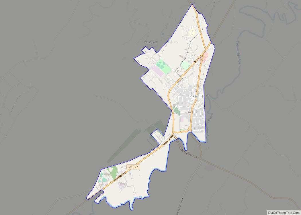
Online Interactive Map
Click on ![]() to view map in "full screen" mode.
to view map in "full screen" mode.
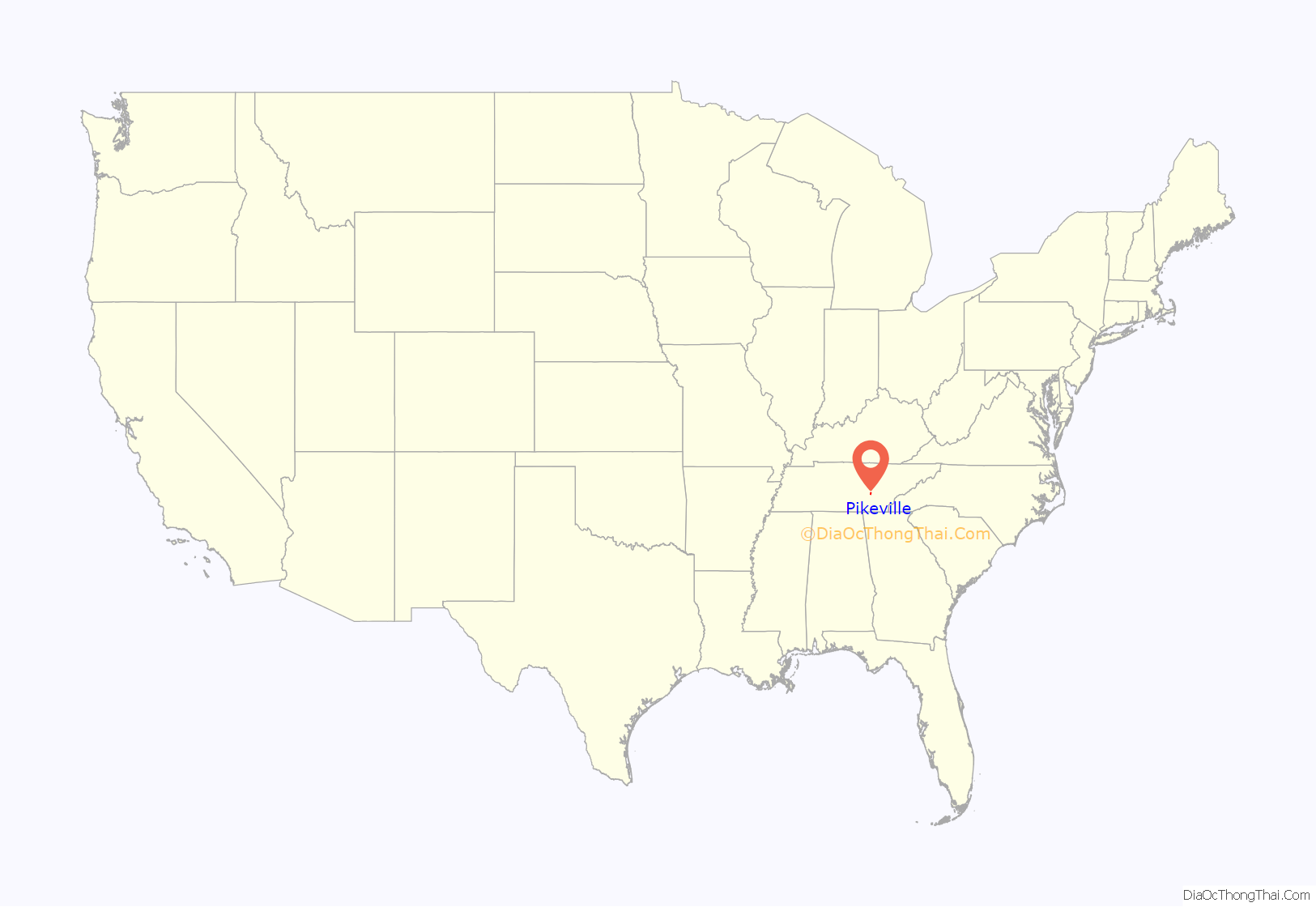
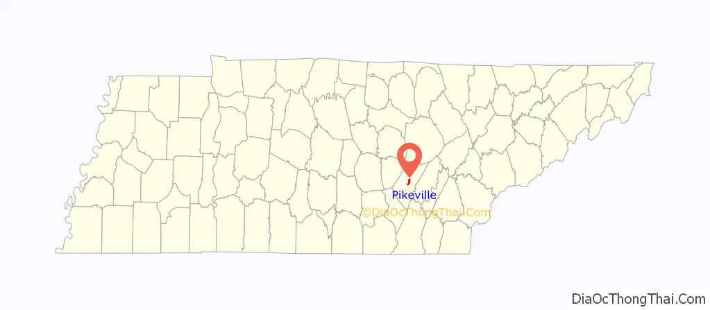
Pikeville location map. Where is Pikeville city?
History
The Sequatchie River valley was part of Cherokee lands until 1805, when the Cherokee ceded it to the U.S. as part of the Treaty of Tellico. By the late 18th century, the valley had been identified by hunters, one of whom, Anthony Bledsoe (1739-1788), became the county’s namesake. Bledsoe County was formed in 1807, with the town of Madison as its county seat.
Pikeville was established in 1816 on lands donated by Charles Love, an early Sequatchie settler. The origin of the town’s name is unknown, although some have suggested that it was named for explorer General Zebulon Pike. By 1818, the Bledsoe County seat had been moved from Madison to Pikeville. The town was incorporated in 1830.
J.V. Wigle (1890–1970), a combustion engineer from Michigan and laboratory assistant at Eastern Michigan University, met a local woman, Mattie Lawson, and settled down in Pikeville. He first brought electricity to town when he electrified the house where he lived near the corner of Poplar and Wiegle streets (Wiegle Street, named after J.V. Wigle, is misspelled). In addition to bringing electricity to Pikeville, Wigle bottled Coca-Cola and made wrought iron railings in the community. He was granted two U.S. patents in 1931 (1,798,289 & 1,814,535) for a coin selecting device and a braking mechanism. His two sons attended the engineering school at Vanderbilt University. His son Tom (1933–2006) helped build U.S. Route 127 heading north out of town as it rises up the mountain near the county line, during a summer job between semesters at Vanderbilt. Wigle is buried with his wife in Pikeville City Cemetery in the family plot, along with Tom Wigle.
Pikeville Road Map
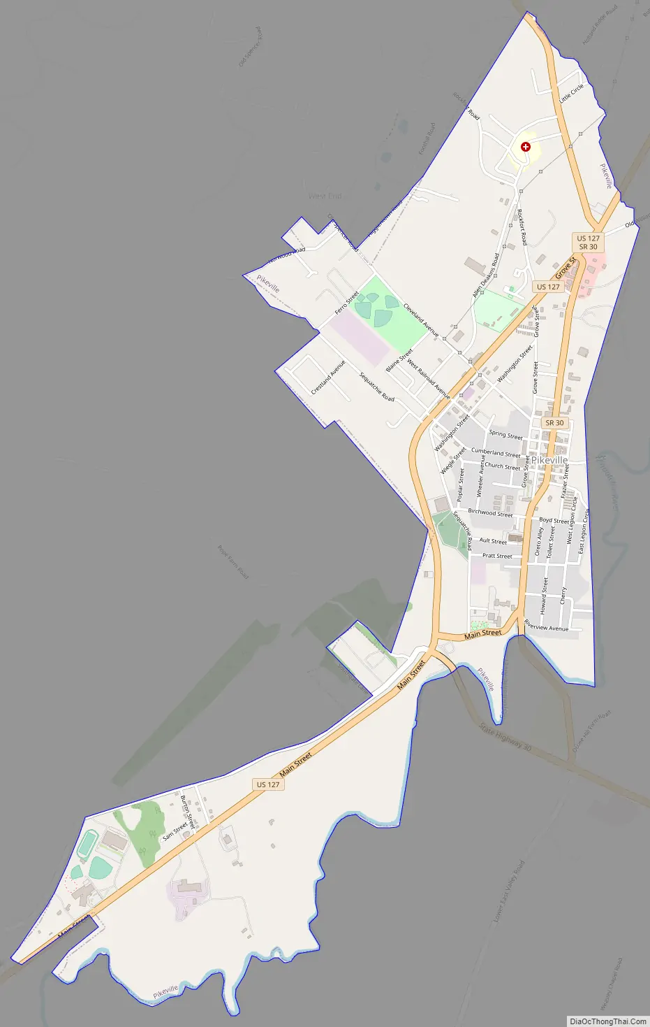
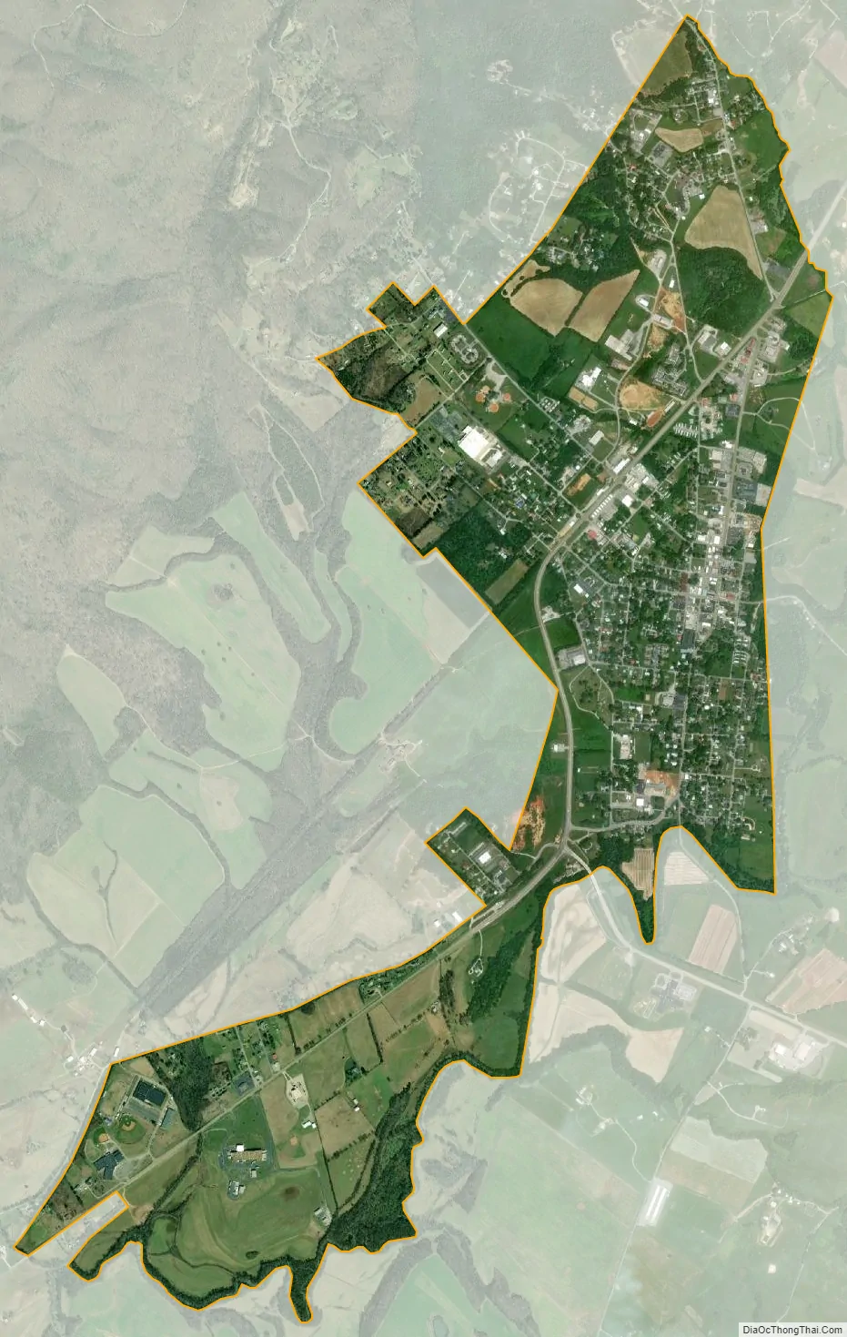
Pikeville city Satellite Map
Geography
Pikeville is located at 35°36′27″N 85°11′29″W / 35.60750°N 85.19139°W / 35.60750; -85.19139 (35.607470, -85.191340). The city is situated in the northern half of the Sequatchie Valley, a deep, narrow, and fertile valley that presents as a large rupture in the southern Cumberland Plateau. The walls of the plateau, namely Walden Ridge and Little Mountain, rise prominently to the east and west, respectively. The Sequatchie River passes through the eastern section of Pikeville.
The primary highway running through Pikeville is U.S. Route 127, which connects the city to Crossville atop the plateau to the north and Dunlap to the south. In Pikeville, US-127 splits, with the main route running along Main Street through the city’s business district and courthouse square, and a bypass running through a newer commercial area in the western part of the city. State Route 30, which connects Pikeville with Spencer and the Fall Creek Falls State Park area atop the plateau to the west and Dayton across the plateau to the east, runs congruent with US-127 through most of the city.
According to the United States Census Bureau, the city has a total area of 2.4 square miles (6.2 km), all land.
Climate
See also
Map of Tennessee State and its subdivision:- Anderson
- Bedford
- Benton
- Bledsoe
- Blount
- Bradley
- Campbell
- Cannon
- Carroll
- Carter
- Cheatham
- Chester
- Claiborne
- Clay
- Cocke
- Coffee
- Crockett
- Cumberland
- Davidson
- Decatur
- DeKalb
- Dickson
- Dyer
- Fayette
- Fentress
- Franklin
- Gibson
- Giles
- Grainger
- Greene
- Grundy
- Hamblen
- Hamilton
- Hancock
- Hardeman
- Hardin
- Hawkins
- Haywood
- Henderson
- Henry
- Hickman
- Houston
- Humphreys
- Jackson
- Jefferson
- Johnson
- Knox
- Lake
- Lauderdale
- Lawrence
- Lewis
- Lincoln
- Loudon
- Macon
- Madison
- Marion
- Marshall
- Maury
- McMinn
- McNairy
- Meigs
- Monroe
- Montgomery
- Moore
- Morgan
- Obion
- Overton
- Perry
- Pickett
- Polk
- Putnam
- Rhea
- Roane
- Robertson
- Rutherford
- Scott
- Sequatchie
- Sevier
- Shelby
- Smith
- Stewart
- Sullivan
- Sumner
- Tipton
- Trousdale
- Unicoi
- Union
- Van Buren
- Warren
- Washington
- Wayne
- Weakley
- White
- Williamson
- Wilson
- Alabama
- Alaska
- Arizona
- Arkansas
- California
- Colorado
- Connecticut
- Delaware
- District of Columbia
- Florida
- Georgia
- Hawaii
- Idaho
- Illinois
- Indiana
- Iowa
- Kansas
- Kentucky
- Louisiana
- Maine
- Maryland
- Massachusetts
- Michigan
- Minnesota
- Mississippi
- Missouri
- Montana
- Nebraska
- Nevada
- New Hampshire
- New Jersey
- New Mexico
- New York
- North Carolina
- North Dakota
- Ohio
- Oklahoma
- Oregon
- Pennsylvania
- Rhode Island
- South Carolina
- South Dakota
- Tennessee
- Texas
- Utah
- Vermont
- Virginia
- Washington
- West Virginia
- Wisconsin
- Wyoming