Tellico Plains is a town in Monroe County, Tennessee, United States. The population was 859 at the 2000 census and 880 at the 2010 census.
| Name: | Tellico Plains town |
|---|---|
| LSAD Code: | 43 |
| LSAD Description: | town (suffix) |
| State: | Tennessee |
| County: | Monroe County |
| Incorporated: | 1911 |
| Elevation: | 876 ft (267 m) |
| Total Area: | 1.95 sq mi (5.06 km²) |
| Land Area: | 1.95 sq mi (5.06 km²) |
| Water Area: | 0.00 sq mi (0.00 km²) |
| Total Population: | 762 |
| Population Density: | 390.37/sq mi (150.72/km²) |
| ZIP code: | 37385 |
| Area code: | 423 |
| FIPS code: | 4773260 |
| GNISfeature ID: | 1304037 |
| Website: | www.tellicoplainstn.com |
Online Interactive Map
Click on ![]() to view map in "full screen" mode.
to view map in "full screen" mode.
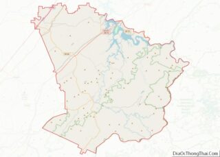
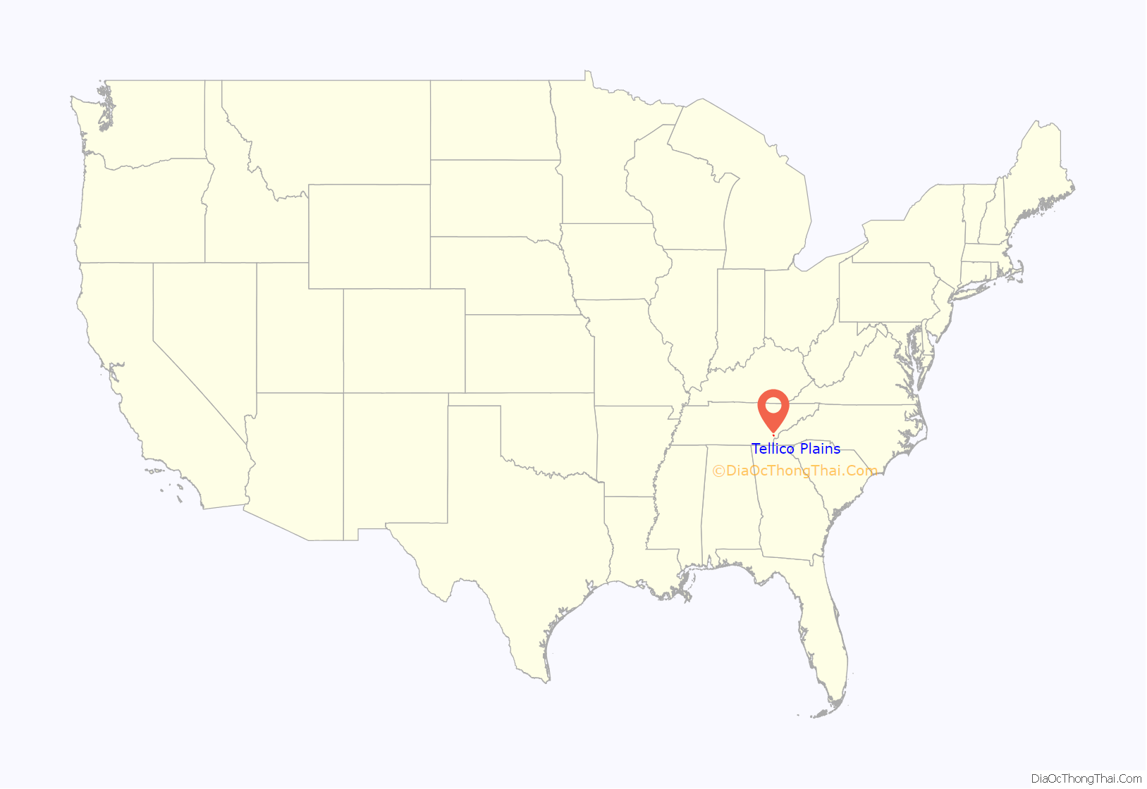
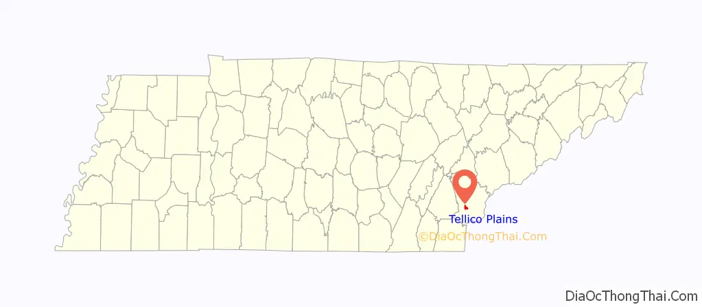
Tellico Plains location map. Where is Tellico Plains town?
History
The area along the Tellico River was inhabited for thousands of years by indigenous peoples. The historic Muscogee settled here, before moving further south. In the late 18th century, the Cherokee settled in this area, displaced from the east and north by European colonial encroachment.
A United States fur trade factory was situated here between 1795 and 1807.
Tellico Plains occupies the former site of the Cherokee town of Great Tellico, which was one of the more important towns of the Overhill Cherokee during the late 18th century and before Indian Removal of the 1830s. Two important Native American trails met at Great Tellico, the Trading Path and the Warrior Path, which connected farflung communities.
European Americans moved into the area and developed the land for agriculture, chiefly subsistence farming. During the 1840s, Elisha Johnson, a former mayor of Rochester, New York, purchased a plantation here and built the Tellico River Mansion on his property. With his brother Ebenezer, the former mayor of Buffalo, New York, he purchased the Tellico Iron and Manufacturing Company.
During the Civil War, the Confederacy commandeered the iron works for production of munitions. General William Sherman’s Union Army soldiers destroyed the Tellico Iron Works. Sherman pardoned Elisha Johnson for his part in supplying the Confederates because of Johnson’s northern birth and sympathies. Johnson returned to the North, settling in Ithaca, New York, where he died in 1866.
The nearby Coker Creek was the site of a minor gold rush during the late 1800s. The small crossroads town of Coker Creek has a gold-panning tourist attraction. Visitors can rent pans and receive professional instructions from the proprietor of the souvenir shop. Visitors can also explore the old gold mines in the surrounding hills, although the mines are in a state of disrepair. Commercial gold mining continues on at least one private plot located slightly to the southwest of the tourist attraction.
In the late 19th and early 20th centuries, Tellico Plains became the base of operations for the Babcock Lumber Company, which ran logging operations throughout the Tellico River basin. When it finished clearcutting, it sold its land to the US Forest Service. It has worked for decades to restore the woods.
Tellico Plains was incorporated in 1911. Its first mayor was Columbus Jenkins, father of a noted attorney, Ray Jenkins.
Tellico Plains is home to the Charles Hall Museum. The town is also the eastern terminus of the Trans America Trail, a popular OHV route to Oregon and the Pacific Ocean.
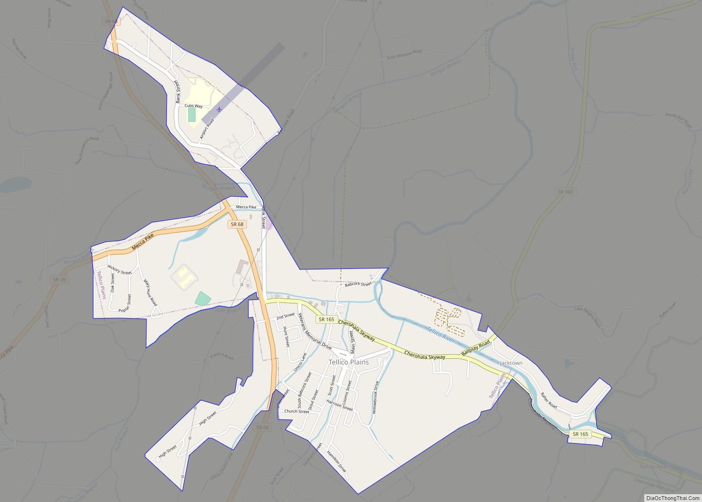
Tellico Plains Road Map
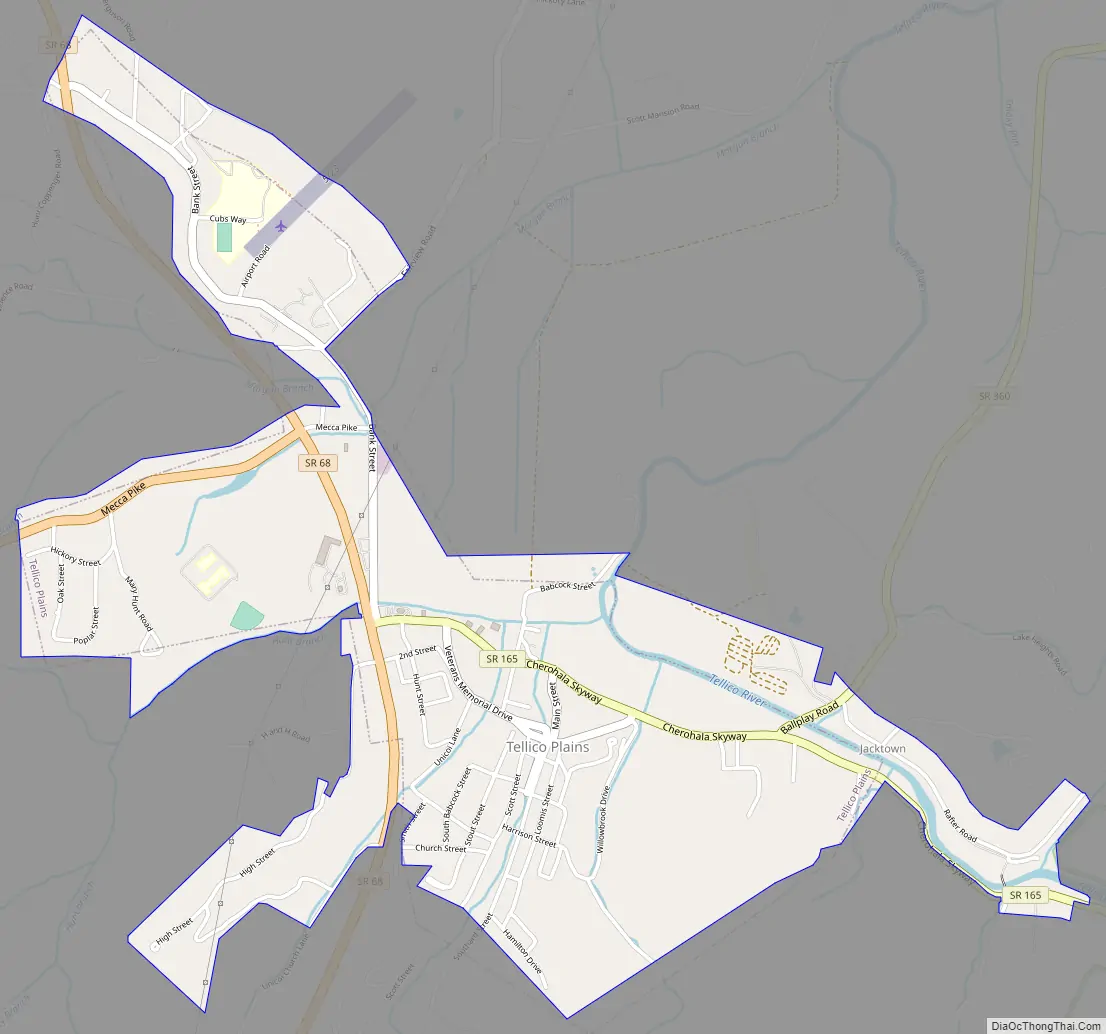
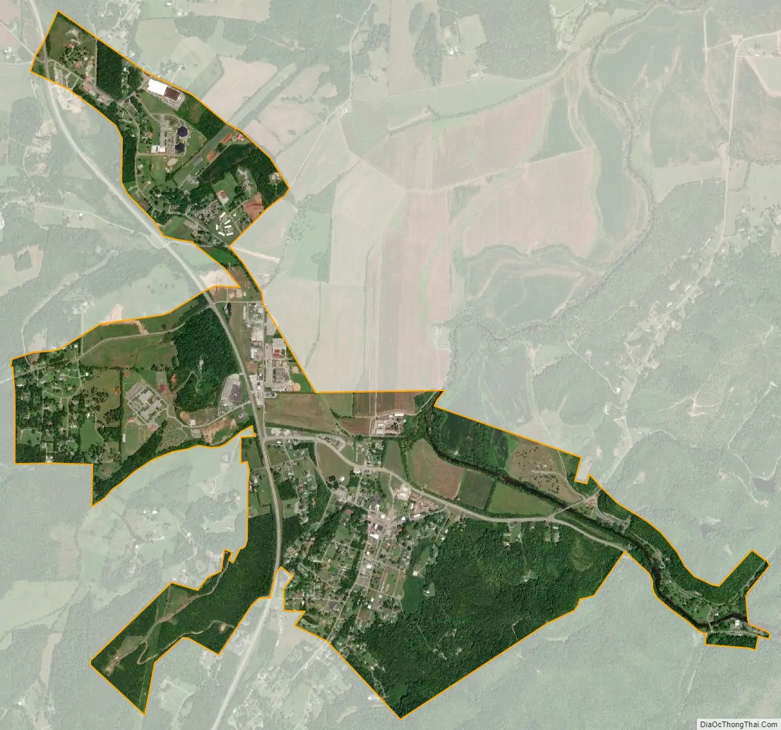
Tellico Plains city Satellite Map
Geography
Tellico Plains is located at 35°22′0″N 84°17′56″W / 35.36667°N 84.29889°W / 35.36667; -84.29889 (35.366575, -84.298955).
According to the United States Census Bureau, the town has a total area of 1.6 square miles (4.1 km), all land.
The town is located on the Tellico River near the location where the river emerges from the higher peaks of the Appalachian Mountains and into the less rugged Ridge-and-Valley Appalachians.
See also
Map of Tennessee State and its subdivision:- Anderson
- Bedford
- Benton
- Bledsoe
- Blount
- Bradley
- Campbell
- Cannon
- Carroll
- Carter
- Cheatham
- Chester
- Claiborne
- Clay
- Cocke
- Coffee
- Crockett
- Cumberland
- Davidson
- Decatur
- DeKalb
- Dickson
- Dyer
- Fayette
- Fentress
- Franklin
- Gibson
- Giles
- Grainger
- Greene
- Grundy
- Hamblen
- Hamilton
- Hancock
- Hardeman
- Hardin
- Hawkins
- Haywood
- Henderson
- Henry
- Hickman
- Houston
- Humphreys
- Jackson
- Jefferson
- Johnson
- Knox
- Lake
- Lauderdale
- Lawrence
- Lewis
- Lincoln
- Loudon
- Macon
- Madison
- Marion
- Marshall
- Maury
- McMinn
- McNairy
- Meigs
- Monroe
- Montgomery
- Moore
- Morgan
- Obion
- Overton
- Perry
- Pickett
- Polk
- Putnam
- Rhea
- Roane
- Robertson
- Rutherford
- Scott
- Sequatchie
- Sevier
- Shelby
- Smith
- Stewart
- Sullivan
- Sumner
- Tipton
- Trousdale
- Unicoi
- Union
- Van Buren
- Warren
- Washington
- Wayne
- Weakley
- White
- Williamson
- Wilson
- Alabama
- Alaska
- Arizona
- Arkansas
- California
- Colorado
- Connecticut
- Delaware
- District of Columbia
- Florida
- Georgia
- Hawaii
- Idaho
- Illinois
- Indiana
- Iowa
- Kansas
- Kentucky
- Louisiana
- Maine
- Maryland
- Massachusetts
- Michigan
- Minnesota
- Mississippi
- Missouri
- Montana
- Nebraska
- Nevada
- New Hampshire
- New Jersey
- New Mexico
- New York
- North Carolina
- North Dakota
- Ohio
- Oklahoma
- Oregon
- Pennsylvania
- Rhode Island
- South Carolina
- South Dakota
- Tennessee
- Texas
- Utah
- Vermont
- Virginia
- Washington
- West Virginia
- Wisconsin
- Wyoming