Toone is a town in Hardeman County, Tennessee, United States. The population was 364 at the 2010 census.
| Name: | Toone town |
|---|---|
| LSAD Code: | 43 |
| LSAD Description: | town (suffix) |
| State: | Tennessee |
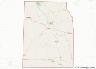
| County: | Hardeman County |
| Incorporated: | 1903 |
| Elevation: | 410 ft (125 m) |
| Total Area: | 1.07 sq mi (2.79 km²) |
| Land Area: | 1.07 sq mi (2.79 km²) |
| Water Area: | 0.00 sq mi (0.00 km²) |
| Total Population: | 270 |
| Population Density: | 251.16/sq mi (96.94/km²) |
| ZIP code: | 38381 |
| Area code: | 731 |
| FIPS code: | 4774640 |
| GNISfeature ID: | 1304137 |
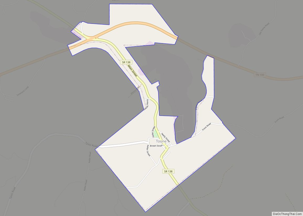
Online Interactive Map
Click on ![]() to view map in "full screen" mode.
to view map in "full screen" mode.
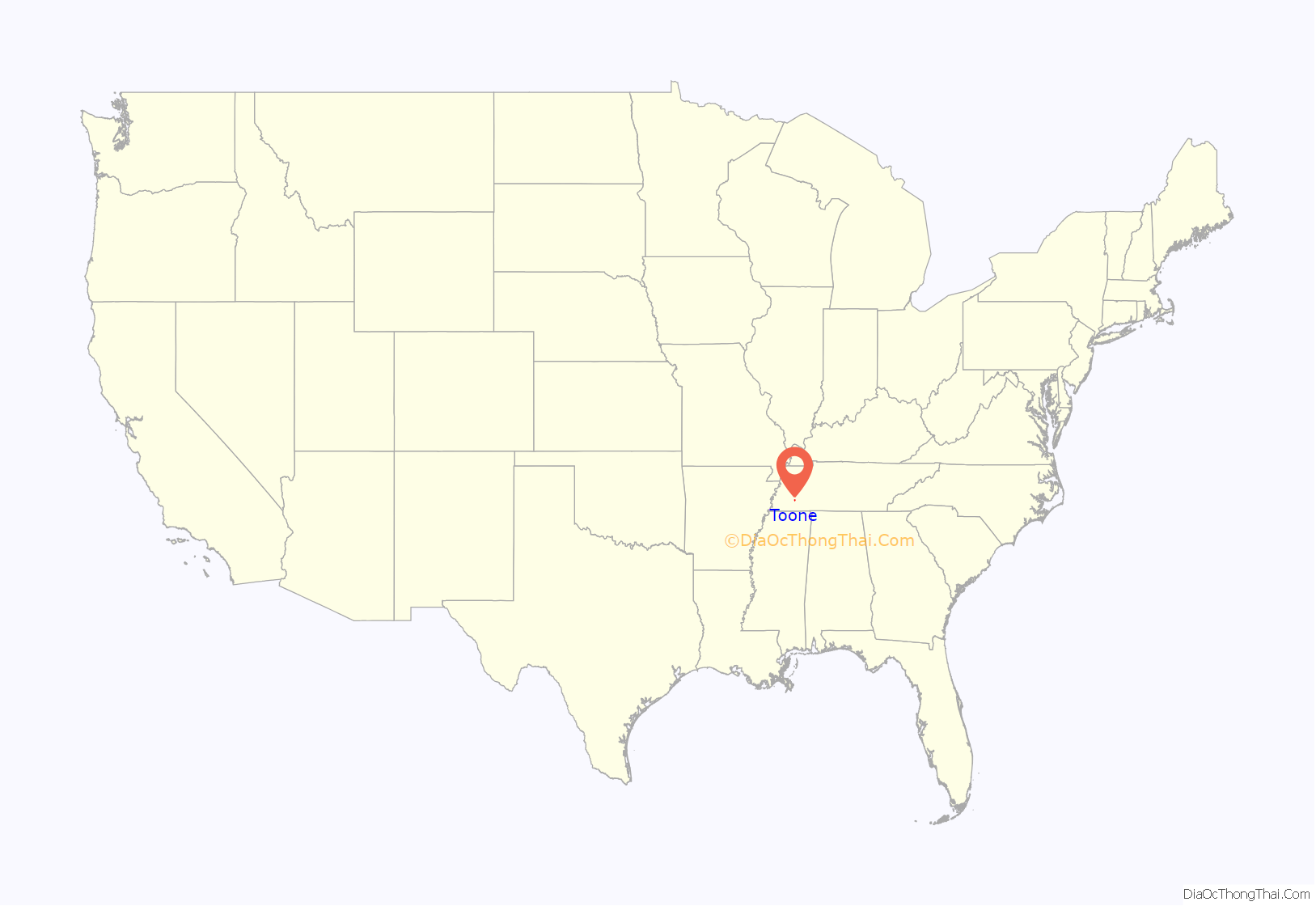
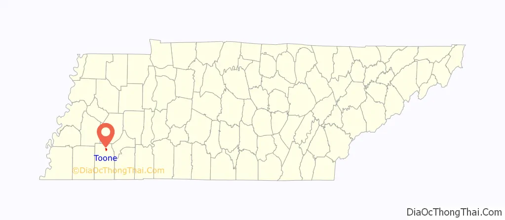
Toone location map. Where is Toone town?
History
Toone is located in former Chickasaw country. The first Europeans to visit the area arrived on flatboats via the Hatchie River as early as 1725. By 1830 the community was populated enough that it was included in the United States census. In 1856, Toone developed into a railroad town with businesses opening up around the railroad. Brick manufacturing became the major industry, and many homes still have original Toone bricks in their architecture. During the Civil War, the town served as an encampment for the Union Army and saw one small skirmish for rail line control.
Kilgore Flares Company explosion
On September 14, 2010, an explosion and flash fire occurred at the Kilgore Flares Company plant near Toone. Six workers were injured in the mishap, three of them critically. Another accident at the facility in 2001 caused the death of one employee. Kilgore manufactures airborne expendable decoy flares for the US military.
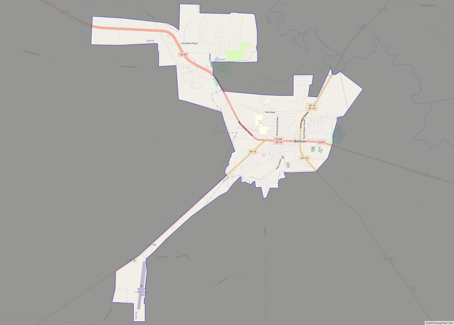
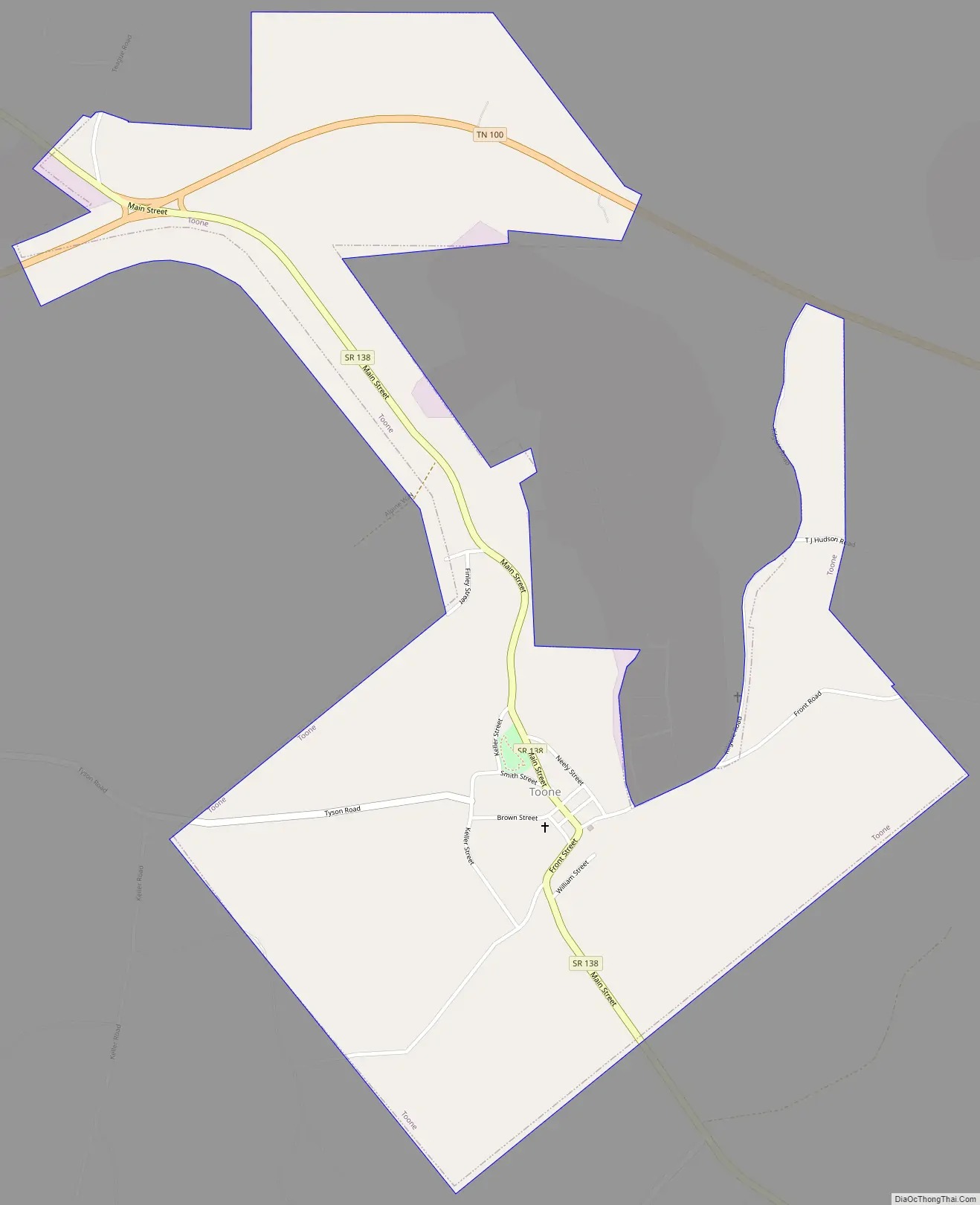
Toone Road Map
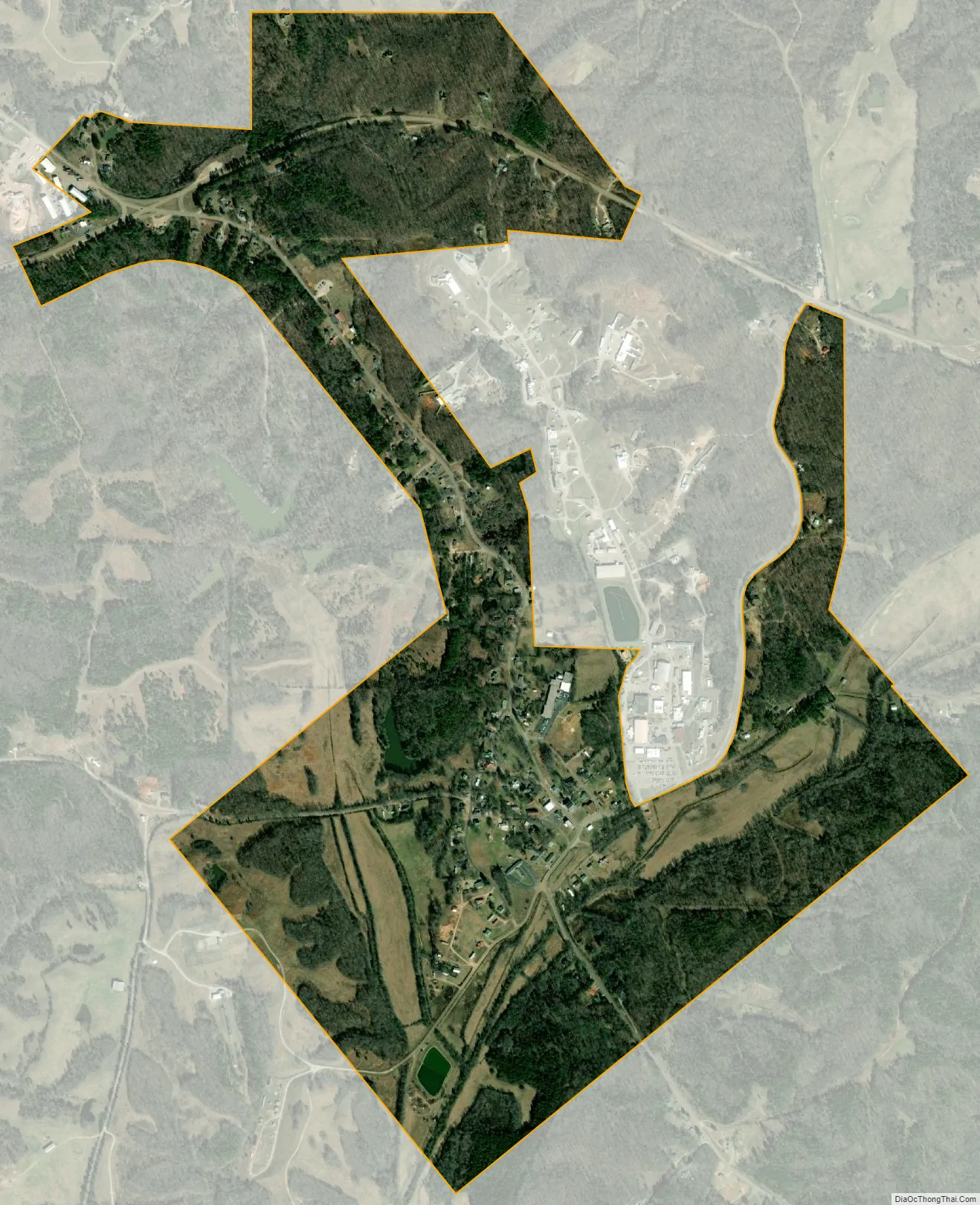
Toone city Satellite Map
Geography
Toone is located in northern Hardeman County at 35°21′8″N 88°57′14″W / 35.35222°N 88.95389°W / 35.35222; -88.95389 (35.352311, -88.953801). Tennessee State Route 138 (SR 138) is Main Street, leading northwest 21 miles (34 km) to Interstate 40 (I-40) between Jackson and Brownsville, and southeast 2 miles (3 km) to its terminus at SR 18. Bolivar, the Hardeman county seat, is 8 miles (13 km) south of Toone via SR 138 and SR 18. SR 100 runs through a northern extension of Toone, leading east 19 miles (31 km) to Henderson and west 11 miles (18 km) to Whiteville.
According to the United States Census Bureau, the town has a total area of 1.0 square mile (2.7 km), all of it recorded as land. Pugh Creek flows through the southern part of the town, running southwest to Mill Creek and the Hatchie River.
See also
Map of Tennessee State and its subdivision:- Anderson
- Bedford
- Benton
- Bledsoe
- Blount
- Bradley
- Campbell
- Cannon
- Carroll
- Carter
- Cheatham
- Chester
- Claiborne
- Clay
- Cocke
- Coffee
- Crockett
- Cumberland
- Davidson
- Decatur
- DeKalb
- Dickson
- Dyer
- Fayette
- Fentress
- Franklin
- Gibson
- Giles
- Grainger
- Greene
- Grundy
- Hamblen
- Hamilton
- Hancock
- Hardeman
- Hardin
- Hawkins
- Haywood
- Henderson
- Henry
- Hickman
- Houston
- Humphreys
- Jackson
- Jefferson
- Johnson
- Knox
- Lake
- Lauderdale
- Lawrence
- Lewis
- Lincoln
- Loudon
- Macon
- Madison
- Marion
- Marshall
- Maury
- McMinn
- McNairy
- Meigs
- Monroe
- Montgomery
- Moore
- Morgan
- Obion
- Overton
- Perry
- Pickett
- Polk
- Putnam
- Rhea
- Roane
- Robertson
- Rutherford
- Scott
- Sequatchie
- Sevier
- Shelby
- Smith
- Stewart
- Sullivan
- Sumner
- Tipton
- Trousdale
- Unicoi
- Union
- Van Buren
- Warren
- Washington
- Wayne
- Weakley
- White
- Williamson
- Wilson
- Alabama
- Alaska
- Arizona
- Arkansas
- California
- Colorado
- Connecticut
- Delaware
- District of Columbia
- Florida
- Georgia
- Hawaii
- Idaho
- Illinois
- Indiana
- Iowa
- Kansas
- Kentucky
- Louisiana
- Maine
- Maryland
- Massachusetts
- Michigan
- Minnesota
- Mississippi
- Missouri
- Montana
- Nebraska
- Nevada
- New Hampshire
- New Jersey
- New Mexico
- New York
- North Carolina
- North Dakota
- Ohio
- Oklahoma
- Oregon
- Pennsylvania
- Rhode Island
- South Carolina
- South Dakota
- Tennessee
- Texas
- Utah
- Vermont
- Virginia
- Washington
- West Virginia
- Wisconsin
- Wyoming