Windsor Heights is a city in Polk County, Iowa, United States. The population was 5,252 at the time of the 2020 census. It is part of the Des Moines–West Des Moines Metropolitan Statistical Area.
| Name: | Windsor Heights city |
|---|---|
| LSAD Code: | 25 |
| LSAD Description: | city (suffix) |
| State: | Iowa |
| County: | Polk County |
| Incorporated: | July 19, 1941 |
| Elevation: | 955 ft (291 m) |
| Total Area: | 1.43 sq mi (3.72 km²) |
| Land Area: | 1.43 sq mi (3.72 km²) |
| Water Area: | 0.00 sq mi (0.00 km²) |
| Total Population: | 5,252 |
| Population Density: | 3,662.48/sq mi (1,413.61/km²) |
| ZIP code: | 50324 |
| Area code: | 515 |
| FIPS code: | 1986250 |
| GNISfeature ID: | 0463128 |
| Website: | http://www.windsorheights.org/ |
Online Interactive Map
Click on ![]() to view map in "full screen" mode.
to view map in "full screen" mode.
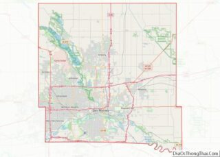
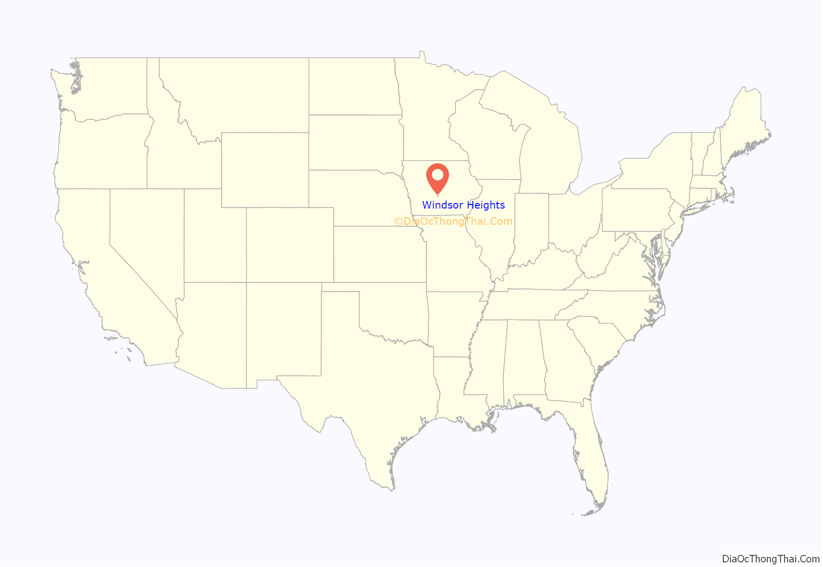
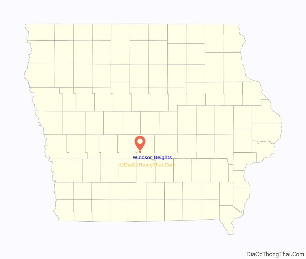
Windsor Heights location map. Where is Windsor Heights city?
History
Windsor Heights incorporated as a city on July 19, 1941. It was named for nearby Windsor Elementary School in Des Moines; the school was named for early settler Henry Clay Windsor, whose family donated land for the school. In 1958 Windsor Heights annexed the neighboring community of Crestwood, which added roughly 1,300 people to the city and established the city’s present boundaries.
Although Windsor Heights is primarily a residential community, some “big-box” retailers have opened stores here, including Wal-Mart, Sam’s Club, and Hy-Vee.
On June 26, 2008, the United States Postal Service gave Windsor Heights its own ZIP code of 50324 that was scheduled to take effect on July 1, 2009. Before that, the city shared ZIP codes with neighboring portions of Des Moines and Urbandale.
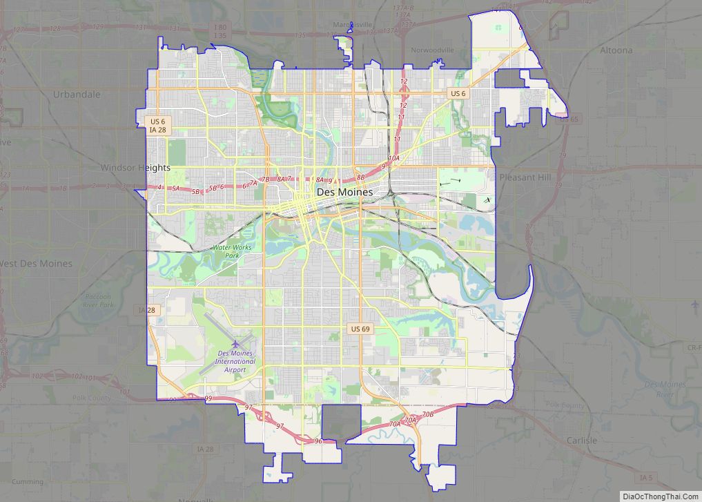
Windsor Heights Road Map
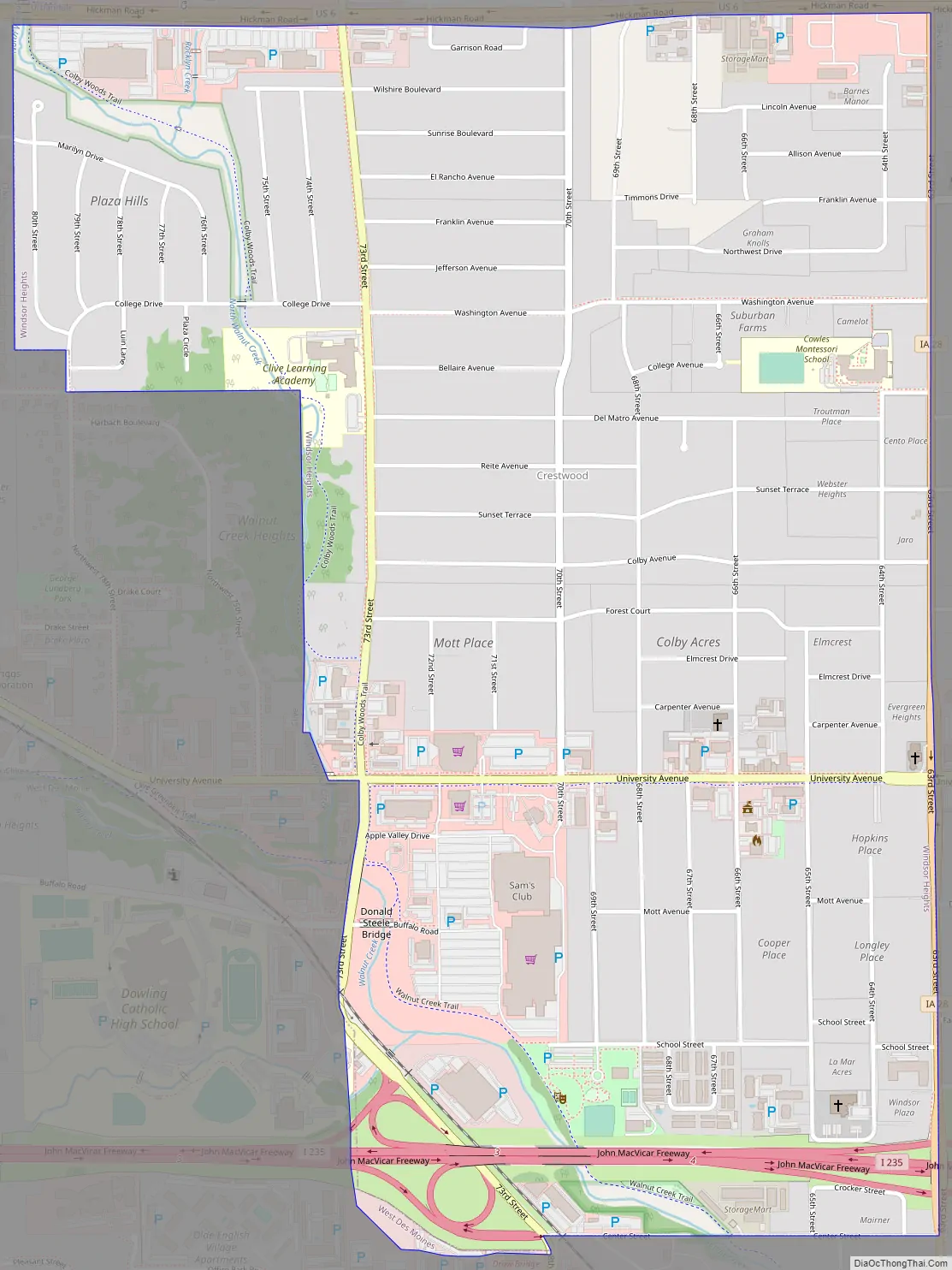
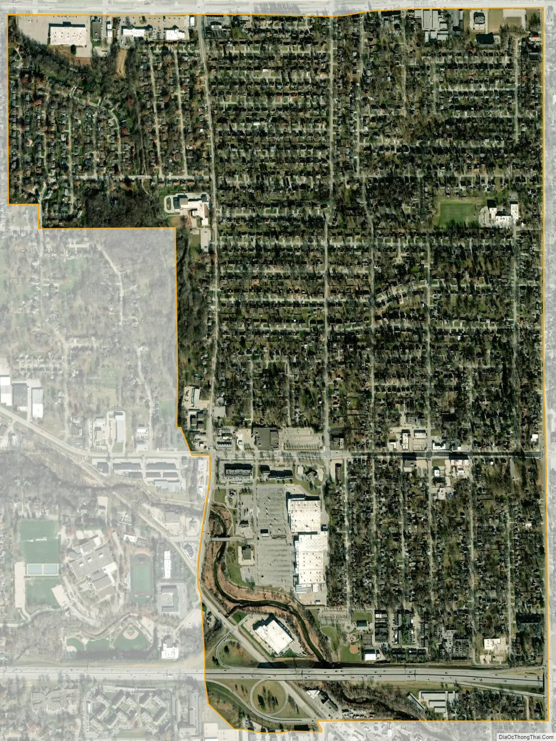
Windsor Heights city Satellite Map
Geography
Windsor Heights is located at 41°36′17″N 94°42′40″W / 41.60472°N 94.71111°W / 41.60472; -94.71111 (41.604722,-93.711111).
According to the United States Census Bureau, the city has a total area of 1.41 square miles (3.65 km), all land.
Windsor Heights is surrounded by other cities: Urbandale to the north, Clive to the west, West Des Moines to the south, and Des Moines to the east. Interstate 235 runs through the far southern part of the city, U.S. Route 6 (Hickman Road) forms the boundary with Urbandale, and Iowa Highway 28 (63rd Street) the boundary with Des Moines.
Climate
See also
Map of Iowa State and its subdivision:- Adair
- Adams
- Allamakee
- Appanoose
- Audubon
- Benton
- Black Hawk
- Boone
- Bremer
- Buchanan
- Buena Vista
- Butler
- Calhoun
- Carroll
- Cass
- Cedar
- Cerro Gordo
- Cherokee
- Chickasaw
- Clarke
- Clay
- Clayton
- Clinton
- Crawford
- Dallas
- Davis
- Decatur
- Delaware
- Des Moines
- Dickinson
- Dubuque
- Emmet
- Fayette
- Floyd
- Franklin
- Fremont
- Greene
- Grundy
- Guthrie
- Hamilton
- Hancock
- Hardin
- Harrison
- Henry
- Howard
- Humboldt
- Ida
- Iowa
- Jackson
- Jasper
- Jefferson
- Johnson
- Jones
- Keokuk
- Kossuth
- Lee
- Linn
- Louisa
- Lucas
- Lyon
- Madison
- Mahaska
- Marion
- Marshall
- Mills
- Mitchell
- Monona
- Monroe
- Montgomery
- Muscatine
- O'Brien
- Osceola
- Page
- Palo Alto
- Plymouth
- Pocahontas
- Polk
- Pottawattamie
- Poweshiek
- Ringgold
- Sac
- Scott
- Shelby
- Sioux
- Story
- Tama
- Taylor
- Union
- Van Buren
- Wapello
- Warren
- Washington
- Wayne
- Webster
- Winnebago
- Winneshiek
- Woodbury
- Worth
- Wright
- Alabama
- Alaska
- Arizona
- Arkansas
- California
- Colorado
- Connecticut
- Delaware
- District of Columbia
- Florida
- Georgia
- Hawaii
- Idaho
- Illinois
- Indiana
- Iowa
- Kansas
- Kentucky
- Louisiana
- Maine
- Maryland
- Massachusetts
- Michigan
- Minnesota
- Mississippi
- Missouri
- Montana
- Nebraska
- Nevada
- New Hampshire
- New Jersey
- New Mexico
- New York
- North Carolina
- North Dakota
- Ohio
- Oklahoma
- Oregon
- Pennsylvania
- Rhode Island
- South Carolina
- South Dakota
- Tennessee
- Texas
- Utah
- Vermont
- Virginia
- Washington
- West Virginia
- Wisconsin
- Wyoming