Urbandale is a city in Polk and Dallas counties, Iowa, United States. As of the 2020 U.S. Census, the city population was 45,580. It is part of the Des Moines–West Des Moines Metropolitan Statistical Area.
| Name: | Urbandale city |
|---|---|
| LSAD Code: | 25 |
| LSAD Description: | city (suffix) |
| State: | Iowa |
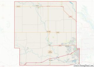
| County: | Dallas County, Polk County |
| Incorporated: | April 16, 1917 |
| Elevation: | 945 ft (288 m) |
| Total Area: | 22.55 sq mi (58.41 km²) |
| Land Area: | 22.53 sq mi (58.35 km²) |
| Water Area: | 0.02 sq mi (0.06 km²) |
| Total Population: | 45,580 |
| Population Density: | 2,023.26/sq mi (781.19/km²) |
| ZIP code: | 50322, 50323, 50325, 50111, 50131, 50263, |
| Area code: | 515 |
| FIPS code: | 1979950 |
| GNISfeature ID: | 0462504 |
| Website: | www.urbandale.org |
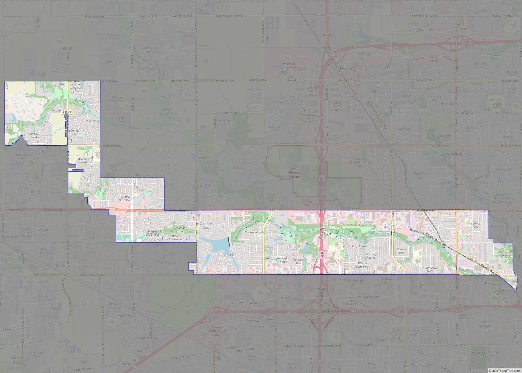
Online Interactive Map
Click on ![]() to view map in "full screen" mode.
to view map in "full screen" mode.
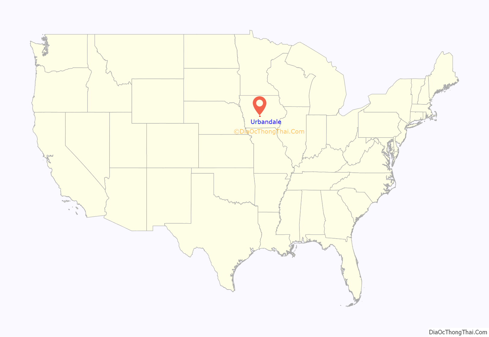
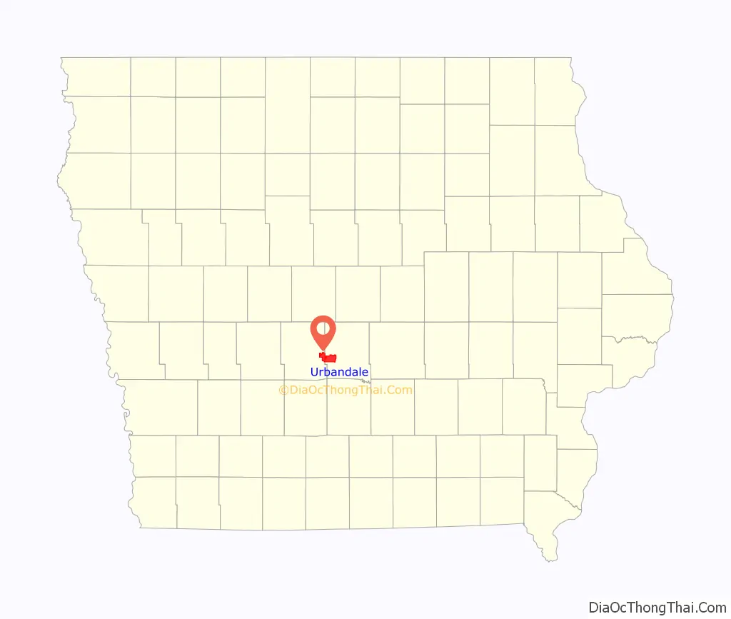
Urbandale location map. Where is Urbandale city?
History
Urbandale was incorporated as a city on April 16, 1917. In its early days, Urbandale served as a streetcar suburb of Des Moines with four coal mines. Urbandale served as the end of the “Urbandale Line” after plans to build a railroad from Des Moines to Woodward were abandoned because of right-of-way issues. The coal mines had closed by the end of the 1940s while streetcar service ended in 1951.
In 1920, shortly after the city incorporated, Urbandale had 298 people. Its population in 1950 was 1,777, but the city grew rapidly after that along with the rest of Des Moines’ suburbs. By 1970, Urbandale had 14,434 people, and in 2000 it had 29,072. Although most of the city’s developed area is in Polk County, Urbandale has expanded westward into Dallas County in recent years.
In 2012, Urbandale gained national attention after President Barack Obama held a reelection campaign rally at Living History Farms.
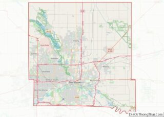
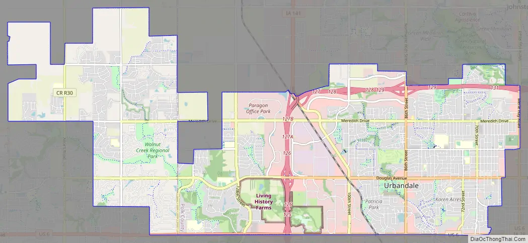
Urbandale Road Map
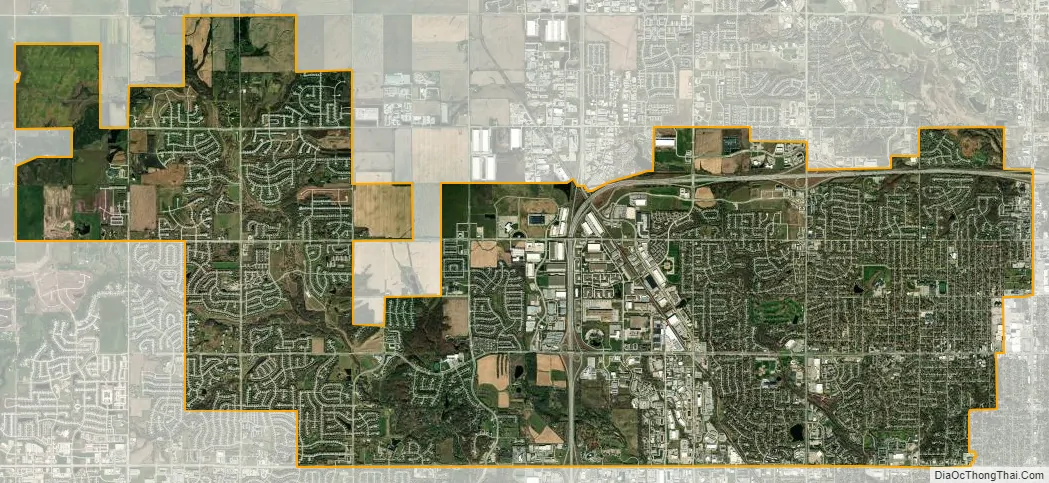
Urbandale city Satellite Map
Geography
Urbandale is located in the northwest part of the Des Moines Metro Area at the intersections of Interstates 35 and 80, and Iowa Highway 141. According to the United States Census Bureau, the city has a total area of 21.94 square miles (56.82 km), of which 21.92 square miles (56.77 km) is land and 0.02 square miles (0.05 km) is water.
See also
Map of Iowa State and its subdivision:- Adair
- Adams
- Allamakee
- Appanoose
- Audubon
- Benton
- Black Hawk
- Boone
- Bremer
- Buchanan
- Buena Vista
- Butler
- Calhoun
- Carroll
- Cass
- Cedar
- Cerro Gordo
- Cherokee
- Chickasaw
- Clarke
- Clay
- Clayton
- Clinton
- Crawford
- Dallas
- Davis
- Decatur
- Delaware
- Des Moines
- Dickinson
- Dubuque
- Emmet
- Fayette
- Floyd
- Franklin
- Fremont
- Greene
- Grundy
- Guthrie
- Hamilton
- Hancock
- Hardin
- Harrison
- Henry
- Howard
- Humboldt
- Ida
- Iowa
- Jackson
- Jasper
- Jefferson
- Johnson
- Jones
- Keokuk
- Kossuth
- Lee
- Linn
- Louisa
- Lucas
- Lyon
- Madison
- Mahaska
- Marion
- Marshall
- Mills
- Mitchell
- Monona
- Monroe
- Montgomery
- Muscatine
- O'Brien
- Osceola
- Page
- Palo Alto
- Plymouth
- Pocahontas
- Polk
- Pottawattamie
- Poweshiek
- Ringgold
- Sac
- Scott
- Shelby
- Sioux
- Story
- Tama
- Taylor
- Union
- Van Buren
- Wapello
- Warren
- Washington
- Wayne
- Webster
- Winnebago
- Winneshiek
- Woodbury
- Worth
- Wright
- Alabama
- Alaska
- Arizona
- Arkansas
- California
- Colorado
- Connecticut
- Delaware
- District of Columbia
- Florida
- Georgia
- Hawaii
- Idaho
- Illinois
- Indiana
- Iowa
- Kansas
- Kentucky
- Louisiana
- Maine
- Maryland
- Massachusetts
- Michigan
- Minnesota
- Mississippi
- Missouri
- Montana
- Nebraska
- Nevada
- New Hampshire
- New Jersey
- New Mexico
- New York
- North Carolina
- North Dakota
- Ohio
- Oklahoma
- Oregon
- Pennsylvania
- Rhode Island
- South Carolina
- South Dakota
- Tennessee
- Texas
- Utah
- Vermont
- Virginia
- Washington
- West Virginia
- Wisconsin
- Wyoming