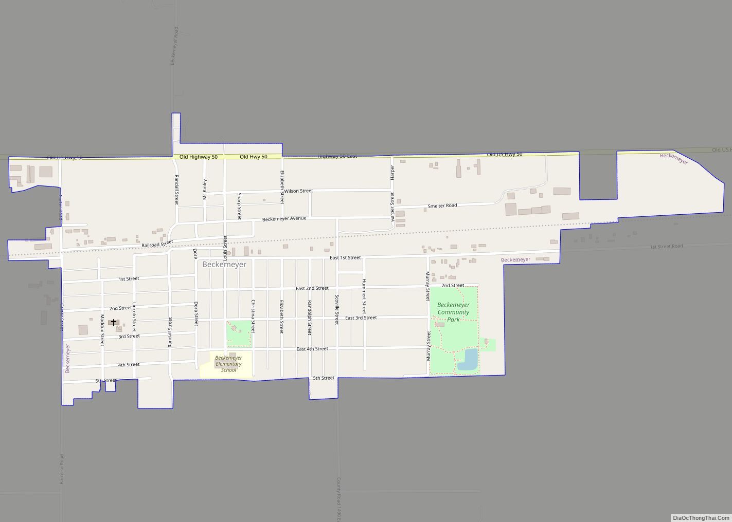
Beckemeyer is a village in Wade Township, Clinton County, Illinois, United States. The population was 923 as of the 2020 census.
| Name: | Beckemeyer village |
|---|---|
| LSAD Code: | 47 |
| LSAD Description: | village (suffix) |
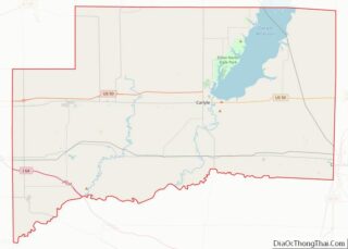
| State: | Illinois |
| County: | Clinton County |
| Elevation: | 456 ft (139 m) |
| Total Area: | 0.62 sq mi (1.60 km²) |
| Land Area: | 0.62 sq mi (1.60 km²) |
| Water Area: | 0.00 sq mi (0.00 km²) |
| Total Population: | 923 |
| Population Density: | 1,495.95/sq mi (577.74/km²) |
| Area code: | 618 |
| FIPS code: | 1704533 |
| GNISfeature ID: | 2398063 |
| Website: | http://beckemeyeril.gov/ |
Online Interactive Map
Click on ![]() to view map in "full screen" mode.
to view map in "full screen" mode.
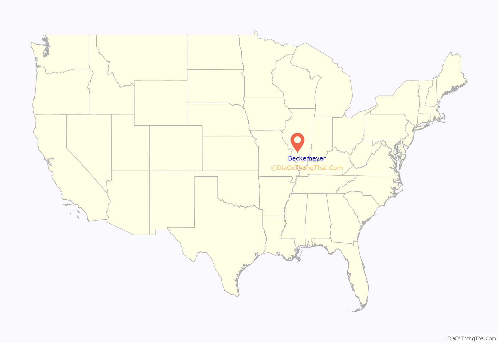
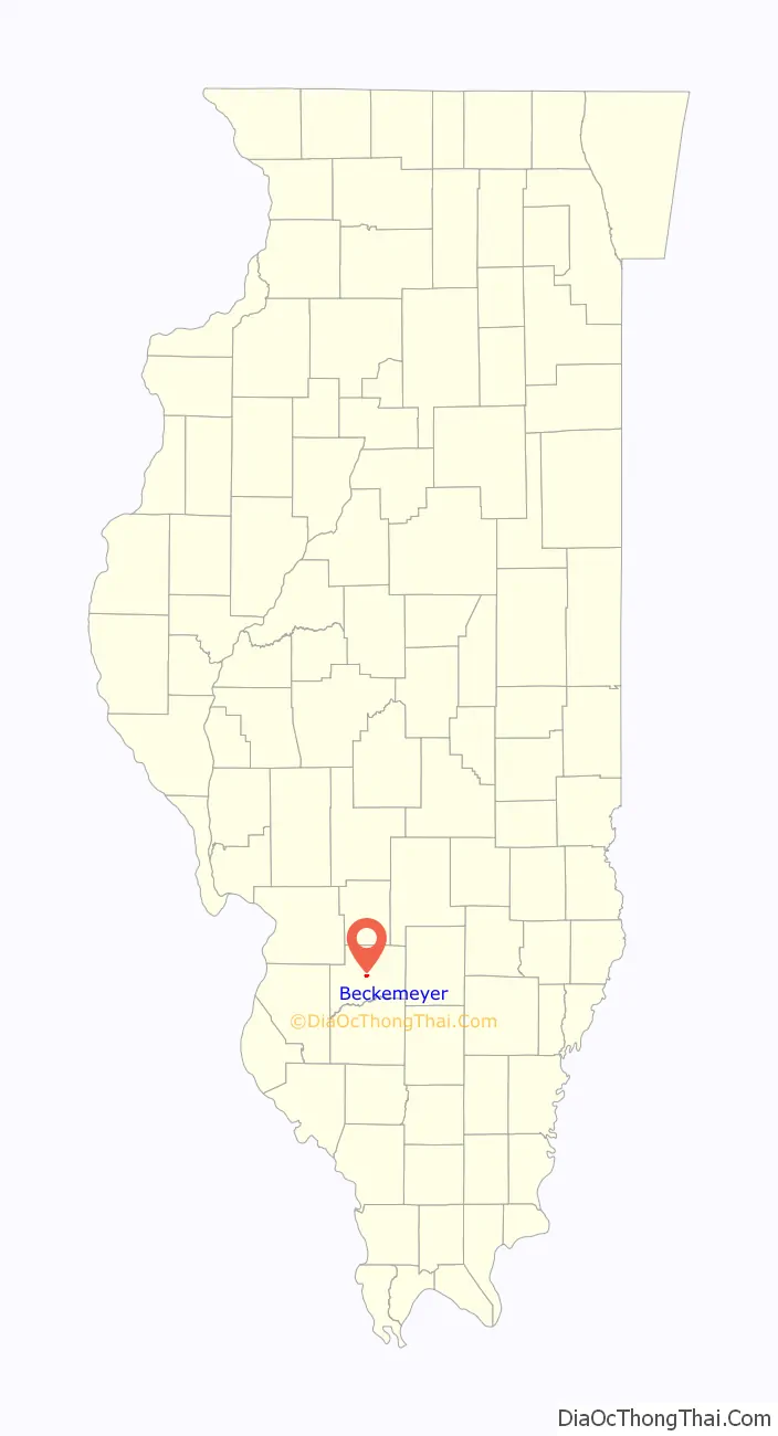
Beckemeyer location map. Where is Beckemeyer village?
History
Samuel B. Watkins was reported to be the first settler in the area, circa 1817. Beckemeyer began as a way station on the Ohio and Mississippi Railroad. It was organized and laid out in 1866 and originally named “Buxton” in honor of a railroad attorney.
A large coal seam underlying the village and surrounding area was mined starting in 1894, resulting in growth of Buxton. It was renamed “Beckemeyer” after an election held in 1905. The first school and bank were opened in 1906.
On 25 March 1947, the Centralia Coal mine exploded killing 111 people. Nine of the people killed were citizens of Beckemeyer. In 1997 a memorial was built in Beckemeyer, the memorial called “Miners Memorial Park” is dedicated to the miners from Beckemeyer that died in the explosion.
On 7 February 1976, a train crashed into a truck going 56 mph killing 12 people including 11 children, and left another four injured. The accident was the worst in Clinton County History.
A Zinc smelter plant called Circle Smelting Corp operated in the village from 1904 to 1994, in 1993 a study indicated the town was highly contaminated with over 10,000 cubic yards of industrial waste high in lead content from the industry. In 1994 the EPA forced the plant to shut down and declared it a Superfund site. About 35,000 cubic yards of material was removed from over 300 properties and deposited under a concrete cover.
Beckemeyer Road Map
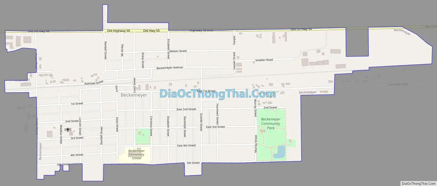
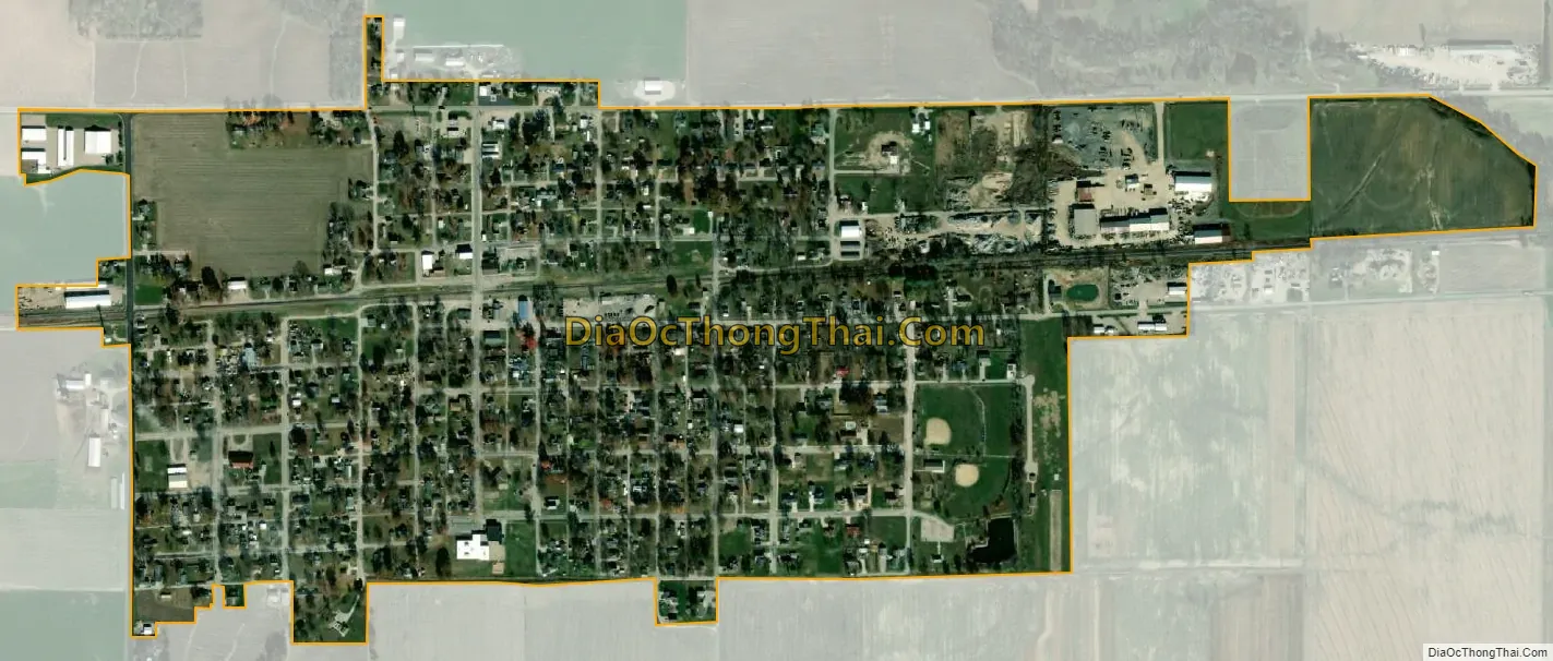
Beckemeyer city Satellite Map
Geography
According to the 2021 census gazetteer files, Beckemeyer has a total area of 0.61 square miles (1.58 km), all land.
See also
Map of Illinois State and its subdivision:- Adams
- Alexander
- Bond
- Boone
- Brown
- Bureau
- Calhoun
- Carroll
- Cass
- Champaign
- Christian
- Clark
- Clay
- Clinton
- Coles
- Cook
- Crawford
- Cumberland
- De Kalb
- De Witt
- Douglas
- Dupage
- Edgar
- Edwards
- Effingham
- Fayette
- Ford
- Franklin
- Fulton
- Gallatin
- Greene
- Grundy
- Hamilton
- Hancock
- Hardin
- Henderson
- Henry
- Iroquois
- Jackson
- Jasper
- Jefferson
- Jersey
- Jo Daviess
- Johnson
- Kane
- Kankakee
- Kendall
- Knox
- La Salle
- Lake
- Lake Michigan
- Lawrence
- Lee
- Livingston
- Logan
- Macon
- Macoupin
- Madison
- Marion
- Marshall
- Mason
- Massac
- McDonough
- McHenry
- McLean
- Menard
- Mercer
- Monroe
- Montgomery
- Morgan
- Moultrie
- Ogle
- Peoria
- Perry
- Piatt
- Pike
- Pope
- Pulaski
- Putnam
- Randolph
- Richland
- Rock Island
- Saint Clair
- Saline
- Sangamon
- Schuyler
- Scott
- Shelby
- Stark
- Stephenson
- Tazewell
- Union
- Vermilion
- Wabash
- Warren
- Washington
- Wayne
- White
- Whiteside
- Will
- Williamson
- Winnebago
- Woodford
- Alabama
- Alaska
- Arizona
- Arkansas
- California
- Colorado
- Connecticut
- Delaware
- District of Columbia
- Florida
- Georgia
- Hawaii
- Idaho
- Illinois
- Indiana
- Iowa
- Kansas
- Kentucky
- Louisiana
- Maine
- Maryland
- Massachusetts
- Michigan
- Minnesota
- Mississippi
- Missouri
- Montana
- Nebraska
- Nevada
- New Hampshire
- New Jersey
- New Mexico
- New York
- North Carolina
- North Dakota
- Ohio
- Oklahoma
- Oregon
- Pennsylvania
- Rhode Island
- South Carolina
- South Dakota
- Tennessee
- Texas
- Utah
- Vermont
- Virginia
- Washington
- West Virginia
- Wisconsin
- Wyoming