Berwyn /ˈbɜːrwɪn/ is a suburban city in Cook County, Illinois, coterminous with Berwyn Township, which was formed in 1908 after breaking off from Cicero Township. As of the 2020 census, the city had a total population of 57,250.
| Name: | Berwyn city |
|---|---|
| LSAD Code: | 25 |
| LSAD Description: | city (suffix) |
| State: | Illinois |
| County: | Cook County |
| Incorporated: | 1908 |
| Total Area: | 3.90 sq mi (10.11 km²) |
| Land Area: | 3.90 sq mi (10.11 km²) |
| Water Area: | 0.00 sq mi (0.00 km²) 0% |
| Total Population: | 57,250 |
| Population Density: | 14,664.45/sq mi (5,661.31/km²) |
| Area code: | 708/464 |
| FIPS code: | 1705573 |
| Website: | www.berwyn-il.gov |
Online Interactive Map
Click on ![]() to view map in "full screen" mode.
to view map in "full screen" mode.
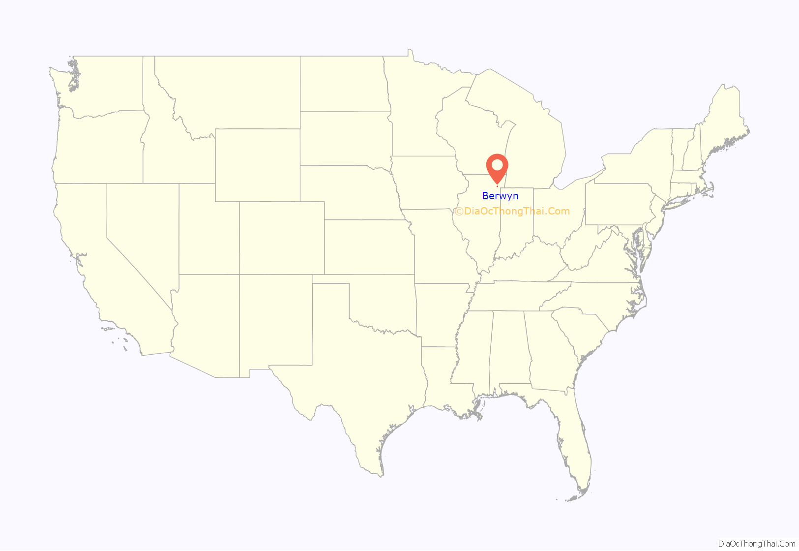
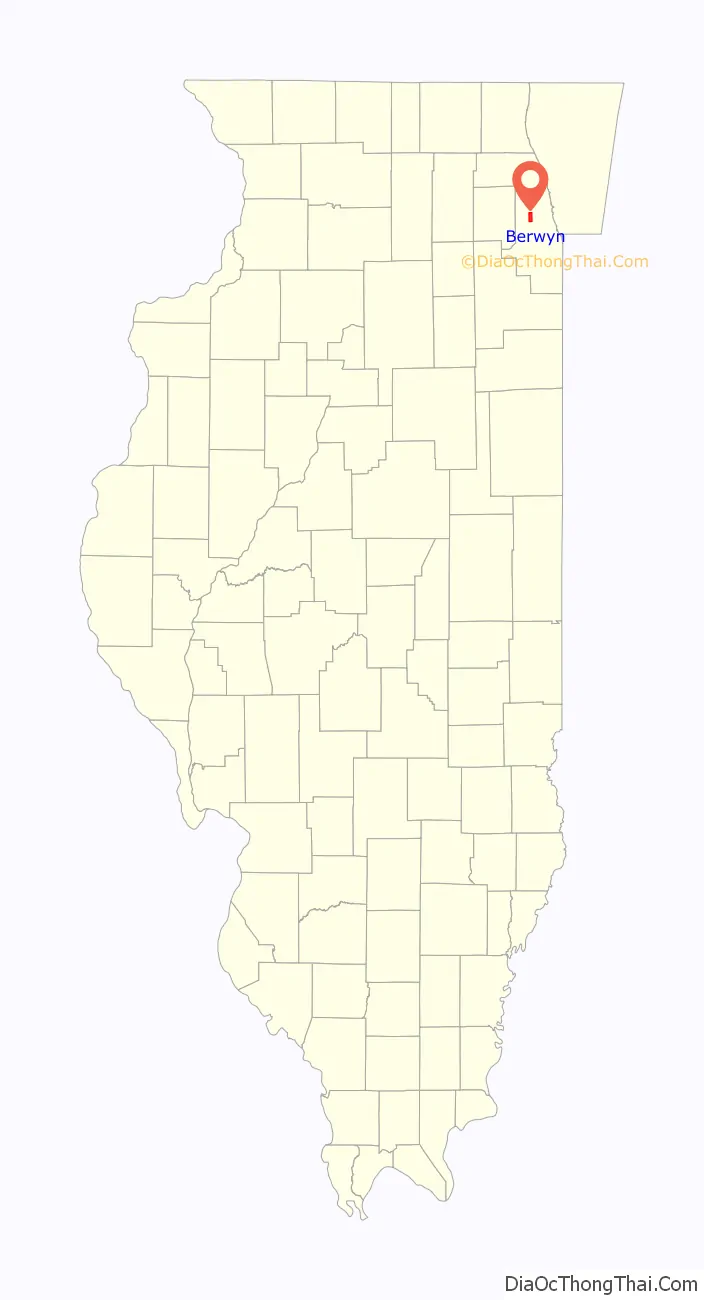
Berwyn location map. Where is Berwyn city?
History
Before being settled, the land that is now Berwyn was traversed by Native American trails. The most important trails converged near the Chicago portage, and two notable routes crossed what is today Berwyn. A branch of the Trail to Green Bay crossed Berwyn at what is now Riverside Drive, and the Ottawa Trail spanned the southern end of the city.
In 1846, the first land in “Berwyn” was deeded to Theodore Doty, who built the 8-foot-wide (2.4 m) Plank Road from Chicago to Ottawa along the Ottawa Trail. The trail had been used as a French and Indian trade route and more recently as a stagecoach route to Lisle. This thoroughfare became what is now Ogden Avenue in South Berwyn. In 1856, Thomas F. Baldwin purchased 347 acres (1.40 km) of land, bordered by what is now Ogden Avenue, Ridgeland Avenue, 31st Street, and Harlem Avenue, in hopes of developing a rich and aristocratic community called “LaVergne”. However, few people were interested in grassy marshland. Mud Lake extended nearly to the southern border of today’s Berwyn, and the land regularly flooded during heavy rains. The only mode of transportation to LaVergne was horse and buggy on the Plank Road.
To encourage people to move to LaVergne, Baldwin sold an 80-foot-wide (24 m) strip of property to the Burlington and Quincy Railroad in 1862. The rail line opened in 1864, but the train did not stop regularly in the area. The railroad refused to build a station, so the residents of the area constructed LaVergne Station on Ridgeland Avenue in 1874.
However, the financial panic of 1873 and Baldwin’s death in 1876 stunted the growth of LaVergne. Baldwin’s daughter, Emma, inherited her father’s estate, and in 1879 she sold most of the land to a group of realtors controlled by Marshall Field. The new development enacted building codes and stipulated the minimum building cost of each home. By the end of 1880, 12 new homes were built. By 1888, the settlement had grown so much that the Baldwin family donated the triangular piece of land bounded by Ogden Avenue, 34th Street, and Gunderson Avenue so that a school could be built. LaVergne School became the first public building in Berwyn.
In 1890, Charles E. Piper and Wilbur J. Andrews, two Chicago attorneys, purchased a 106-acre (0.43 km) plot of land from the Field syndicate to develop. The land was bounded by Wesley, Kenilworth, 31st Street, and Ogden Avenues. By the following year, the two received approval from Cicero Township to double their land holdings.
Piper and Andrews wanted the railroad to build a station in their development, but the railroad already had stations at La Vergne and at Harlem Avenue. Piper and Andrews decided to build a station with the understanding that trains would stop regularly. They did not know what to name their station so they consulted a Pennsylvania train timetable to find a name. The name they chose was Berwyn, a Main Line suburb of Philadelphia noted for its beauty. After 1901, all settlements in the area were known as Berwyn.
While Piper and Andrews were developing the southern portion of present-day Berwyn, John Kelly was helping to develop the north part from 12th Street to 16th Street. This area was really a part of an Oak Park subdivision, and it even appeared on some maps as “South Oak Park”. In fact, children who lived in this area went to school in Oak Park. John Kelly was known as “Mr. Everything” because he was a realtor, builder, insurance seller, and community servant.
In between the two settlements, there was little except for a few farms. The area between 16th and 31st streets was not settled. There were only two paths by which to travel between the two settlements, and today these paths are known as Oak Park Avenue and Ridgeland Avenue. Although Berwyn was chartered as a city in 1908, it was not until the 1920s that this middle portion of land was developed.
During this time, Berwyn was the area’s fastest growing suburb. The city’s stringent building codes resulted in block upon block of well-built brick two-story bungalows. Many also contained elaborate design elements typically not seen, such as stained glass windows, clay tile roofs, terra cotta, and intricate brick patterns. Today, Berwyn is noted as having the most significant collection of Chicago-style bungalows in the nation.
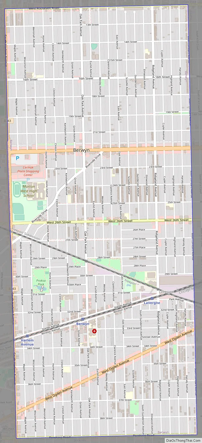
Berwyn Road Map
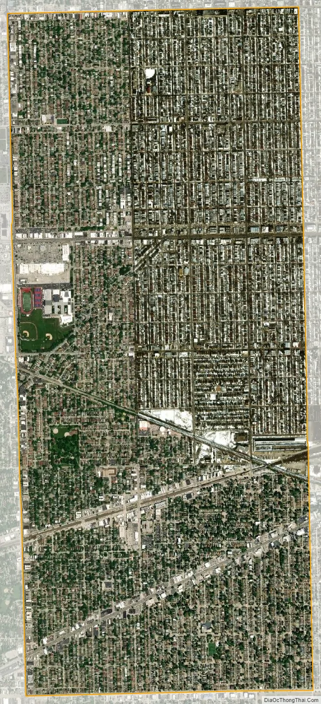
Berwyn city Satellite Map
Geography
According to the 2021 census gazetteer files, Berwyn has a total area of 3.90 square miles (10.10 km), all land. Bordering suburbs include Oak Park to the north, Cicero to the east, Stickney to the south, and Lyons, Riverside, North Riverside, and Forest Park to the west. Geologically, Berwyn is predominately composed of Glacial Lake Bottom from the Wisconsin Glacial Episode, the most recent glacial period. A beach ridge of sand and gravel, made during one of the stages of Lake Chicago, is also present in the city. This is most easily identified as Riverside Drive. The elevation change due to the ridge is clearly seen on the 2800 block of Maple Ave. Prior to the settlement of Berwyn, the land was grassy marshland. The body of water that connected the South Branch of the Chicago River to the Des Plaines River was a shallow waterway or a muddy slough (depending on the season) known as Mud Lake. Mud Lake extended nearly to the southern border of today’s Berwyn, and the southern end of Berwyn flooded regularly during heavy rains in its early years.
See also
Map of Illinois State and its subdivision:- Adams
- Alexander
- Bond
- Boone
- Brown
- Bureau
- Calhoun
- Carroll
- Cass
- Champaign
- Christian
- Clark
- Clay
- Clinton
- Coles
- Cook
- Crawford
- Cumberland
- De Kalb
- De Witt
- Douglas
- Dupage
- Edgar
- Edwards
- Effingham
- Fayette
- Ford
- Franklin
- Fulton
- Gallatin
- Greene
- Grundy
- Hamilton
- Hancock
- Hardin
- Henderson
- Henry
- Iroquois
- Jackson
- Jasper
- Jefferson
- Jersey
- Jo Daviess
- Johnson
- Kane
- Kankakee
- Kendall
- Knox
- La Salle
- Lake
- Lake Michigan
- Lawrence
- Lee
- Livingston
- Logan
- Macon
- Macoupin
- Madison
- Marion
- Marshall
- Mason
- Massac
- McDonough
- McHenry
- McLean
- Menard
- Mercer
- Monroe
- Montgomery
- Morgan
- Moultrie
- Ogle
- Peoria
- Perry
- Piatt
- Pike
- Pope
- Pulaski
- Putnam
- Randolph
- Richland
- Rock Island
- Saint Clair
- Saline
- Sangamon
- Schuyler
- Scott
- Shelby
- Stark
- Stephenson
- Tazewell
- Union
- Vermilion
- Wabash
- Warren
- Washington
- Wayne
- White
- Whiteside
- Will
- Williamson
- Winnebago
- Woodford
- Alabama
- Alaska
- Arizona
- Arkansas
- California
- Colorado
- Connecticut
- Delaware
- District of Columbia
- Florida
- Georgia
- Hawaii
- Idaho
- Illinois
- Indiana
- Iowa
- Kansas
- Kentucky
- Louisiana
- Maine
- Maryland
- Massachusetts
- Michigan
- Minnesota
- Mississippi
- Missouri
- Montana
- Nebraska
- Nevada
- New Hampshire
- New Jersey
- New Mexico
- New York
- North Carolina
- North Dakota
- Ohio
- Oklahoma
- Oregon
- Pennsylvania
- Rhode Island
- South Carolina
- South Dakota
- Tennessee
- Texas
- Utah
- Vermont
- Virginia
- Washington
- West Virginia
- Wisconsin
- Wyoming


