Oak Park is a village in Cook County, Illinois, adjacent to Chicago. It is the 26th-most populous municipality in Illinois with a population of 54,583 as of the 2020 U.S. Census estimate. Oak Park was first settled in 1835 and later incorporated in 1902, when it separated from Cicero. It is closely tied to the smaller town of River Forest Illinois, sharing Oak Park and River Forest High School. Architect Frank Lloyd Wright and his wife settled in Oak Park in 1889, and his work heavily influenced local architecture and design, including the Frank Lloyd Wright Home and Studio. Over the years, rapid development was spurred by railroads and street cars connecting the village to jobs in nearby Chicago. In 1968, Oak Park passed the Open Housing Ordinance, which helped devise strategies to integrate the village rather than resegregate.
Today, Oak Park remains ethnically diverse, and is known for its socially liberal politics, with 80% or higher voter turnout in every presidential election since 2000. Oak Park is closely connected to Chicago with Chicago Transit Authority access via the Green Line and Blue Line “L” train lines, as well as the Metra Oak Park station downtown.
| Name: | Oak Park village |
|---|---|
| LSAD Code: | 47 |
| LSAD Description: | village (suffix) |
| State: | Illinois |
| County: | Cook County |
| Elevation: | 620 ft (190 m) |
| Total Area: | 4.70 sq mi (12.17 km²) |
| Land Area: | 4.70 sq mi (12.17 km²) |
| Water Area: | 0.00 sq mi (0.00 km²) |
| Total Population: | 54,583 |
| Population Density: | 11,613.40/sq mi (4,484.14/km²) |
| Area code: | 708 |
| FIPS code: | 1754885 |
| Website: | www.oak-park.us |
Online Interactive Map
Click on ![]() to view map in "full screen" mode.
to view map in "full screen" mode.
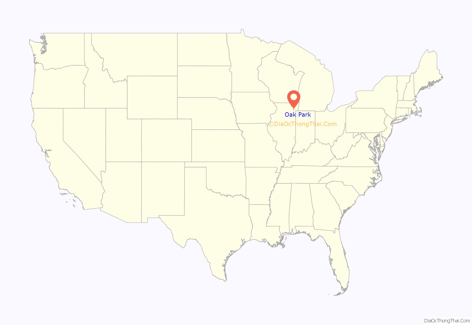
Oak Park location map. Where is Oak Park village?

History
In 1835, Joseph and Betty Kettlestrings, immigrants from Yorkshire, England, staked out a farm and built a house near Lake Street and Harlem Avenue, west of Chicago. Once their children were born, they moved to Chicago for the schools in 1843, and moved back again in 1855 to build a more substantial home a bit east on their quarter section of land. More farmers and settlers had entered the area. Their land was called by several names locally, including Oak Ridge, Harlem, and Kettlestrings Grove. When the first post office was set up, it could not use the name Oak Ridge, as another post office was using that name in Illinois, so the post office chose Oak Park, and that name became the name for the settlement as it grew, and for the town when it incorporated in 1902.
By 1850, the Galena and Chicago Union Railroad (after that, the Chicago & Northwestern and now Union Pacific) was constructed as far as Elgin, Illinois, and passed through the settlement area. In the 1850s the land on which Oak Park sits was part of the new Chicago suburb, the town of Cicero. The population of the area boomed during the 1870s, with Chicago residents resettling in Cicero following the Great Chicago Fire of 1871 and the expansion of railroads and street cars to the area. “In 1872, when Oak Park received its own railroad depot on the Chicago and Northwestern Railway, its rapid emergence as a residential suburb of Chicago began. In 1877, the railroad was running thirty-nine trains daily between Oak Park and Chicago; in the subsequent year, more railroads and street car lines, with increased service, came to link Oak Park and Chicago. As Chicago grew from a regional center to a national metropolis Oak Park expanded – from 500 residents in 1872 to 1,812 in 1890, to 9,353 in 1900, to 20,911 in 1910, to 39,585 in 1920. Oak Park thus emerged as a leading Chicago suburb.”
A review of Oak Park’s history by Wiss, Janny, Elstner Associates in 2006 further explains the importance of railroads and street cars in the development of Oak Park:
The Village of Oak Park was formally established in 1902, disengaging from Cicero following a referendum. According to the local historical society, “The period 1892–1950 saw the construction of almost all of the housing stock in Oak Park, and most of the village’s current buildings.” The village population grew quickly, and “by 1930, the village had a population of 64,000, even larger than the current population,” while cherishing a reputation as the “World’s Largest Village.” Chicago grew rapidly in the 19th century, recording 4,470 residing in the 1840 Census in the place so recently a fur trading post, reaching 1,099,850 in 1890, and then 1,698,575 in 1900, passing Philadelphia to the number two spot in the US, and in that year, the fifth largest in the world. Chicago was well located on the shores of Lake Michigan for transport; after the fire of 1871, Chicago rebuilt its center and exploded with new ideas; Oak Park grew along with its neighbor to the east, having location and railroad and street car connections in its favor.
After World War II, “Oak Park was affected by larger developmental trends in the Chicago Metropolitan area. The construction of the Eisenhower Expressway cut through the southern portion of the Village in the mid 1950s. Starting in the 1960s and 1970s, Oak Park has made a conscious effort to accommodate changing demographics and social pressures while maintaining the suburban character that has long made the Village a desirable residential location. Beginning in the 1960s, Oak Park faced the issue of racial integration with effective programs to maintain the character and stability of the Village, while encouraging integration on racial basis. This included passage of The Open Housing Ordinance in 1968 which has helped maintain the ethnically diverse population seen in the village still today.
Oak Park has a history of alcohol prohibition. When the village was incorporated, no alcohol was allowed to be sold within its village limits. This law was relaxed in 1973, when restaurants and hotels were allowed to serve alcohol with meals, and was further loosened in 2002, when select grocery stores received governmental permission to sell packaged liquor. Today, alcohol, such as beer and wine, is easily accessible with many bars and cocktail lounges around the village.
In 1889, Frank Lloyd Wright and his wife settled in Oak Park. He built many homes and the Unity Temple, his own church, in the village, before he left in 1911 to settle in Wisconsin. Oak Park attracts architecture buffs and others to view the many Wright-designed homes found in the village, alongside homes reflecting other architectural styles. The largest collection of Wright-designed residential properties in the world is in Oak Park. A distinct focus on historic preservation of important architectural styles began in the 1970s and continues, with many buildings marked as historically significant, and so far, three historic districts defined. Other attractions include Ernest Hemingway’s birthplace home and his boyhood home, the Ernest Hemingway Museum, the three Oak Park homes of writer and Tarzan creator Edgar Rice Burroughs, Wright’s Unity Temple, Pleasant Home, and the Oak Park-River Forest Historical Society.
Oak Park and River Forest High School is a comprehensive college preparatory school, with a long list of alumni who have made major or notable contributions to their fields of endeavor. Among these are Nobel Prize-winning author Ernest Hemingway, football Hall-of-Famer George Trafton, McDonald’s founder Ray Kroc, city planner Walter Burley Griffin, comedian Kathy Griffin, basketball player Iman Shumpert, and the voice of cartoon character Homer Simpson, Dan Castellaneta.
Oak Park Road Map

Oak Park city Satellite Map

Geography
Oak Park is located immediately west of the city of Chicago. The boundary between the two municipalities is Austin Boulevard on the east side of Oak Park and North Avenue/Illinois Route 64 on the village’s north side. Oak Park borders Cicero along its southern border, Roosevelt Road/Illinois Route 38, from Austin to Lombard; and Berwyn from Lombard to Harlem Avenue. Harlem/Illinois Route 43 serves as its western border, where between Roosevelt and South Boulevard, it borders Forest Park and between North Boulevard and North Avenue to the west it borders River Forest.
The entire village of Oak Park lies on the shore of ancient Lake Chicago, which covered most of the city of Chicago during the last Ice Age, and was the forerunner to today’s Lake Michigan. Ridgeland Avenue in eastern Oak Park marks the shoreline of the lake, and was once an actual ridge. As with the geographical setup of the Chicago River, which connects to the present day Lake Michigan just north of the city’s Loop, the ancient Des Plaines river once emptied into glacial Lake Chicago, making prehistoric Oak Park a “Plains river Delta” system. One of North America’s four continental divides runs through Oak Park. This divide, a slight rise running north–south through the village, separates the Saint Lawrence River watershed from the Mississippi River watershed, and is marked by one plaque on Lake Street at Forest Avenue and another in the northwest corner of Taylor Park.
According to the 2010 census, Oak Park has a total area of 4.7 sq mi (12.17 km), all land.
See also
Map of Illinois State and its subdivision:- Adams
- Alexander
- Bond
- Boone
- Brown
- Bureau
- Calhoun
- Carroll
- Cass
- Champaign
- Christian
- Clark
- Clay
- Clinton
- Coles
- Cook
- Crawford
- Cumberland
- De Kalb
- De Witt
- Douglas
- Dupage
- Edgar
- Edwards
- Effingham
- Fayette
- Ford
- Franklin
- Fulton
- Gallatin
- Greene
- Grundy
- Hamilton
- Hancock
- Hardin
- Henderson
- Henry
- Iroquois
- Jackson
- Jasper
- Jefferson
- Jersey
- Jo Daviess
- Johnson
- Kane
- Kankakee
- Kendall
- Knox
- La Salle
- Lake
- Lake Michigan
- Lawrence
- Lee
- Livingston
- Logan
- Macon
- Macoupin
- Madison
- Marion
- Marshall
- Mason
- Massac
- McDonough
- McHenry
- McLean
- Menard
- Mercer
- Monroe
- Montgomery
- Morgan
- Moultrie
- Ogle
- Peoria
- Perry
- Piatt
- Pike
- Pope
- Pulaski
- Putnam
- Randolph
- Richland
- Rock Island
- Saint Clair
- Saline
- Sangamon
- Schuyler
- Scott
- Shelby
- Stark
- Stephenson
- Tazewell
- Union
- Vermilion
- Wabash
- Warren
- Washington
- Wayne
- White
- Whiteside
- Will
- Williamson
- Winnebago
- Woodford
- Alabama
- Alaska
- Arizona
- Arkansas
- California
- Colorado
- Connecticut
- Delaware
- District of Columbia
- Florida
- Georgia
- Hawaii
- Idaho
- Illinois
- Indiana
- Iowa
- Kansas
- Kentucky
- Louisiana
- Maine
- Maryland
- Massachusetts
- Michigan
- Minnesota
- Mississippi
- Missouri
- Montana
- Nebraska
- Nevada
- New Hampshire
- New Jersey
- New Mexico
- New York
- North Carolina
- North Dakota
- Ohio
- Oklahoma
- Oregon
- Pennsylvania
- Rhode Island
- South Carolina
- South Dakota
- Tennessee
- Texas
- Utah
- Vermont
- Virginia
- Washington
- West Virginia
- Wisconsin
- Wyoming


