Bolingbrook is a village in Will and DuPage counties in the U.S. state of Illinois. It is a southwest suburb of Chicago on I-55 and Historic Route 66 (Frontage Road). The village was a new town built on the Gateway Wetlands west of the Des Plaines River in the 1960s. Bolingbrook experienced rapid growth in the 1980s and 1990s, and eventually became the second largest town in the county after Joliet. Per the 2020 census, the population was 73,922. As of 2010, it is the 17th largest incorporated place in Illinois and the state’s 2nd largest village.
| Name: | Bolingbrook village |
|---|---|
| LSAD Code: | 47 |
| LSAD Description: | village (suffix) |
| State: | Illinois |
| County: | DuPage County, Will County |
| Incorporated: | October 6, 1965 |
| Total Area: | 25.12 sq mi (65.07 km²) |
| Land Area: | 24.92 sq mi (64.54 km²) |
| Water Area: | 0.21 sq mi (0.54 km²) 0.87% |
| Total Population: | 73,922 |
| Population Density: | 2,966.73/sq mi (1,145.44/km²) |
| Area code: | 630/331 and 815/779 |
| FIPS code: | 1707133 |
| Website: | www.bolingbrook.com |
Online Interactive Map
Click on ![]() to view map in "full screen" mode.
to view map in "full screen" mode.
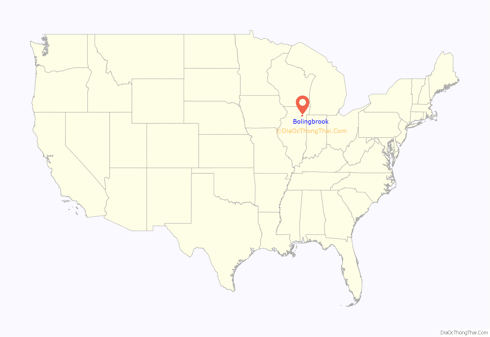
Bolingbrook location map. Where is Bolingbrook village?
History
Bolingbrook is a suburb of Chicago incorporated in 1965. Similar to the neighboring village of Woodridge, almost all of the businesses, homes, churches and other buildings in Bolingbrook were built after 1960. The first settlement in what is now Bolingbrook was established in 1831, but the informal farming villages remained unincorporated for over 130 years. The area that is now Bolingbrook is located in the heart of the Gateway Wetlands, which begin in Downers Grove and end just north of the Joliet city limits. The tiny Boardman Cemetery, in what is now the Heritage Creek subdivision, contains the remains of some of these early residents.
Modern Bolingbrook has its roots in the housing boom of the 1950s. The first subdivision in Bolingbrook, known as Westbury, was immediately west of Route 53. A second subdivision, known as Colonial Village, followed on the far east side of Route 53.
The village continued to grow steadily for the remainder of the 1960s, reaching a population of 7,000 by 1970. The 1970s were the first period of rapid growth in Bolingbrook, during which its population quintupled to reach over 37,000 by 1980. Much of this growth was as much due to mass annexation as well as raw population growth; the population of Bolingbrook by the 1970 census but with its 1980 land boundary was approximately 25,000, further reflecting the vigorous annexation that took place during the 1970s.
By 1990, Bolingbrook’s population had only increased by about 10% from the previous decade, to about 41,000.
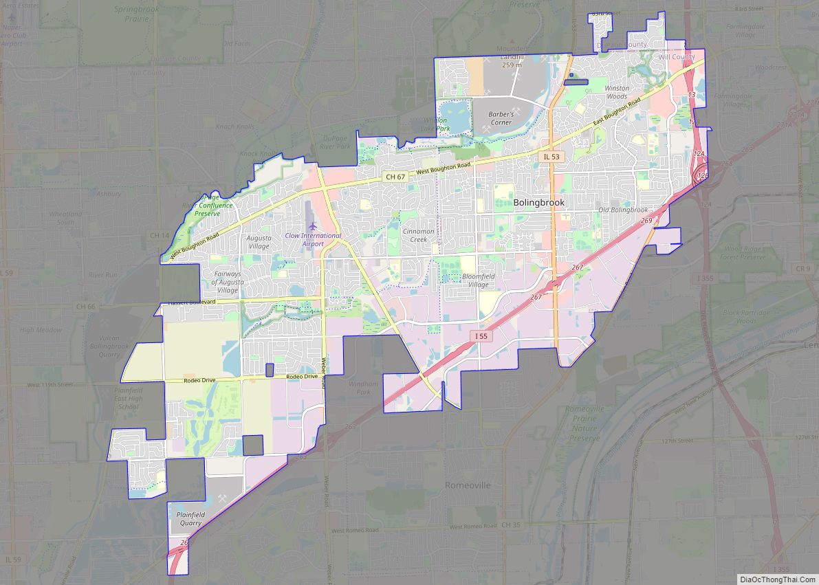
Bolingbrook Road Map
Bolingbrook city Satellite Map
Geography
Bolingbrook is approximately 28 miles southwest of Downtown Chicago.
According to the 2021 census gazetteer files, Bolingbrook has a total area of 25.12 square miles (65.06 km), of which 24.92 square miles (64.54 km) (or 99.18%) is land and 0.21 square miles (0.54 km) (or 0.82%) is water.
Bolingbrook borders the communities of Woodridge, Romeoville, Plainfield, Naperville, and Darien.
Interstate 55, locally the Stevenson Expressway, runs through the southern part of the village heading northeast toward Chicago and southwest toward Plainfield and Joliet. Interstate 355, also known as the Veterans Memorial Tollway (formerly the North-South Tollway), runs along the far east side of the village between New Lenox and Addison. Illinois Route 53, locally known as Bolingbrook Drive, runs north–south through the middle of the village.
Other main streets in Bolingbrook include Boughton Road, Lily Cache Lane, Weber Road, Veterans Parkway (formerly Naperville Road), Briarcliff Road, Hassert Boulevard (formerly 111th Street), Rodeo Drive (formerly 119th Street), Schmidt Road, Crossroads Parkway, and Remington Boulevard.
See also
Map of Illinois State and its subdivision:- Adams
- Alexander
- Bond
- Boone
- Brown
- Bureau
- Calhoun
- Carroll
- Cass
- Champaign
- Christian
- Clark
- Clay
- Clinton
- Coles
- Cook
- Crawford
- Cumberland
- De Kalb
- De Witt
- Douglas
- Dupage
- Edgar
- Edwards
- Effingham
- Fayette
- Ford
- Franklin
- Fulton
- Gallatin
- Greene
- Grundy
- Hamilton
- Hancock
- Hardin
- Henderson
- Henry
- Iroquois
- Jackson
- Jasper
- Jefferson
- Jersey
- Jo Daviess
- Johnson
- Kane
- Kankakee
- Kendall
- Knox
- La Salle
- Lake
- Lake Michigan
- Lawrence
- Lee
- Livingston
- Logan
- Macon
- Macoupin
- Madison
- Marion
- Marshall
- Mason
- Massac
- McDonough
- McHenry
- McLean
- Menard
- Mercer
- Monroe
- Montgomery
- Morgan
- Moultrie
- Ogle
- Peoria
- Perry
- Piatt
- Pike
- Pope
- Pulaski
- Putnam
- Randolph
- Richland
- Rock Island
- Saint Clair
- Saline
- Sangamon
- Schuyler
- Scott
- Shelby
- Stark
- Stephenson
- Tazewell
- Union
- Vermilion
- Wabash
- Warren
- Washington
- Wayne
- White
- Whiteside
- Will
- Williamson
- Winnebago
- Woodford
- Alabama
- Alaska
- Arizona
- Arkansas
- California
- Colorado
- Connecticut
- Delaware
- District of Columbia
- Florida
- Georgia
- Hawaii
- Idaho
- Illinois
- Indiana
- Iowa
- Kansas
- Kentucky
- Louisiana
- Maine
- Maryland
- Massachusetts
- Michigan
- Minnesota
- Mississippi
- Missouri
- Montana
- Nebraska
- Nevada
- New Hampshire
- New Jersey
- New Mexico
- New York
- North Carolina
- North Dakota
- Ohio
- Oklahoma
- Oregon
- Pennsylvania
- Rhode Island
- South Carolina
- South Dakota
- Tennessee
- Texas
- Utah
- Vermont
- Virginia
- Washington
- West Virginia
- Wisconsin
- Wyoming
