Browns is a village in Edwards County, Illinois, United States. The population was 139 as of the 2020 census, slightly up from 134 as of the 2010 census.
| Name: | Browns village |
|---|---|
| LSAD Code: | 47 |
| LSAD Description: | village (suffix) |
| State: | Illinois |
| County: | Edwards County |
| Elevation: | 397 ft (121 m) |
| Total Area: | 0.29 sq mi (0.75 km²) |
| Land Area: | 0.29 sq mi (0.75 km²) |
| Water Area: | 0.00 sq mi (0.00 km²) |
| Total Population: | 139 |
| Population Density: | 479.31/sq mi (185.25/km²) |
| Area code: | 618 |
| FIPS code: | 1708979 |
Online Interactive Map
Click on ![]() to view map in "full screen" mode.
to view map in "full screen" mode.
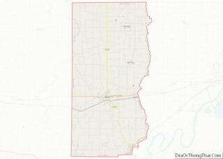
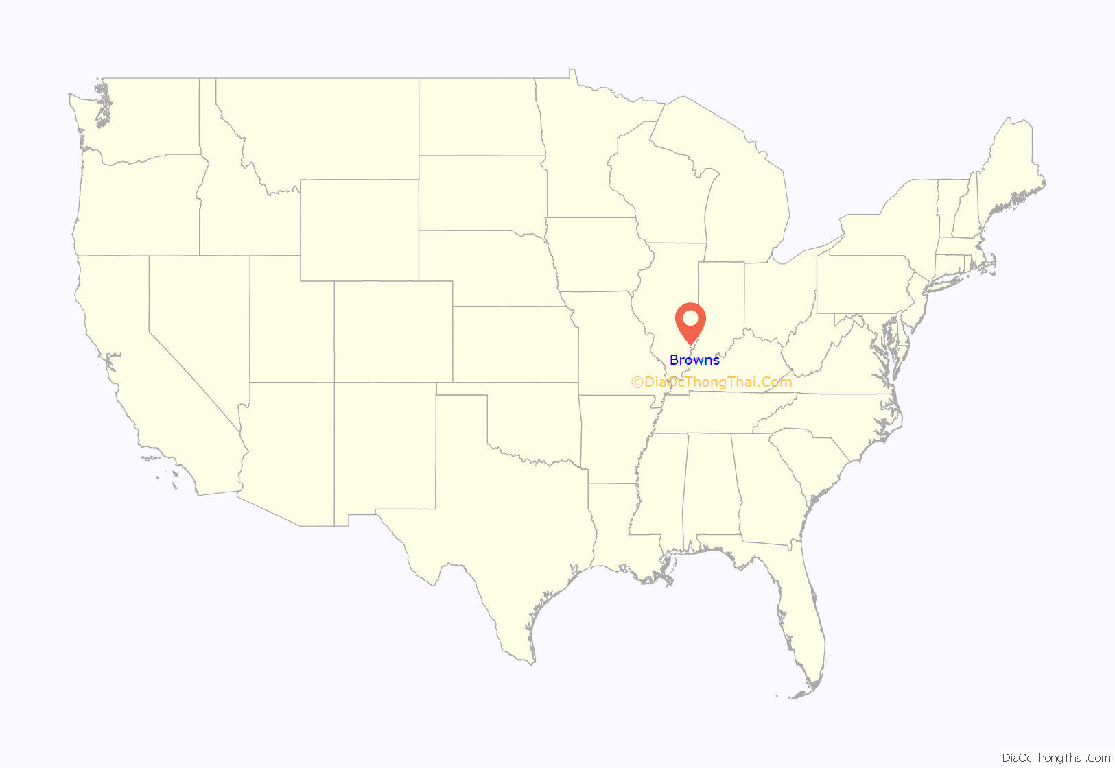
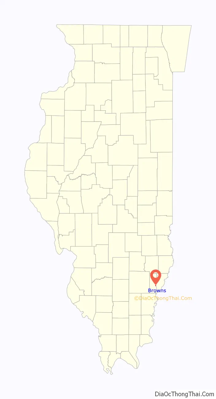
Browns location map. Where is Browns village?
History
Few records of the early history are available because the first books were destroyed by fire. Recorded history of Browns begins in 1880 when John Henderson and his wife Emma had the present site surveyed into blocks, streets, lots and alleys and named it “Frazier”.
On May 7, 1892, a petition was filed asking that an election be held to incorporate the site as the village of Browns, apparently in honor of John L. Brown, a prominent citizen of that name. The election was held on May 24 of that year and carried narrowly, 31 to 27.
The village of Browns is a “dry” community and has been since the Prohibition days.
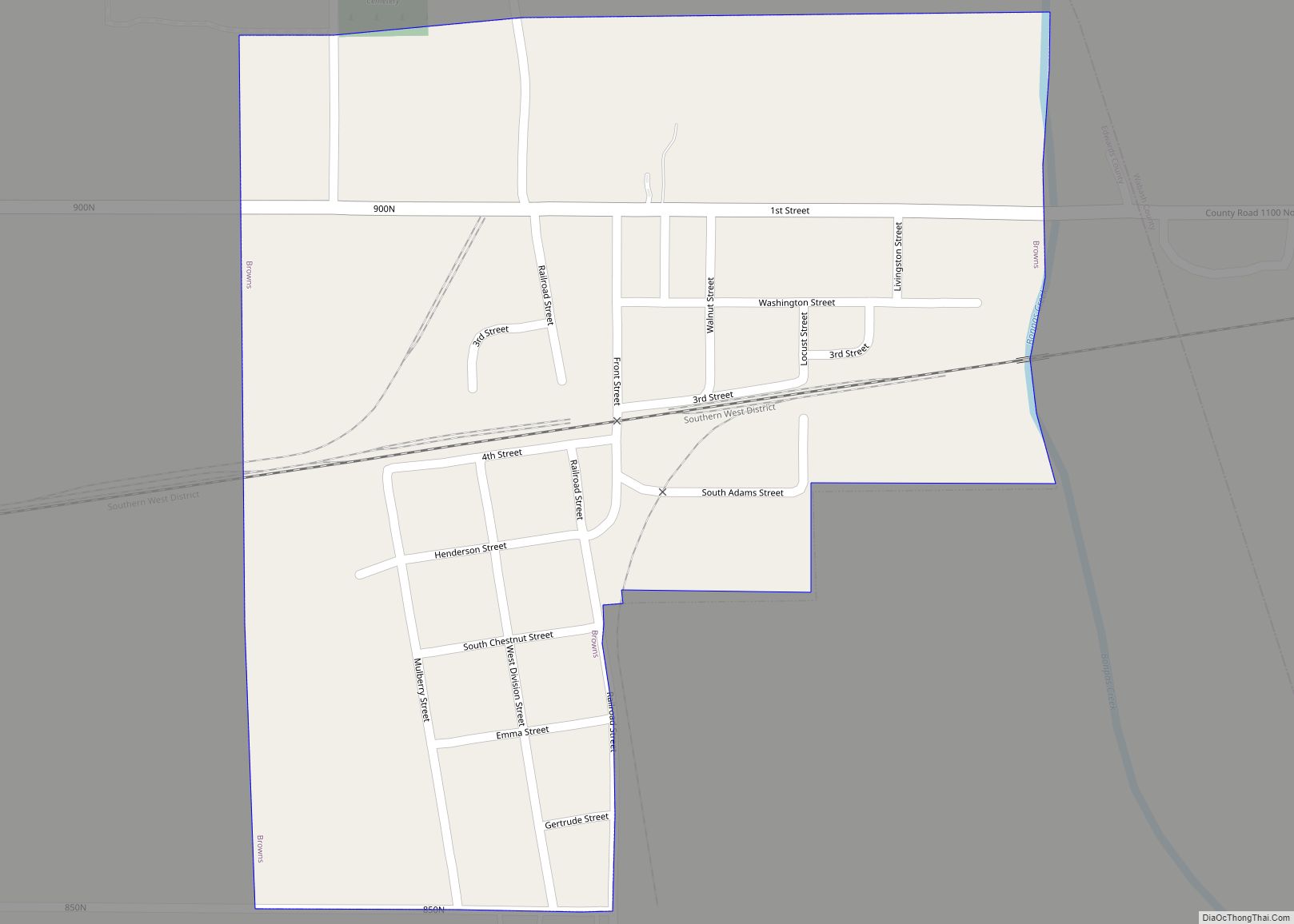
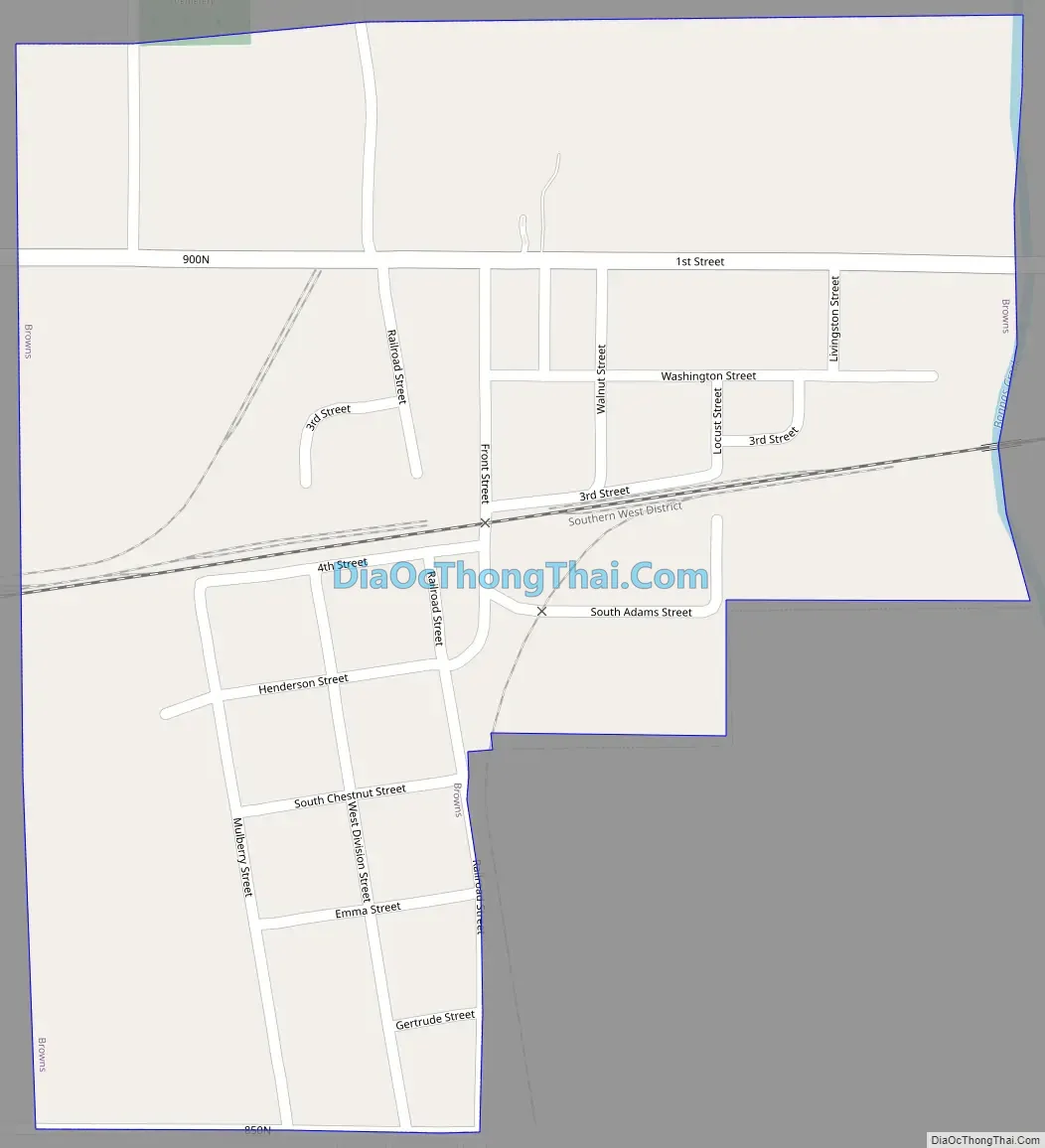
Browns Road Map
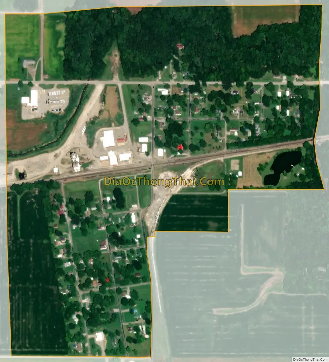
Browns city Satellite Map
Geography
Browns is located on the eastern border of Edwards County at 38°22′36″N 87°58′58″W / 38.37667°N 87.98278°W / 38.37667; -87.98278 (38.376732, -87.982873). The eastern village limit is Bonpas Creek, which forms the Wabash County line. Illinois Route 15 passes just north of the village, leading west 4 miles (6 km) to Albion, the Edwards County seat, and east 13 miles (21 km) to Mount Carmel.
According to the 2010 census, Browns has a total area of 0.29 square miles (0.75 km), all land.
See also
Map of Illinois State and its subdivision:- Adams
- Alexander
- Bond
- Boone
- Brown
- Bureau
- Calhoun
- Carroll
- Cass
- Champaign
- Christian
- Clark
- Clay
- Clinton
- Coles
- Cook
- Crawford
- Cumberland
- De Kalb
- De Witt
- Douglas
- Dupage
- Edgar
- Edwards
- Effingham
- Fayette
- Ford
- Franklin
- Fulton
- Gallatin
- Greene
- Grundy
- Hamilton
- Hancock
- Hardin
- Henderson
- Henry
- Iroquois
- Jackson
- Jasper
- Jefferson
- Jersey
- Jo Daviess
- Johnson
- Kane
- Kankakee
- Kendall
- Knox
- La Salle
- Lake
- Lake Michigan
- Lawrence
- Lee
- Livingston
- Logan
- Macon
- Macoupin
- Madison
- Marion
- Marshall
- Mason
- Massac
- McDonough
- McHenry
- McLean
- Menard
- Mercer
- Monroe
- Montgomery
- Morgan
- Moultrie
- Ogle
- Peoria
- Perry
- Piatt
- Pike
- Pope
- Pulaski
- Putnam
- Randolph
- Richland
- Rock Island
- Saint Clair
- Saline
- Sangamon
- Schuyler
- Scott
- Shelby
- Stark
- Stephenson
- Tazewell
- Union
- Vermilion
- Wabash
- Warren
- Washington
- Wayne
- White
- Whiteside
- Will
- Williamson
- Winnebago
- Woodford
- Alabama
- Alaska
- Arizona
- Arkansas
- California
- Colorado
- Connecticut
- Delaware
- District of Columbia
- Florida
- Georgia
- Hawaii
- Idaho
- Illinois
- Indiana
- Iowa
- Kansas
- Kentucky
- Louisiana
- Maine
- Maryland
- Massachusetts
- Michigan
- Minnesota
- Mississippi
- Missouri
- Montana
- Nebraska
- Nevada
- New Hampshire
- New Jersey
- New Mexico
- New York
- North Carolina
- North Dakota
- Ohio
- Oklahoma
- Oregon
- Pennsylvania
- Rhode Island
- South Carolina
- South Dakota
- Tennessee
- Texas
- Utah
- Vermont
- Virginia
- Washington
- West Virginia
- Wisconsin
- Wyoming