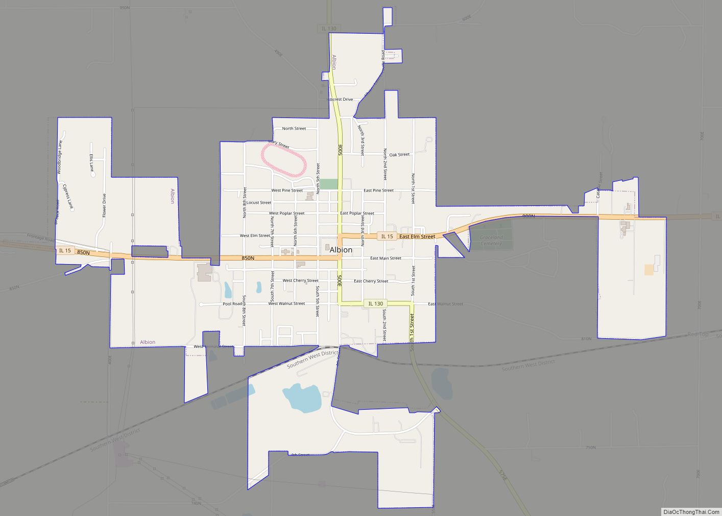
Albion is a city in and the county seat of Edwards County, Illinois, United States. The population was 1,971 at the 2020 census. The city was named “Albion” after an ancient and poetic reference to the island of Great Britain.
| Name: | Albion city |
|---|---|
| LSAD Code: | 25 |
| LSAD Description: | city (suffix) |
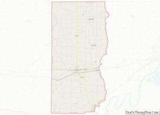
| State: | Illinois |
| County: | Edwards County |
| Elevation: | 525 ft (160 m) |
| Total Area: | 2.18 sq mi (5.65 km²) |
| Land Area: | 2.14 sq mi (5.53 km²) |
| Water Area: | 0.05 sq mi (0.12 km²) |
| Total Population: | 1,971 |
| Population Density: | 922.75/sq mi (356.32/km²) |
| Area code: | 618 |
| FIPS code: | 1700568 |
Online Interactive Map
Click on ![]() to view map in "full screen" mode.
to view map in "full screen" mode.
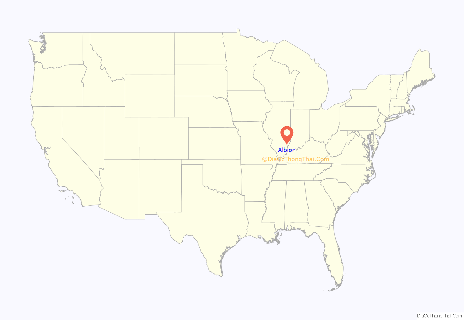
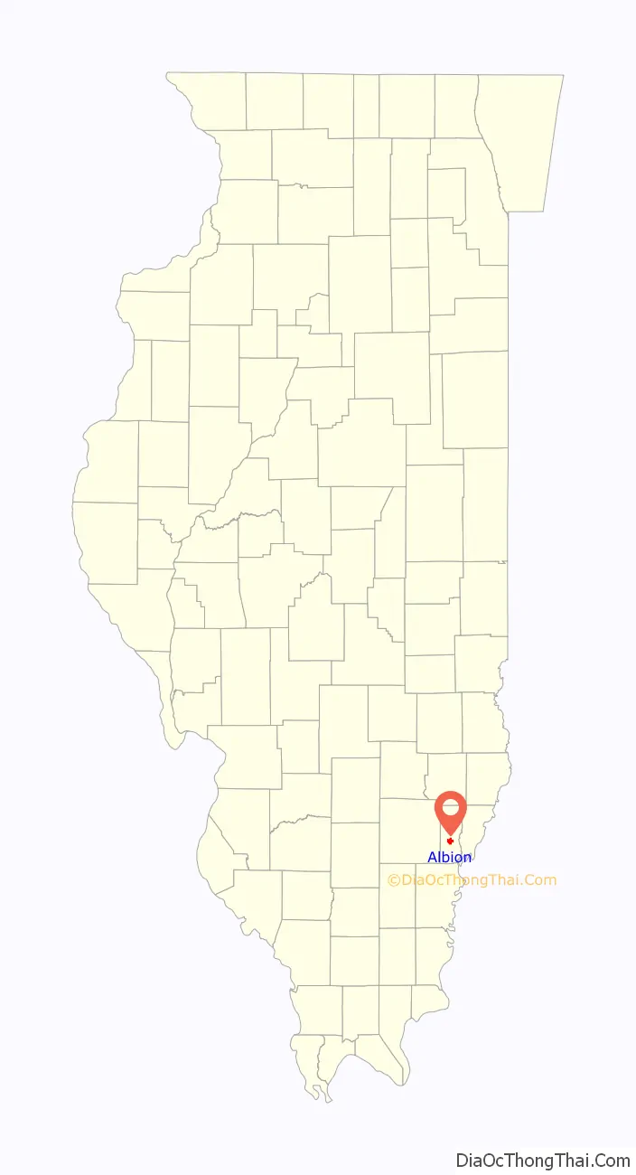
Albion location map. Where is Albion city?
History
The settlement now known as Albion was originally known to the world as “Mr. Morris Birkbeck’s English Prairie”, when Morris Birkbeck, an English Quaker, established this settlement in Illinois with co-founder George Flower (1788-1862) in 1817. Upon an unreconcilable fall-out between Birkbeck and Flower, the portion of English Prairie then settled on by George Flower was given the name Albion a year later in 1818, Albion being a literary name for England.
In 1821, the county seat of Edwards County was moved from Palmyra to Albion, eighteen miles to the west. However, residents of the larger Mount Carmel felt their town should be the county seat. Four companies of militia marched from Mount Carmel towards Albion to seize the county documents stored in the courthouse. The situation was eventually resolved in 1824 by separating Wabash County from Edwards County at Bonpas Creek and making Mount Carmel the seat of Wabash County. The two counties are among the smallest in Illinois.
The township of Albion has a curious link with England and brewing. George Flower and Morris Birkbeck, a Quaker agriculturalist and radical, organised the purchase of 26,400 acres of land in the southern “Illinois Territory,” and encouraged settlers from England to come and join them. Among them was George’s father Richard Flower, an experienced brewer (who at some point taught his son about making popular beer styles of the period, including London Porter). Flower came across the Atlantic with all his remaining children.
The settlement espoused a firm abolitionist ethos, and escaped slaves from Kentucky settled in Albion, encouraged by the Flowers and other community leaders. However, these formerly enslaved people were always in danger of being kidnapped by bounty hunters aiming to return them to slavery. Around 1823-24 one such gang of eight to ten kidnapped a group of free African-American residents of Albion and headed south. They were pursued by an outraged armed party led by Richard’s youngest son, Edward. He was only eighteen years old, but his posse successfully captured the gang “at the rifle’s mouth,” freed the captives, and took the kidnappers to face judgment under the law.
Friends or ‘business associates’ of the original kidnappers’ allies plotted to kill the young Flower or his father in revenge. According to some newspaper reports, a cousin also named Richard was tragically mistaken for Edward’s father and killed in a pre-planned argument and fight. On another occasion, a bullet was fired through a window of Richard’s house and smashed a mirror above his head. The family decided that the only safe plan was for Edward Flower to leave the country. Back in England after 1825, he decided to take up the family trade and, after a struggling start, Flower’s Brewery in Stratford-upon-Avon became one of the most famous in England, surviving as a separate company to the 1950s and as a brand to this day. Edward loved Illinois and missed his former life in America with his family. He regretted his forced departure and frequently mused about returning. During the Civil War, Flower spoke at meetings around Britain and Ireland in support of the Union, and against slavery. As a retiree, he made a six-month visit to the US with his wife Celina in 1866, after the war was over.
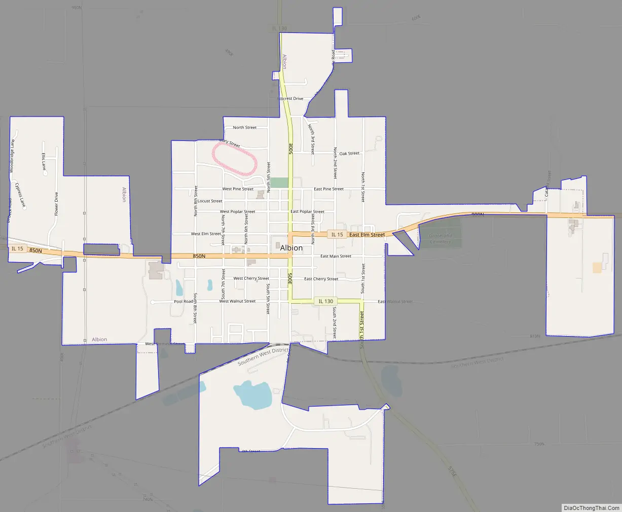
Albion Road Map
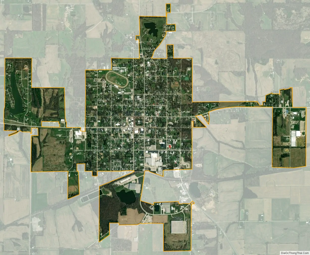
Albion city Satellite Map
Geography
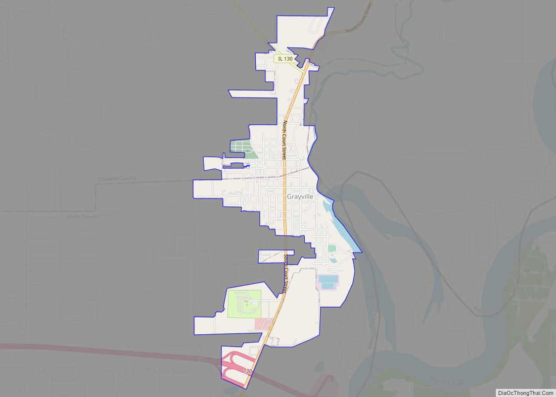
Albion is located south of the center of Edwards County. In it, Illinois Route 130 and Illinois Route 15 meet. Route 130 leads north 25 miles (40 km) to Olney and south 10 miles (16 km) to Grayville, while Route 15 leads east 16 miles (26 km) to Mount Carmel and west 16 miles (26 km) to Fairfield.
According to the 2021 census gazetteer files, Albion has a total area of 2.18 square miles (5.65 km), of which 2.14 square miles (5.54 km) (or 97.89%) is land and 0.05 square miles (0.13 km) (or 2.11%) is water.
A 3.8-magnitude earthquake occurred seven and a half miles outside of the city on September 19, 2017.
See also
Map of Illinois State and its subdivision:- Adams
- Alexander
- Bond
- Boone
- Brown
- Bureau
- Calhoun
- Carroll
- Cass
- Champaign
- Christian
- Clark
- Clay
- Clinton
- Coles
- Cook
- Crawford
- Cumberland
- De Kalb
- De Witt
- Douglas
- Dupage
- Edgar
- Edwards
- Effingham
- Fayette
- Ford
- Franklin
- Fulton
- Gallatin
- Greene
- Grundy
- Hamilton
- Hancock
- Hardin
- Henderson
- Henry
- Iroquois
- Jackson
- Jasper
- Jefferson
- Jersey
- Jo Daviess
- Johnson
- Kane
- Kankakee
- Kendall
- Knox
- La Salle
- Lake
- Lake Michigan
- Lawrence
- Lee
- Livingston
- Logan
- Macon
- Macoupin
- Madison
- Marion
- Marshall
- Mason
- Massac
- McDonough
- McHenry
- McLean
- Menard
- Mercer
- Monroe
- Montgomery
- Morgan
- Moultrie
- Ogle
- Peoria
- Perry
- Piatt
- Pike
- Pope
- Pulaski
- Putnam
- Randolph
- Richland
- Rock Island
- Saint Clair
- Saline
- Sangamon
- Schuyler
- Scott
- Shelby
- Stark
- Stephenson
- Tazewell
- Union
- Vermilion
- Wabash
- Warren
- Washington
- Wayne
- White
- Whiteside
- Will
- Williamson
- Winnebago
- Woodford
- Alabama
- Alaska
- Arizona
- Arkansas
- California
- Colorado
- Connecticut
- Delaware
- District of Columbia
- Florida
- Georgia
- Hawaii
- Idaho
- Illinois
- Indiana
- Iowa
- Kansas
- Kentucky
- Louisiana
- Maine
- Maryland
- Massachusetts
- Michigan
- Minnesota
- Mississippi
- Missouri
- Montana
- Nebraska
- Nevada
- New Hampshire
- New Jersey
- New Mexico
- New York
- North Carolina
- North Dakota
- Ohio
- Oklahoma
- Oregon
- Pennsylvania
- Rhode Island
- South Carolina
- South Dakota
- Tennessee
- Texas
- Utah
- Vermont
- Virginia
- Washington
- West Virginia
- Wisconsin
- Wyoming