Cicero (originally known as Hawthorne) is a suburb of Chicago and an incorporated town in Cook County, Illinois, United States. Per the 2020 census, the population was 85,268, making it the 11th largest municipality in Illinois. The town of Cicero is named after Marcus Tullius Cicero, a Roman statesman and orator.
| Name: | Cicero town |
|---|---|
| LSAD Code: | 43 |
| LSAD Description: | town (suffix) |
| State: | Illinois |
| County: | Cook County |
| Incorporated: | February 28, 1867 (1867-02-28) |
| Elevation: | 607 ft (185 m) |
| Total Area: | 5.87 sq mi (15.19 km²) |
| Land Area: | 5.87 sq mi (15.19 km²) |
| Water Area: | 0.00 sq mi (0.00 km²) 0% |
| Total Population: | 85,268 |
| Population Density: | 14,538.45/sq mi (5,613.28/km²) |
| ZIP code: | 60804 |
| Area code: | 708/464 |
| FIPS code: | 1714351 |
| GNISfeature ID: | 2584746 |
| Website: | www.thetownofcicero.com |
Online Interactive Map
Click on ![]() to view map in "full screen" mode.
to view map in "full screen" mode.
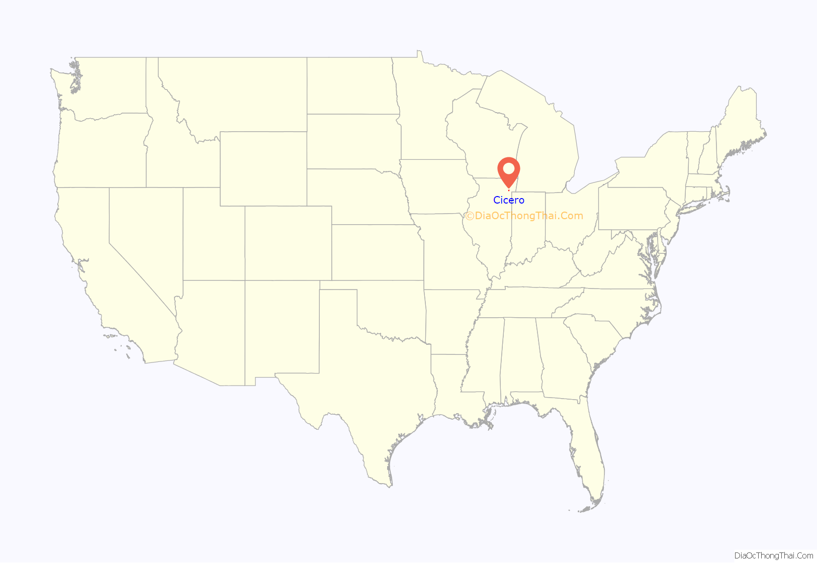
Cicero location map. Where is Cicero town?
History
Originally, Cicero Township occupied an area six times the size of its current territory. The cities of Oak Park and Berwyn were incorporated from portions of Cicero Township, and other portions, such as Austin, were annexed into the city of Chicago.
By 1911, an aerodrome called the Cicero Flying Field had been established as the town’s first aircraft facility of any type, located on a roughly square plot of land about 800 meters (1/2-mile) per side, on then-open ground at 41°51′19.03″N 87°44′56.5″W / 41.8552861°N 87.749028°W / 41.8552861; -87.749028 by the Aero Club of Illinois, founded on February 10, 1910. Famous pilots like Hans-Joachim Buddecke, Lincoln Beachey, Chance M. Vought and others flew from there at various times during the “pioneer era” of aviation in the United States shortly before the nation’s involvement in World War I, before the field closed in mid-April 1916.
Al Capone built his criminal empire in Chicago before moving to Cicero to escape the reach of Chicago police. The 1924 Cicero municipal elections were particularly violent due to gang-related efforts to secure a favorable election result.
On July 11–12, 1951, a race riot erupted in Cicero when a white mob of around 4,000 attacked and burned an apartment building at 6139 W. 19th Street that housed the African-American family of Harvey Clark Jr., a Chicago Transit Authority bus driver who had relocated to the all-white city. Governor Adlai E. Stevenson was forced to call out the Illinois National Guard. The Clarks moved away and the building had to be boarded up. The Cicero riot received worldwide condemnation.
Cicero was taken up and abandoned several times as site for a civil rights march in the mid-1960s. Cicero had a sundown town policy prohibiting African Americans from living in the city. The American Friends Service Committee, Martin Luther King Jr., and many affiliated organizations, including churches, were conducting marches against housing and school de facto segregation and inequality in Chicago and several suburbs, but the leaders feared too violent a response in Chicago Lawn and Cicero. Eventually, a substantial march (met by catcalls, flying bottles and bricks) was conducted in Chicago Lawn, but only a splinter group, led by Jesse Jackson, marched in Cicero. The marches in the Chicago suburbs helped galvanize support for the passage of the Civil Rights Act of 1968, extending federal prohibitions against discrimination to private housing. The act also created the United States Department of Housing and Urban Development’s Office of Fair Housing and Equal Opportunity, which enforces the law.
The 1980s and 1990s saw a heavy influx of Hispanic (mostly Mexican and Central American) residents to Cicero. Once considered mainly a Czech or Bohemian town, most of the European-style restaurants and shops on 22nd Street (now Cermak Road) have been replaced by Spanish-titled businesses. In addition, Cicero has a small black community.
Cicero has seen a revival in its commercial sector, with many new mini-malls and large retail stores. New condominiums are also being built in the city.
Cicero has long had a reputation of government scandal. By 2002, Republican Town President Betty Loren-Maltese was sent to federal prison in California, for misappropriating $12 million in funds.
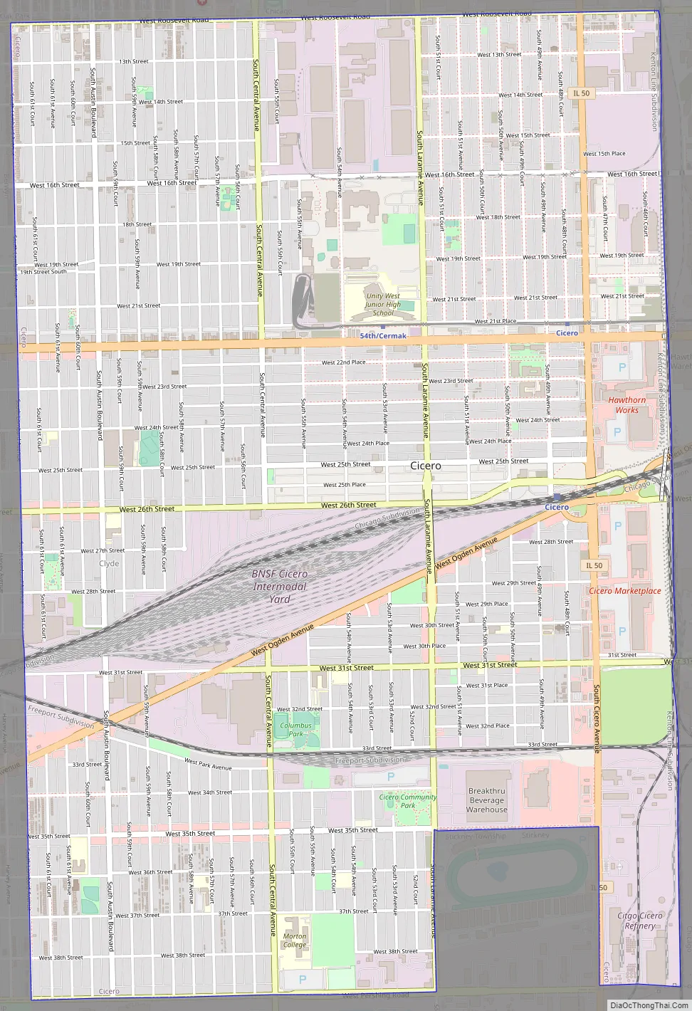
Cicero Road Map
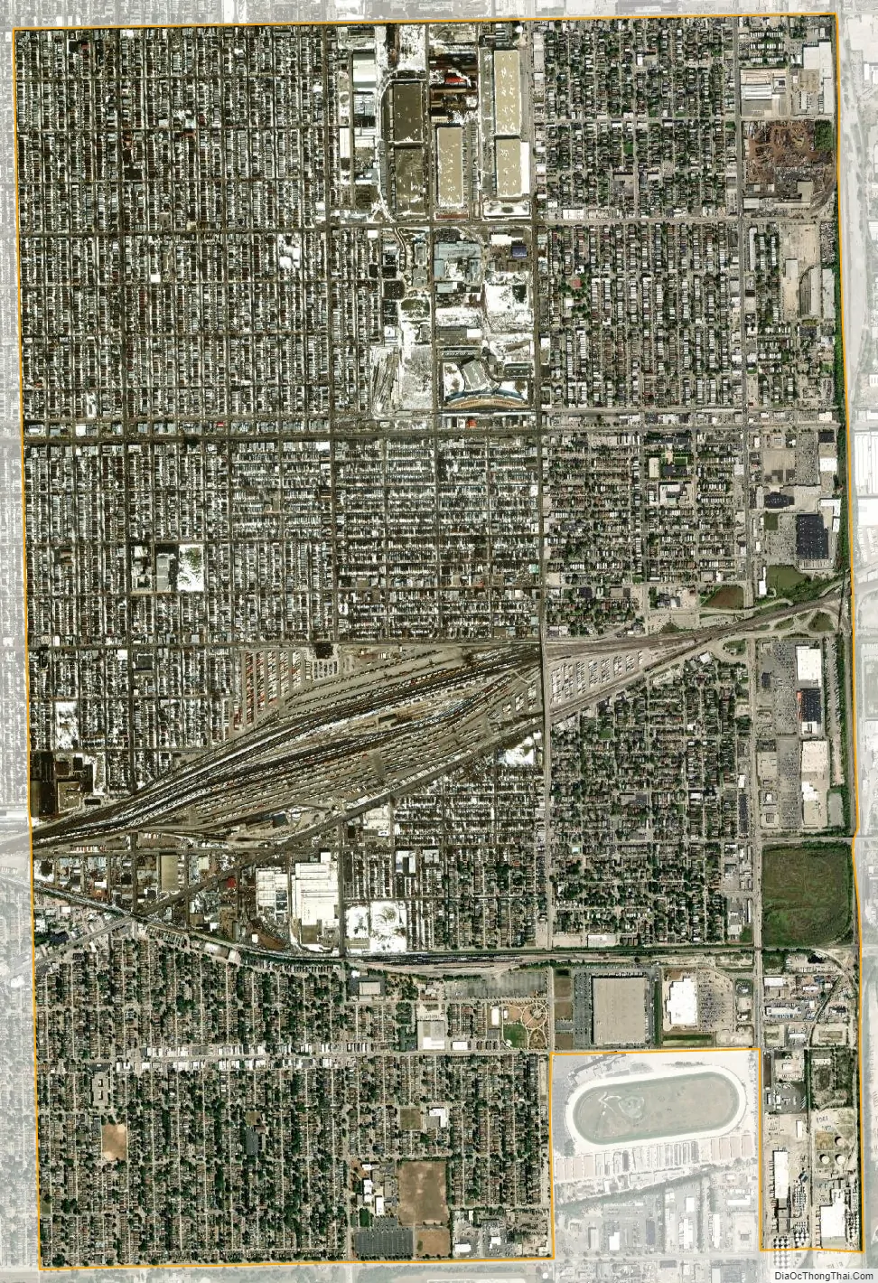
Cicero city Satellite Map
Geography
According to the 2021 census gazetteer files, Cicero has a total area of 5.87 square miles (15.20 km), all land. Cicero formerly ran from Harlem Avenue to Western Avenue and Pershing Road to North Avenue; however, much of this area was annexed by Chicago.
Landmarks
- St. Mary of Czestochowa, a Neo-Gothic church built in the Polish Cathedral style along with the sculpture of Christ the King by famed sculptor Professor Czesław Dźwigaj, who also cast the monumental bronze doors at St. Hyacinth’s Basilica in Chicago. The church’s other claim to fame is as the site of Al Capone’s sister Mafalda’s wedding in 1930.
- J. Sterling Morton High School, East Campus, also known as Morton East High School, was built in 1894. The original school was destroyed by fire in 1924, and the current building was constructed. Located at 2423 S. Austin Blvd, Morton East serves residents of Cicero.
- Chodl Auditorium, located inside Morton East High School, was built in 1924 (completed 1927) to replace the 1,200-seat auditorium which was destroyed by fire. The auditorium was originally a dual-purpose room, serving as a gymnasium for students, and was originally built for this purpose. In 1967 the school stopped using the auditorium as a gymnasium. Chodl Auditorium is among the largest non-commercial proscenium theatres in the Chicago Metropolitan Area and is listed with the National Register of Historic Places.
- Hawthorne Works Tower, one of the original towers of the enormous Western Electric manufacturing plant that once stood east of Cicero Avenue, is still located behind the Hawthorne Works Shopping Center near the corner of Cermak Road (22nd Street) and Cicero Avenue.
- Chicagoland Sports Hall of Fame.
On the south side of Cicero, there were two racetracks. Hawthorne Race Course, located in Cicero and Stickney, is a horse racing track still in operation. Just north of it was Chicago Motor Speedway at Sportsman’s Park, which was formerly Sportsman’s Park Racetrack (for horse racing) for many years. This Sportsman’s Park facility is now closed, acquired by the Town of Cicero, and has since been demolished. Facilities of the Wirtz Beverage Group have been built on the west half and a Walmart built on the east half.
See also
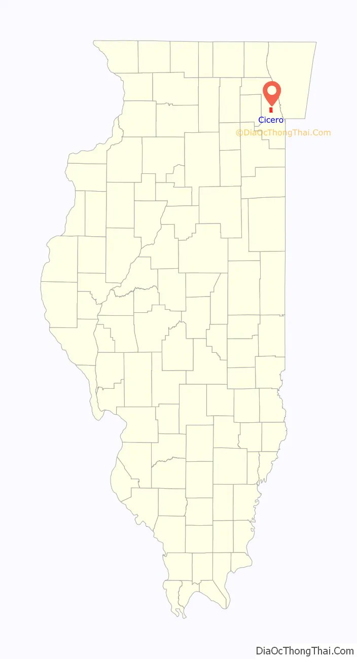
Map of Illinois State and its subdivision:- Adams
- Alexander
- Bond
- Boone
- Brown
- Bureau
- Calhoun
- Carroll
- Cass
- Champaign
- Christian
- Clark
- Clay
- Clinton
- Coles
- Cook
- Crawford
- Cumberland
- De Kalb
- De Witt
- Douglas
- Dupage
- Edgar
- Edwards
- Effingham
- Fayette
- Ford
- Franklin
- Fulton
- Gallatin
- Greene
- Grundy
- Hamilton
- Hancock
- Hardin
- Henderson
- Henry
- Iroquois
- Jackson
- Jasper
- Jefferson
- Jersey
- Jo Daviess
- Johnson
- Kane
- Kankakee
- Kendall
- Knox
- La Salle
- Lake
- Lake Michigan
- Lawrence
- Lee
- Livingston
- Logan
- Macon
- Macoupin
- Madison
- Marion
- Marshall
- Mason
- Massac
- McDonough
- McHenry
- McLean
- Menard
- Mercer
- Monroe
- Montgomery
- Morgan
- Moultrie
- Ogle
- Peoria
- Perry
- Piatt
- Pike
- Pope
- Pulaski
- Putnam
- Randolph
- Richland
- Rock Island
- Saint Clair
- Saline
- Sangamon
- Schuyler
- Scott
- Shelby
- Stark
- Stephenson
- Tazewell
- Union
- Vermilion
- Wabash
- Warren
- Washington
- Wayne
- White
- Whiteside
- Will
- Williamson
- Winnebago
- Woodford
- Alabama
- Alaska
- Arizona
- Arkansas
- California
- Colorado
- Connecticut
- Delaware
- District of Columbia
- Florida
- Georgia
- Hawaii
- Idaho
- Illinois
- Indiana
- Iowa
- Kansas
- Kentucky
- Louisiana
- Maine
- Maryland
- Massachusetts
- Michigan
- Minnesota
- Mississippi
- Missouri
- Montana
- Nebraska
- Nevada
- New Hampshire
- New Jersey
- New Mexico
- New York
- North Carolina
- North Dakota
- Ohio
- Oklahoma
- Oregon
- Pennsylvania
- Rhode Island
- South Carolina
- South Dakota
- Tennessee
- Texas
- Utah
- Vermont
- Virginia
- Washington
- West Virginia
- Wisconsin
- Wyoming


