Colchester is a city in McDonough County, Illinois, United States. The population was 1,108 at the 2020 census, down from 1,401 in 2010. The city is named after the town of Colchester, England.
| Name: | Colchester city |
|---|---|
| LSAD Code: | 25 |
| LSAD Description: | city (suffix) |
| State: | Illinois |
| County: | McDonough County |
| Elevation: | 697 ft (212 m) |
| Total Area: | 1.15 sq mi (2.98 km²) |
| Land Area: | 1.15 sq mi (2.98 km²) |
| Water Area: | 0.00 sq mi (0.00 km²) |
| Total Population: | 1,108 |
| Population Density: | 963.48/sq mi (371.88/km²) |
| ZIP code: | 62326 |
| Area code: | 309 |
| FIPS code: | 1715378 |
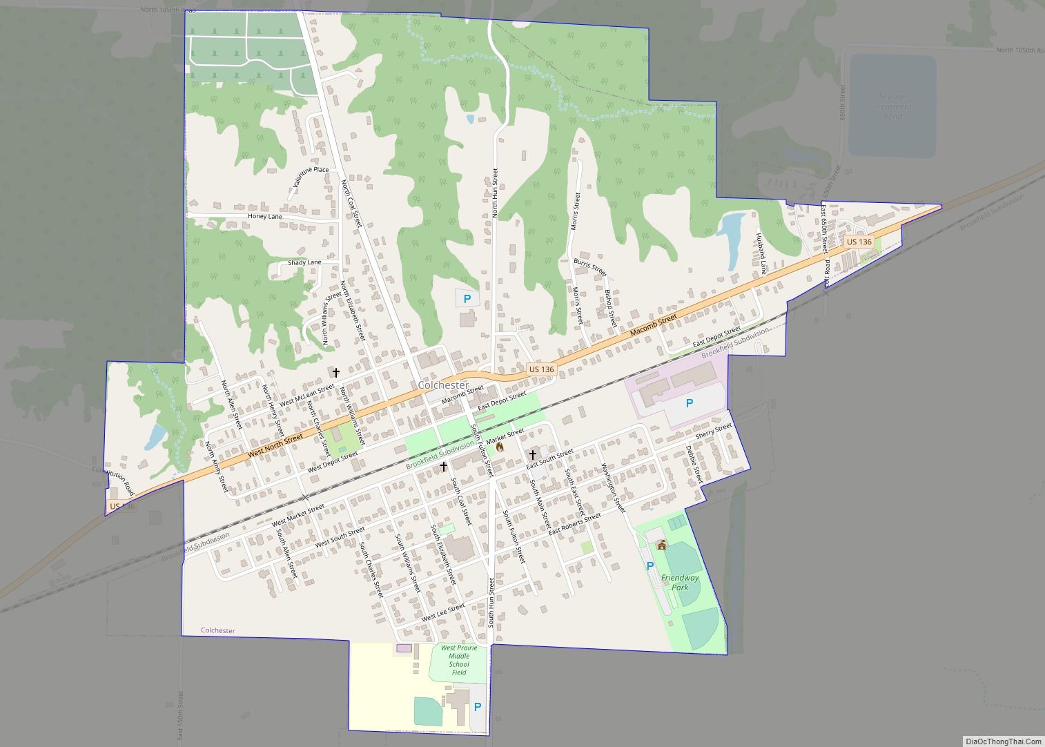
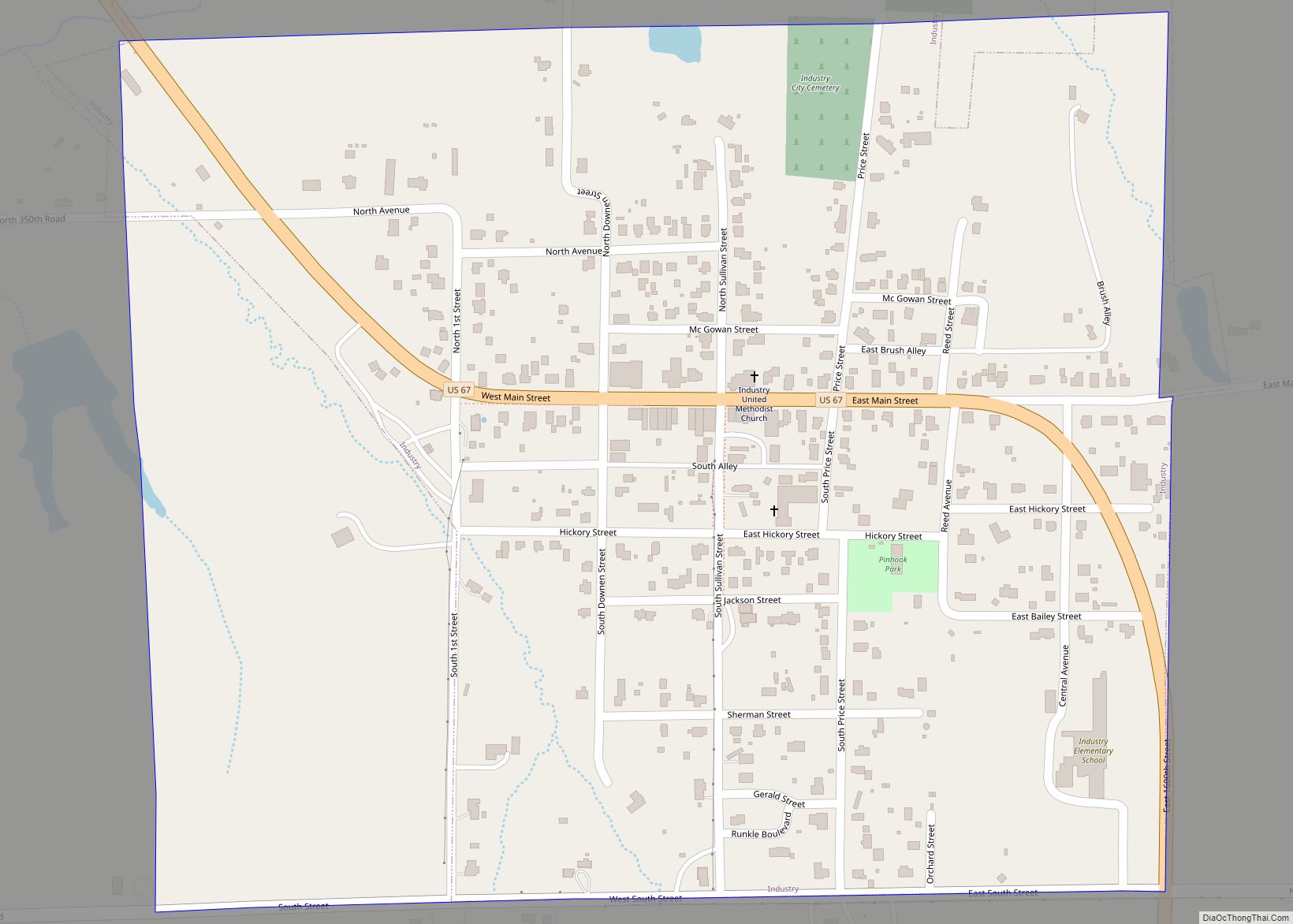
Online Interactive Map
Click on ![]() to view map in "full screen" mode.
to view map in "full screen" mode.
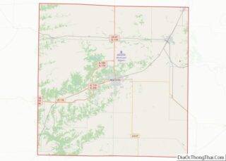
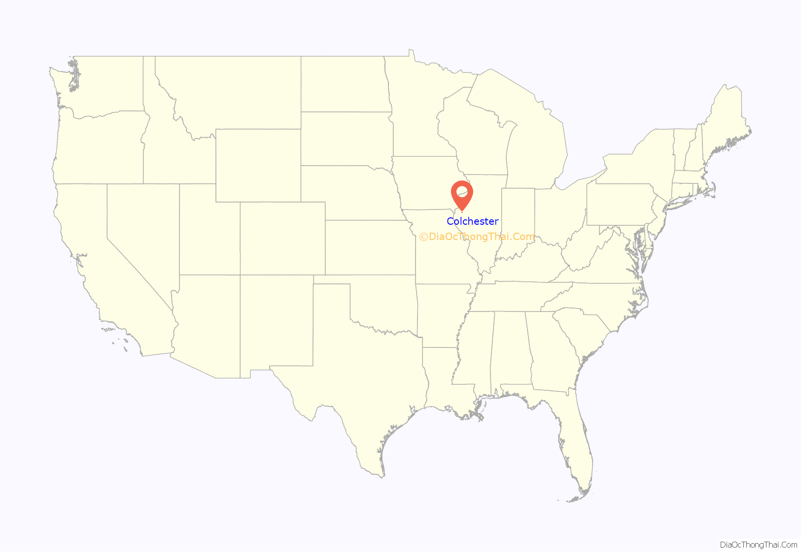
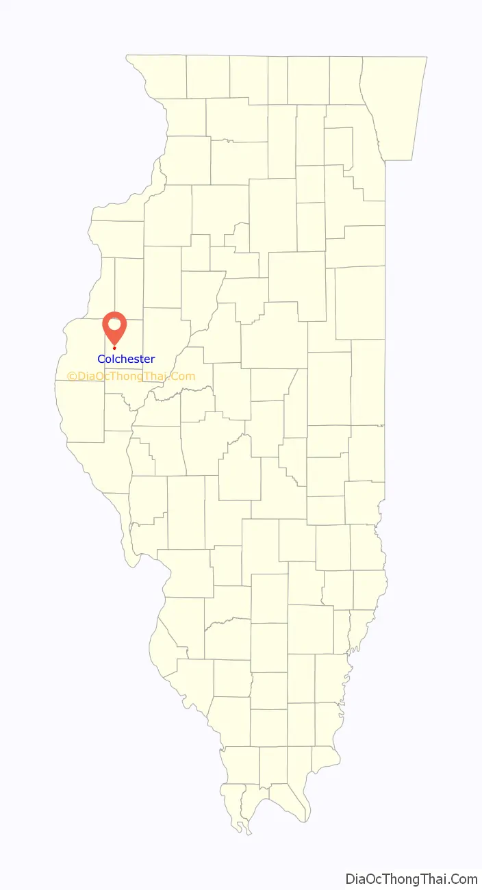
Colchester location map. Where is Colchester city?
History
Coal was discovered near Colchester in the 1850s.
According to the North American Stratigraphic Code, rock units were given names that included the geographic name of a location where the rock unit was first described. If the rock unit consisted of a dominant rock type, the rock type was included in the name. In this case, when coal was first discovered and described in Colchester, Illinois, the rock unit was named “Colchester Coal”. When this particular coal unit was encountered in a different location, the coal was correctly identified as Colchester Coal.
The mines in Colchester attracted immigrants from Pennsylvania. At first these included the descendants of Irish Protestant refugees from the Irish Rebellion of 1798. Later they were joined by Irish Catholic refugees from the Great Famine.
During the 1920s, Colchester was the home of Henry “Kelly” Wagle, a bootlegger associated with Al Capone. Wagle was involved in the production of alcohol and its transportation between Chicago and Kansas City.
On September 11, 1921, members of the disgraced Chicago “Black Sox” baseball team played with the Colchester team in a game against nearby Macomb. Kelly Wagle paid to bring the players to Colchester.
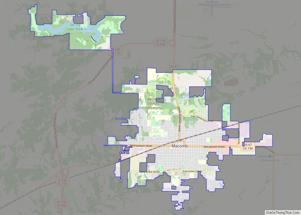
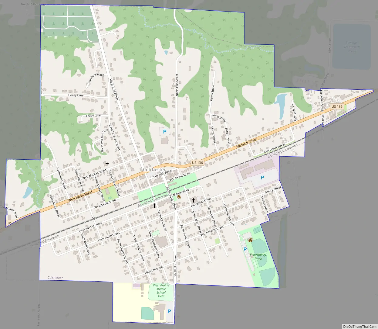
Colchester Road Map
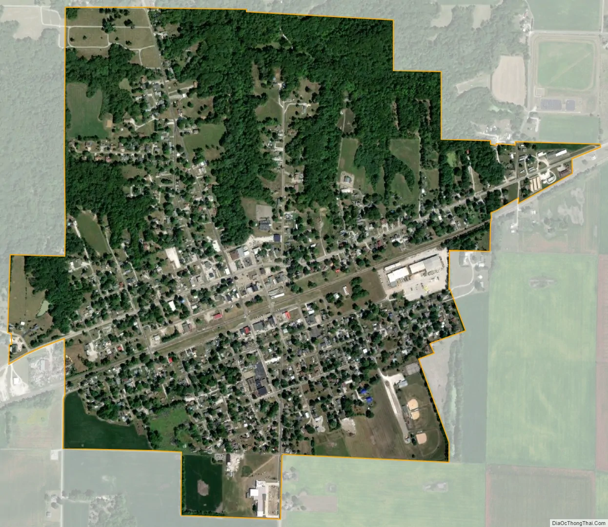
Colchester city Satellite Map
Geography
Colchester is located in western McDonough County at 40°25′31″N 90°47′32″W / 40.42528°N 90.79222°W / 40.42528; -90.79222 (40.425174, -90.792339). U.S. Route 136 passes through the center of town as Macomb Street and North Street, leading northeast 7 miles (11 km) to Macomb, the county seat, and west 19 miles (31 km) to Carthage. Illinois Route 110/336, a four-lane divided highway, bypasses Colchester to the south, joining US 136 3.5 miles (5.6 km) west of the city.
According to the U.S. Census Bureau, Colchester has a total area of 1.15 square miles (2.98 km), all land.
Argyle Lake State Park is 2 miles (3 km) north of Colchester.
See also
Map of Illinois State and its subdivision:- Adams
- Alexander
- Bond
- Boone
- Brown
- Bureau
- Calhoun
- Carroll
- Cass
- Champaign
- Christian
- Clark
- Clay
- Clinton
- Coles
- Cook
- Crawford
- Cumberland
- De Kalb
- De Witt
- Douglas
- Dupage
- Edgar
- Edwards
- Effingham
- Fayette
- Ford
- Franklin
- Fulton
- Gallatin
- Greene
- Grundy
- Hamilton
- Hancock
- Hardin
- Henderson
- Henry
- Iroquois
- Jackson
- Jasper
- Jefferson
- Jersey
- Jo Daviess
- Johnson
- Kane
- Kankakee
- Kendall
- Knox
- La Salle
- Lake
- Lake Michigan
- Lawrence
- Lee
- Livingston
- Logan
- Macon
- Macoupin
- Madison
- Marion
- Marshall
- Mason
- Massac
- McDonough
- McHenry
- McLean
- Menard
- Mercer
- Monroe
- Montgomery
- Morgan
- Moultrie
- Ogle
- Peoria
- Perry
- Piatt
- Pike
- Pope
- Pulaski
- Putnam
- Randolph
- Richland
- Rock Island
- Saint Clair
- Saline
- Sangamon
- Schuyler
- Scott
- Shelby
- Stark
- Stephenson
- Tazewell
- Union
- Vermilion
- Wabash
- Warren
- Washington
- Wayne
- White
- Whiteside
- Will
- Williamson
- Winnebago
- Woodford
- Alabama
- Alaska
- Arizona
- Arkansas
- California
- Colorado
- Connecticut
- Delaware
- District of Columbia
- Florida
- Georgia
- Hawaii
- Idaho
- Illinois
- Indiana
- Iowa
- Kansas
- Kentucky
- Louisiana
- Maine
- Maryland
- Massachusetts
- Michigan
- Minnesota
- Mississippi
- Missouri
- Montana
- Nebraska
- Nevada
- New Hampshire
- New Jersey
- New Mexico
- New York
- North Carolina
- North Dakota
- Ohio
- Oklahoma
- Oregon
- Pennsylvania
- Rhode Island
- South Carolina
- South Dakota
- Tennessee
- Texas
- Utah
- Vermont
- Virginia
- Washington
- West Virginia
- Wisconsin
- Wyoming