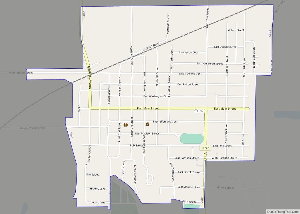
Cuba is a city in Fulton County, Illinois, United States. The population was 1,294 at the 2010 census, down from 1,418 at the 2000 census.
| Name: | Cuba city |
|---|---|
| LSAD Code: | 25 |
| LSAD Description: | city (suffix) |
| State: | Illinois |
| County: | Fulton County |
| Founded: | 1818 |
| Elevation: | 682 ft (208 m) |
| Total Area: | 0.54 sq mi (1.41 km²) |
| Land Area: | 0.54 sq mi (1.41 km²) |
| Water Area: | 0.00 sq mi (0.00 km²) |
| Total Population: | 1,184 |
| Population Density: | 2,180.48/sq mi (841.60/km²) |
| Area code: | 309 |
| FIPS code: | 1717991 |
Online Interactive Map
Click on ![]() to view map in "full screen" mode.
to view map in "full screen" mode.
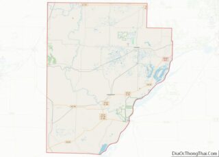
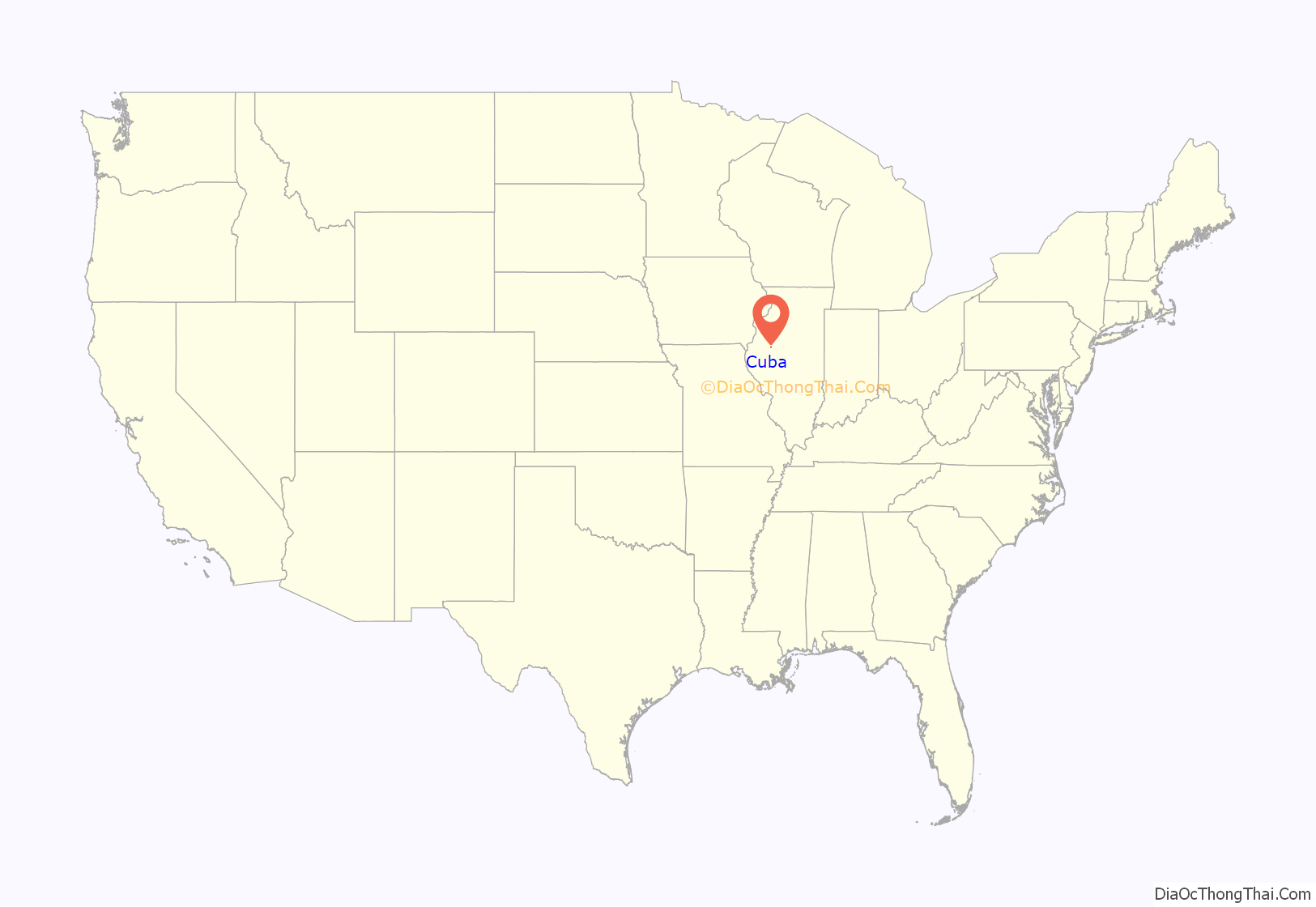
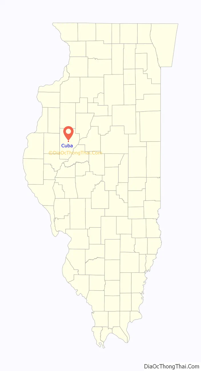
Cuba location map. Where is Cuba city?
History
Cuba was founded in 1837 when the two rival towns of Centerville and Middleton merged. The new town was named after the island of Cuba. A post office has been in operation at Cuba since 1837.
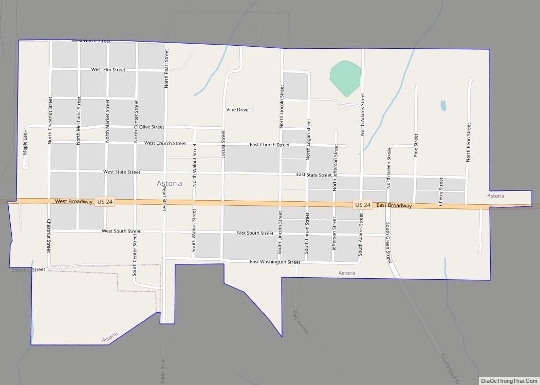
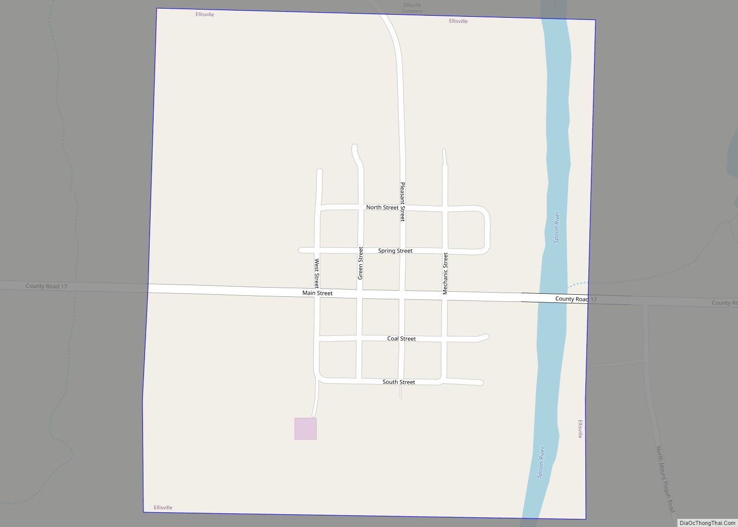
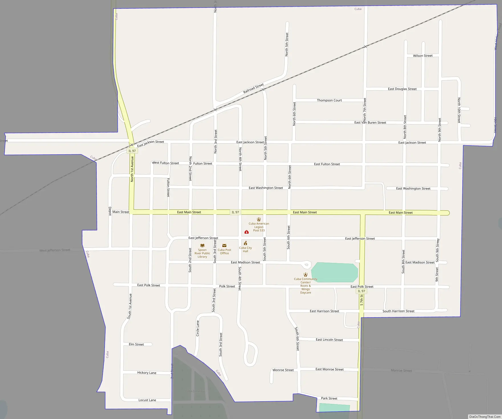
Cuba Road Map
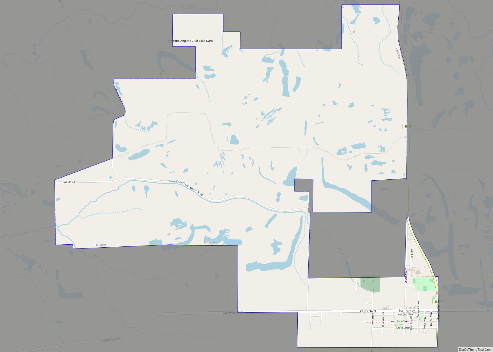
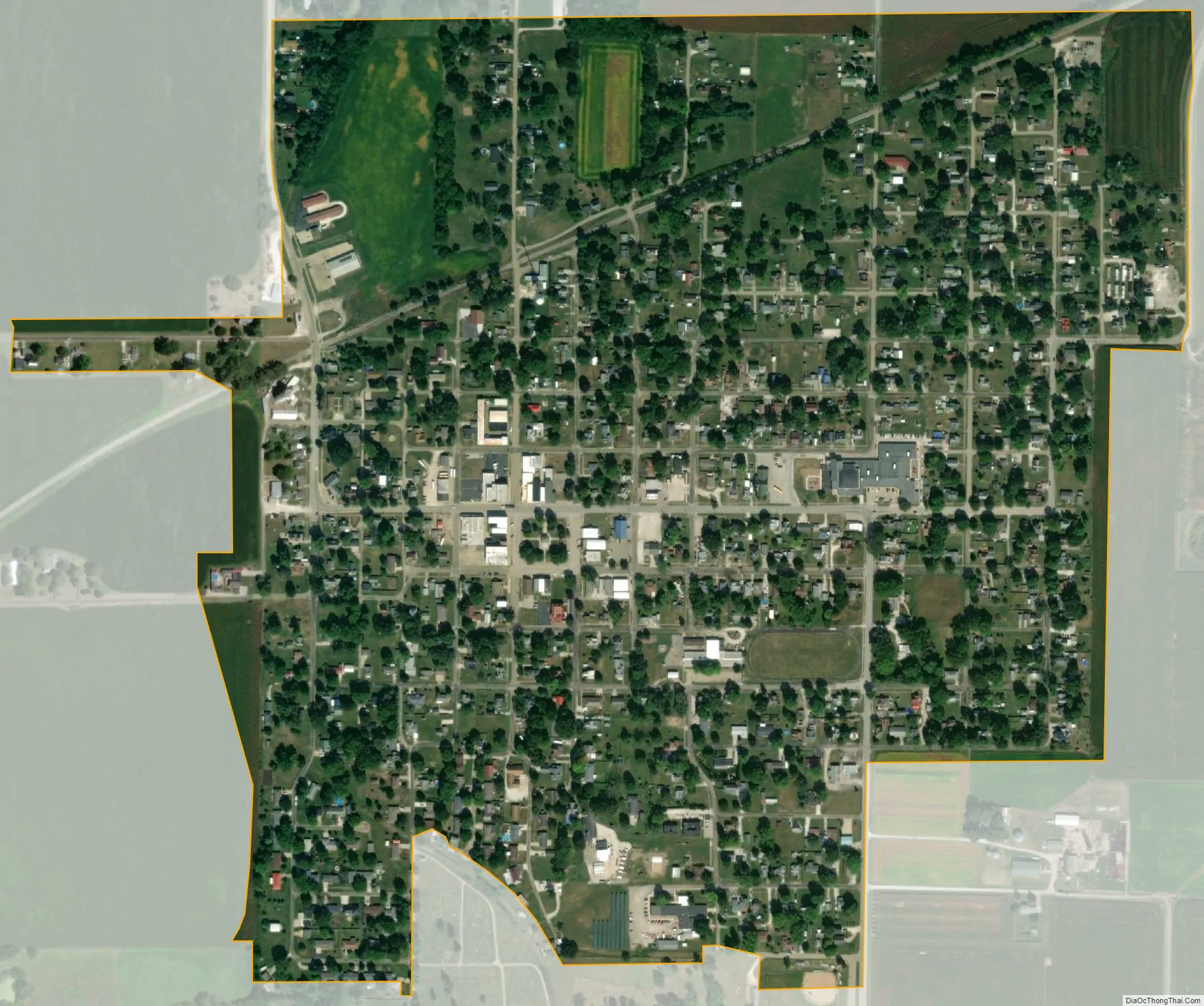
Cuba city Satellite Map
Geography
Cuba is located near the geographic center of Fulton County. Illinois Route 97 passes through the city, leading north 40 miles (64 km) to Galesburg and south 20 miles (32 km) to Havana on the Illinois River.
According to the 2010 census, Cuba has a total area of 0.54 square miles (1.40 km), all land.
See also
Map of Illinois State and its subdivision:- Adams
- Alexander
- Bond
- Boone
- Brown
- Bureau
- Calhoun
- Carroll
- Cass
- Champaign
- Christian
- Clark
- Clay
- Clinton
- Coles
- Cook
- Crawford
- Cumberland
- De Kalb
- De Witt
- Douglas
- Dupage
- Edgar
- Edwards
- Effingham
- Fayette
- Ford
- Franklin
- Fulton
- Gallatin
- Greene
- Grundy
- Hamilton
- Hancock
- Hardin
- Henderson
- Henry
- Iroquois
- Jackson
- Jasper
- Jefferson
- Jersey
- Jo Daviess
- Johnson
- Kane
- Kankakee
- Kendall
- Knox
- La Salle
- Lake
- Lake Michigan
- Lawrence
- Lee
- Livingston
- Logan
- Macon
- Macoupin
- Madison
- Marion
- Marshall
- Mason
- Massac
- McDonough
- McHenry
- McLean
- Menard
- Mercer
- Monroe
- Montgomery
- Morgan
- Moultrie
- Ogle
- Peoria
- Perry
- Piatt
- Pike
- Pope
- Pulaski
- Putnam
- Randolph
- Richland
- Rock Island
- Saint Clair
- Saline
- Sangamon
- Schuyler
- Scott
- Shelby
- Stark
- Stephenson
- Tazewell
- Union
- Vermilion
- Wabash
- Warren
- Washington
- Wayne
- White
- Whiteside
- Will
- Williamson
- Winnebago
- Woodford
- Alabama
- Alaska
- Arizona
- Arkansas
- California
- Colorado
- Connecticut
- Delaware
- District of Columbia
- Florida
- Georgia
- Hawaii
- Idaho
- Illinois
- Indiana
- Iowa
- Kansas
- Kentucky
- Louisiana
- Maine
- Maryland
- Massachusetts
- Michigan
- Minnesota
- Mississippi
- Missouri
- Montana
- Nebraska
- Nevada
- New Hampshire
- New Jersey
- New Mexico
- New York
- North Carolina
- North Dakota
- Ohio
- Oklahoma
- Oregon
- Pennsylvania
- Rhode Island
- South Carolina
- South Dakota
- Tennessee
- Texas
- Utah
- Vermont
- Virginia
- Washington
- West Virginia
- Wisconsin
- Wyoming