Danvers is a village in McLean County, Illinois, United States. The population was 1,089 as of the 2020 census. It is part of the Bloomington–Normal Metropolitan Statistical Area.
| Name: | Danvers village |
|---|---|
| LSAD Code: | 47 |
| LSAD Description: | village (suffix) |
| State: | Illinois |
| County: | McLean County |
| Founded: | 1836 |
| Elevation: | 807 ft (246 m) |
| Total Area: | 0.80 sq mi (2.08 km²) |
| Land Area: | 0.80 sq mi (2.08 km²) |
| Water Area: | 0.00 sq mi (0.00 km²) |
| Total Population: | 1,089 |
| Population Density: | 1,356.16/sq mi (523.31/km²) |
| ZIP code: | 61732 |
| Area code: | 309 |
| FIPS code: | 1718537 |
| Website: | danversil.com |
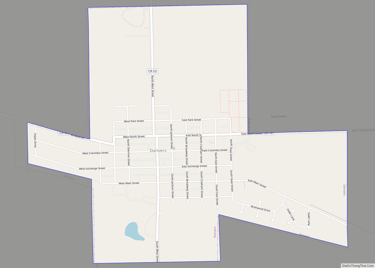
Online Interactive Map
Click on ![]() to view map in "full screen" mode.
to view map in "full screen" mode.
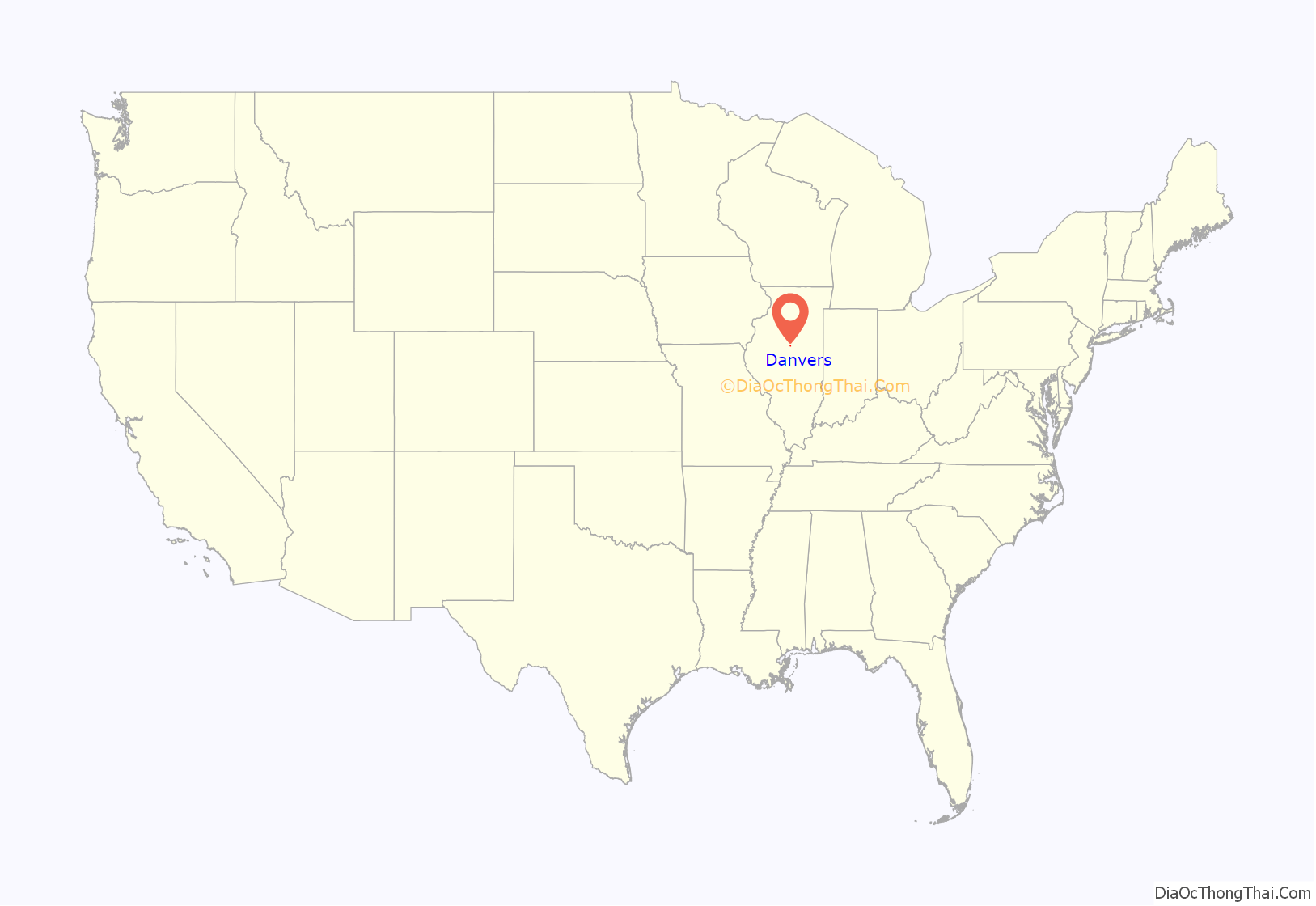
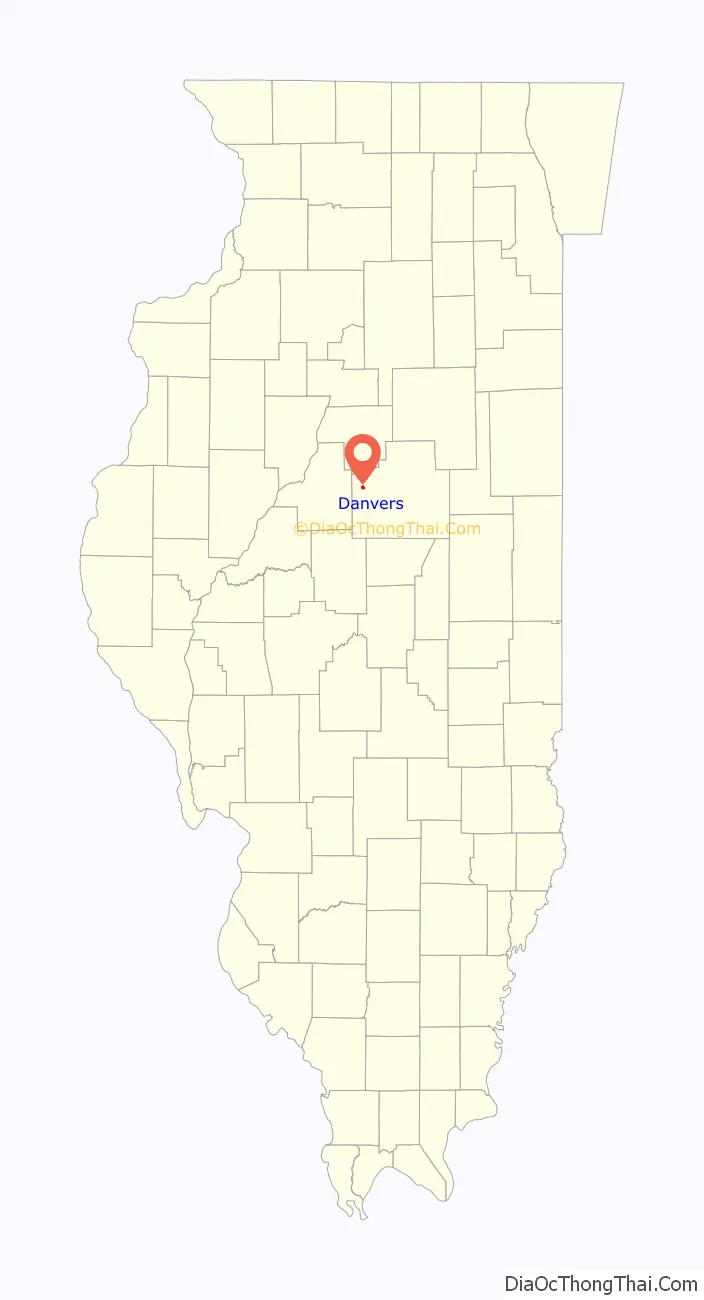
Danvers location map. Where is Danvers village?
History
Origin
Danvers was laid out under the name of “Concord” on February 20, 1836, by Israel W. Hall (1799 – 1865) and Matthew Robb (1801 – 1870). The name Concord was given to the town by Hall after Concord, Massachusetts. A rival town, Wilkesborough, just over a mile to the east, was laid out by James O. Barnard on June 3 of the same year. Wilkesborough had 96 lots and a public square. Both towns were part of the great town founding surge in Illinois that peaked in 1836. Between 1835 and 1837 eight new towns and many additions were laid out in McLean County. At this time it was fairly common for two towns to be founded close to each other as they competed for the same locational advantage. In this case both towns were on the stage route from Bloomington to Peoria and Pekin. For several years it was unclear which town would be successful. Wilkesborough did quite well and by 1859 had 15 heads of family, but Concord had three times that number. Eventually it became clear that Concord would was the more successful place, but the people of Concord had to go to Wilkesborough to get their mail. By the late 1870s Wilkesborough had completely vanished.
Original design
Like many other new places laid out in the 1830s, the original plan of the new town was designed around a central public square. However, unlike most such places (for example, Lexington and LeRoy), the plat used at Concord showed with dashed lines how the streets which entered the public square midway along each side could be extended to meet at the center of the square. In effect, this unusual feature of the plan made it possible to subdivide the square into four smaller rectangles. This was soon done. One of these rectangles has always been a park, but the other three have been put to different civic uses, including locations for the library, fire station, water tower, and school gymnasium.
Early growth and change of name
The early growth of Danvers was extremely slow. Although both Hall and Robb lived in the area, neither was a resident of the town. The first building in Concord was erected in 1837 by Nicholas Conger, but Conger himself does not seem to have lived there. The first actual resident was Asa Rankin. Eventually a small mill was erected by Hobson and Havens. In the words of the 1879 county history, “For more than six years the place was nearly lifeless.” In 1848 or 1849 a post office was established in Concord. Most of the early rural settlement around the new town was near Stout’s Grove, which began just west of Concord, and for the first twenty years of the town’s life the prairie to the north, east and south was used mainly as open grazing land.
In 1836 Illinois had no way of regulating town names and popular names were frequently repeated. There were at least two other places in Illinois named Concord. Therefore, in 1861, the name of the town was changed to Danvers. The new name was taken from the town of Danvers in Essex County, Massachusetts. During the late 1840s and early 1850s the town grew more rapidly. Danvers was incorporated as a village under a special charter on May 7, 1869.
Railroads and inter-urbans
In the late 1850s and 1860s, farmers began moving into the prairies around the newly renamed town, which became the center of an exceptionally productive agricultural district. It became clear that if Danvers was going to ship grain, a railroad was essential. In the 1850s the Illinois Central and the Chicago and Alton railroads had both passed through McLean County, but neither came close to Danvers. A town meeting was held and it was decided that Danvers would subscribe to $50,000 in railroad bonds. Many other communities in the state were taking similar action, something most of them came to regret: the bonds were quickly sold in Europe or the East, and the taxpayers of towns and townships were forced to pay for railroads that often provided indifferent service.
On November 25, 1869, a celebration was held in Danvers to hail the arrival of the first train. A great public picnic was held, and large amounts of chicken, oysters and coffee were consumed. Scheduled rail service would continue until December 1982, and the last special train stopped in Danvers in August 1984. In 1907 Danvers also became a stop on the electric interurban railroad. These tracks were laid along Exchange Street and passed through the center of the town. The Illinois Traction System operated long after similar electric railroads in other areas had closed. In 1942 the interurban tracks were threatened when the government scoured the country for surplus metal for war needs, but citizens protested that the electric railroad was vital to local people and saved great amounts of gasoline. Service on the interurban finally ended on February 21, 1953.
Later years
In 1870 the population of Danvers was 356. By 1900 it had climbed to 607 and by 1950 to 762. By 2000 it was over 1,100, meaning that unlike many similar places, the town had grown more rapidly than at any earlier period. Much of this increase in population was due to a substantial number of people who found the town a pleasant residential base when working in Bloomington-Normal or Peoria.
In the late nineteenth and twentieth centuries, Danvers was the home of Dr. F. J. Parkhurst’s distinctive alcohol treatment facility, the Willowbark Institute. Beginning in 1880 the doctor sought to treat addiction to strong spirits by administering small amounts of alcohol, followed by a stiff dose of foul-tasting willowbark extract. Parkhurst’s facility operated until about 1920 and was revived by others from 1935 to the early 1950s.
Danvers was also distinctive for its drift gas wells. During the last glacial epoch, vegetation was buried by ice-carried soil. Its decay produced gas that could be tapped in shallow wells and used for some domestic purposes. At one time there were more than seventy such wells in the Danvers area.
The village is currently home to a cooperative grain elevator, two bars, a bank, and a gas station.
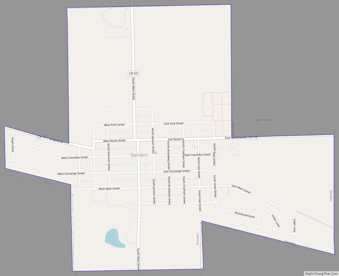
Danvers Road Map
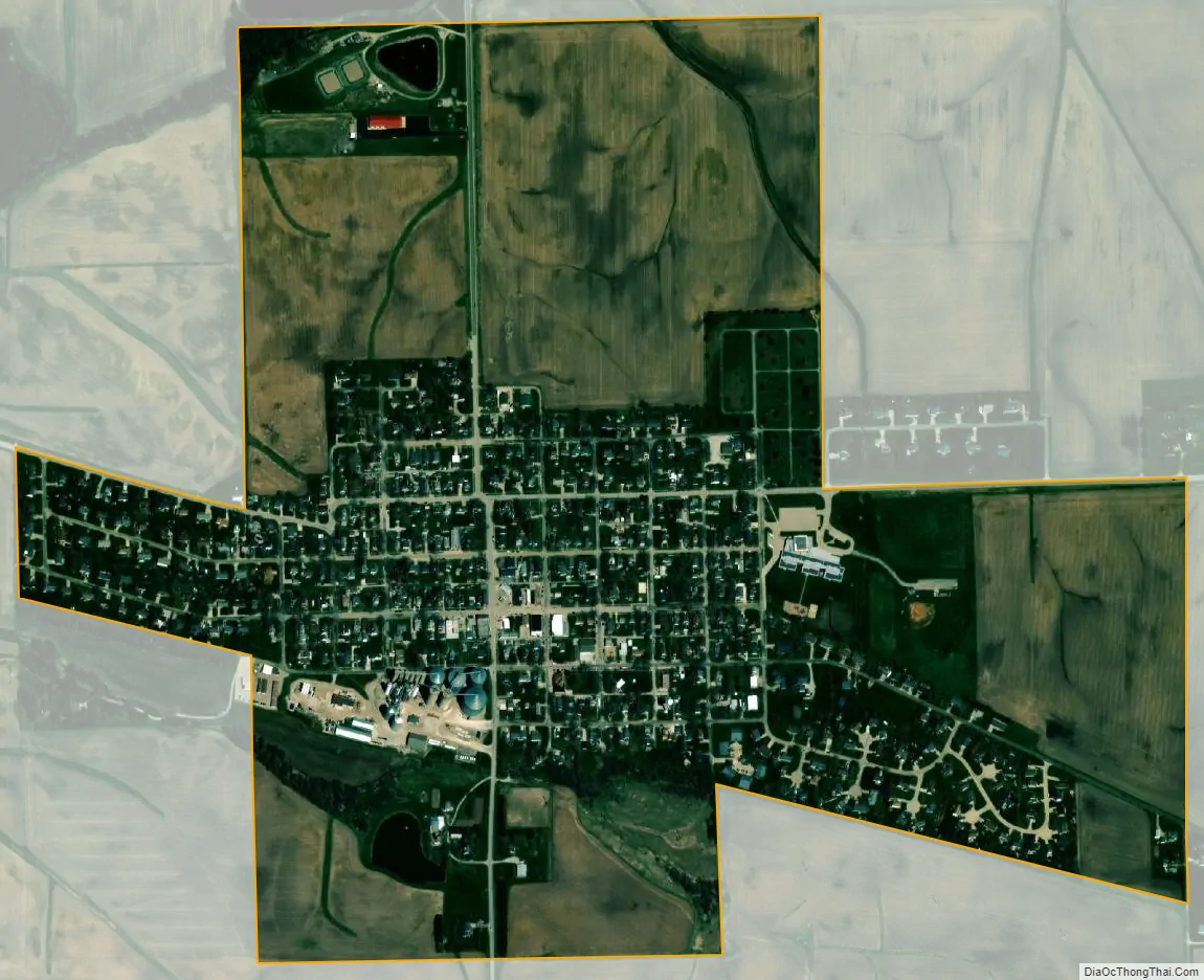
Danvers city Satellite Map
Geography
Danvers is in western McLean County, 11 miles (18 km) northwest of Bloomington, the county seat. Illinois Route 9 passes just south of the village, leading southeast 6 miles (10 km) to Twin Grove and then on to Bloomington, and west 10 miles (16 km) to Mackinaw.
According to the U.S. Census Bureau, Danvers has a total area of 0.80 square miles (2.07 km), all land. It drains northwest toward the West Fork of Sugar Creek, a southwest-flowing stream within the Sangamon River watershed.
See also
Map of Illinois State and its subdivision:- Adams
- Alexander
- Bond
- Boone
- Brown
- Bureau
- Calhoun
- Carroll
- Cass
- Champaign
- Christian
- Clark
- Clay
- Clinton
- Coles
- Cook
- Crawford
- Cumberland
- De Kalb
- De Witt
- Douglas
- Dupage
- Edgar
- Edwards
- Effingham
- Fayette
- Ford
- Franklin
- Fulton
- Gallatin
- Greene
- Grundy
- Hamilton
- Hancock
- Hardin
- Henderson
- Henry
- Iroquois
- Jackson
- Jasper
- Jefferson
- Jersey
- Jo Daviess
- Johnson
- Kane
- Kankakee
- Kendall
- Knox
- La Salle
- Lake
- Lake Michigan
- Lawrence
- Lee
- Livingston
- Logan
- Macon
- Macoupin
- Madison
- Marion
- Marshall
- Mason
- Massac
- McDonough
- McHenry
- McLean
- Menard
- Mercer
- Monroe
- Montgomery
- Morgan
- Moultrie
- Ogle
- Peoria
- Perry
- Piatt
- Pike
- Pope
- Pulaski
- Putnam
- Randolph
- Richland
- Rock Island
- Saint Clair
- Saline
- Sangamon
- Schuyler
- Scott
- Shelby
- Stark
- Stephenson
- Tazewell
- Union
- Vermilion
- Wabash
- Warren
- Washington
- Wayne
- White
- Whiteside
- Will
- Williamson
- Winnebago
- Woodford
- Alabama
- Alaska
- Arizona
- Arkansas
- California
- Colorado
- Connecticut
- Delaware
- District of Columbia
- Florida
- Georgia
- Hawaii
- Idaho
- Illinois
- Indiana
- Iowa
- Kansas
- Kentucky
- Louisiana
- Maine
- Maryland
- Massachusetts
- Michigan
- Minnesota
- Mississippi
- Missouri
- Montana
- Nebraska
- Nevada
- New Hampshire
- New Jersey
- New Mexico
- New York
- North Carolina
- North Dakota
- Ohio
- Oklahoma
- Oregon
- Pennsylvania
- Rhode Island
- South Carolina
- South Dakota
- Tennessee
- Texas
- Utah
- Vermont
- Virginia
- Washington
- West Virginia
- Wisconsin
- Wyoming