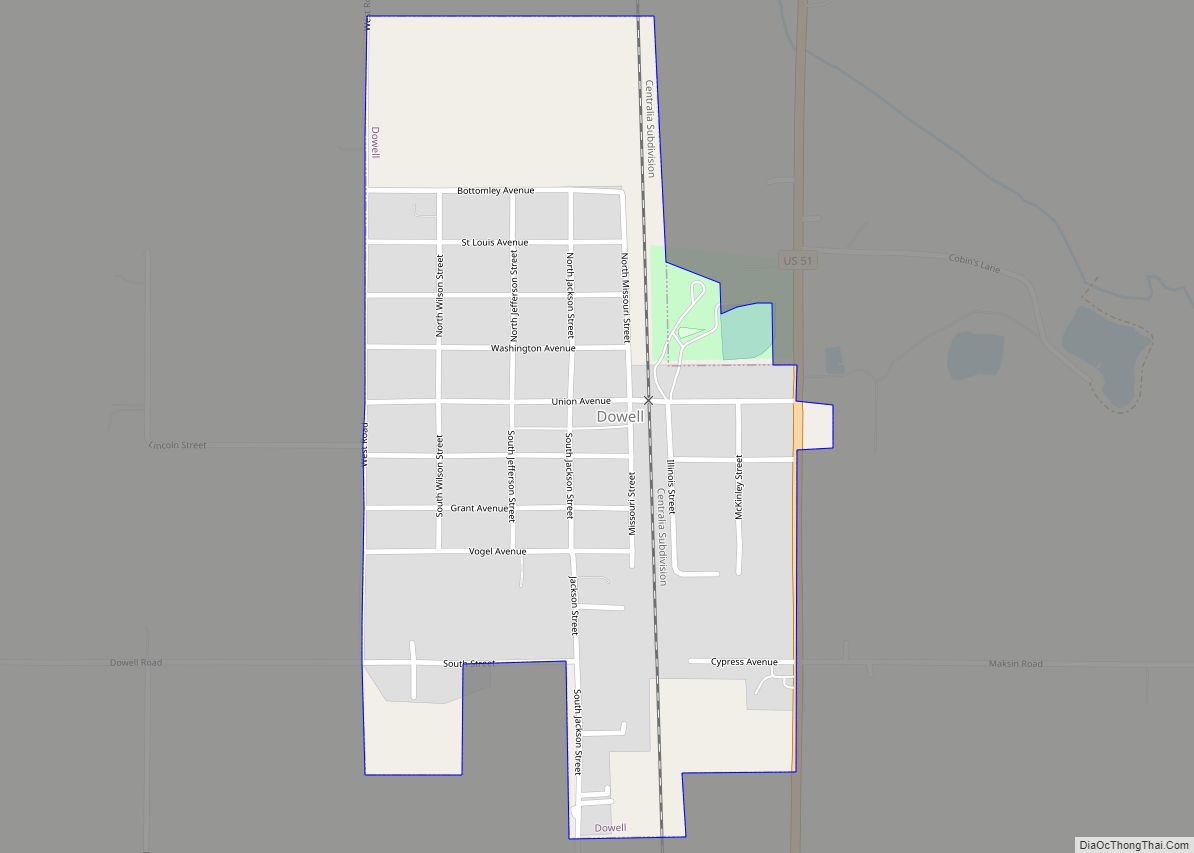
Dowell is a village in Jackson County, Illinois, United States. The population was estimated to be 385 at the 2020 census, down from 408 at the 2010 census.
| Name: | Dowell village |
|---|---|
| LSAD Code: | 47 |
| LSAD Description: | village (suffix) |
| State: | Illinois |
| County: | Jackson County |
| Founded: | 1915 |
| Elevation: | 400 ft (100 m) |
| Total Area: | 0.39 sq mi (1.01 km²) |
| Land Area: | 0.39 sq mi (1.01 km²) |
| Water Area: | 0.00 sq mi (0.00 km²) |
| Total Population: | 368 |
| Population Density: | 943.59/sq mi (364.23/km²) |
| Area code: | 618 |
| FIPS code: | 1720565 |
Online Interactive Map
Click on ![]() to view map in "full screen" mode.
to view map in "full screen" mode.
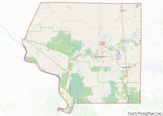
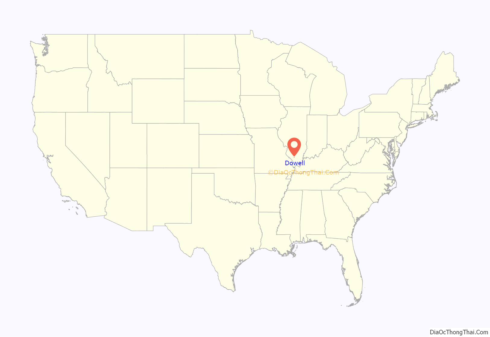
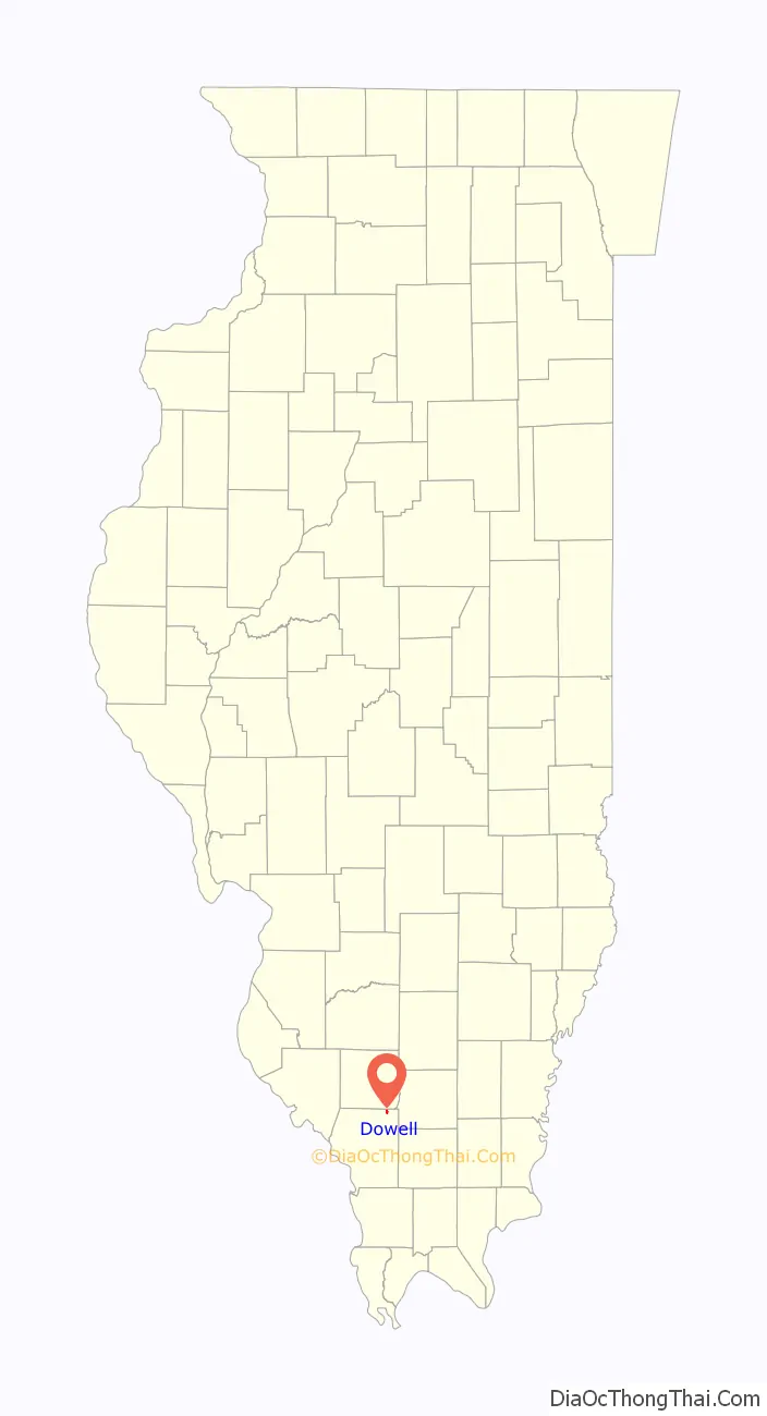
Dowell location map. Where is Dowell village?
History
Dowell was founded as a coal town and named by Du Quoin attorney George Dowell and William Lafont. They requested bids for property development as early as 1917. In 1922, the town’s population was over 2,000.
In February, 1920, the Dowell State Bank was opened in the town. Town founders George Dowell and William Lafont were among the first directors of the bank. It was the scene of a bank robbery on September 30, 1924. The bank closed in 1932 following embezzlement charges against its president, William Lafont.
In late 1920, construction began on a railroad depot serving the Illinois Central Railroad.
Coal mining brought many eastern European immigrants to the village, including Rusyns. At one time there was a Russian Orthodox church which is now closed. The area is still served by a church in nearby Royalton.
Kathleen Coal Mine
The town has supported miners from local coal mines. The Kathleen Coal Mine was located northeast of the village. It was opened and operated by the Union Colliery Company. It was the scene of a disaster in 1921 and again in 1936. In early 1937, it was the largest producing mine in Jackson county, producing over 5,000 tons of coal per day and employing over 500 men.
The mine was closed in November, 1946 after the coal vein was no longer accessible. On the site as of December, 2021 is Cobin’s Salvage Yard. There are few remaining signs of the mine that once built the village of Dowell. A small concrete structure, the mine tipple, is the only structure that remains from the mine.
A second mine, known as the “New Kathleen”, was opened in January 1946. This second mine closed by 1958. , Land scars are still visible from this mine.
Baseball Team
The town hosted a baseball team that consisted of players who worked in the Kathleen Mine. The team was named the Dowell Kathleens. They occasionally played against the St. Louis Browns, a professional team, as well as the Belleville Stags, a minor league team.
Dowell Road Map
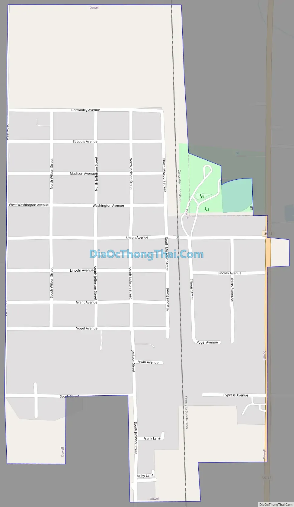
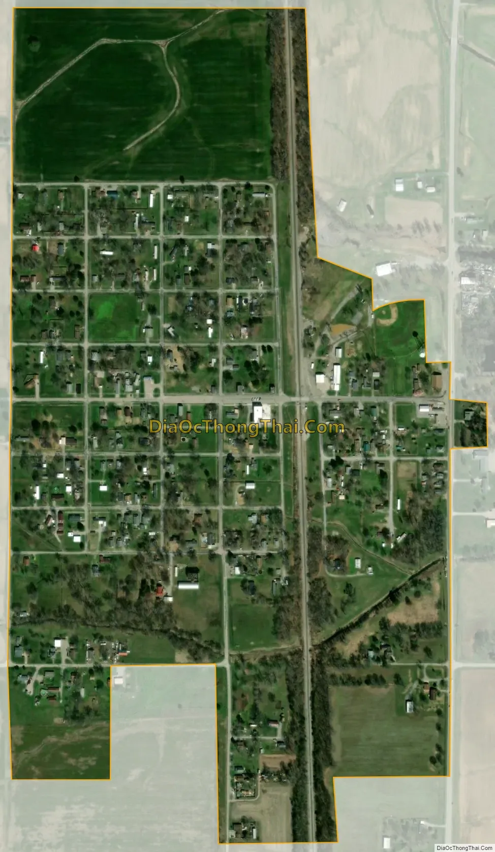
Dowell city Satellite Map
Geography
Dowell is located in northeastern Jackson County at 37°56′22″N 89°14′22″W / 37.93944°N 89.23944°W / 37.93944; -89.23944 (37.939545, -89.239553). U.S. Route 51 passes through the eastern side of the village, leading south 9 miles (14 km) to De Soto and north 5 miles (8 km) to Du Quoin.
According to the 2010 census, Dowell has a total area of 0.391 square miles (1.01 km), of which 0.39 square miles (1.01 km) (or 99.74%) is land and 0.001 square miles (0.00 km) (or 0.26%) is water.
See also
Map of Illinois State and its subdivision:- Adams
- Alexander
- Bond
- Boone
- Brown
- Bureau
- Calhoun
- Carroll
- Cass
- Champaign
- Christian
- Clark
- Clay
- Clinton
- Coles
- Cook
- Crawford
- Cumberland
- De Kalb
- De Witt
- Douglas
- Dupage
- Edgar
- Edwards
- Effingham
- Fayette
- Ford
- Franklin
- Fulton
- Gallatin
- Greene
- Grundy
- Hamilton
- Hancock
- Hardin
- Henderson
- Henry
- Iroquois
- Jackson
- Jasper
- Jefferson
- Jersey
- Jo Daviess
- Johnson
- Kane
- Kankakee
- Kendall
- Knox
- La Salle
- Lake
- Lake Michigan
- Lawrence
- Lee
- Livingston
- Logan
- Macon
- Macoupin
- Madison
- Marion
- Marshall
- Mason
- Massac
- McDonough
- McHenry
- McLean
- Menard
- Mercer
- Monroe
- Montgomery
- Morgan
- Moultrie
- Ogle
- Peoria
- Perry
- Piatt
- Pike
- Pope
- Pulaski
- Putnam
- Randolph
- Richland
- Rock Island
- Saint Clair
- Saline
- Sangamon
- Schuyler
- Scott
- Shelby
- Stark
- Stephenson
- Tazewell
- Union
- Vermilion
- Wabash
- Warren
- Washington
- Wayne
- White
- Whiteside
- Will
- Williamson
- Winnebago
- Woodford
- Alabama
- Alaska
- Arizona
- Arkansas
- California
- Colorado
- Connecticut
- Delaware
- District of Columbia
- Florida
- Georgia
- Hawaii
- Idaho
- Illinois
- Indiana
- Iowa
- Kansas
- Kentucky
- Louisiana
- Maine
- Maryland
- Massachusetts
- Michigan
- Minnesota
- Mississippi
- Missouri
- Montana
- Nebraska
- Nevada
- New Hampshire
- New Jersey
- New Mexico
- New York
- North Carolina
- North Dakota
- Ohio
- Oklahoma
- Oregon
- Pennsylvania
- Rhode Island
- South Carolina
- South Dakota
- Tennessee
- Texas
- Utah
- Vermont
- Virginia
- Washington
- West Virginia
- Wisconsin
- Wyoming