Downs is a village in McLean County, Illinois, United States. The population was 1,201 at the 2020 census, up from 1,005 in 2010. It is part of the Bloomington–Normal Metropolitan Statistical Area.
| Name: | Downs village |
|---|---|
| LSAD Code: | 47 |
| LSAD Description: | village (suffix) |
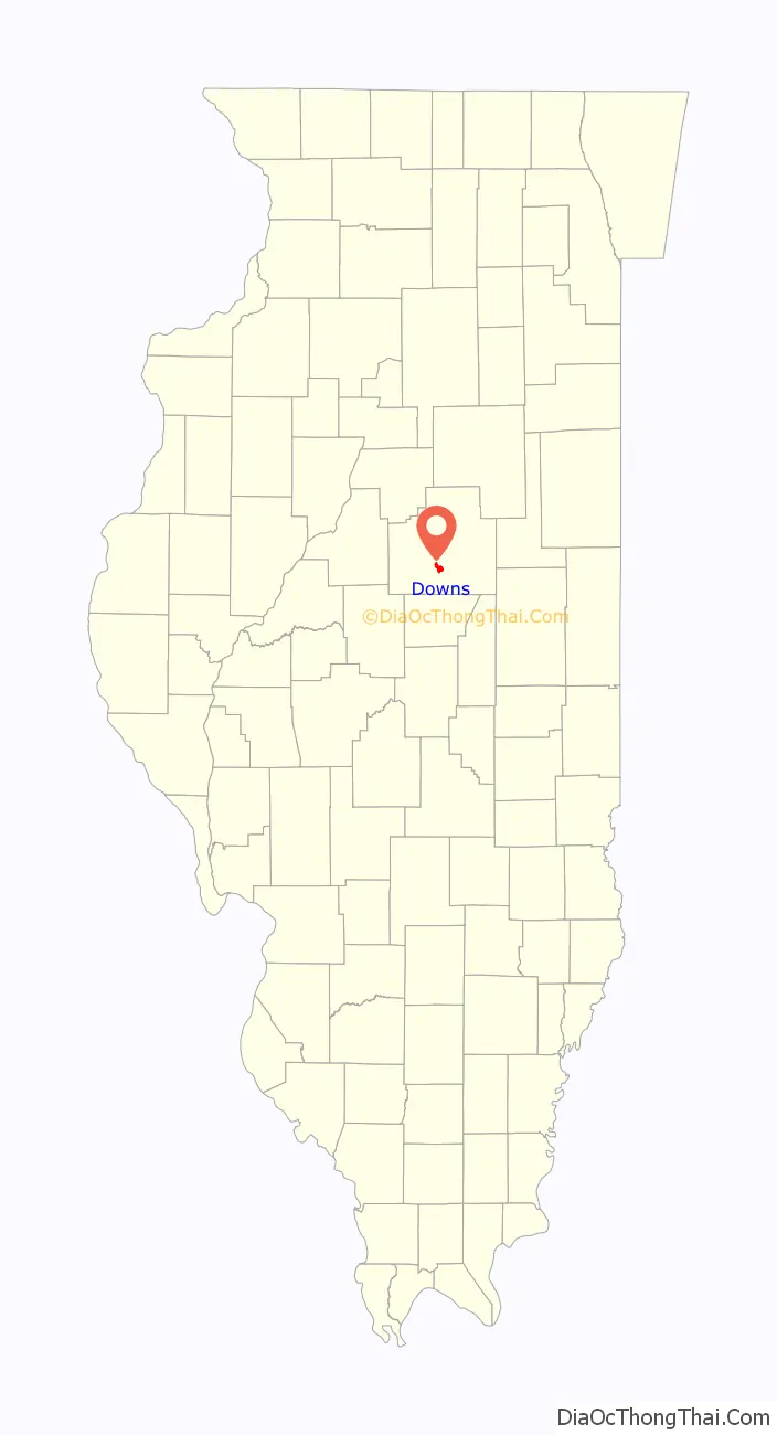
| State: | Illinois |
| County: | McLean County |
| Elevation: | 755 ft (230 m) |
| Total Area: | 3.00 sq mi (7.76 km²) |
| Land Area: | 3.00 sq mi (7.76 km²) |
| Water Area: | 0.00 sq mi (0.00 km²) |
| Total Population: | 1,201 |
| Population Density: | 400.60/sq mi (154.67/km²) |
| ZIP code: | 61736 (Downs) 61705 (Bloomington) |
| Area code: | 309 |
| FIPS code: | 1720643 |
| Website: | www.villageofdowns.org |
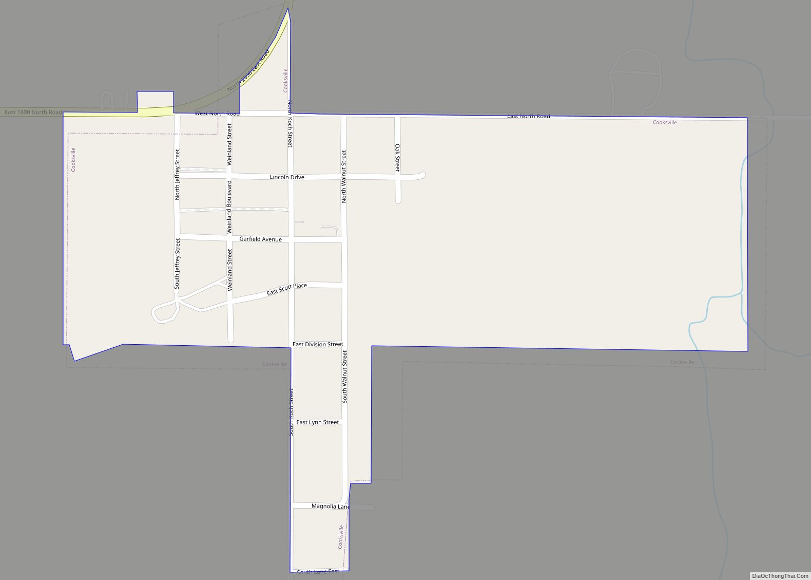
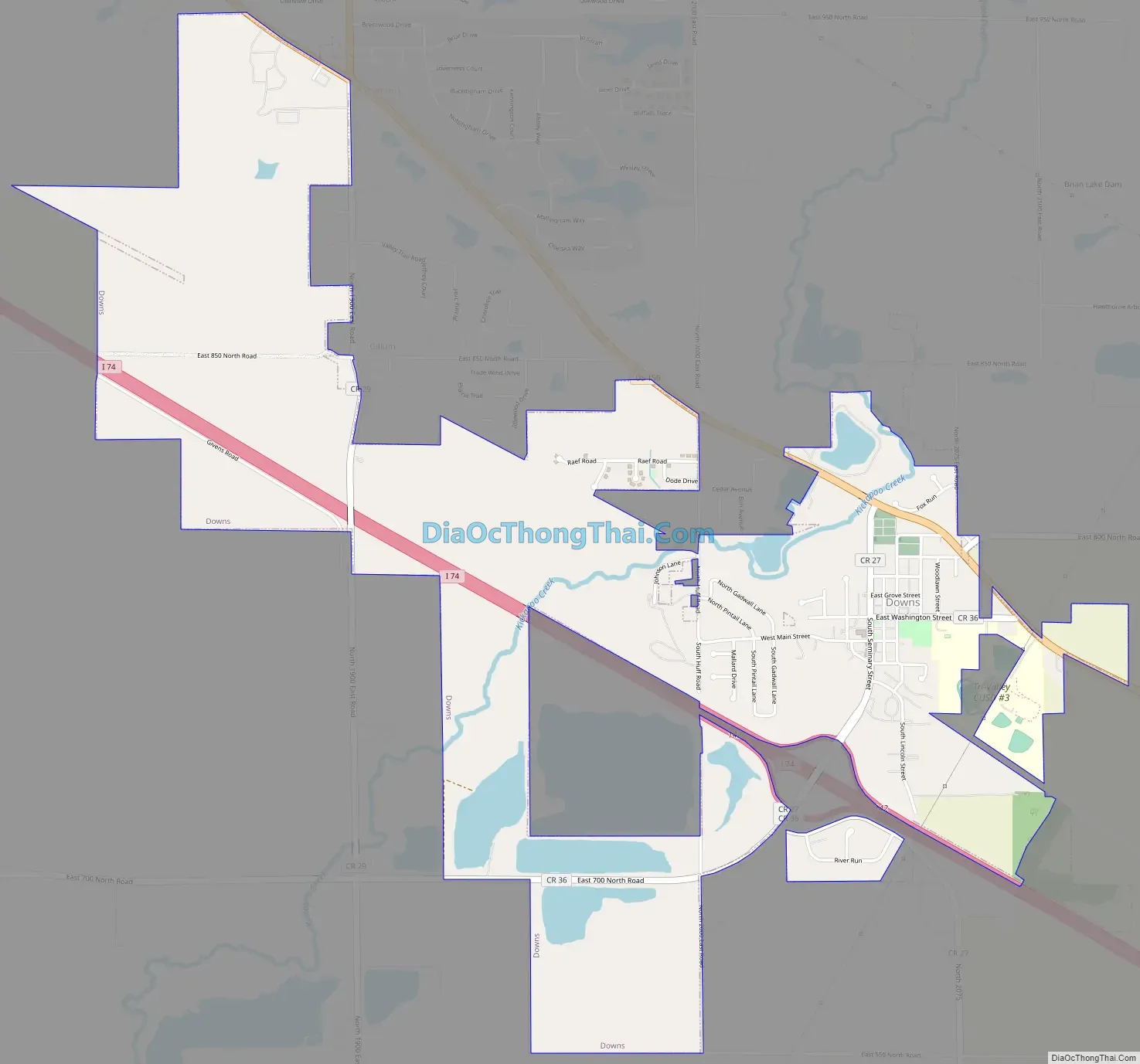
Online Interactive Map
Click on ![]() to view map in "full screen" mode.
to view map in "full screen" mode.
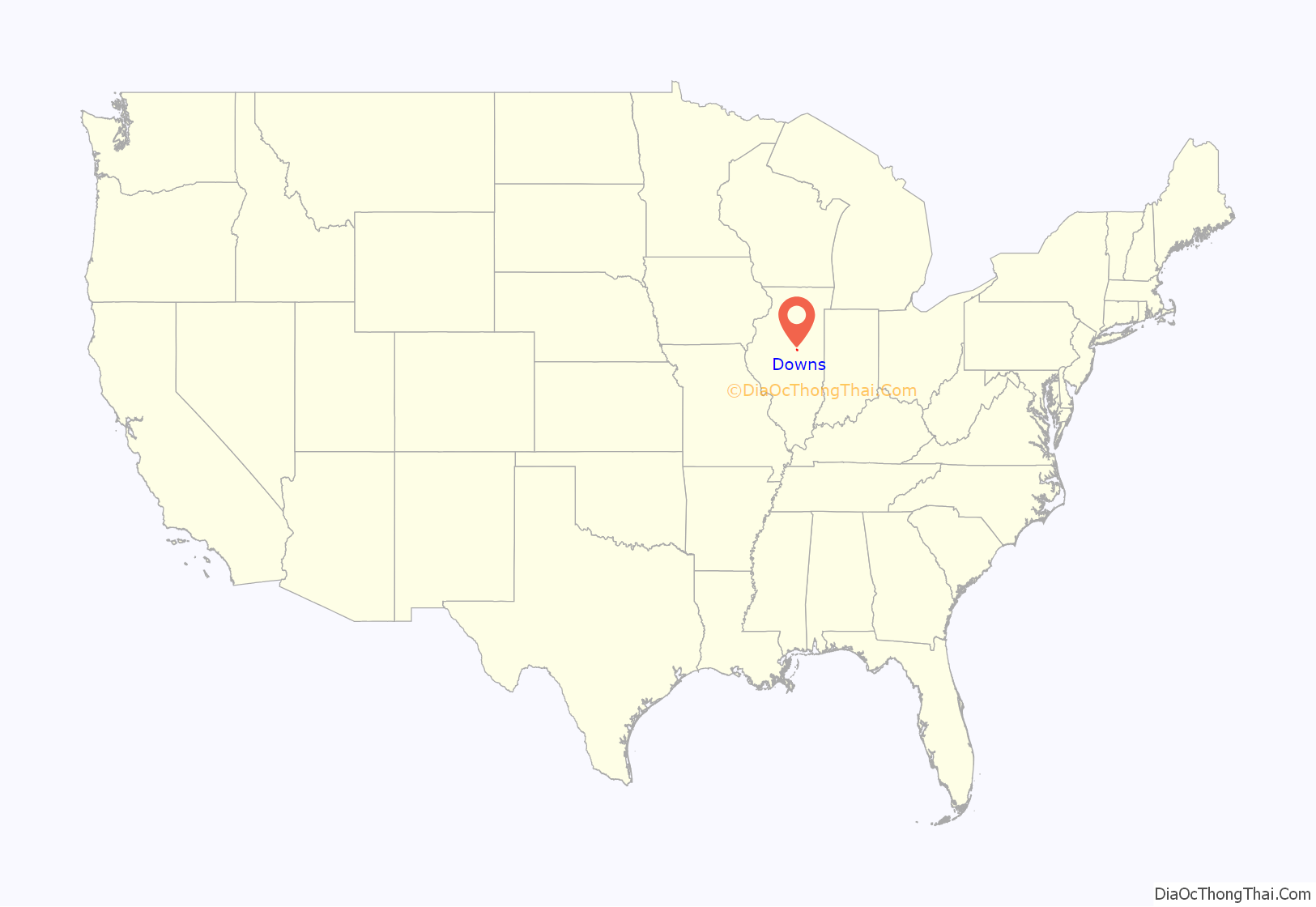
Downs location map. Where is Downs village?
History
Downs was originally a small community known as “Delta”, established by McLean County settlers in 1829. Previously, the area served as a trading post for the Kickapoo people. When the Indiana, Bloomington and Western Railway was built in 1869, several buildings were dismantled and reconstructed further south to put the town closer to the railroad. The town was then renamed “Priceville” in honor of John Price, a resident who owned the land near the tracks. In 1902, the town’s name was changed to “Downs”, after postal clerks commonly confused Priceville with the similarly-named Illinois town of Princeville. Downs is named for Lawson Downs, one of the area’s pioneer settlers.
Downs Road Map
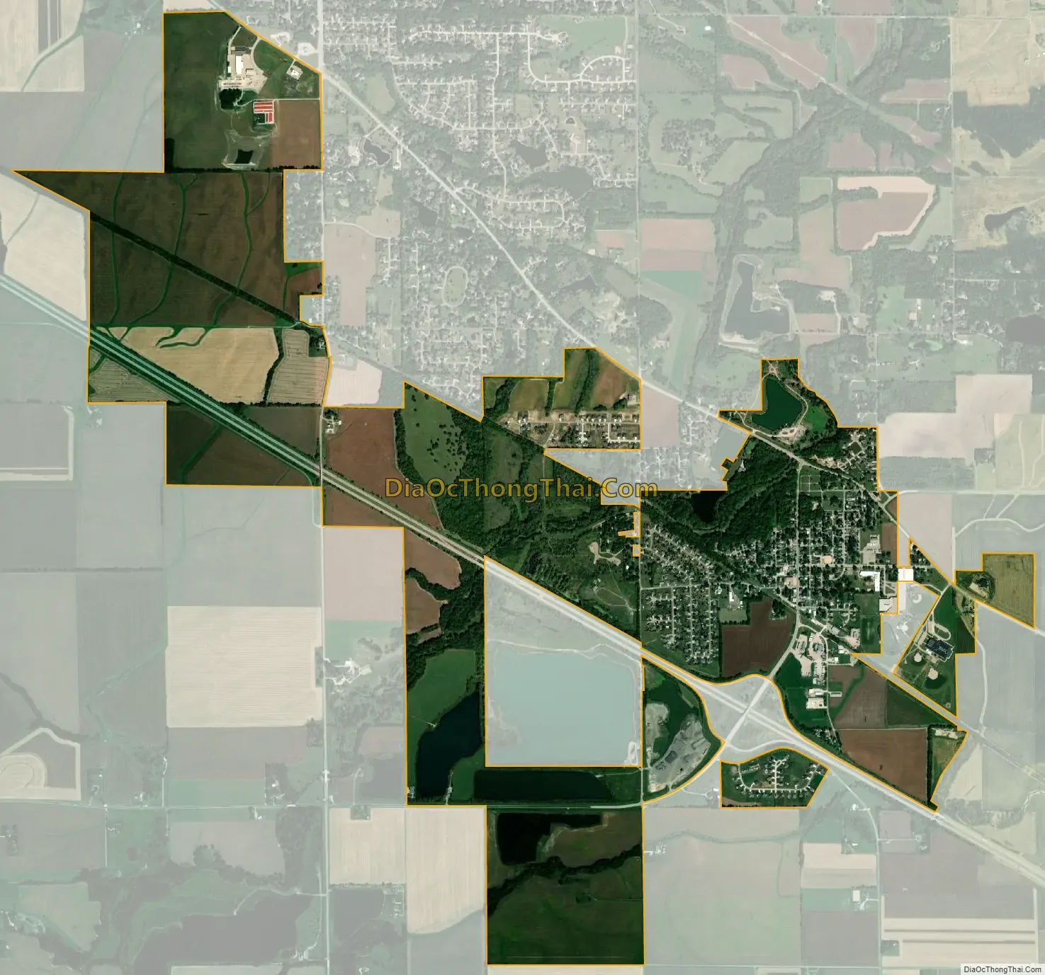
Downs city Satellite Map
Geography
Downs is in southern McLean County, 9 miles (14 km) southeast of Bloomington, the county seat. U.S. Route 150 passes through the northeast side of the village, leading northwest to Bloomington and southeast 6 miles (10 km) to Le Roy. Interstate 74 passes through the southwest side of the village, with access from Exit 142. I-74 leads northwest to Bloomington and southeast 40 miles (64 km) to Champaign.
According to the U.S. Census Bureau, Downs has a total area of 3.00 square miles (7.77 km), all land. Kickapoo Creek flows through the northwest side of the village, leading southwest to Salt Creek, a tributary of the Sangamon River, near Lincoln.
See also
Map of Illinois State and its subdivision:- Adams
- Alexander
- Bond
- Boone
- Brown
- Bureau
- Calhoun
- Carroll
- Cass
- Champaign
- Christian
- Clark
- Clay
- Clinton
- Coles
- Cook
- Crawford
- Cumberland
- De Kalb
- De Witt
- Douglas
- Dupage
- Edgar
- Edwards
- Effingham
- Fayette
- Ford
- Franklin
- Fulton
- Gallatin
- Greene
- Grundy
- Hamilton
- Hancock
- Hardin
- Henderson
- Henry
- Iroquois
- Jackson
- Jasper
- Jefferson
- Jersey
- Jo Daviess
- Johnson
- Kane
- Kankakee
- Kendall
- Knox
- La Salle
- Lake
- Lake Michigan
- Lawrence
- Lee
- Livingston
- Logan
- Macon
- Macoupin
- Madison
- Marion
- Marshall
- Mason
- Massac
- McDonough
- McHenry
- McLean
- Menard
- Mercer
- Monroe
- Montgomery
- Morgan
- Moultrie
- Ogle
- Peoria
- Perry
- Piatt
- Pike
- Pope
- Pulaski
- Putnam
- Randolph
- Richland
- Rock Island
- Saint Clair
- Saline
- Sangamon
- Schuyler
- Scott
- Shelby
- Stark
- Stephenson
- Tazewell
- Union
- Vermilion
- Wabash
- Warren
- Washington
- Wayne
- White
- Whiteside
- Will
- Williamson
- Winnebago
- Woodford
- Alabama
- Alaska
- Arizona
- Arkansas
- California
- Colorado
- Connecticut
- Delaware
- District of Columbia
- Florida
- Georgia
- Hawaii
- Idaho
- Illinois
- Indiana
- Iowa
- Kansas
- Kentucky
- Louisiana
- Maine
- Maryland
- Massachusetts
- Michigan
- Minnesota
- Mississippi
- Missouri
- Montana
- Nebraska
- Nevada
- New Hampshire
- New Jersey
- New Mexico
- New York
- North Carolina
- North Dakota
- Ohio
- Oklahoma
- Oregon
- Pennsylvania
- Rhode Island
- South Carolina
- South Dakota
- Tennessee
- Texas
- Utah
- Vermont
- Virginia
- Washington
- West Virginia
- Wisconsin
- Wyoming