Elkville is a village in Jackson County, Illinois, United States. The population was 928 at the 2010 census, down from 1,001 at the 2000 census. As of 2018 the estimated population was 871.
| Name: | Elkville village |
|---|---|
| LSAD Code: | 47 |
| LSAD Description: | village (suffix) |
| State: | Illinois |
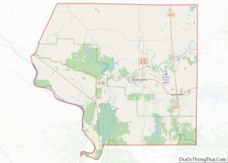
| County: | Jackson County |
| Elevation: | 400 ft (100 m) |
| Total Area: | 0.77 sq mi (2.00 km²) |
| Land Area: | 0.77 sq mi (1.99 km²) |
| Water Area: | 0.01 sq mi (0.01 km²) |
| Total Population: | 838 |
| Population Density: | 1,092.57/sq mi (421.71/km²) |
| ZIP code: | 62932 |
| Area code: | 618 |
| FIPS code: | 1723373 |
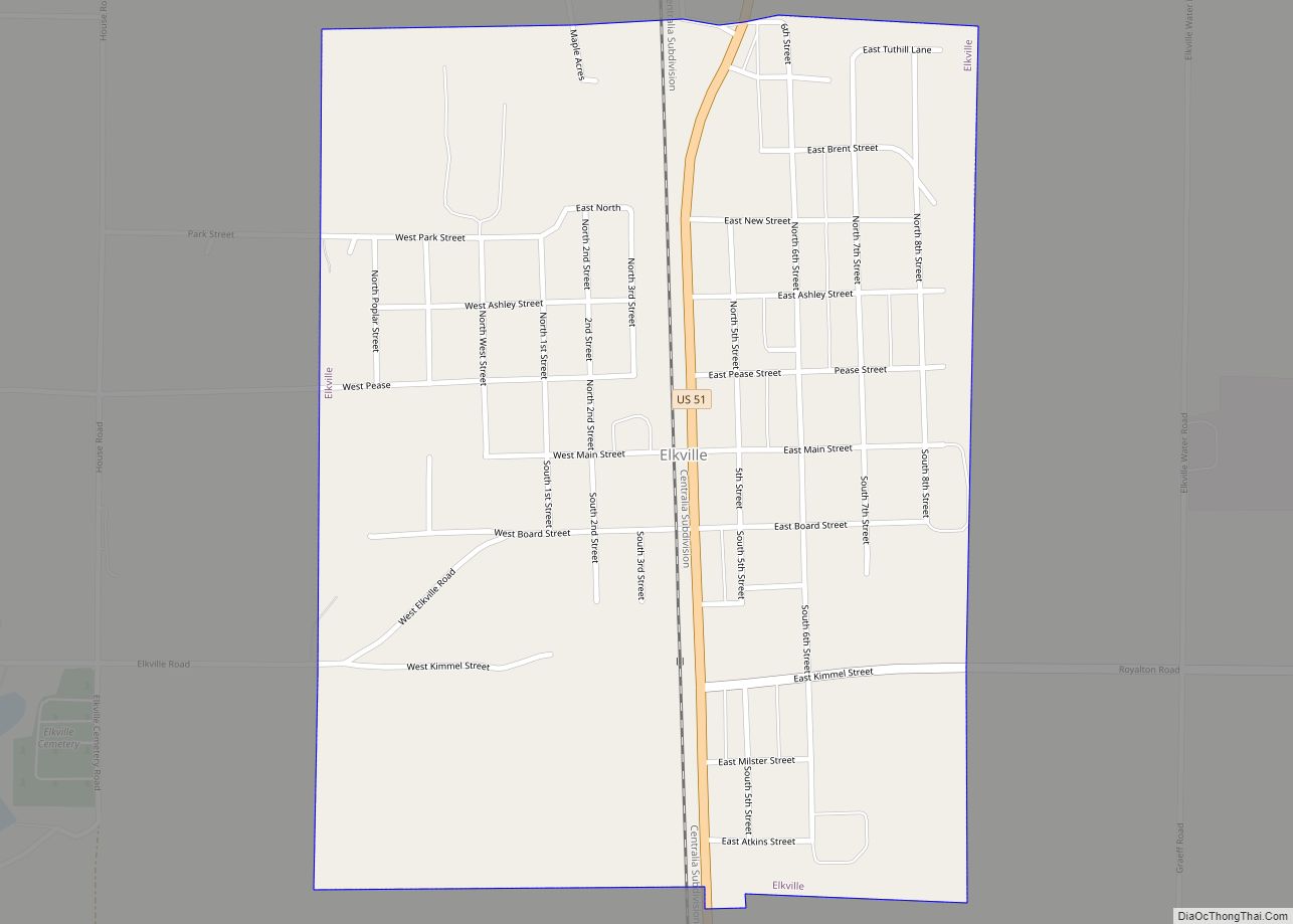
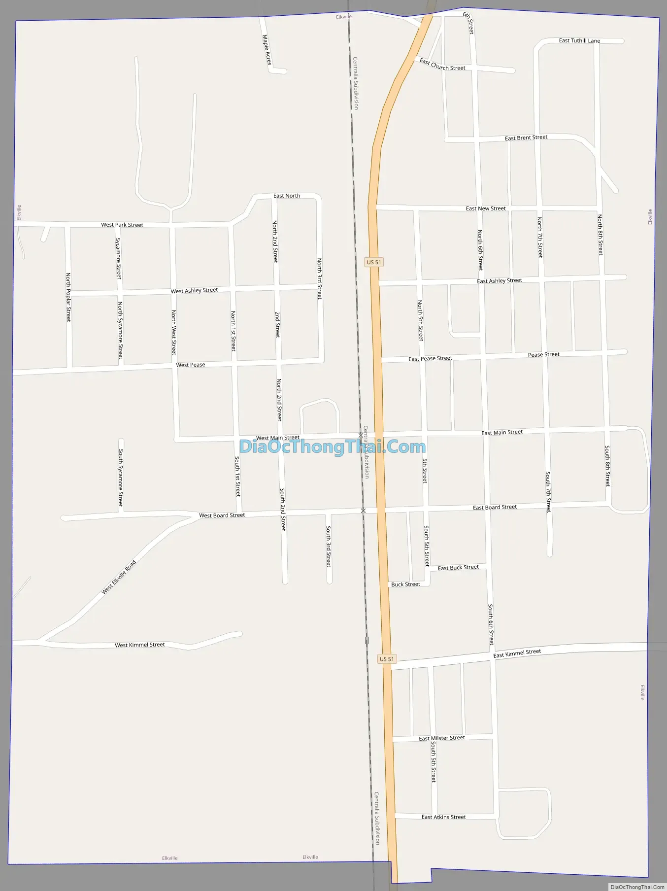
Online Interactive Map
Click on ![]() to view map in "full screen" mode.
to view map in "full screen" mode.
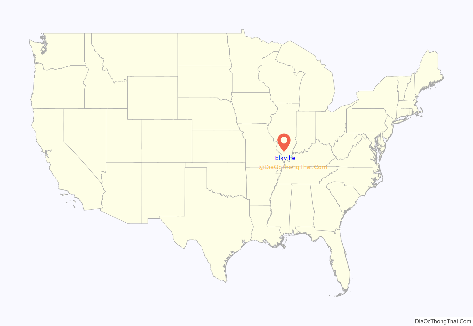
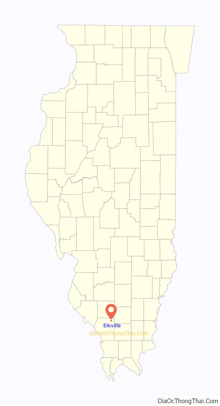
Elkville location map. Where is Elkville village?
History
The village was named for the elk which frequented mineral licks near the original town site. Harmon P. Burroughs (1846–1907), farmer and Illinois state representative, lived in Elkville.
Elkville Road Map
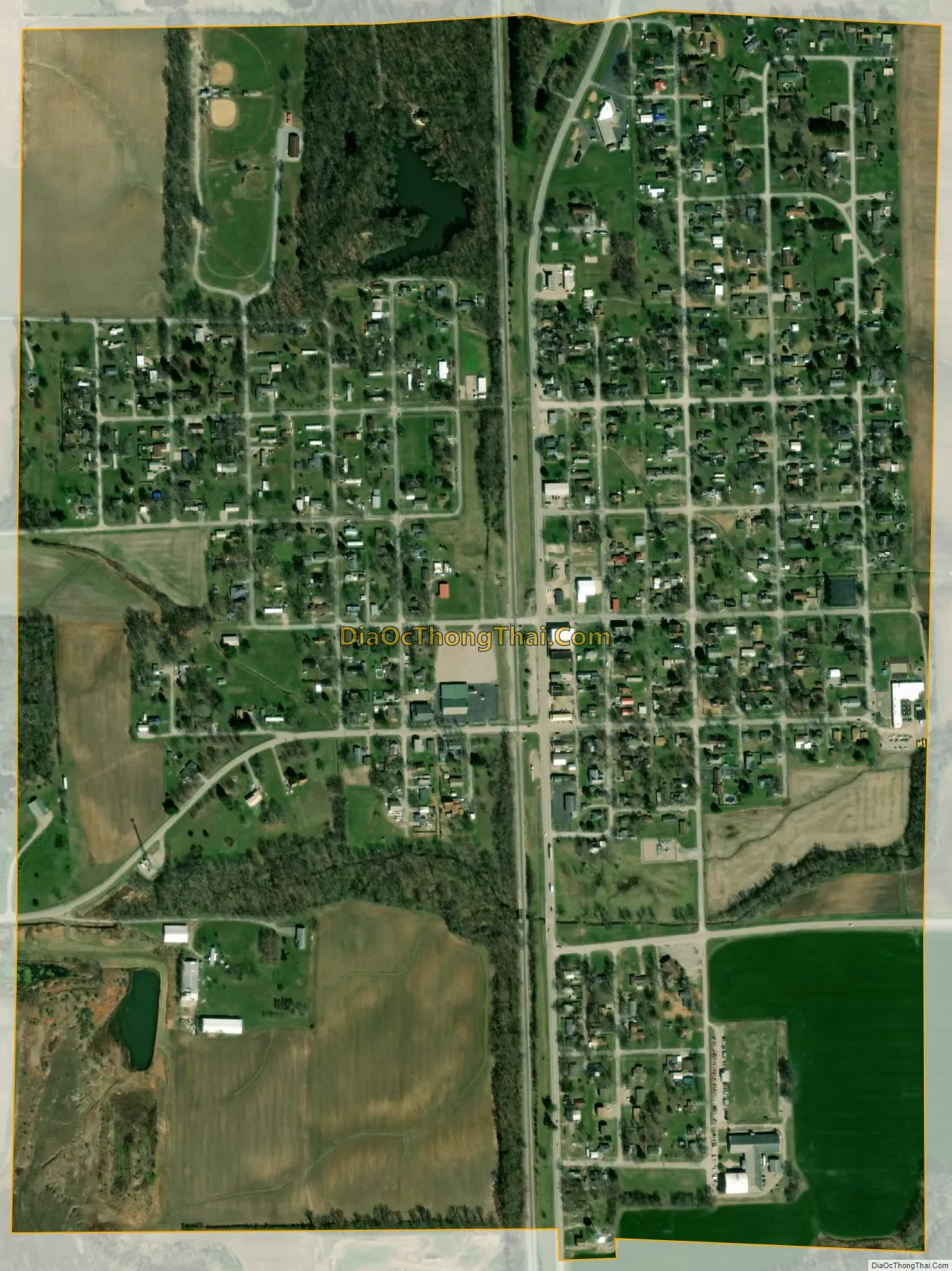
Elkville city Satellite Map
Geography
Elkville is located in northeastern Jackson County at 37°54′39″N 89°14′7″W / 37.91083°N 89.23528°W / 37.91083; -89.23528 (37.910851, −89.235198). U.S. Route 51 runs through the center of the village, leading north 7 miles (11 km) to Du Quoin and south the same distance to De Soto. Carbondale is 13 miles (21 km) south of Elkville via US-51.
According to the 2010 census, Elkville has a total area of 0.765 square miles (1.98 km), of which 0.76 square miles (1.97 km) (or 99.35%) is land and 0.005 square miles (0.01 km) (or 0.65%) is water.
See also
Map of Illinois State and its subdivision:- Adams
- Alexander
- Bond
- Boone
- Brown
- Bureau
- Calhoun
- Carroll
- Cass
- Champaign
- Christian
- Clark
- Clay
- Clinton
- Coles
- Cook
- Crawford
- Cumberland
- De Kalb
- De Witt
- Douglas
- Dupage
- Edgar
- Edwards
- Effingham
- Fayette
- Ford
- Franklin
- Fulton
- Gallatin
- Greene
- Grundy
- Hamilton
- Hancock
- Hardin
- Henderson
- Henry
- Iroquois
- Jackson
- Jasper
- Jefferson
- Jersey
- Jo Daviess
- Johnson
- Kane
- Kankakee
- Kendall
- Knox
- La Salle
- Lake
- Lake Michigan
- Lawrence
- Lee
- Livingston
- Logan
- Macon
- Macoupin
- Madison
- Marion
- Marshall
- Mason
- Massac
- McDonough
- McHenry
- McLean
- Menard
- Mercer
- Monroe
- Montgomery
- Morgan
- Moultrie
- Ogle
- Peoria
- Perry
- Piatt
- Pike
- Pope
- Pulaski
- Putnam
- Randolph
- Richland
- Rock Island
- Saint Clair
- Saline
- Sangamon
- Schuyler
- Scott
- Shelby
- Stark
- Stephenson
- Tazewell
- Union
- Vermilion
- Wabash
- Warren
- Washington
- Wayne
- White
- Whiteside
- Will
- Williamson
- Winnebago
- Woodford
- Alabama
- Alaska
- Arizona
- Arkansas
- California
- Colorado
- Connecticut
- Delaware
- District of Columbia
- Florida
- Georgia
- Hawaii
- Idaho
- Illinois
- Indiana
- Iowa
- Kansas
- Kentucky
- Louisiana
- Maine
- Maryland
- Massachusetts
- Michigan
- Minnesota
- Mississippi
- Missouri
- Montana
- Nebraska
- Nevada
- New Hampshire
- New Jersey
- New Mexico
- New York
- North Carolina
- North Dakota
- Ohio
- Oklahoma
- Oregon
- Pennsylvania
- Rhode Island
- South Carolina
- South Dakota
- Tennessee
- Texas
- Utah
- Vermont
- Virginia
- Washington
- West Virginia
- Wisconsin
- Wyoming