Elwood is a village in rural Will County, Illinois, United States, approximately 40 miles southwest of Chicago. The population was 2,229 at the 2020 United States Census, down from 2,279 in 2010.
| Name: | Elwood village |
|---|---|
| LSAD Code: | 47 |
| LSAD Description: | village (suffix) |
| State: | Illinois |
| County: | Will County |
| Elevation: | 646 ft (197 m) |
| Total Area: | 13.80 sq mi (35.74 km²) |
| Land Area: | 13.65 sq mi (35.35 km²) |
| Water Area: | 0.15 sq mi (0.39 km²) |
| Total Population: | 2,229 |
| Population Density: | 163.30/sq mi (63.05/km²) |
| Area code: | 815 |
| FIPS code: | 1723945 |
| Website: | villageofelwood.com |
Online Interactive Map
Click on ![]() to view map in "full screen" mode.
to view map in "full screen" mode.
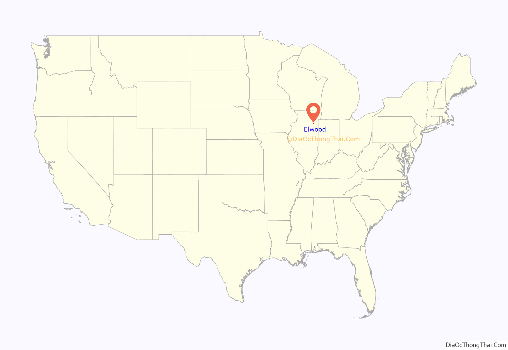
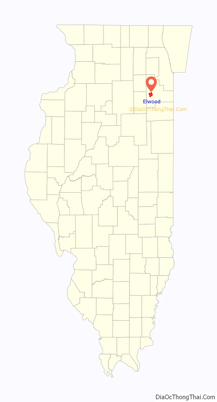
Elwood location map. Where is Elwood village?
History
Elwood was founded in 1854 and incorporated as a village in 1869. The completion of the Joliet–Bloomington railroad played a major role in the founding of Elwood. By 1900, Elwood was a small farming community with a population of about 400. In the late 1930s, the federal government acquired nearby land for troop training and weapons production, on which site the Joliet Arsenal was built and commenced operation in 1940. Arsenal construction played an important role in the development of Elwood and brought about 175 people into the area. In 1942, a massive explosion at the arsenal killed 42 workers and caused widespread damage. In 1954, the village celebrated its centennial, and 20,000 people gathered to watch the parade. By 1970, Elwood had a population of about 750.
On May 8, 1988, a tornado touched down about three miles (5 km) north of the village, uprooting large trees and heavily damaging a few homes and pole built buildings.
In 1990, the village began to experience more rapid growth. By 1996, Elwood’s population rose to nearly 1,423, and is now estimated at 2,300, with development accelerating due to the construction of the CenterPoint Intermodal Center facility. The Northern Illinois Planning Commission estimates that Elwood will have a population of nearly 20,000 by 2030.
The Midewin National Tallgrass Prairie, a prairie reserve operated by the United States Forest Service is located on the site of the former Joliet Army Ammunition Plant near Elwood, Illinois, and was established by federal law in 1996. In 1999, the 982 acre (397 ha) Abraham Lincoln National Cemetery was dedicated in Elwood. When fully completed, it will provide 400,000 burial spaces.
Fires
Two major fires have taken place in Elwood, the first on August 26, 1995, in which the fire station was destroyed. The second, which occurred on May 5, 2008, completely destroyed Bill’s Inn. A residential fire in the Wyndstone Village subdivision on April 17, 2009 caused significant damage to some townhomes.
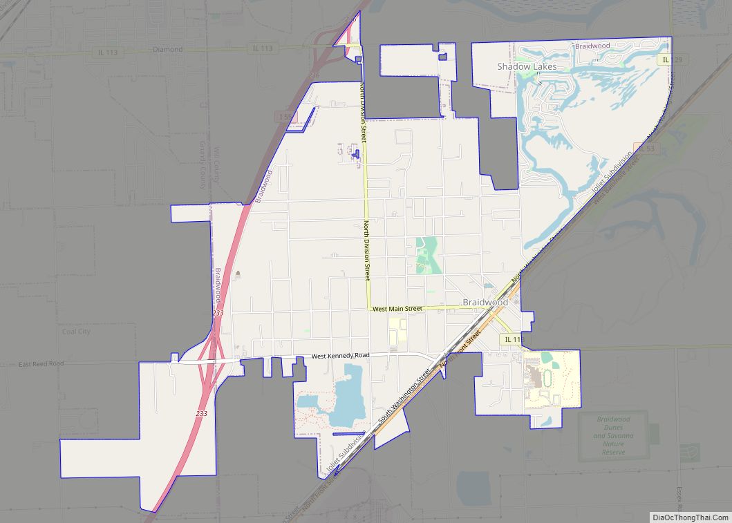
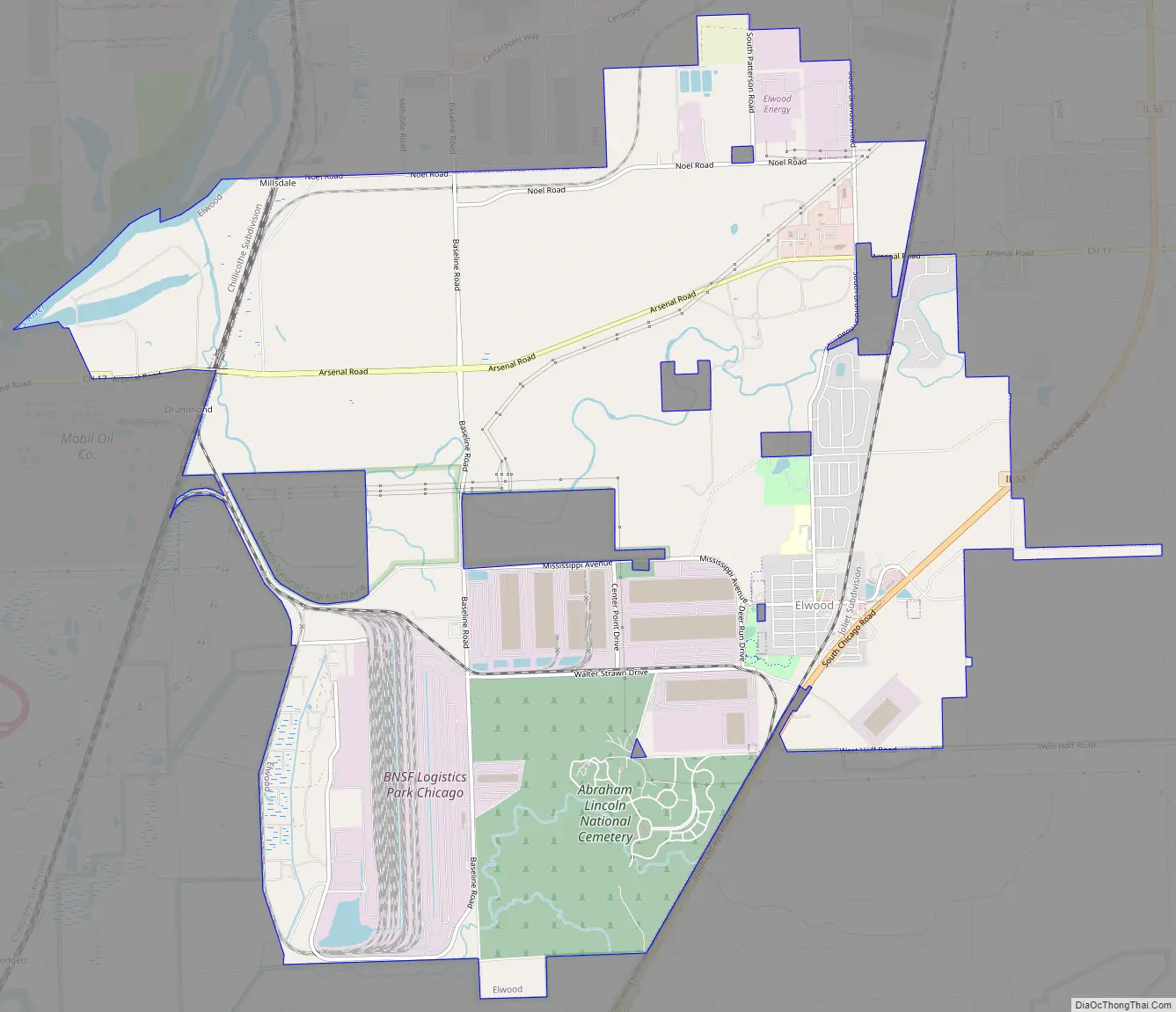
Elwood Road Map
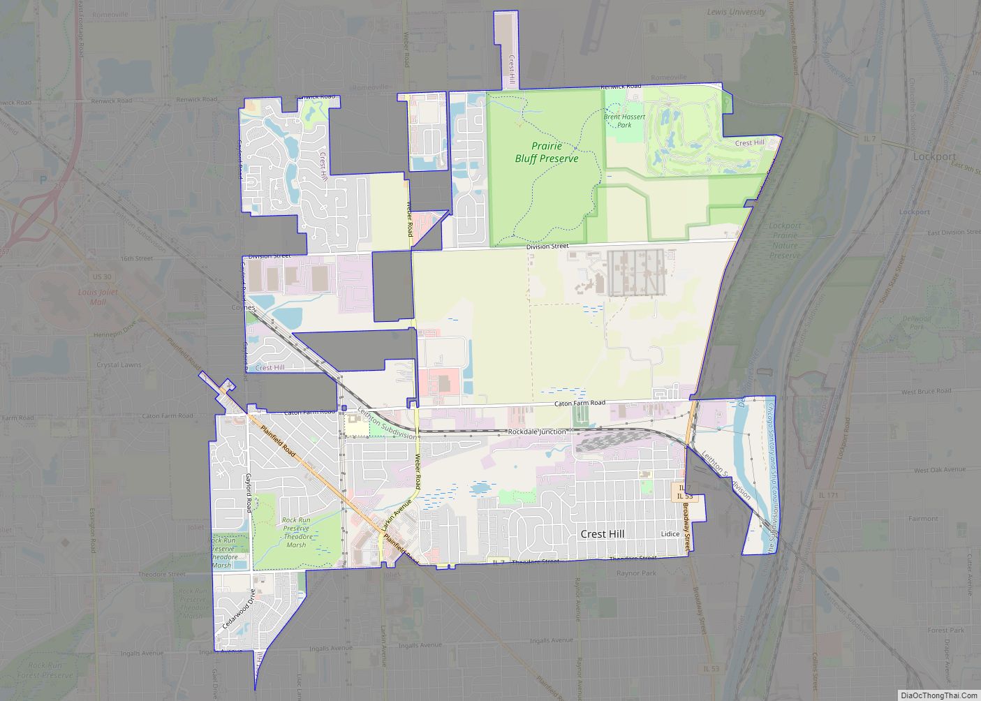
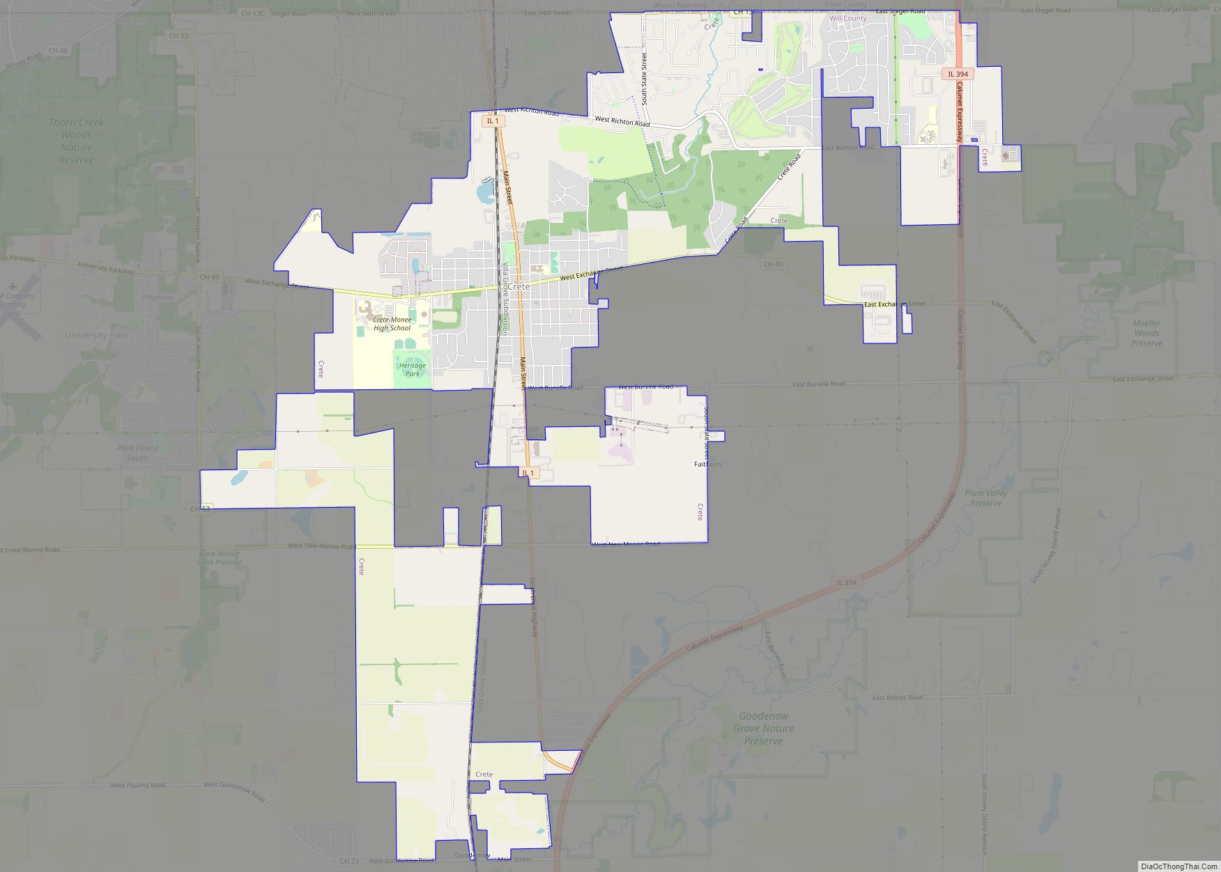
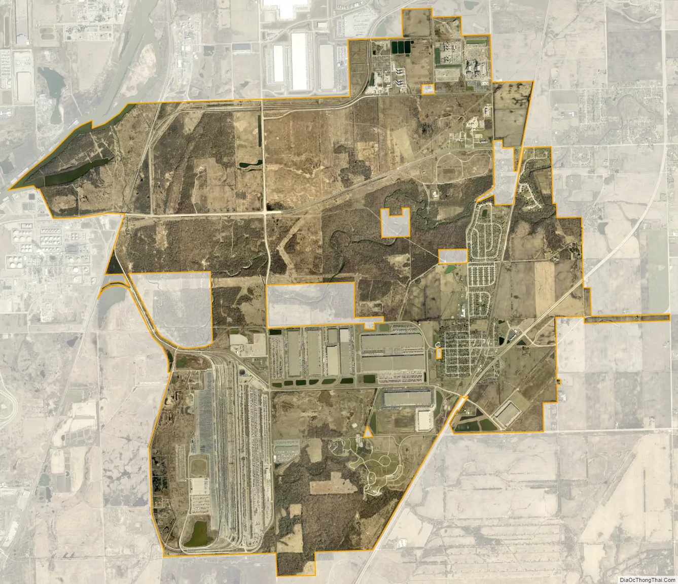
Elwood city Satellite Map
Geography
Elwood is located at 41°24′49″N 88°6′38″W / 41.41361°N 88.11056°W / 41.41361; -88.11056 (41.413615, -88.110438). The nearest major highways are Interstate 80 to the north and Interstate 55 to the west. The former Route 66 highway passes through the village on the east side. According to the 2010 census, Elwood has a total area of 6.53 square miles (16.91 km), all land.
See also
Map of Illinois State and its subdivision:- Adams
- Alexander
- Bond
- Boone
- Brown
- Bureau
- Calhoun
- Carroll
- Cass
- Champaign
- Christian
- Clark
- Clay
- Clinton
- Coles
- Cook
- Crawford
- Cumberland
- De Kalb
- De Witt
- Douglas
- Dupage
- Edgar
- Edwards
- Effingham
- Fayette
- Ford
- Franklin
- Fulton
- Gallatin
- Greene
- Grundy
- Hamilton
- Hancock
- Hardin
- Henderson
- Henry
- Iroquois
- Jackson
- Jasper
- Jefferson
- Jersey
- Jo Daviess
- Johnson
- Kane
- Kankakee
- Kendall
- Knox
- La Salle
- Lake
- Lake Michigan
- Lawrence
- Lee
- Livingston
- Logan
- Macon
- Macoupin
- Madison
- Marion
- Marshall
- Mason
- Massac
- McDonough
- McHenry
- McLean
- Menard
- Mercer
- Monroe
- Montgomery
- Morgan
- Moultrie
- Ogle
- Peoria
- Perry
- Piatt
- Pike
- Pope
- Pulaski
- Putnam
- Randolph
- Richland
- Rock Island
- Saint Clair
- Saline
- Sangamon
- Schuyler
- Scott
- Shelby
- Stark
- Stephenson
- Tazewell
- Union
- Vermilion
- Wabash
- Warren
- Washington
- Wayne
- White
- Whiteside
- Will
- Williamson
- Winnebago
- Woodford
- Alabama
- Alaska
- Arizona
- Arkansas
- California
- Colorado
- Connecticut
- Delaware
- District of Columbia
- Florida
- Georgia
- Hawaii
- Idaho
- Illinois
- Indiana
- Iowa
- Kansas
- Kentucky
- Louisiana
- Maine
- Maryland
- Massachusetts
- Michigan
- Minnesota
- Mississippi
- Missouri
- Montana
- Nebraska
- Nevada
- New Hampshire
- New Jersey
- New Mexico
- New York
- North Carolina
- North Dakota
- Ohio
- Oklahoma
- Oregon
- Pennsylvania
- Rhode Island
- South Carolina
- South Dakota
- Tennessee
- Texas
- Utah
- Vermont
- Virginia
- Washington
- West Virginia
- Wisconsin
- Wyoming