Energy is a village in Williamson County, Illinois, United States. The population was 1,146 at the 2010 census. The community was named for local “Energy” brand coal.
| Name: | Energy village |
|---|---|
| LSAD Code: | 47 |
| LSAD Description: | village (suffix) |
| State: | Illinois |
| County: | Williamson County |
| Elevation: | 459 ft (140 m) |
| Total Area: | 1.21 sq mi (3.14 km²) |
| Land Area: | 1.19 sq mi (3.09 km²) |
| Water Area: | 0.02 sq mi (0.05 km²) |
| Total Population: | 974 |
| Population Density: | 815.75/sq mi (315.01/km²) |
| ZIP code: | 62933 |
| Area code: | 618 |
| FIPS code: | 1724166 |
| GNISfeature ID: | 2398834 |
| Website: | www.villageofenergy.com |
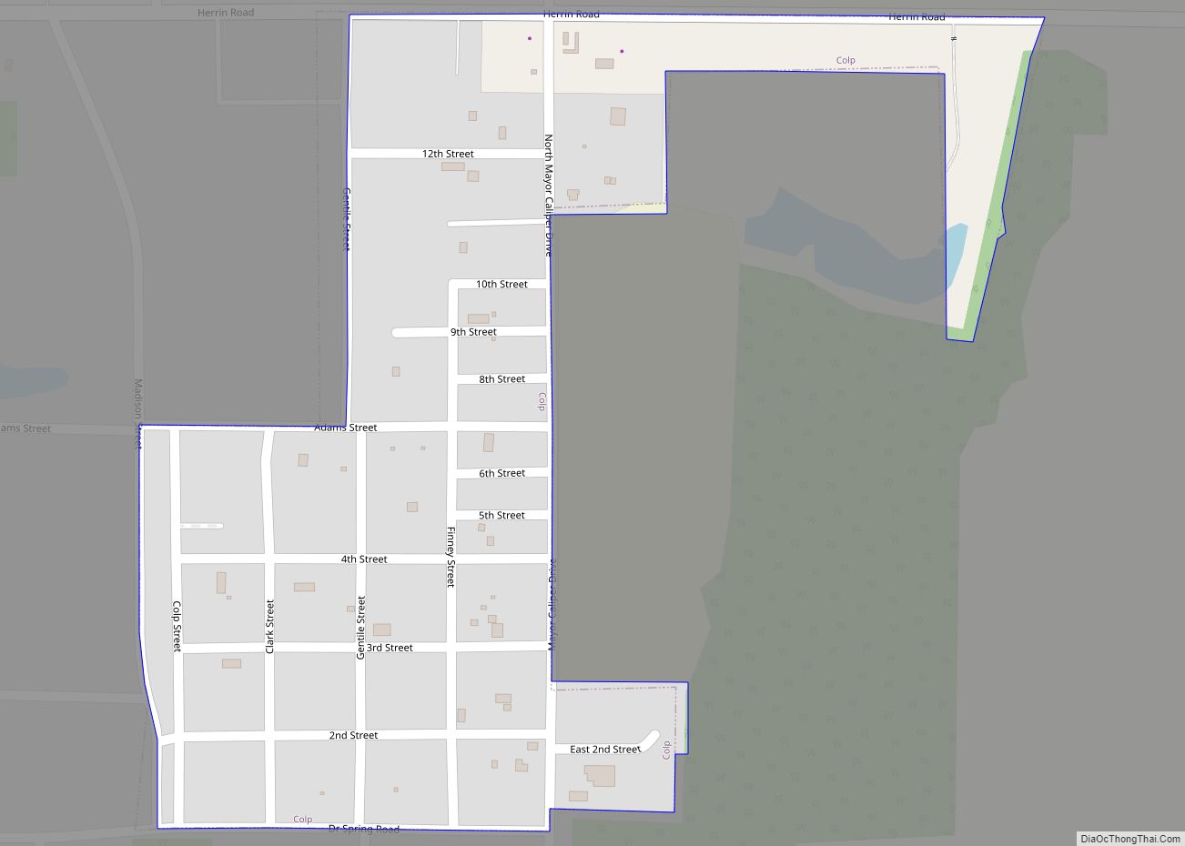
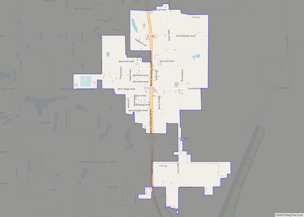
Online Interactive Map
Click on ![]() to view map in "full screen" mode.
to view map in "full screen" mode.
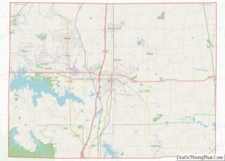
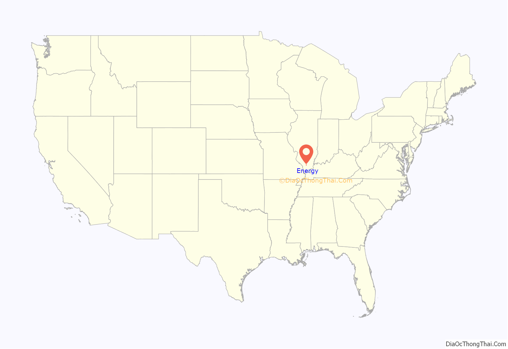
Energy location map. Where is Energy village?
History
What is now Energy was originally known as “Fordville,” which was established in the early 1900s as a stop along the Coal Belt Railway. It was named for Wiley Ford and his son, William, who platted the village. A post office opened in 1905, and the village incorporated the following year.
In 1909, Herbert Taylor (1876–1937) purchased the coal mining operations in the area. He marketed his company’s coal under the name “Energy,” and in 1913 he convinced the Fordville village council to adopt this name for the village. The post office changed its name the same year.
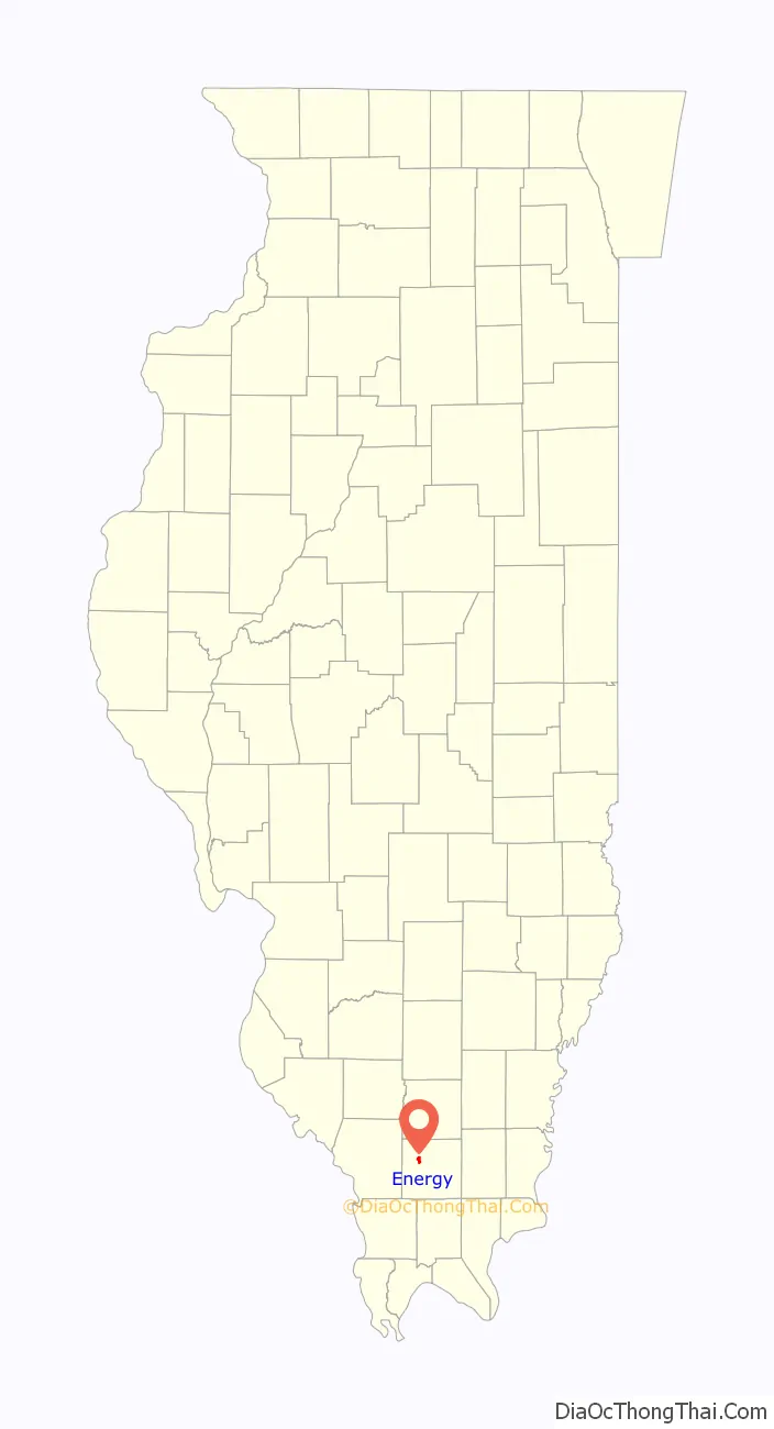
Energy Road Map
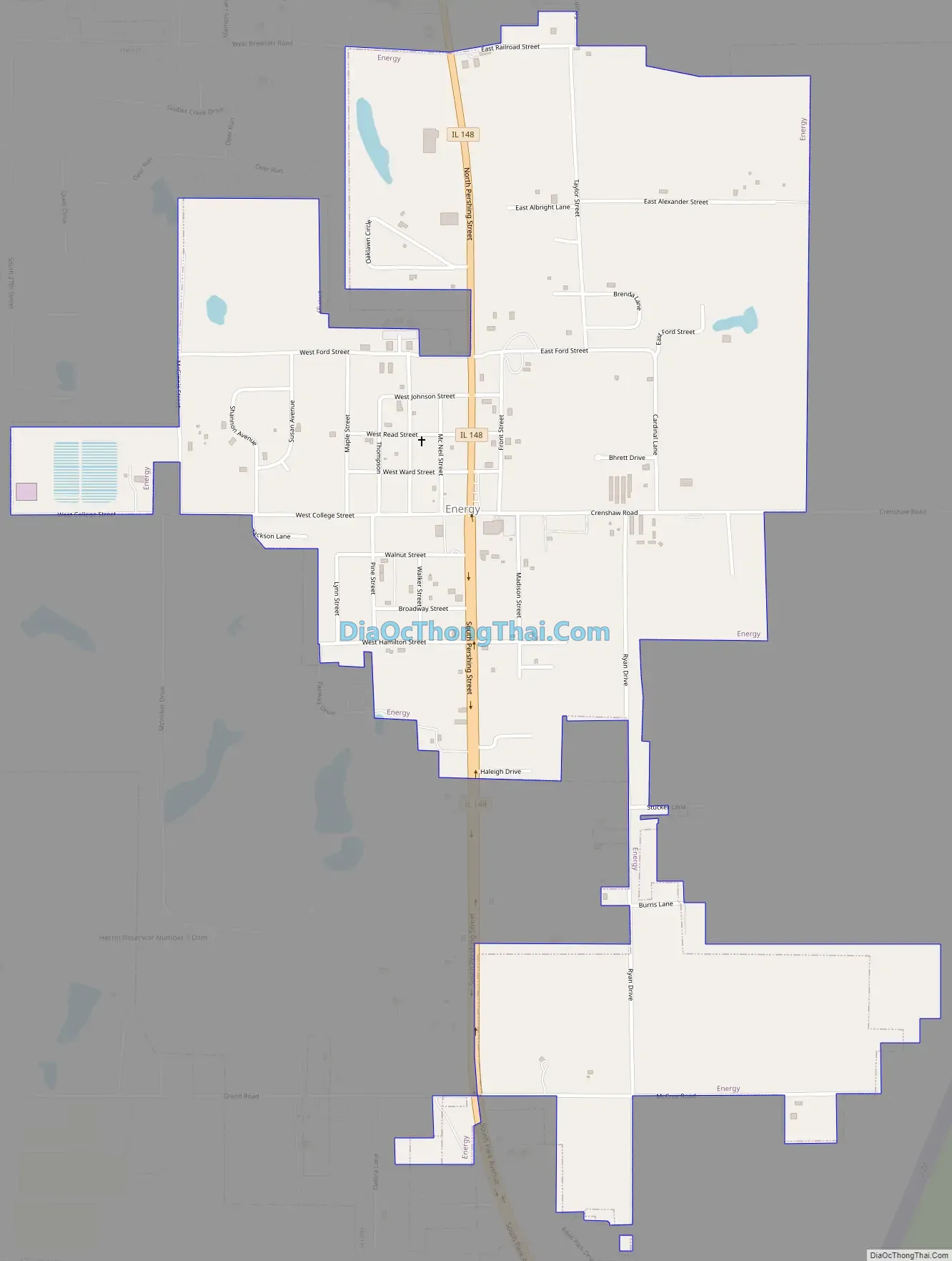
Energy city Satellite Map
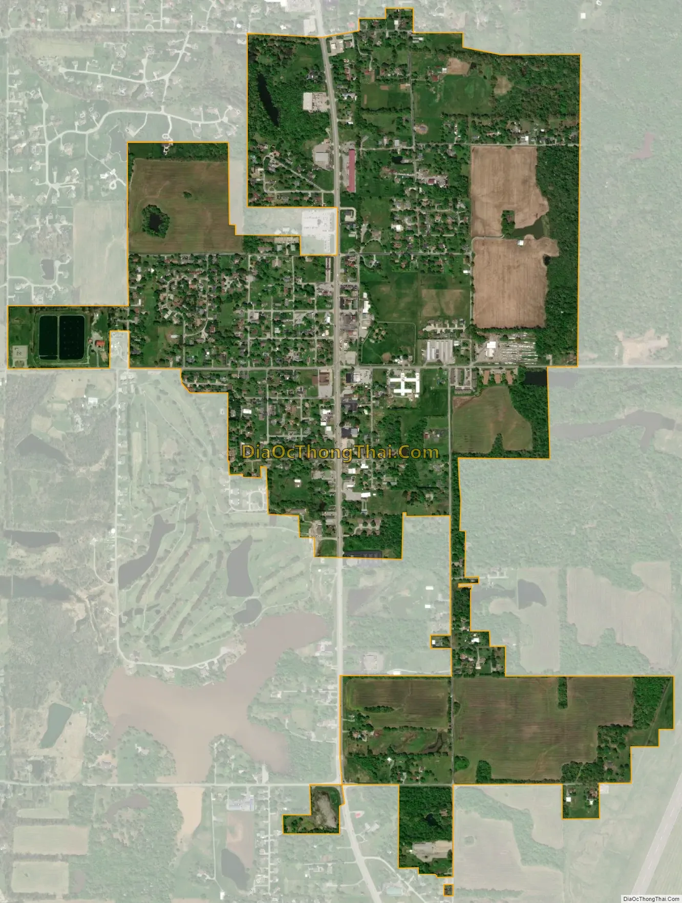
Geography
Energy is located at 37°46′21″N 89°1′32″W / 37.77250°N 89.02556°W / 37.77250; -89.02556 (37.772398, -89.025519).
According to the 2010 census, Energy has a total area of 1.198 square miles (3.10 km), of which 1.18 square miles (3.06 km) (or 98.5%) is land and 0.018 square miles (0.05 km) (or 1.5%) is water.
See also
Map of Illinois State and its subdivision:- Adams
- Alexander
- Bond
- Boone
- Brown
- Bureau
- Calhoun
- Carroll
- Cass
- Champaign
- Christian
- Clark
- Clay
- Clinton
- Coles
- Cook
- Crawford
- Cumberland
- De Kalb
- De Witt
- Douglas
- Dupage
- Edgar
- Edwards
- Effingham
- Fayette
- Ford
- Franklin
- Fulton
- Gallatin
- Greene
- Grundy
- Hamilton
- Hancock
- Hardin
- Henderson
- Henry
- Iroquois
- Jackson
- Jasper
- Jefferson
- Jersey
- Jo Daviess
- Johnson
- Kane
- Kankakee
- Kendall
- Knox
- La Salle
- Lake
- Lake Michigan
- Lawrence
- Lee
- Livingston
- Logan
- Macon
- Macoupin
- Madison
- Marion
- Marshall
- Mason
- Massac
- McDonough
- McHenry
- McLean
- Menard
- Mercer
- Monroe
- Montgomery
- Morgan
- Moultrie
- Ogle
- Peoria
- Perry
- Piatt
- Pike
- Pope
- Pulaski
- Putnam
- Randolph
- Richland
- Rock Island
- Saint Clair
- Saline
- Sangamon
- Schuyler
- Scott
- Shelby
- Stark
- Stephenson
- Tazewell
- Union
- Vermilion
- Wabash
- Warren
- Washington
- Wayne
- White
- Whiteside
- Will
- Williamson
- Winnebago
- Woodford
- Alabama
- Alaska
- Arizona
- Arkansas
- California
- Colorado
- Connecticut
- Delaware
- District of Columbia
- Florida
- Georgia
- Hawaii
- Idaho
- Illinois
- Indiana
- Iowa
- Kansas
- Kentucky
- Louisiana
- Maine
- Maryland
- Massachusetts
- Michigan
- Minnesota
- Mississippi
- Missouri
- Montana
- Nebraska
- Nevada
- New Hampshire
- New Jersey
- New Mexico
- New York
- North Carolina
- North Dakota
- Ohio
- Oklahoma
- Oregon
- Pennsylvania
- Rhode Island
- South Carolina
- South Dakota
- Tennessee
- Texas
- Utah
- Vermont
- Virginia
- Washington
- West Virginia
- Wisconsin
- Wyoming