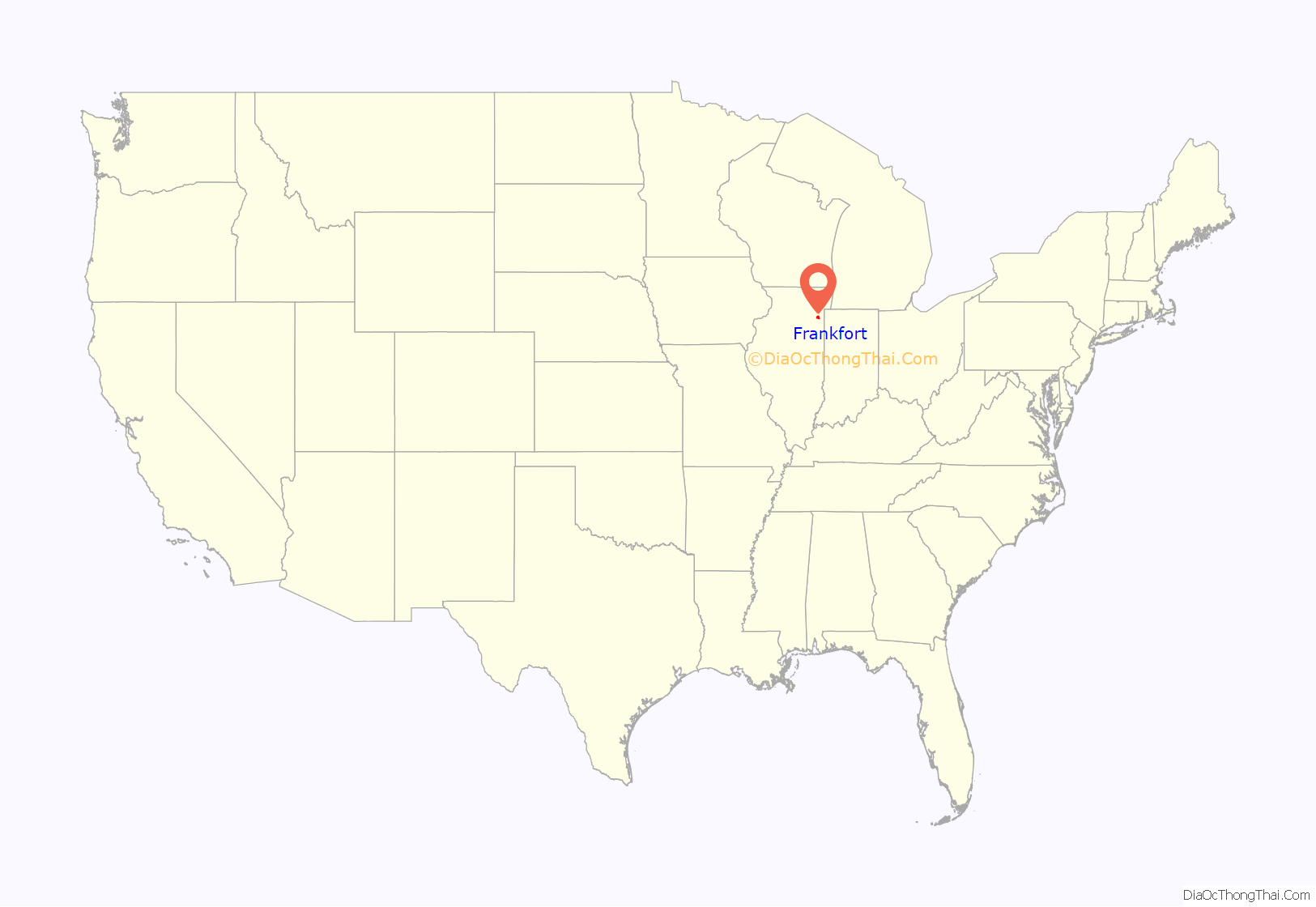
Frankfort is a village in Will County and Cook County in the U.S. state of Illinois. It is a southern suburb of Chicago, and is approximately 28 miles (45 km) south of the city. As of the 2020 census, the population was 20,296.
Frankfort’s historic downtown area contains the Frankfort Grainery, Breidert Green, and a portion of the Old Plank Road Trail, a 22 mile-long paved recreation trail. The village also contains Commissioners Park and multiple schools, including Lincoln-Way East High School and Dr. Julian Rogus School.
| Name: | Frankfort village |
|---|---|
| LSAD Code: | 47 |
| LSAD Description: | village (suffix) |
| State: | Illinois |
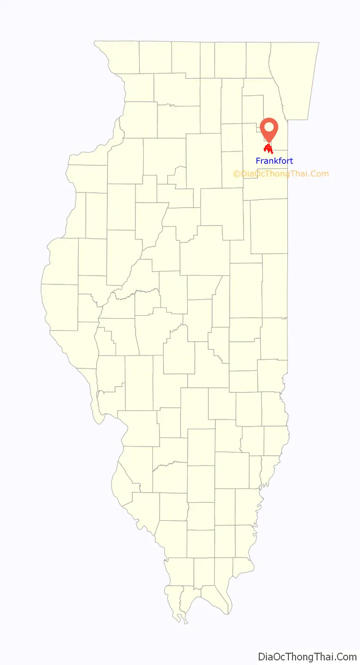
| County: | Cook County, Will County |
| Incorporated: | 1879 |
| Total Area: | 15.79 sq mi (40.91 km²) |
| Land Area: | 15.79 sq mi (40.91 km²) |
| Water Area: | 0.00 sq mi (0.00 km²) 0% |
| Total Population: | 20,296 |
| Population Density: | 1,285.04/sq mi (496.14/km²) |
| Area code: | 815 |
| FIPS code: | 1727624 |
| Website: | villageoffrankfort.com |
Online Interactive Map
Click on ![]() to view map in "full screen" mode.
to view map in "full screen" mode.
Frankfort location map. Where is Frankfort village?
History
First inhabited by Native Americans, including the Potawatomi and Sac and Fox tribes, Frankfort was used as a conduit between the Des Plaines and St. Joseph rivers. Originally, the area was part of the Virginia Territory before the French signed a treaty with Manitoqua, the Potawatomi chief, for land in the Prestwick area. The first pioneers came to Frankfort in the early 1830s by means of the Des Plaines River from the southwest and by wagon from the east along the Sauk Trail, a roadway that still exists today.
William Rice, the first non-native settler, made a permanent settlement in Frankfort in 1831. While the first pioneers, coming mainly from the New England colonies, were mostly of English and Scottish descent, German settlers made the village of Frankfort a reality. Later in the 1840s German settlers migrated from Germany to Frankfort. They had fled harsh conditions in their homeland by coming to America and proved to be very industrious and experienced farmers as they soon bought most of the fertile farm land from the “Yankees”, who were more inclined to provide services for local needs. Establishing both ownership and pride in the area, the German settlers implemented the first system of resident concern for local lands, which has been maintained ever since.
What is now known as Frankfort Township was originally part of the Hickory Creek Precinct. Will County was originally divided into ten precincts. The county, in 1850, was changed to the township form of government. Frankfort Township was named by Frederick Cappel after his native city, Frankfurt am Main, Germany. In 1855 the Joliet and Northern Indiana Railroad built a line through an area linking Joliet, Illinois, with Lake Station, Indiana. The J&NI Railroad was leased to the Michigan Central Railroad, and service was implemented in July 1855. Nelson D. Elwood, an officer of the rail line, and Sherman Bowen, a Joliet attorney and real estate man, jointly platted a village of around 23 acres (9.3 ha) in March 1855 and named it Frankfort after the township. It was commonly referred to as “Frankfort Station” because of the railroad depot located there, but when the village was incorporated, the “station” was dropped from the name.
John McDonald became the first railroad agent in 1857.
In 1879, the village of Frankfort was incorporated, and elected John McDonald as the first Village President. Along with the establishment of the government, among the first undertakings of the newly formed administration was the institution of land use policies. Early plans that were recorded indicated a traditional grid pattern with residential uses surrounding the business district and railroad line and additional land provided for schools and public open spaces.
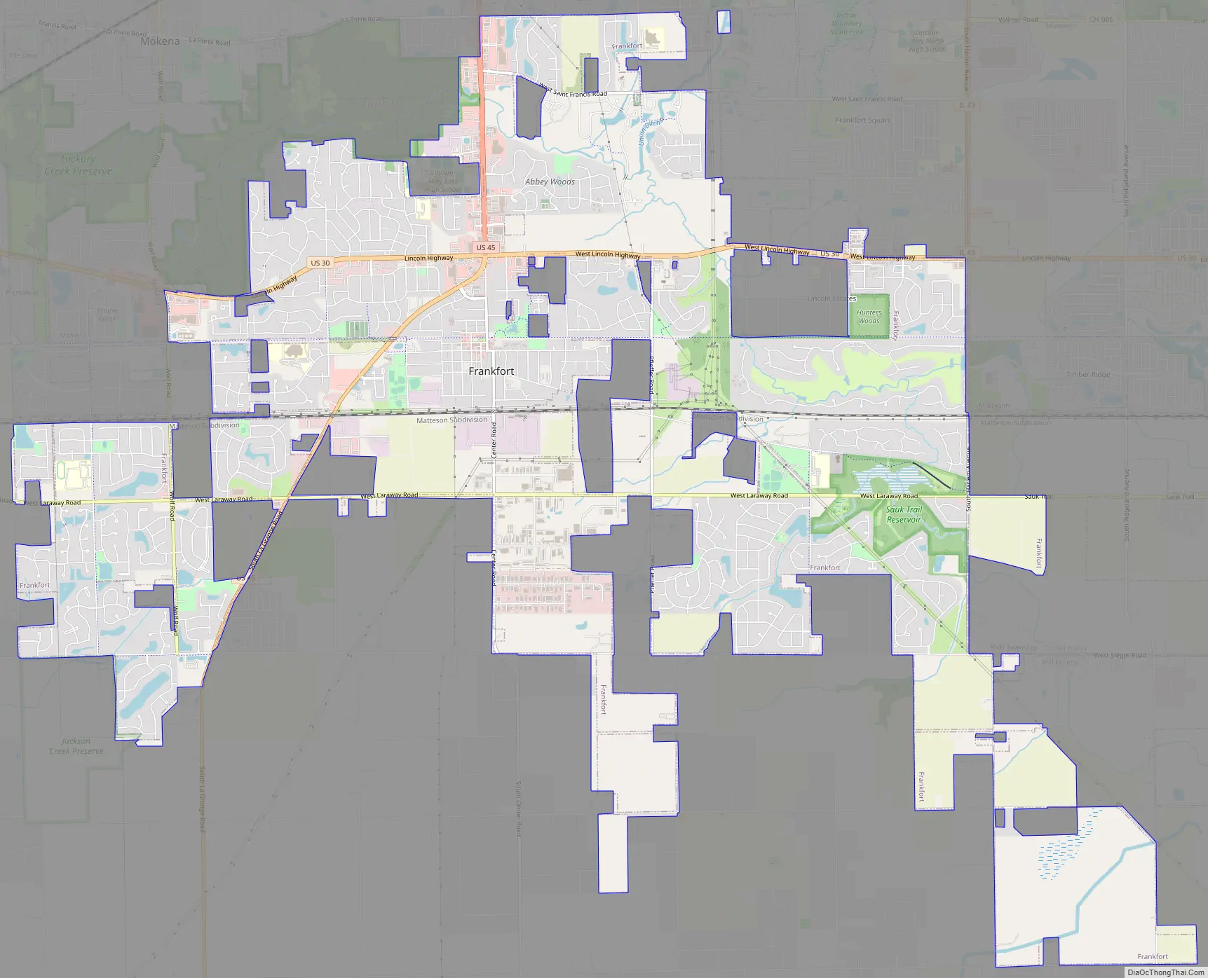
Frankfort Road Map
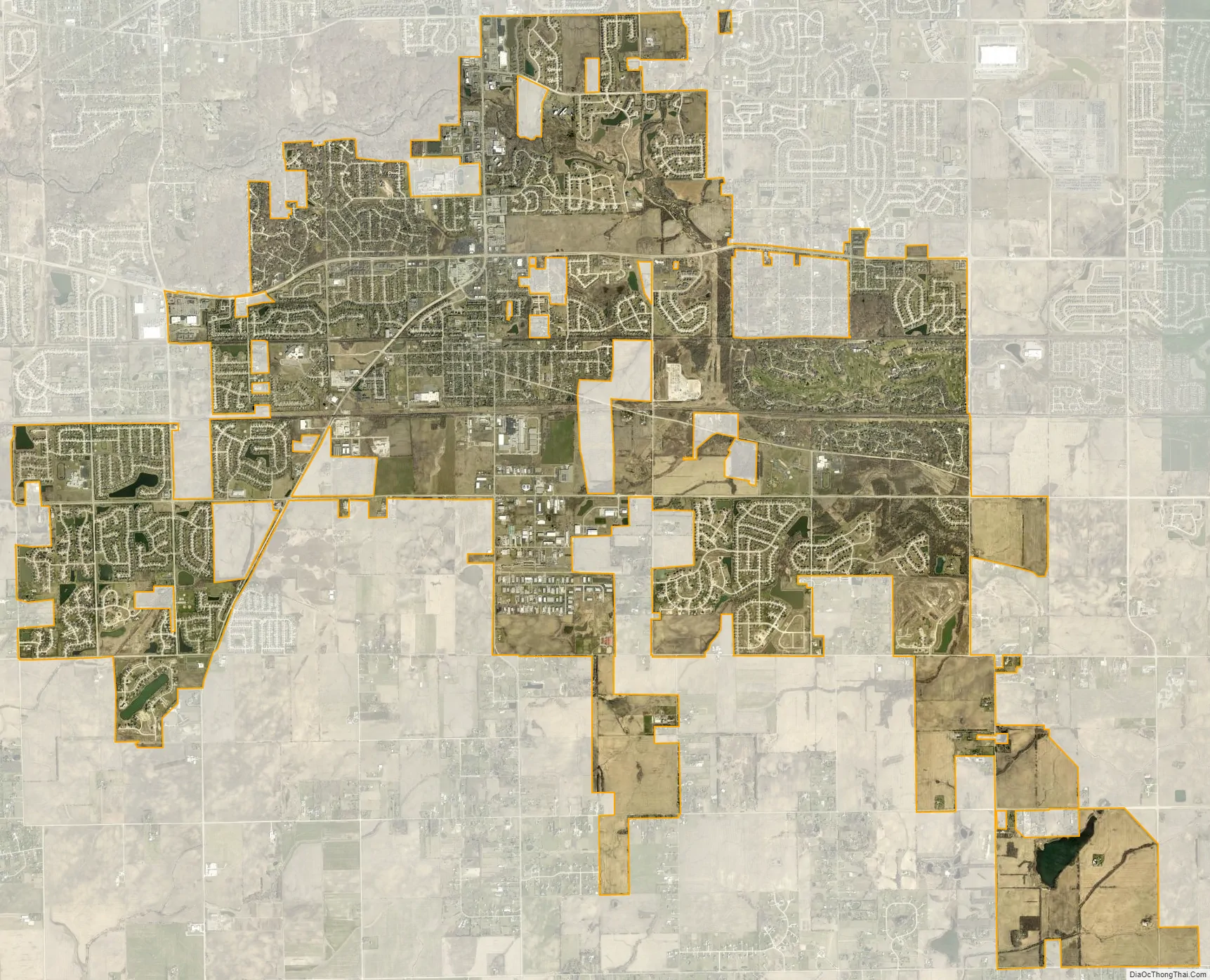
Frankfort city Satellite Map
Geography
Frankfort is located at 41°29′53″N 87°50′58″W / 41.49806°N 87.84944°W / 41.49806; -87.84944 (41.498133, -87.849549).
According to the 2021 census gazetteer files, Frankfort has a total area of 15.79 square miles (40.90 km), all land.
Frankfort is located in the Chicago Metropolitan area, and is approximately 28 miles south of Chicago.
An unincorporated area north of the village of Frankfort (in Frankfort Township) is a census-designated place known as Frankfort Square.
The village is bordered by Richton Park to the east, Tinley Park, Frankfort Square and Matteson to the northeast, Mokena and New Lenox to the west and Monee and University Park to the southeast.
See also
Map of Illinois State and its subdivision:- Adams
- Alexander
- Bond
- Boone
- Brown
- Bureau
- Calhoun
- Carroll
- Cass
- Champaign
- Christian
- Clark
- Clay
- Clinton
- Coles
- Cook
- Crawford
- Cumberland
- De Kalb
- De Witt
- Douglas
- Dupage
- Edgar
- Edwards
- Effingham
- Fayette
- Ford
- Franklin
- Fulton
- Gallatin
- Greene
- Grundy
- Hamilton
- Hancock
- Hardin
- Henderson
- Henry
- Iroquois
- Jackson
- Jasper
- Jefferson
- Jersey
- Jo Daviess
- Johnson
- Kane
- Kankakee
- Kendall
- Knox
- La Salle
- Lake
- Lake Michigan
- Lawrence
- Lee
- Livingston
- Logan
- Macon
- Macoupin
- Madison
- Marion
- Marshall
- Mason
- Massac
- McDonough
- McHenry
- McLean
- Menard
- Mercer
- Monroe
- Montgomery
- Morgan
- Moultrie
- Ogle
- Peoria
- Perry
- Piatt
- Pike
- Pope
- Pulaski
- Putnam
- Randolph
- Richland
- Rock Island
- Saint Clair
- Saline
- Sangamon
- Schuyler
- Scott
- Shelby
- Stark
- Stephenson
- Tazewell
- Union
- Vermilion
- Wabash
- Warren
- Washington
- Wayne
- White
- Whiteside
- Will
- Williamson
- Winnebago
- Woodford
- Alabama
- Alaska
- Arizona
- Arkansas
- California
- Colorado
- Connecticut
- Delaware
- District of Columbia
- Florida
- Georgia
- Hawaii
- Idaho
- Illinois
- Indiana
- Iowa
- Kansas
- Kentucky
- Louisiana
- Maine
- Maryland
- Massachusetts
- Michigan
- Minnesota
- Mississippi
- Missouri
- Montana
- Nebraska
- Nevada
- New Hampshire
- New Jersey
- New Mexico
- New York
- North Carolina
- North Dakota
- Ohio
- Oklahoma
- Oregon
- Pennsylvania
- Rhode Island
- South Carolina
- South Dakota
- Tennessee
- Texas
- Utah
- Vermont
- Virginia
- Washington
- West Virginia
- Wisconsin
- Wyoming


