Germantown is a village in Clinton County, Illinois, United States. The population was 1,324 at the 2020 census.
| Name: | Germantown village |
|---|---|
| LSAD Code: | 47 |
| LSAD Description: | village (suffix) |
| State: | Illinois |
| County: | Clinton County |
| Elevation: | 436 ft (133 m) |
| Total Area: | 1.01 sq mi (2.63 km²) |
| Land Area: | 1.01 sq mi (2.63 km²) |
| Water Area: | 0.00 sq mi (0.00 km²) |
| Total Population: | 1,324 |
| Population Density: | 1,305.72/sq mi (504.26/km²) |
| Area code: | 618 |
| FIPS code: | 1729041 |
| GNISfeature ID: | 2398955 |
| Website: | www.germantownil.net |
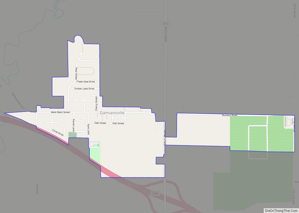
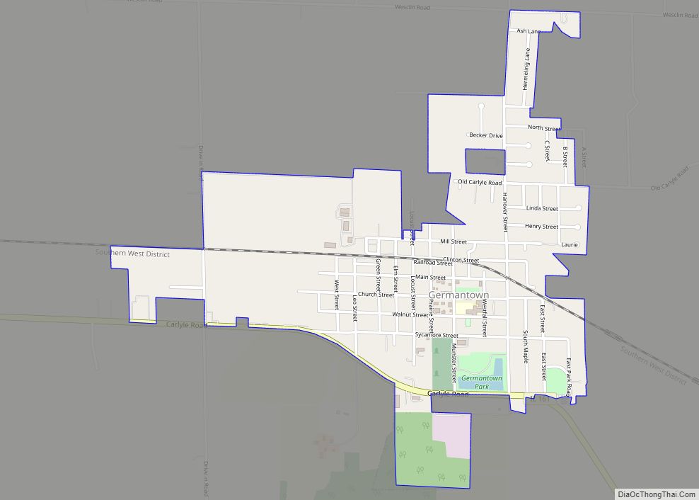
Online Interactive Map
Click on ![]() to view map in "full screen" mode.
to view map in "full screen" mode.
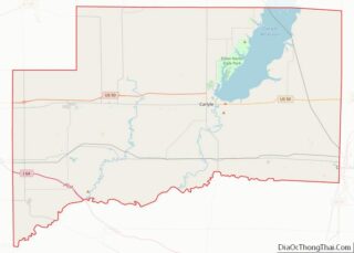
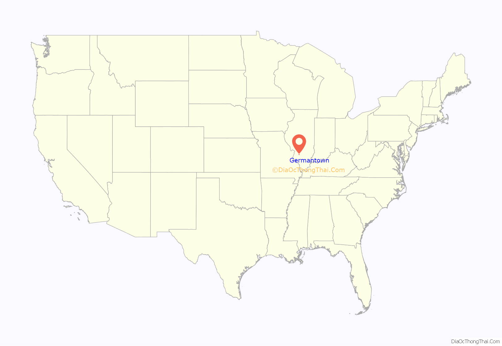
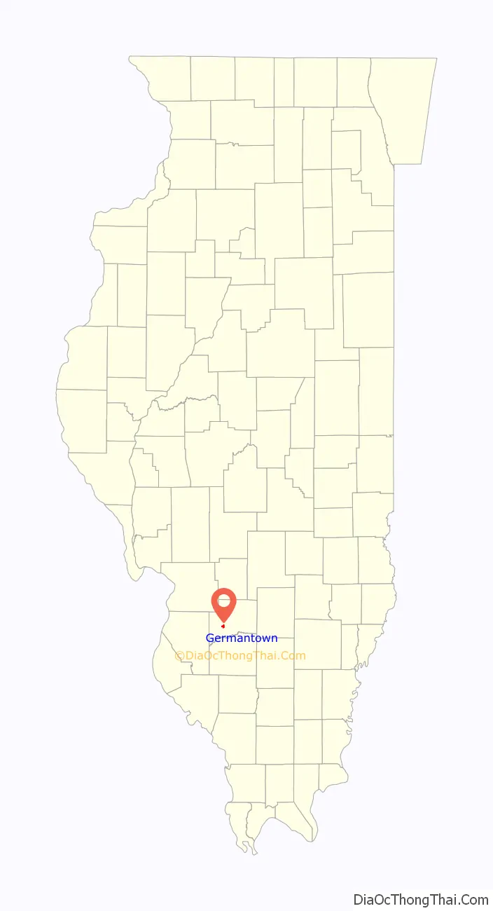
Germantown location map. Where is Germantown village?
History
The village of Germantown was established in 1833. Formerly known as “Hanover” for the city in Germany that was the hometown of the first settlers, Germantown is said to be one of the first true German settlements in Illinois.
Germantown Road Map
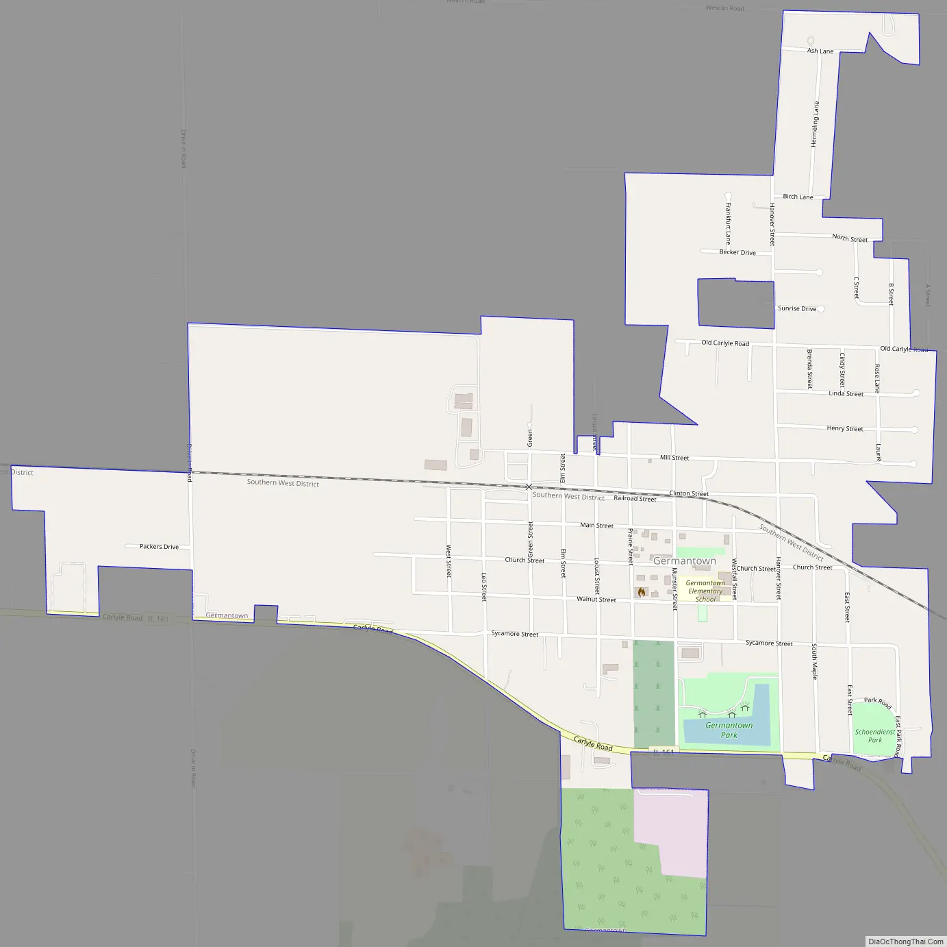
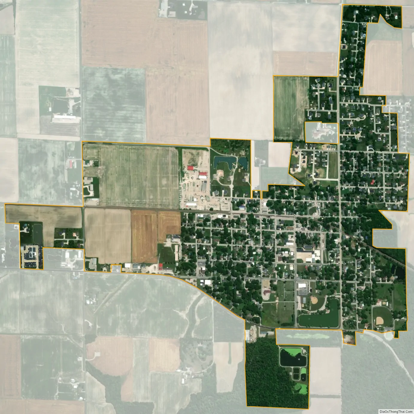
Germantown city Satellite Map
Geography
Illinois Route 161 runs along the southern border of the village, leading east 22 miles (35 km) to Centralia and west 9 miles (14 km) to New Baden. St. Louis is 39 miles (63 km) to the west via Interstate 64.
According to the 2021 census gazetteer files, Germantown has a total area of 1.01 square miles (2.62 km), all land.
See also
Map of Illinois State and its subdivision:- Adams
- Alexander
- Bond
- Boone
- Brown
- Bureau
- Calhoun
- Carroll
- Cass
- Champaign
- Christian
- Clark
- Clay
- Clinton
- Coles
- Cook
- Crawford
- Cumberland
- De Kalb
- De Witt
- Douglas
- Dupage
- Edgar
- Edwards
- Effingham
- Fayette
- Ford
- Franklin
- Fulton
- Gallatin
- Greene
- Grundy
- Hamilton
- Hancock
- Hardin
- Henderson
- Henry
- Iroquois
- Jackson
- Jasper
- Jefferson
- Jersey
- Jo Daviess
- Johnson
- Kane
- Kankakee
- Kendall
- Knox
- La Salle
- Lake
- Lake Michigan
- Lawrence
- Lee
- Livingston
- Logan
- Macon
- Macoupin
- Madison
- Marion
- Marshall
- Mason
- Massac
- McDonough
- McHenry
- McLean
- Menard
- Mercer
- Monroe
- Montgomery
- Morgan
- Moultrie
- Ogle
- Peoria
- Perry
- Piatt
- Pike
- Pope
- Pulaski
- Putnam
- Randolph
- Richland
- Rock Island
- Saint Clair
- Saline
- Sangamon
- Schuyler
- Scott
- Shelby
- Stark
- Stephenson
- Tazewell
- Union
- Vermilion
- Wabash
- Warren
- Washington
- Wayne
- White
- Whiteside
- Will
- Williamson
- Winnebago
- Woodford
- Alabama
- Alaska
- Arizona
- Arkansas
- California
- Colorado
- Connecticut
- Delaware
- District of Columbia
- Florida
- Georgia
- Hawaii
- Idaho
- Illinois
- Indiana
- Iowa
- Kansas
- Kentucky
- Louisiana
- Maine
- Maryland
- Massachusetts
- Michigan
- Minnesota
- Mississippi
- Missouri
- Montana
- Nebraska
- Nevada
- New Hampshire
- New Jersey
- New Mexico
- New York
- North Carolina
- North Dakota
- Ohio
- Oklahoma
- Oregon
- Pennsylvania
- Rhode Island
- South Carolina
- South Dakota
- Tennessee
- Texas
- Utah
- Vermont
- Virginia
- Washington
- West Virginia
- Wisconsin
- Wyoming