Girard is a city in Macoupin County, Illinois, United States. The population was 1,785 at the 2020 census, down from 2,103 in 2010.
| Name: | Girard city |
|---|---|
| LSAD Code: | 25 |
| LSAD Description: | city (suffix) |
| State: | Illinois |
| County: | Macoupin County |
| Elevation: | 669 ft (204 m) |
| Total Area: | 0.93 sq mi (2.42 km²) |
| Land Area: | 0.93 sq mi (2.42 km²) |
| Water Area: | 0.00 sq mi (0.00 km²) |
| Total Population: | 1,785 |
| Population Density: | 1,911.13/sq mi (737.91/km²) |
| ZIP code: | 62640 |
| Area code: | 217 |
| FIPS code: | 1729392 |
| GNISfeature ID: | 2394904 |
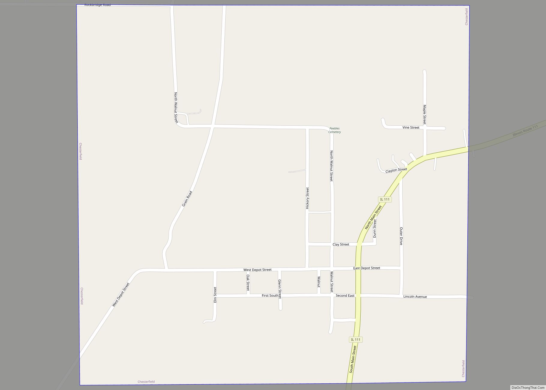
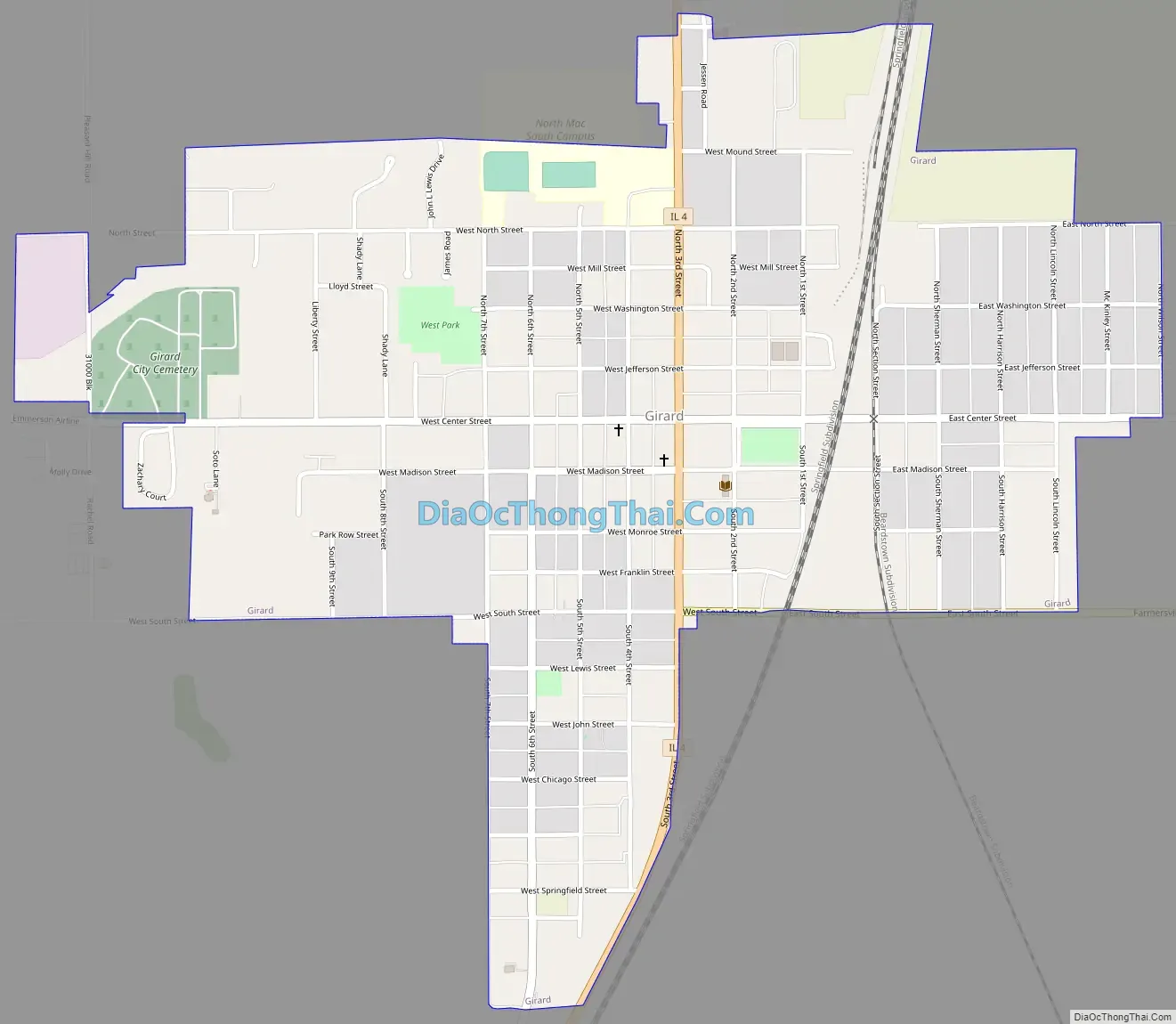
Online Interactive Map
Click on ![]() to view map in "full screen" mode.
to view map in "full screen" mode.
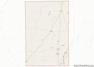
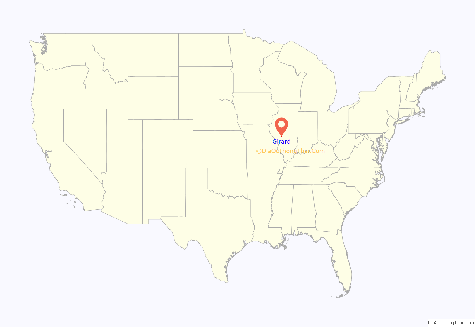
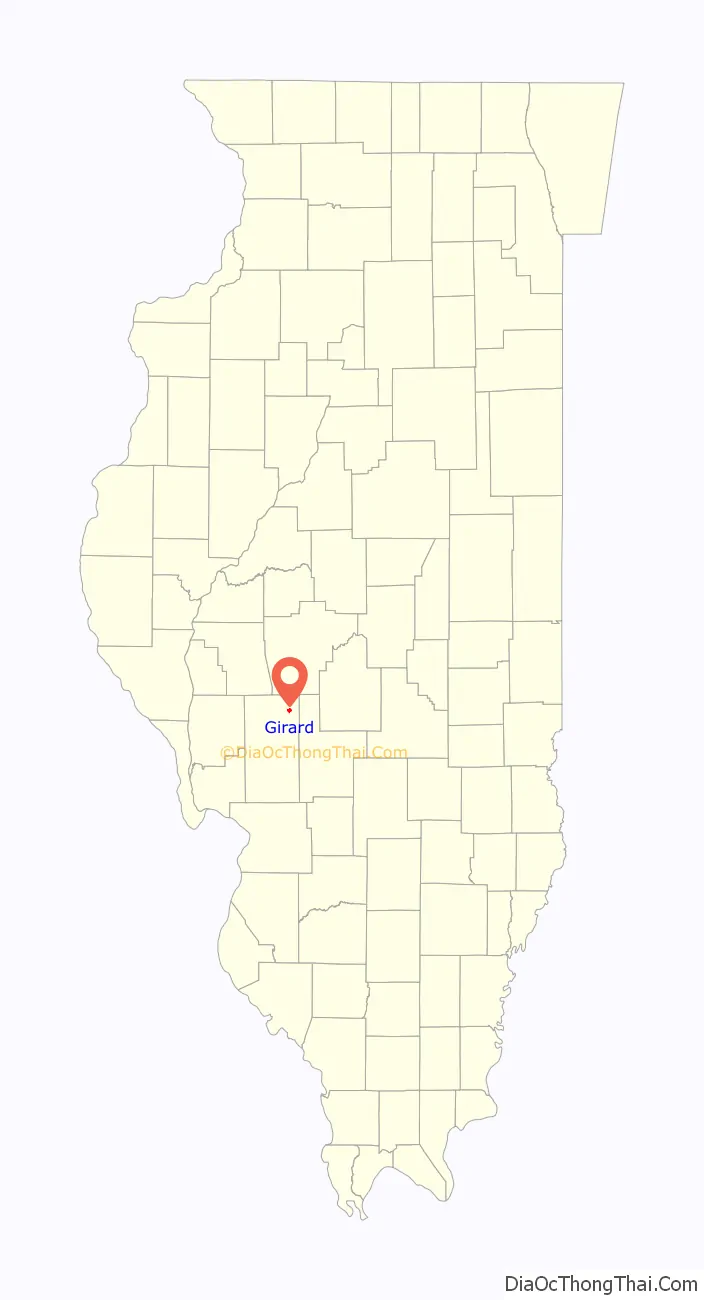
Girard location map. Where is Girard city?
History
Girard is named for Stephen Girard. When the village incorporated as a city, it became politically separate from Girard Township which surrounded it.
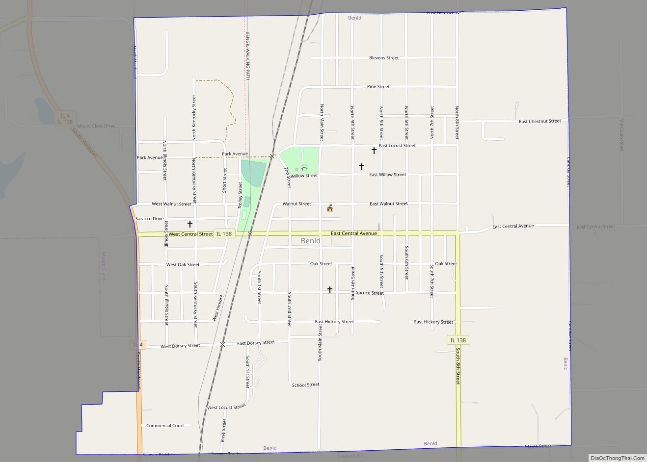
Girard Road Map
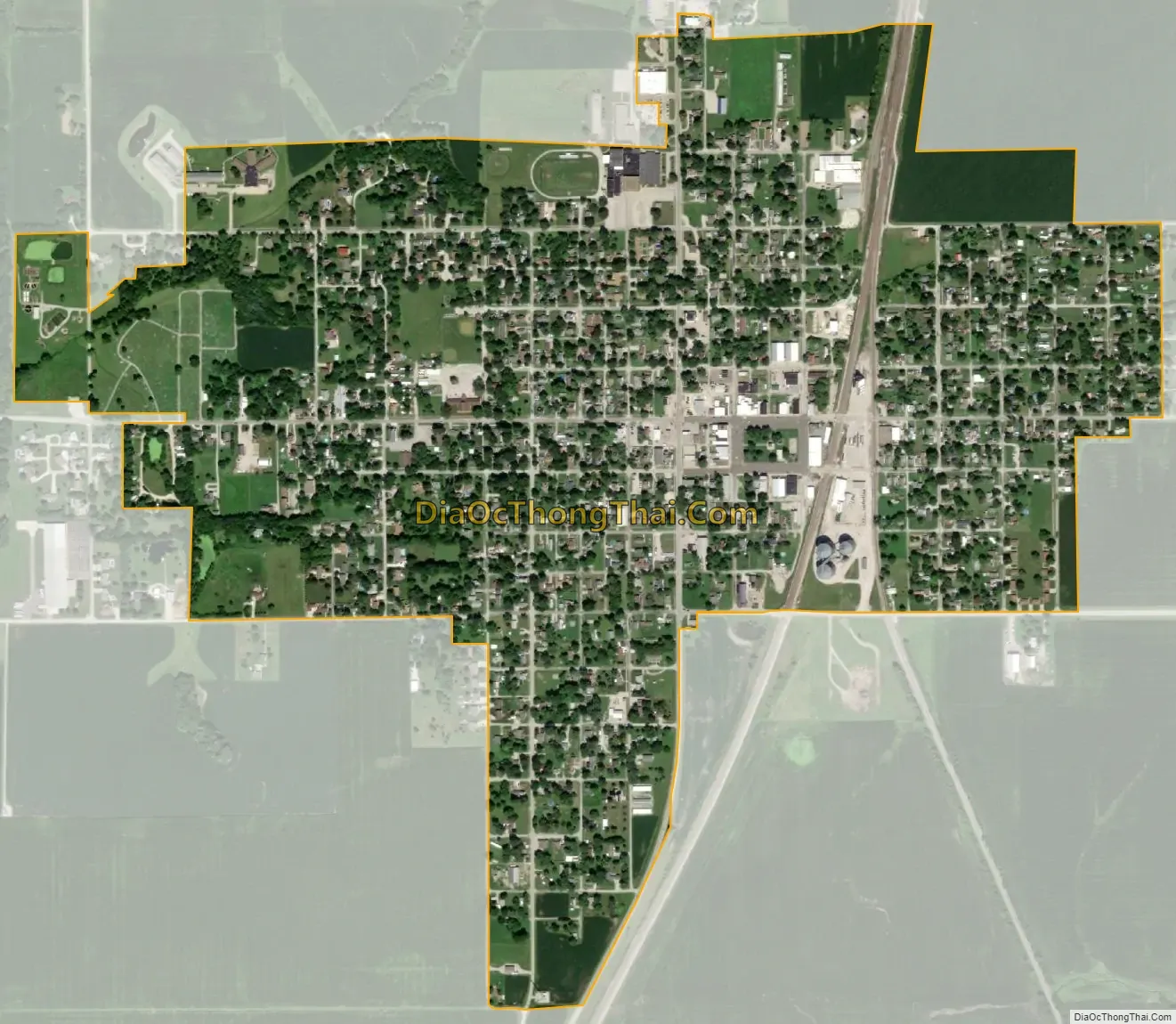
Girard city Satellite Map
Geography
Girard is located in northeastern Macoupin County at 39°26′45″N 89°46′53″W / 39.44583°N 89.78139°W / 39.44583; -89.78139 (39.445947, -89.781253). Illinois Route 4 passes through the center of town as Third Street, leading southwest 14 miles (23 km) to Carlinville, the county seat, and north-northeast 26 miles (42 km) to Springfield, the state capital.
According to the U.S. Census Bureau, Girard has a total area of 0.93 square miles (2.41 km), all land. The city drains west to tributaries of the East Fork of Otter Creek, flowing southwest to Hodges and then Macoupin Creek, a west-flowing tributary of the Illinois River. Sunset Lake and Otter Lake are 4 and 6 miles (6 and 10 km) west of Girard, respectively.
See also
Map of Illinois State and its subdivision:- Adams
- Alexander
- Bond
- Boone
- Brown
- Bureau
- Calhoun
- Carroll
- Cass
- Champaign
- Christian
- Clark
- Clay
- Clinton
- Coles
- Cook
- Crawford
- Cumberland
- De Kalb
- De Witt
- Douglas
- Dupage
- Edgar
- Edwards
- Effingham
- Fayette
- Ford
- Franklin
- Fulton
- Gallatin
- Greene
- Grundy
- Hamilton
- Hancock
- Hardin
- Henderson
- Henry
- Iroquois
- Jackson
- Jasper
- Jefferson
- Jersey
- Jo Daviess
- Johnson
- Kane
- Kankakee
- Kendall
- Knox
- La Salle
- Lake
- Lake Michigan
- Lawrence
- Lee
- Livingston
- Logan
- Macon
- Macoupin
- Madison
- Marion
- Marshall
- Mason
- Massac
- McDonough
- McHenry
- McLean
- Menard
- Mercer
- Monroe
- Montgomery
- Morgan
- Moultrie
- Ogle
- Peoria
- Perry
- Piatt
- Pike
- Pope
- Pulaski
- Putnam
- Randolph
- Richland
- Rock Island
- Saint Clair
- Saline
- Sangamon
- Schuyler
- Scott
- Shelby
- Stark
- Stephenson
- Tazewell
- Union
- Vermilion
- Wabash
- Warren
- Washington
- Wayne
- White
- Whiteside
- Will
- Williamson
- Winnebago
- Woodford
- Alabama
- Alaska
- Arizona
- Arkansas
- California
- Colorado
- Connecticut
- Delaware
- District of Columbia
- Florida
- Georgia
- Hawaii
- Idaho
- Illinois
- Indiana
- Iowa
- Kansas
- Kentucky
- Louisiana
- Maine
- Maryland
- Massachusetts
- Michigan
- Minnesota
- Mississippi
- Missouri
- Montana
- Nebraska
- Nevada
- New Hampshire
- New Jersey
- New Mexico
- New York
- North Carolina
- North Dakota
- Ohio
- Oklahoma
- Oregon
- Pennsylvania
- Rhode Island
- South Carolina
- South Dakota
- Tennessee
- Texas
- Utah
- Vermont
- Virginia
- Washington
- West Virginia
- Wisconsin
- Wyoming