Carlinville is a city and the county seat of Macoupin County, Illinois, United States. As of the 2020 census, the population was 5,710.
It is the home of Blackburn College, a small college affiliated with the Presbyterian church. The city is the former home of Prairie Farms Dairy.
| Name: | Carlinville city |
|---|---|
| LSAD Code: | 25 |
| LSAD Description: | city (suffix) |
| State: | Illinois |
| County: | Macoupin County |
| Founded: | 1865 |
| Elevation: | 617 ft (188 m) |
| Total Area: | 3.37 sq mi (8.72 km²) |
| Land Area: | 3.37 sq mi (8.72 km²) |
| Total Population: | 5,710 |
| Population Density: | 1,694.86/sq mi (654.48/km²) |
| ZIP code: | 62626 |
| Area code: | 217 |
| FIPS code: | 1711202 |
| GNISfeature ID: | 2393743 |
| Website: | www.cityofcarlinville.com |
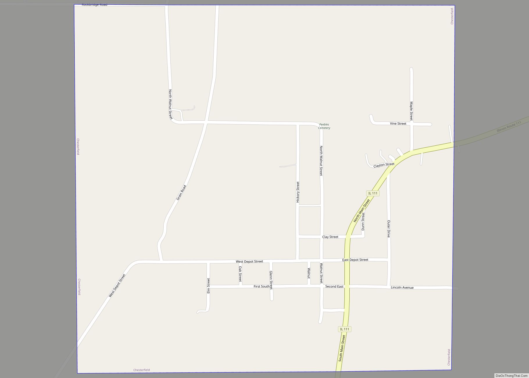
Online Interactive Map
Click on ![]() to view map in "full screen" mode.
to view map in "full screen" mode.
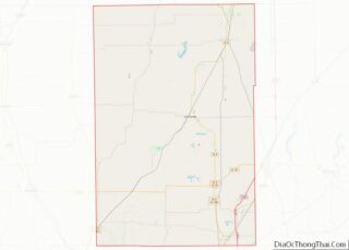
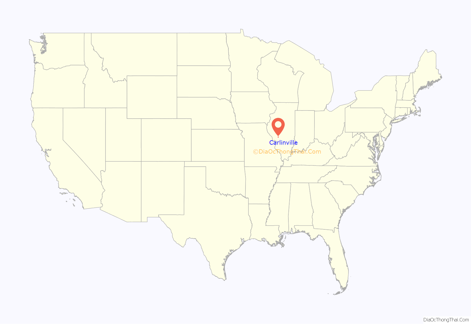
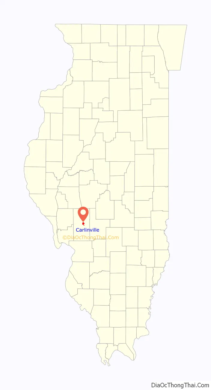
Carlinville location map. Where is Carlinville city?
History
Carlinville is named for Thomas Carlin, seventh governor of Illinois, who as a member of the state legislature was instrumental in creating Macoupin County.
Carlinville has long been a site of Illinois history, and played host to many presidential hopefuls via campaign stops at a time in American history when railway routes produced many visits by politicians. Perhaps the largest and most important hallmark of Carlinville’s history is its courthouse, the largest built outside of New York City at the time of its erection. Built in 1870 and designed by famous state capitol building architect Elijah E. Myers, the construction of Carlinville’s courthouse produced its candidacy for the location of the state capitol. Locally, it is known as “The Million Dollar Courthouse” due to its cost overruns at the time it was built.
In the early 1900s Carlinville became the site of a great many Sears Catalog Homes. An entire neighborhood was constructed of the homes and was funded, in 1918, by Standard Oil of Indiana for its mineworkers in Carlinville, at a cost of approximately one million dollars. In gratitude, Sears, Roebuck named one of its house models the “Carlin”. Today 149 of the original 156 homes still exist, the largest single repository of Sears Catalog Homes in the United States.
One notable resident of Carlinville was American entomologist Charles Robertson, who carried out what is still the single most intensive study of flower-visiting insects of a single locality (Carlinville), culminating in a 221-page book published in 1928 under the title Flowers and Insects. From among the specimens he collected in the process of doing this study, he named over 100 new species of bees and wasps. Scientists in 1970–1972 did a similar survey, and found that most of the bees noted by Robertson were still present. This is presumably due to the existence of bee habitat in hedgerows, on slopes, and in other non-agricultural land in the survey area.
Other notable Carlinvillians include nature writer and novelist Mary Hunter Austin, once called “the most intelligent woman in America” by H.G. Wells, distinguished military personnel, politicians, and others.
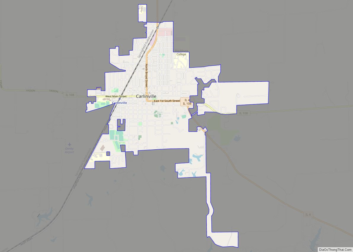
Carlinville Road Map
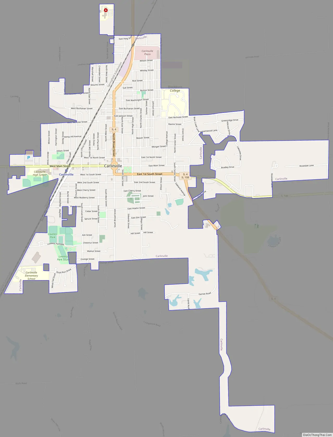
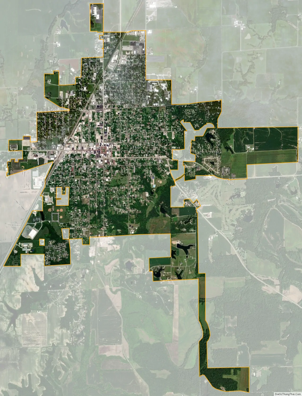
Carlinville city Satellite Map
Geography
Carlinville is in central Macoupin County. Illinois Routes 4 and 108 pass through the city center, joining as East 1st South Street through the city’s east side. Route 4 leads north-northeast 40 miles (64 km) to Springfield, the state capital, and south 21 miles (34 km) to Staunton, while Route 108 leads east 13 miles (21 km) to Interstate 55 and west 29 miles (47 km) to Carrollton.
According to the U.S. Census Bureau, Carlinville has a total area of 3.37 square miles (8.7 km), all land. Briar Creek passes through the east side of the city, joining Macoupin Creek just south of the city limits. Macoupin Creek is a west-flowing tributary of the Illinois River.
Climate
See also
Map of Illinois State and its subdivision:- Adams
- Alexander
- Bond
- Boone
- Brown
- Bureau
- Calhoun
- Carroll
- Cass
- Champaign
- Christian
- Clark
- Clay
- Clinton
- Coles
- Cook
- Crawford
- Cumberland
- De Kalb
- De Witt
- Douglas
- Dupage
- Edgar
- Edwards
- Effingham
- Fayette
- Ford
- Franklin
- Fulton
- Gallatin
- Greene
- Grundy
- Hamilton
- Hancock
- Hardin
- Henderson
- Henry
- Iroquois
- Jackson
- Jasper
- Jefferson
- Jersey
- Jo Daviess
- Johnson
- Kane
- Kankakee
- Kendall
- Knox
- La Salle
- Lake
- Lake Michigan
- Lawrence
- Lee
- Livingston
- Logan
- Macon
- Macoupin
- Madison
- Marion
- Marshall
- Mason
- Massac
- McDonough
- McHenry
- McLean
- Menard
- Mercer
- Monroe
- Montgomery
- Morgan
- Moultrie
- Ogle
- Peoria
- Perry
- Piatt
- Pike
- Pope
- Pulaski
- Putnam
- Randolph
- Richland
- Rock Island
- Saint Clair
- Saline
- Sangamon
- Schuyler
- Scott
- Shelby
- Stark
- Stephenson
- Tazewell
- Union
- Vermilion
- Wabash
- Warren
- Washington
- Wayne
- White
- Whiteside
- Will
- Williamson
- Winnebago
- Woodford
- Alabama
- Alaska
- Arizona
- Arkansas
- California
- Colorado
- Connecticut
- Delaware
- District of Columbia
- Florida
- Georgia
- Hawaii
- Idaho
- Illinois
- Indiana
- Iowa
- Kansas
- Kentucky
- Louisiana
- Maine
- Maryland
- Massachusetts
- Michigan
- Minnesota
- Mississippi
- Missouri
- Montana
- Nebraska
- Nevada
- New Hampshire
- New Jersey
- New Mexico
- New York
- North Carolina
- North Dakota
- Ohio
- Oklahoma
- Oregon
- Pennsylvania
- Rhode Island
- South Carolina
- South Dakota
- Tennessee
- Texas
- Utah
- Vermont
- Virginia
- Washington
- West Virginia
- Wisconsin
- Wyoming