Gillespie is a city in Macoupin County, Illinois, United States, and part of the Metro East region of the St. Louis metropolitan area. The population was 3,168 at the 2020 census.
| Name: | Gillespie city |
|---|---|
| LSAD Code: | 25 |
| LSAD Description: | city (suffix) |
| State: | Illinois |
| County: | Macoupin County |
| Incorporated: | 1853 |
| Elevation: | 659 ft (201 m) |
| Total Area: | 1.48 sq mi (3.8 km²) |
| Land Area: | 1.48 sq mi (3.8 km²) |
| Water Area: | 0.00 sq mi (0.0 km²) |
| Total Population: | 3,168 |
| Population Density: | 2,140.5/sq mi (826.5/km²) |
| ZIP code: | 62033 |
| Area code: | 217 |
| FIPS code: | 1729236 |
| GNISfeature ID: | 2394896 |
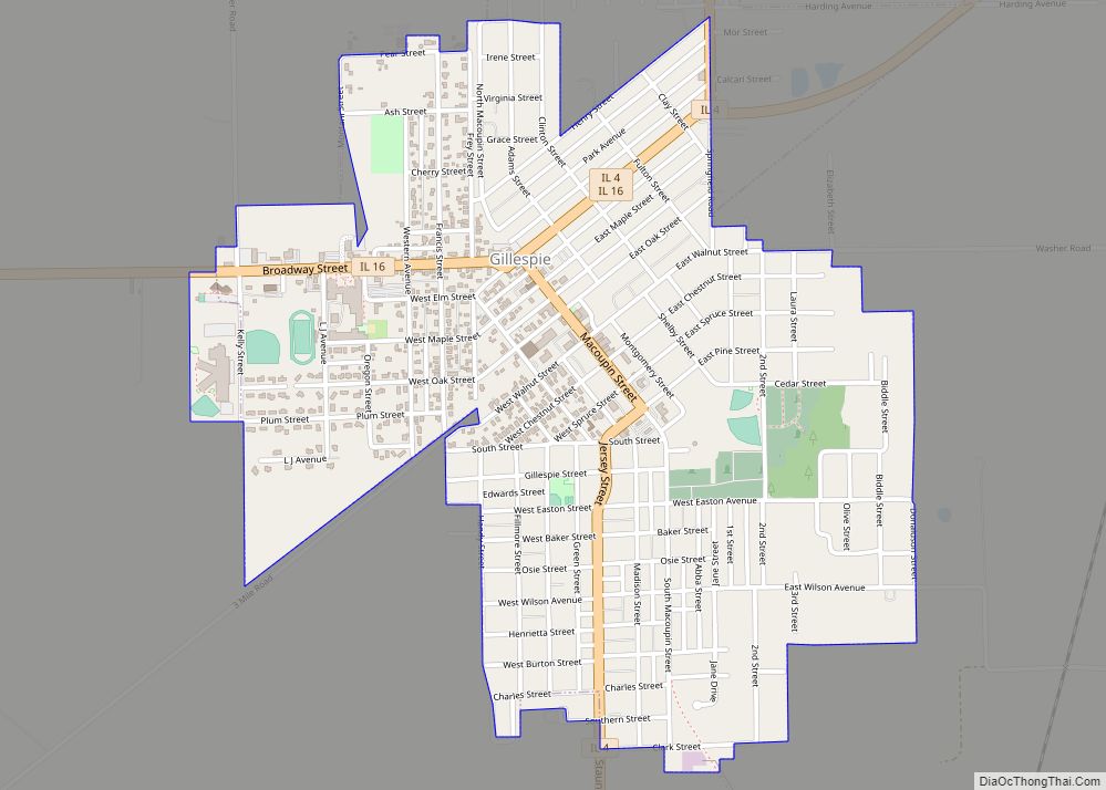
Online Interactive Map
Click on ![]() to view map in "full screen" mode.
to view map in "full screen" mode.
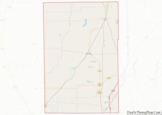
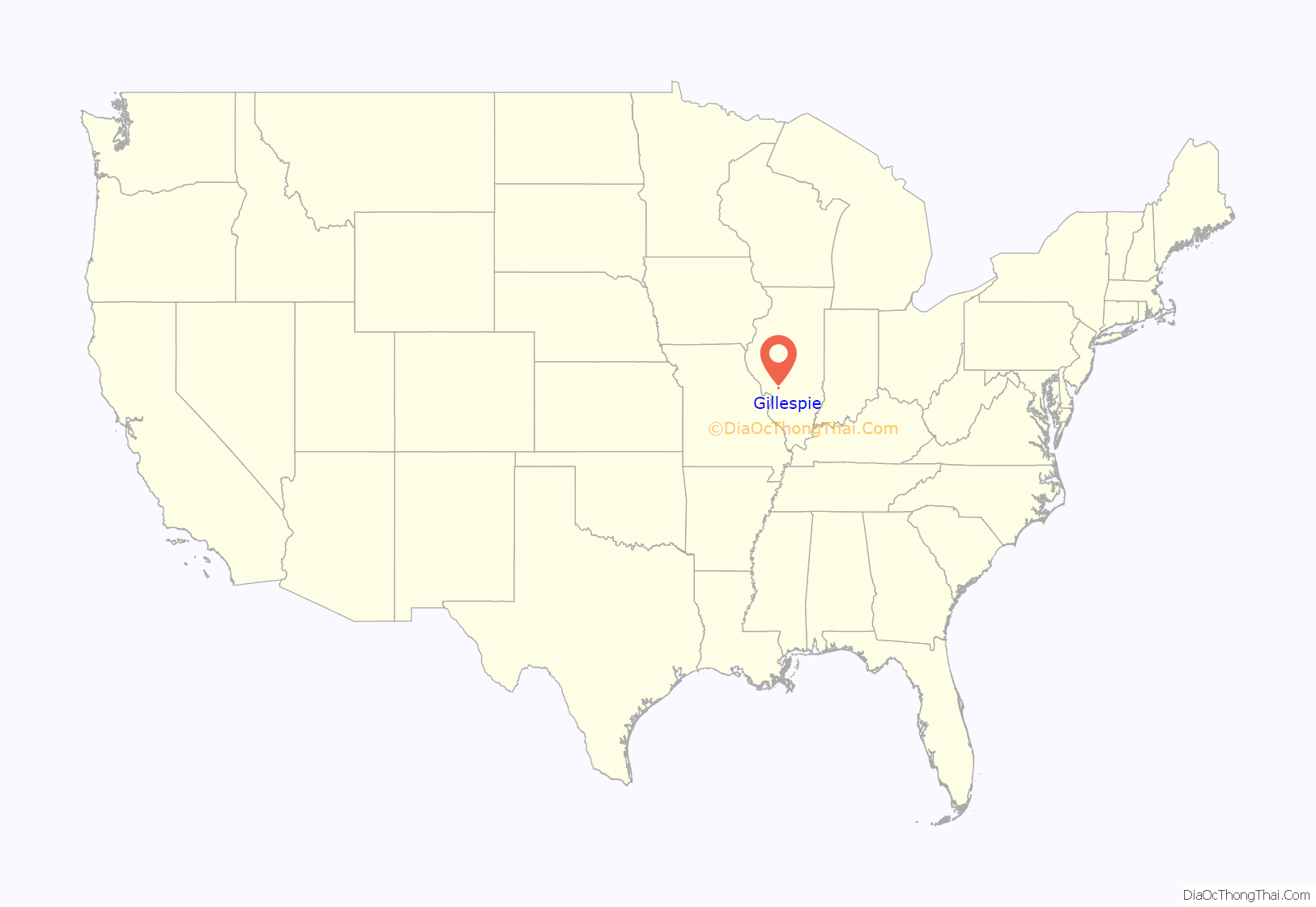
Gillespie location map. Where is Gillespie city?

History
The first group of settlers arrived to what is now Gillespie in the late 1820s from Kentucky, Ohio, and Indiana. The township thrived in the 1830s, increasing in population and businesses. In 1835 the first schoolhouse was built. Gillespie was officially incorporated as a town in the spring of 1853. By 1904, the population rose to 3,100 and there were a number of businesses, churches, and schools. On January 29, 1905, a fire swept through the business district and destroyed most businesses and some homes.
For years, Gillespie’s main source of employment were the multiple coal mines scattered throughout the township operated by the Chicago & Northwestern Railroad Company. It is said that Gillespie boasted three of the largest coal mines in the world.
Gillespie is named for Judge Joseph Gillespie, who was active in Illinois state politics.
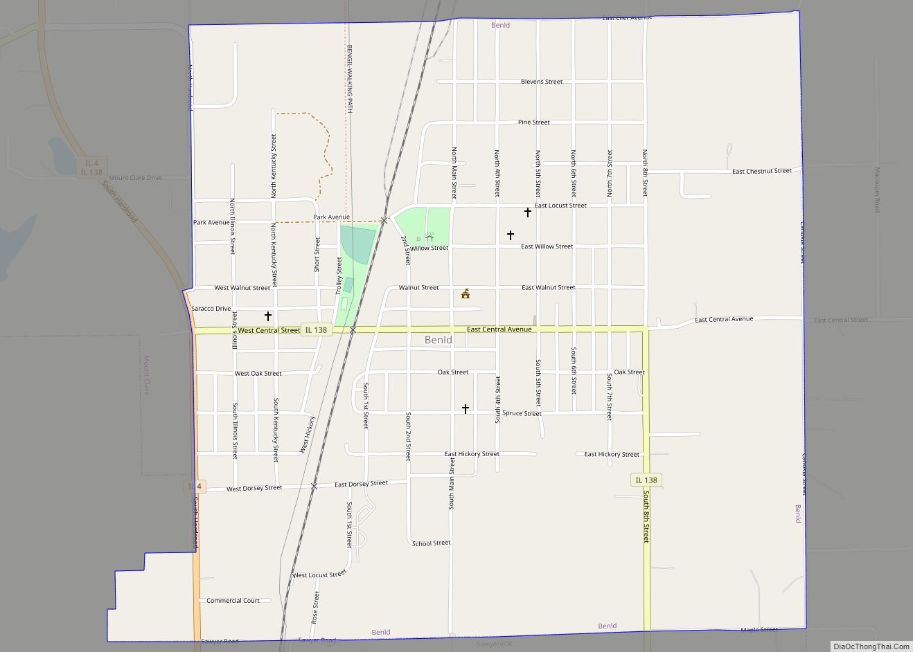
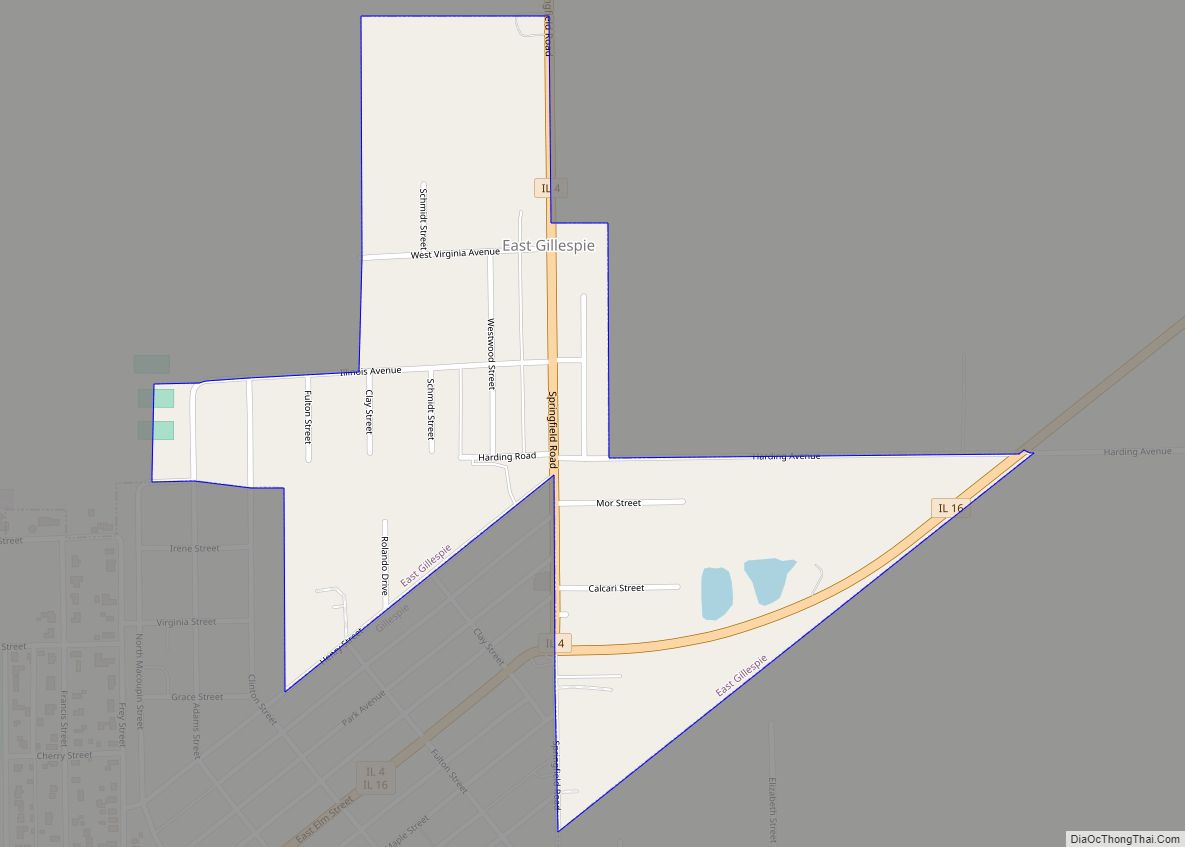
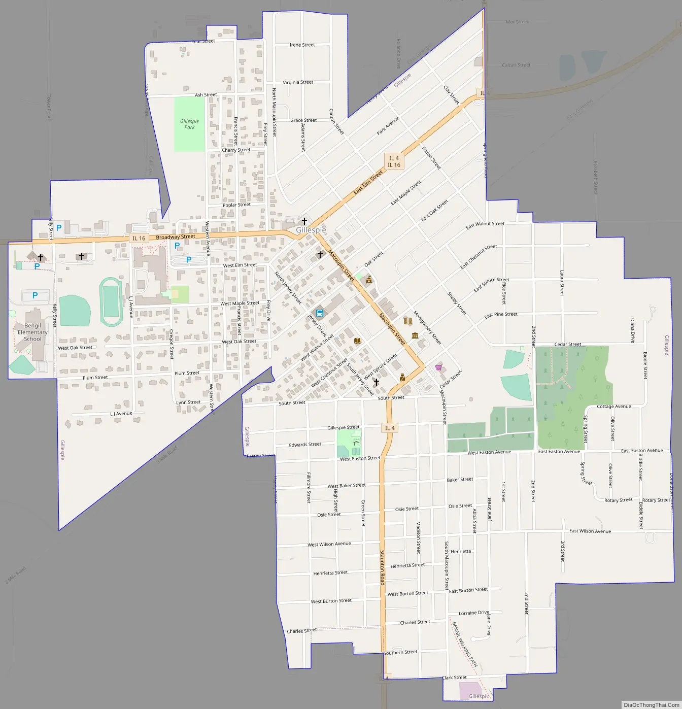
Gillespie Road Map
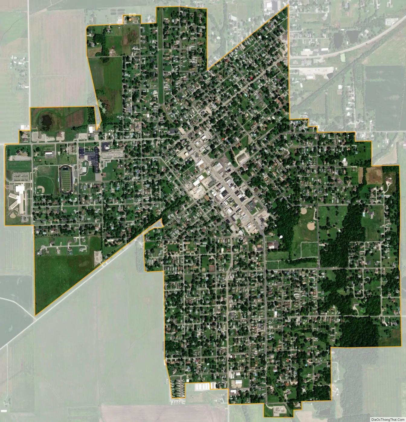
Gillespie city Satellite Map
Geography
Gillespie’s city hall pavilion
Gillespie is located mainly in eastern Gillespie Township but extends east into the west part of Cahokia Township. It is bordered to the north by the village of East Gillespie.
Illinois Routes 4 and 16 pass through Gillespie, joining in the center of town as East Elm Street. Route 4 leads north 13 miles (21 km) to Carlinville, the county seat, and south 8 miles (13 km) to Staunton. St. Louis is 47 miles (76 km) to the southwest. Route 16 leads northeast 10 miles (16 km) to Litchfield and west 28 miles (45 km) to Jerseyville.
According to the U.S. Census Bureau, Gillespie has a total area of 1.48 square miles (3.83 km), all land. The city is drained to the southeast by Bear Creek, a tributary of Cahokia Creek, which runs to the Mississippi River northeast of St. Louis. To the northwest are Old and New Gillespie Lakes, reservoirs on the Dry Fork of Macoupin Creek, a west-flowing tributary of the Illinois River. The two lakes are 3 to 5 miles (4.8 to 8.0 km) northwest of the city, and many people from surrounding towns enjoy fishing, boating, water-skiing and sunbathing there.
See also
Map of Illinois State and its subdivision:- Adams
- Alexander
- Bond
- Boone
- Brown
- Bureau
- Calhoun
- Carroll
- Cass
- Champaign
- Christian
- Clark
- Clay
- Clinton
- Coles
- Cook
- Crawford
- Cumberland
- De Kalb
- De Witt
- Douglas
- Dupage
- Edgar
- Edwards
- Effingham
- Fayette
- Ford
- Franklin
- Fulton
- Gallatin
- Greene
- Grundy
- Hamilton
- Hancock
- Hardin
- Henderson
- Henry
- Iroquois
- Jackson
- Jasper
- Jefferson
- Jersey
- Jo Daviess
- Johnson
- Kane
- Kankakee
- Kendall
- Knox
- La Salle
- Lake
- Lake Michigan
- Lawrence
- Lee
- Livingston
- Logan
- Macon
- Macoupin
- Madison
- Marion
- Marshall
- Mason
- Massac
- McDonough
- McHenry
- McLean
- Menard
- Mercer
- Monroe
- Montgomery
- Morgan
- Moultrie
- Ogle
- Peoria
- Perry
- Piatt
- Pike
- Pope
- Pulaski
- Putnam
- Randolph
- Richland
- Rock Island
- Saint Clair
- Saline
- Sangamon
- Schuyler
- Scott
- Shelby
- Stark
- Stephenson
- Tazewell
- Union
- Vermilion
- Wabash
- Warren
- Washington
- Wayne
- White
- Whiteside
- Will
- Williamson
- Winnebago
- Woodford
- Alabama
- Alaska
- Arizona
- Arkansas
- California
- Colorado
- Connecticut
- Delaware
- District of Columbia
- Florida
- Georgia
- Hawaii
- Idaho
- Illinois
- Indiana
- Iowa
- Kansas
- Kentucky
- Louisiana
- Maine
- Maryland
- Massachusetts
- Michigan
- Minnesota
- Mississippi
- Missouri
- Montana
- Nebraska
- Nevada
- New Hampshire
- New Jersey
- New Mexico
- New York
- North Carolina
- North Dakota
- Ohio
- Oklahoma
- Oregon
- Pennsylvania
- Rhode Island
- South Carolina
- South Dakota
- Tennessee
- Texas
- Utah
- Vermont
- Virginia
- Washington
- West Virginia
- Wisconsin
- Wyoming