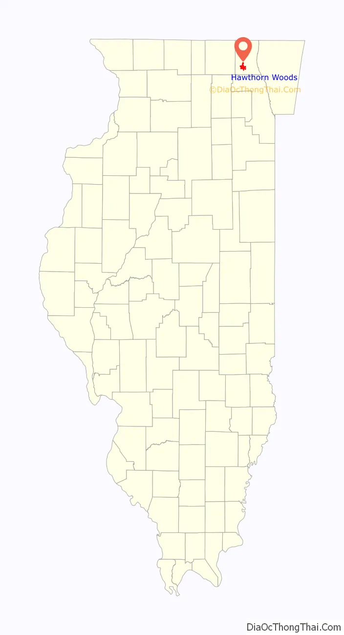
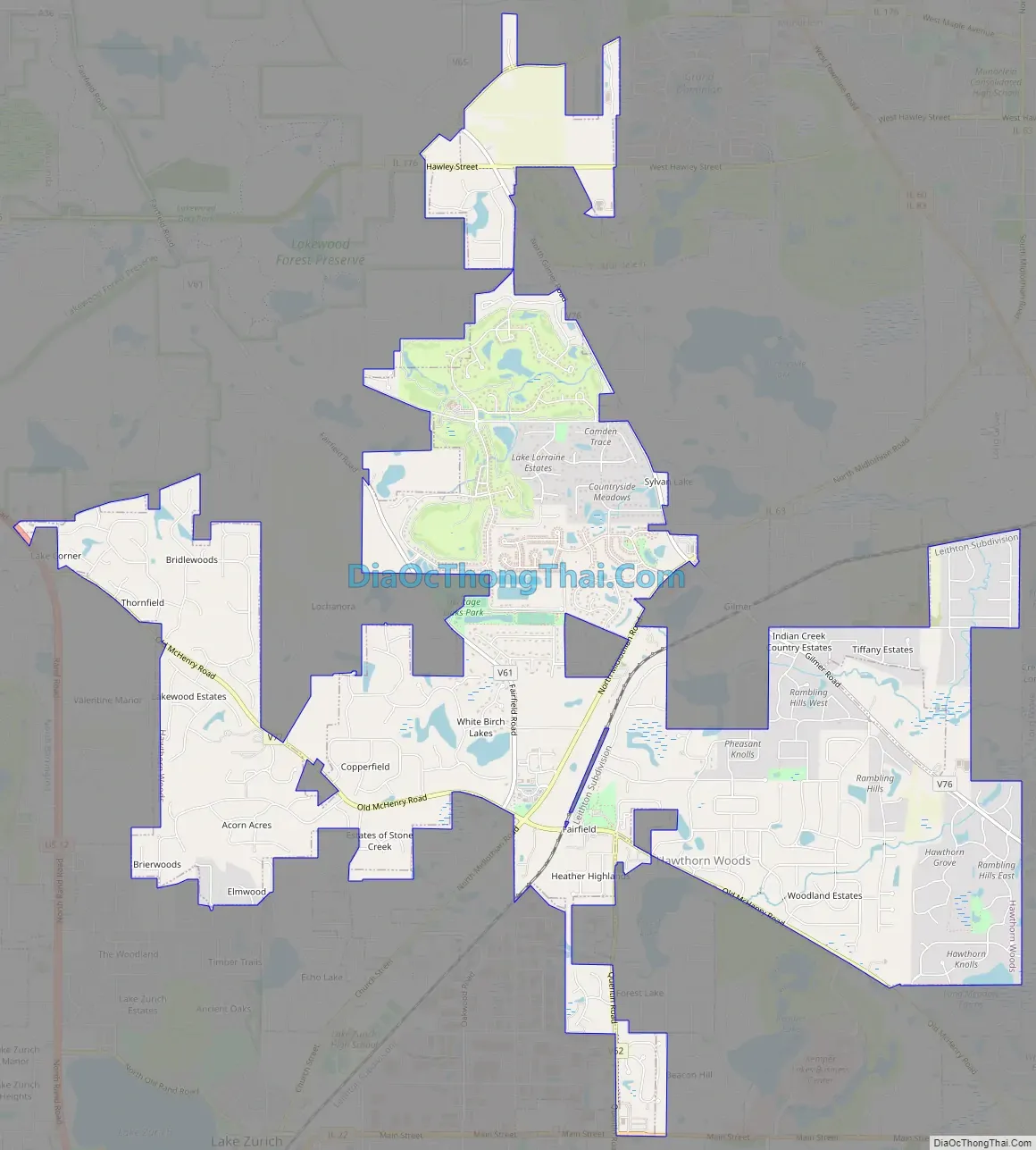
Hawthorn Woods is a village in Fremont and Ela townships in Lake County, Illinois, United States. Per the 2020 census, the population was 9,062. The village is located approximately 40 miles (64 km) northwest of downtown Chicago. Hawthorn Woods was officially incorporated in 1958. Major transportation arteries include Midlothian Road, Old McHenry Road, Algonquin Road, Halfday Road, and the Elgin, Joliet and Eastern Railway. The new Hawthorn Woods Country Club, whose golf course was designed by golf professional Arnold Palmer, is located within the village’s perimeter.
| Name: | Hawthorn Woods village |
|---|---|
| LSAD Code: | 47 |
| LSAD Description: | village (suffix) |
| State: | Illinois |
| County: | Lake County |
| Total Area: | 8.25 sq mi (21.37 km²) |
| Land Area: | 8.05 sq mi (20.84 km²) |
| Water Area: | 0.21 sq mi (0.53 km²) |
| Total Population: | 9,062 |
| Population Density: | 1,126.13/sq mi (434.80/km²) |
| Area code: | 847 |
| FIPS code: | 1733630 |
| Website: | www.vhw.org |
Online Interactive Map
Click on ![]() to view map in "full screen" mode.
to view map in "full screen" mode.
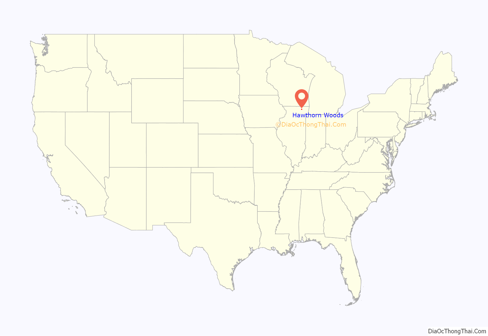
Hawthorn Woods location map. Where is Hawthorn Woods village?
History
Hawthorn Woods, previously inhabited by the Potawatomi tribe. After the famous Treaty of Chicago (1833) which brought thousands of Native Americans in the Midwest to cede their lands. Yankee farmers would later claim this land, the area became a popular destination for both German and Dutch immigrants.
The Lake County Discovery Museum, Cuneo Museum & Gardens, and the Fort Hill Heritage Museum are all accessible in Hawthorn Woods.
Hawthorn Woods Road Map
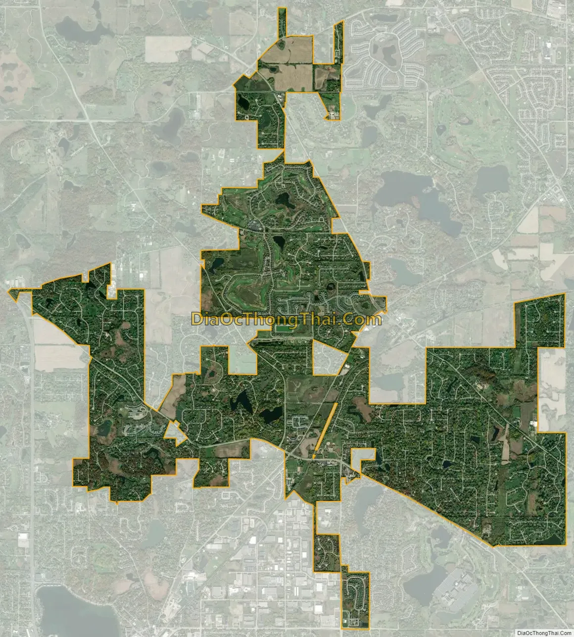
Hawthorn Woods city Satellite Map
Geography
Hawthorn Woods is located at 42°13′41″N 88°3′19″W / 42.22806°N 88.05528°W / 42.22806; -88.05528 (42.228306, -88.055319).
According to the 2010 census, Hawthorn Woods has a total area of 7.926 square miles (20.53 km), of which 7.71 square miles (19.97 km) (or 97.27%) is land and 0.216 square miles (0.56 km) (or 2.73%) is water.
See also
Map of Illinois State and its subdivision:- Adams
- Alexander
- Bond
- Boone
- Brown
- Bureau
- Calhoun
- Carroll
- Cass
- Champaign
- Christian
- Clark
- Clay
- Clinton
- Coles
- Cook
- Crawford
- Cumberland
- De Kalb
- De Witt
- Douglas
- Dupage
- Edgar
- Edwards
- Effingham
- Fayette
- Ford
- Franklin
- Fulton
- Gallatin
- Greene
- Grundy
- Hamilton
- Hancock
- Hardin
- Henderson
- Henry
- Iroquois
- Jackson
- Jasper
- Jefferson
- Jersey
- Jo Daviess
- Johnson
- Kane
- Kankakee
- Kendall
- Knox
- La Salle
- Lake
- Lake Michigan
- Lawrence
- Lee
- Livingston
- Logan
- Macon
- Macoupin
- Madison
- Marion
- Marshall
- Mason
- Massac
- McDonough
- McHenry
- McLean
- Menard
- Mercer
- Monroe
- Montgomery
- Morgan
- Moultrie
- Ogle
- Peoria
- Perry
- Piatt
- Pike
- Pope
- Pulaski
- Putnam
- Randolph
- Richland
- Rock Island
- Saint Clair
- Saline
- Sangamon
- Schuyler
- Scott
- Shelby
- Stark
- Stephenson
- Tazewell
- Union
- Vermilion
- Wabash
- Warren
- Washington
- Wayne
- White
- Whiteside
- Will
- Williamson
- Winnebago
- Woodford
- Alabama
- Alaska
- Arizona
- Arkansas
- California
- Colorado
- Connecticut
- Delaware
- District of Columbia
- Florida
- Georgia
- Hawaii
- Idaho
- Illinois
- Indiana
- Iowa
- Kansas
- Kentucky
- Louisiana
- Maine
- Maryland
- Massachusetts
- Michigan
- Minnesota
- Mississippi
- Missouri
- Montana
- Nebraska
- Nevada
- New Hampshire
- New Jersey
- New Mexico
- New York
- North Carolina
- North Dakota
- Ohio
- Oklahoma
- Oregon
- Pennsylvania
- Rhode Island
- South Carolina
- South Dakota
- Tennessee
- Texas
- Utah
- Vermont
- Virginia
- Washington
- West Virginia
- Wisconsin
- Wyoming


