Homewood is a village in Cook County, Illinois, United States. The population was 19,463 at the 2020 census.
The village sits just a few miles south of Chicago proper. It is bordered by Chicago Heights and Flossmoor to the south, Hazel Crest to the west, East Hazel Crest and Harvey to the north, Glenwood to the east, and South Holland to the northeast.
| Name: | Homewood village |
|---|---|
| LSAD Code: | 47 |
| LSAD Description: | village (suffix) |
| State: | Illinois |
| County: | Cook County |
| Founded: | 1893 |
| Elevation: | 659 ft (201 m) |
| Total Area: | 5.26 sq mi (13.63 km²) |
| Land Area: | 5.22 sq mi (13.51 km²) |
| Water Area: | 0.05 sq mi (0.12 km²) |
| Total Population: | 19,463 |
| Population Density: | 3,731.40/sq mi (1,440.74/km²) |
| Area code: | 708 |
| FIPS code: | 1735879 |
| Website: | www.homesweethomewood.com |
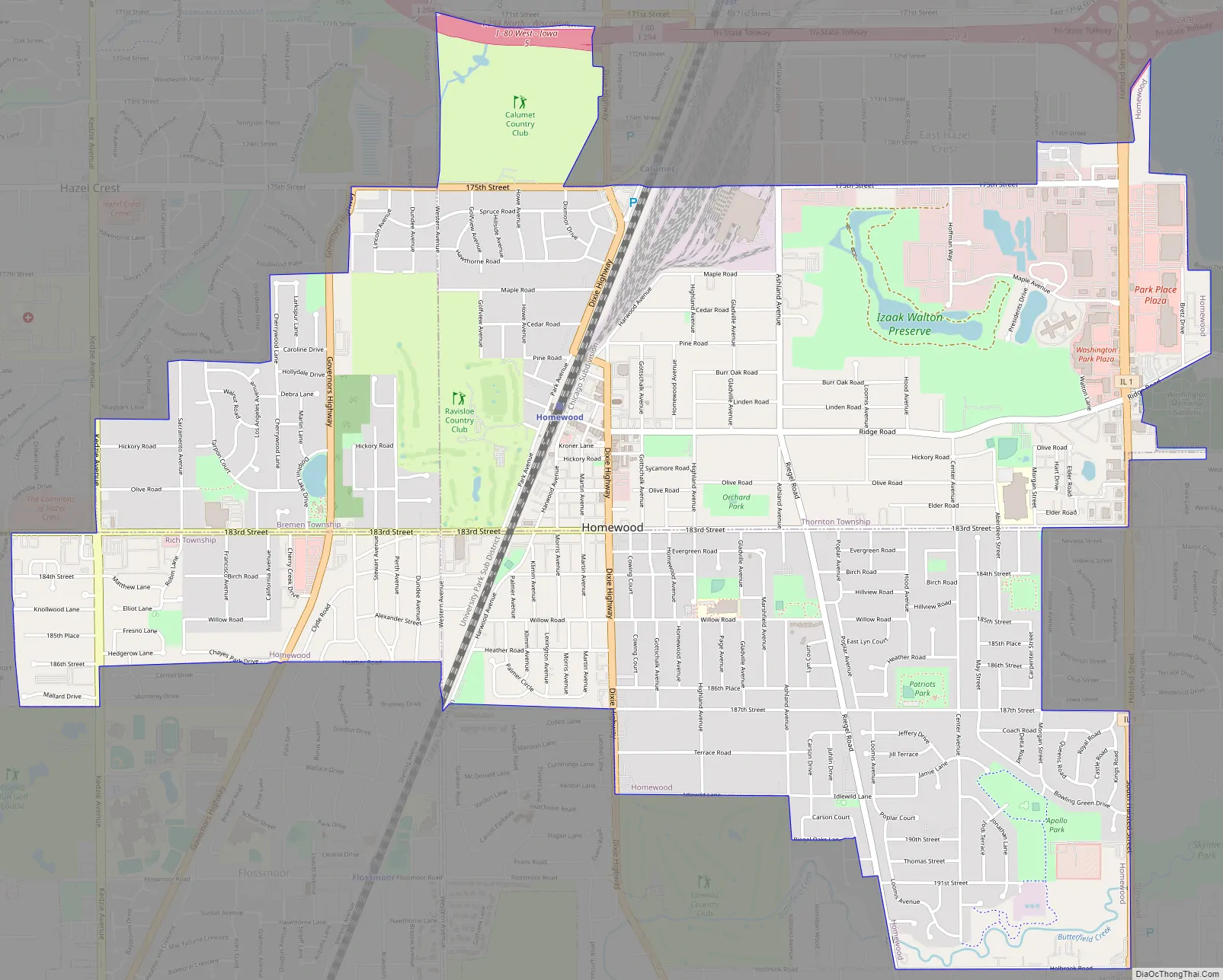
Online Interactive Map
Click on ![]() to view map in "full screen" mode.
to view map in "full screen" mode.
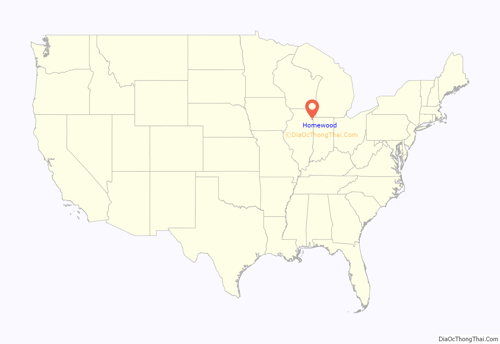
Homewood location map. Where is Homewood village?
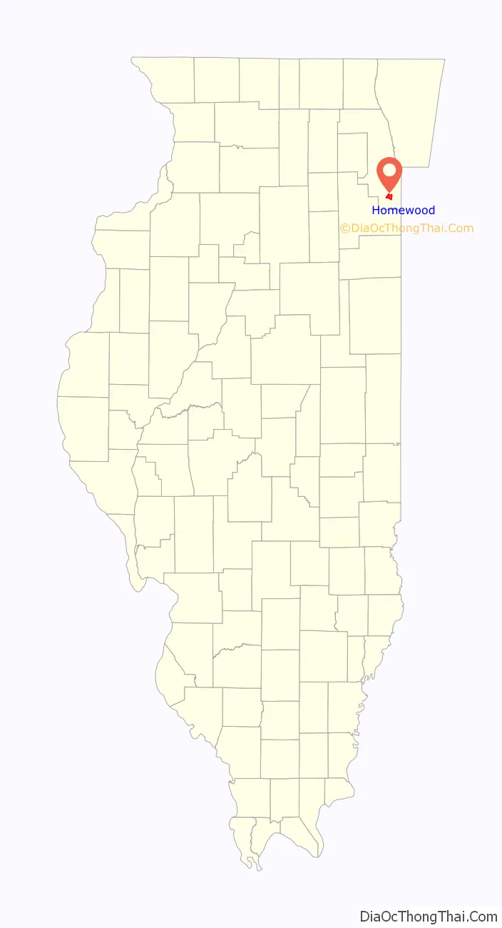
Homewood Road Map
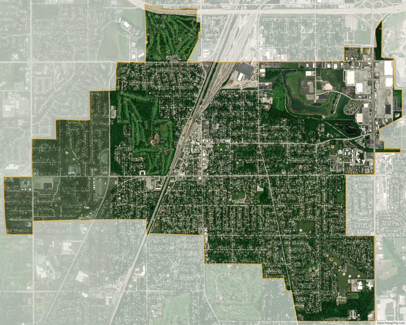
Homewood city Satellite Map
Geography
According to the 2021 census gazetteer files, Homewood has a total area of 5.26 square miles (13.62 km), of which 5.22 square miles (13.52 km) (or 99.11%) is land and 0.05 square miles (0.13 km) (or 0.89%) is water. A south suburban village, Homewood is 22 miles (35 km) due south of The Loop/downtown Chicago at 800 west and 18300 south on the Chicago grid system.
Homewood lies on the Calumet Shoreline. The ancient shoreline can be seen clearly as the sand ridge along Ridge Road.
See also
Map of Illinois State and its subdivision:- Adams
- Alexander
- Bond
- Boone
- Brown
- Bureau
- Calhoun
- Carroll
- Cass
- Champaign
- Christian
- Clark
- Clay
- Clinton
- Coles
- Cook
- Crawford
- Cumberland
- De Kalb
- De Witt
- Douglas
- Dupage
- Edgar
- Edwards
- Effingham
- Fayette
- Ford
- Franklin
- Fulton
- Gallatin
- Greene
- Grundy
- Hamilton
- Hancock
- Hardin
- Henderson
- Henry
- Iroquois
- Jackson
- Jasper
- Jefferson
- Jersey
- Jo Daviess
- Johnson
- Kane
- Kankakee
- Kendall
- Knox
- La Salle
- Lake
- Lake Michigan
- Lawrence
- Lee
- Livingston
- Logan
- Macon
- Macoupin
- Madison
- Marion
- Marshall
- Mason
- Massac
- McDonough
- McHenry
- McLean
- Menard
- Mercer
- Monroe
- Montgomery
- Morgan
- Moultrie
- Ogle
- Peoria
- Perry
- Piatt
- Pike
- Pope
- Pulaski
- Putnam
- Randolph
- Richland
- Rock Island
- Saint Clair
- Saline
- Sangamon
- Schuyler
- Scott
- Shelby
- Stark
- Stephenson
- Tazewell
- Union
- Vermilion
- Wabash
- Warren
- Washington
- Wayne
- White
- Whiteside
- Will
- Williamson
- Winnebago
- Woodford
- Alabama
- Alaska
- Arizona
- Arkansas
- California
- Colorado
- Connecticut
- Delaware
- District of Columbia
- Florida
- Georgia
- Hawaii
- Idaho
- Illinois
- Indiana
- Iowa
- Kansas
- Kentucky
- Louisiana
- Maine
- Maryland
- Massachusetts
- Michigan
- Minnesota
- Mississippi
- Missouri
- Montana
- Nebraska
- Nevada
- New Hampshire
- New Jersey
- New Mexico
- New York
- North Carolina
- North Dakota
- Ohio
- Oklahoma
- Oregon
- Pennsylvania
- Rhode Island
- South Carolina
- South Dakota
- Tennessee
- Texas
- Utah
- Vermont
- Virginia
- Washington
- West Virginia
- Wisconsin
- Wyoming


