McLean is a village in McLean County, Illinois, United States. The population was 743 at the 2020 census, down from 830 in 2010. It is part of the Bloomington–Normal Metropolitan Statistical Area. McLean is the home of the Dixie Travel Plaza.
| Name: | McLean village |
|---|---|
| LSAD Code: | 47 |
| LSAD Description: | village (suffix) |
| State: | Illinois |
| County: | McLean County |
| Elevation: | 709 ft (216 m) |
| Total Area: | 1.18 sq mi (3.05 km²) |
| Land Area: | 1.18 sq mi (3.05 km²) |
| Water Area: | 0.00 sq mi (0.00 km²) |
| Total Population: | 743 |
| Population Density: | 631.27/sq mi (243.67/km²) |
| ZIP code: | 61754 |
| Area code: | 309 |
| FIPS code: | 1745811 |
| Website: | www.mclean-il.com |
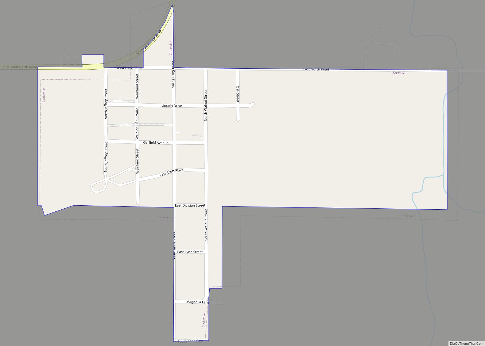
Online Interactive Map
Click on ![]() to view map in "full screen" mode.
to view map in "full screen" mode.
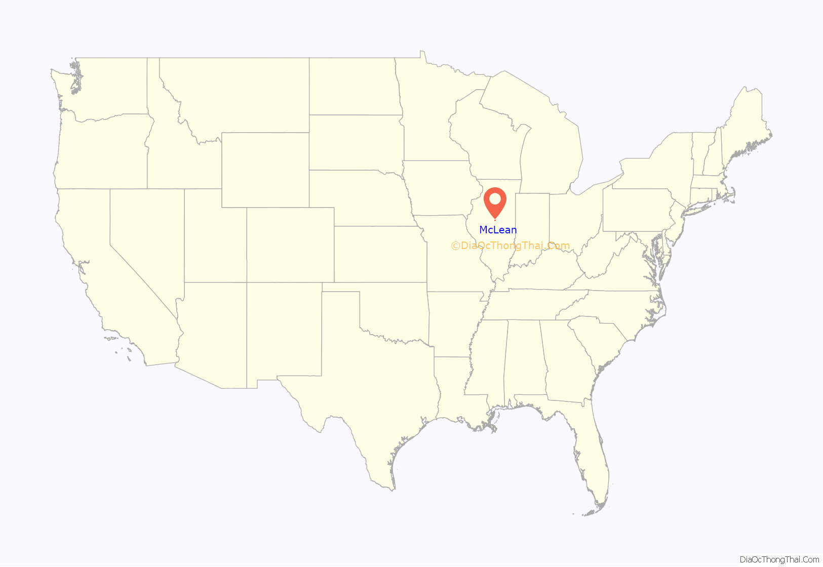
McLean location map. Where is McLean village?
History
Founding
The village of McLean was laid out on June 22, 1855, by Franklin Price (1821 – 1908). Price was born in Chester Valley, Pennsylvania, and was the brother-in-law of Bloomington real estate developer Kersey Fell. Price came to Bloomington in 1849; he worked as a clerk and newspaper writer and was elected mayor of Bloomington in 1855 and again in 1856, serving until 1858. Price never lived in the new town he founded.
McLean was laid out when the Alton and Springfield Railroad, soon to become the Alton Railroad, was first built through McLean County. The nearby towns of Atlanta, Normal, and Towanda were laid out at the same time as McLean. There had been an earlier attempt to found a town nearby.
Mt. Hope, two miles east of McLean, was established in 1836 by the Providence Farmers and Mechanics Emigrating Society of Rhode Island. The colony and its town were not a success; only three settlers actually arrived in McLean County. When the town of McLean was founded, the church building from Mt. Hope was moved into McLean. The first residents of McLean were the brothers G.L. and F.A. Wheelock, railroad employees, who moved into the new station house to conduct business. A blacksmith shop was the first business, and H.H. Dillon built the first warehouse.
McLean was incorporated as a village on May 29, 1866. By 1900, it had grown to a population of 532.
Original town design
The design of the original town of McLean remains almost unaltered to this day from the original plans. The design was similar to other places along the Alton and Springfield Railroad, including Normal, Towanda, Odell, and Dwight. The original town was basically a square with streets aligned north–south and east–west, split diagonally by the railroad with a line of lots paralleling either side of the tracks.
As in other towns along the same railroad, there was a widened rectangular area paralleling the tracks labeled “Depot Grounds”. In the case of McLean, the depot grounds were laid out only on the southeast side of the railroad. The triangle of land on the northwest side, between the lots paralleling the railroad and remainder of the town, was designated as a public property and is still used as a park. The comparable triangle on the opposite side of the tracks was unlabeled, and its intended use is unclear. This same arrangement of public land was followed at the village of Towanda.
McLean was distinctive in that there were no streets between the diagonal line of lots along the tracks. Perhaps because of this, much of the business district developed along Morgan Street, which ran east–west just north of the park, or along Hamilton Street, which ran north–south, just west of the park. The line of lots paralleling the tracks and southeast of the railroad became the location of the hotel and the town jail. Later additions on the east side of the town featured additional lots which parallel the railroad, as well as more conventional blocks.
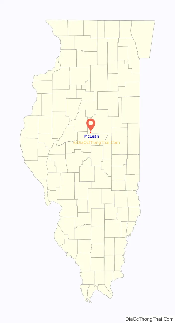
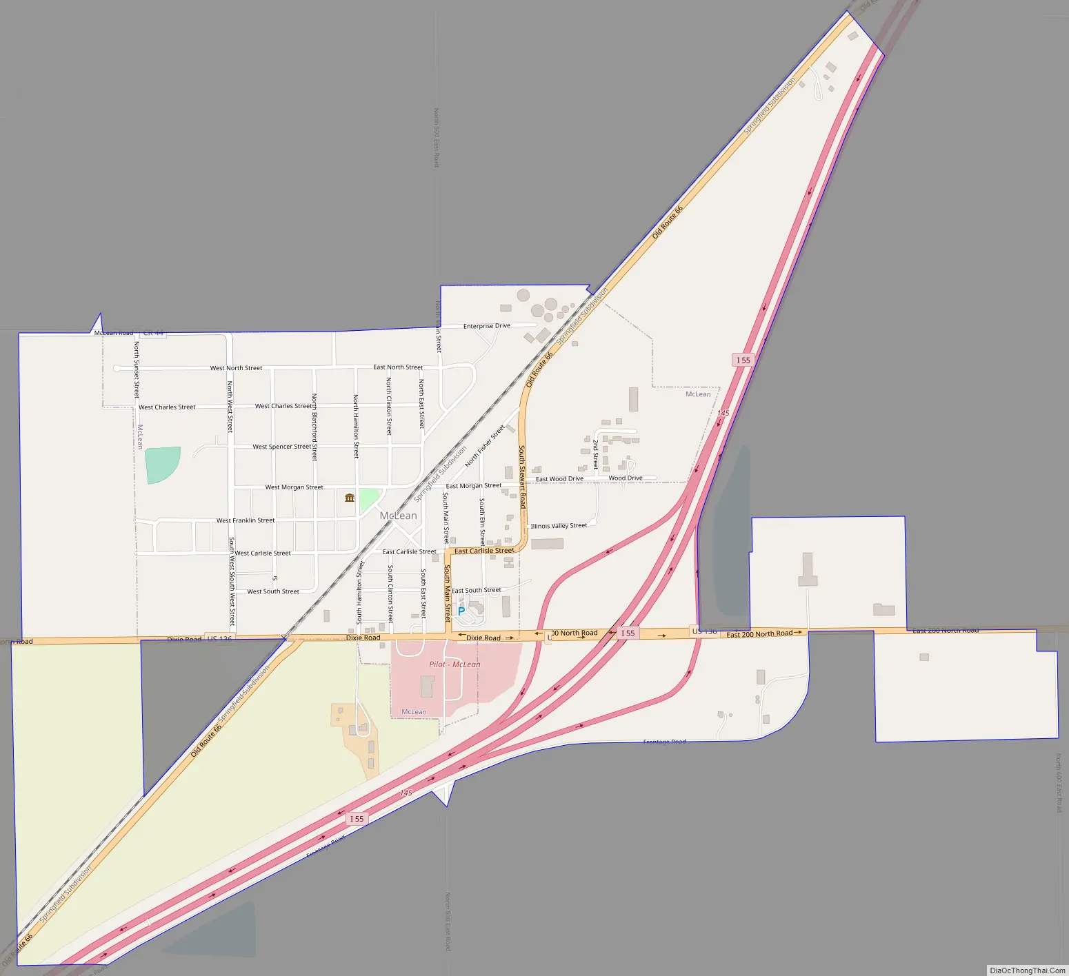
McLean Road Map
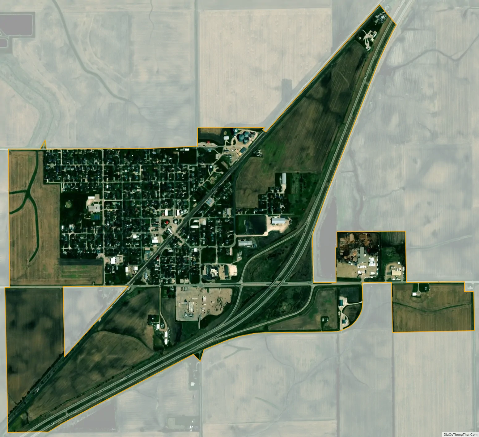
McLean city Satellite Map
Geography
McLean is in southwestern McLean County. Interstate 55 passes through the east side of the village, with access from Exit 145 (U.S. Route 136). I-55 leads northeast 15 miles (24 km) to Bloomington, the county seat, and southwest 16 miles (26 km) to Lincoln. US 136 (Dixie Road) runs along the south edge of the village center and leads east 10 miles (16 km) to Heyworth and west 23 miles (37 km) to San Jose.
According to the U.S. Census Bureau, McLean has a total area of 1.18 square miles (3.06 km), all land.
See also
Map of Illinois State and its subdivision:- Adams
- Alexander
- Bond
- Boone
- Brown
- Bureau
- Calhoun
- Carroll
- Cass
- Champaign
- Christian
- Clark
- Clay
- Clinton
- Coles
- Cook
- Crawford
- Cumberland
- De Kalb
- De Witt
- Douglas
- Dupage
- Edgar
- Edwards
- Effingham
- Fayette
- Ford
- Franklin
- Fulton
- Gallatin
- Greene
- Grundy
- Hamilton
- Hancock
- Hardin
- Henderson
- Henry
- Iroquois
- Jackson
- Jasper
- Jefferson
- Jersey
- Jo Daviess
- Johnson
- Kane
- Kankakee
- Kendall
- Knox
- La Salle
- Lake
- Lake Michigan
- Lawrence
- Lee
- Livingston
- Logan
- Macon
- Macoupin
- Madison
- Marion
- Marshall
- Mason
- Massac
- McDonough
- McHenry
- McLean
- Menard
- Mercer
- Monroe
- Montgomery
- Morgan
- Moultrie
- Ogle
- Peoria
- Perry
- Piatt
- Pike
- Pope
- Pulaski
- Putnam
- Randolph
- Richland
- Rock Island
- Saint Clair
- Saline
- Sangamon
- Schuyler
- Scott
- Shelby
- Stark
- Stephenson
- Tazewell
- Union
- Vermilion
- Wabash
- Warren
- Washington
- Wayne
- White
- Whiteside
- Will
- Williamson
- Winnebago
- Woodford
- Alabama
- Alaska
- Arizona
- Arkansas
- California
- Colorado
- Connecticut
- Delaware
- District of Columbia
- Florida
- Georgia
- Hawaii
- Idaho
- Illinois
- Indiana
- Iowa
- Kansas
- Kentucky
- Louisiana
- Maine
- Maryland
- Massachusetts
- Michigan
- Minnesota
- Mississippi
- Missouri
- Montana
- Nebraska
- Nevada
- New Hampshire
- New Jersey
- New Mexico
- New York
- North Carolina
- North Dakota
- Ohio
- Oklahoma
- Oregon
- Pennsylvania
- Rhode Island
- South Carolina
- South Dakota
- Tennessee
- Texas
- Utah
- Vermont
- Virginia
- Washington
- West Virginia
- Wisconsin
- Wyoming