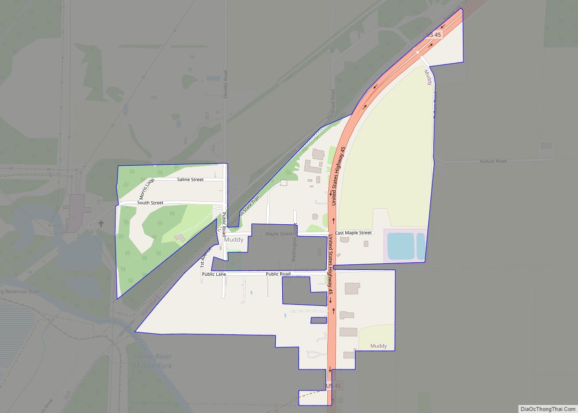
Muddy is a small incorporated village located in the Harrisburg Township in Saline County, Illinois, United States. The population was 78 at the 2000 census.
| Name: | Muddy village |
|---|---|
| LSAD Code: | 47 |
| LSAD Description: | village (suffix) |
| State: | Illinois |
| County: | Saline County |
| Total Area: | 0.30 sq mi (0.79 km²) |
| Land Area: | 0.30 sq mi (0.78 km²) |
| Water Area: | 0.00 sq mi (0.00 km²) |
| Total Population: | 61 |
| Population Density: | 201.32/sq mi (77.71/km²) |
| Area code: | 618 |
| FIPS code: | 1751271 |
Online Interactive Map
Click on ![]() to view map in "full screen" mode.
to view map in "full screen" mode.
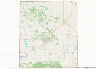
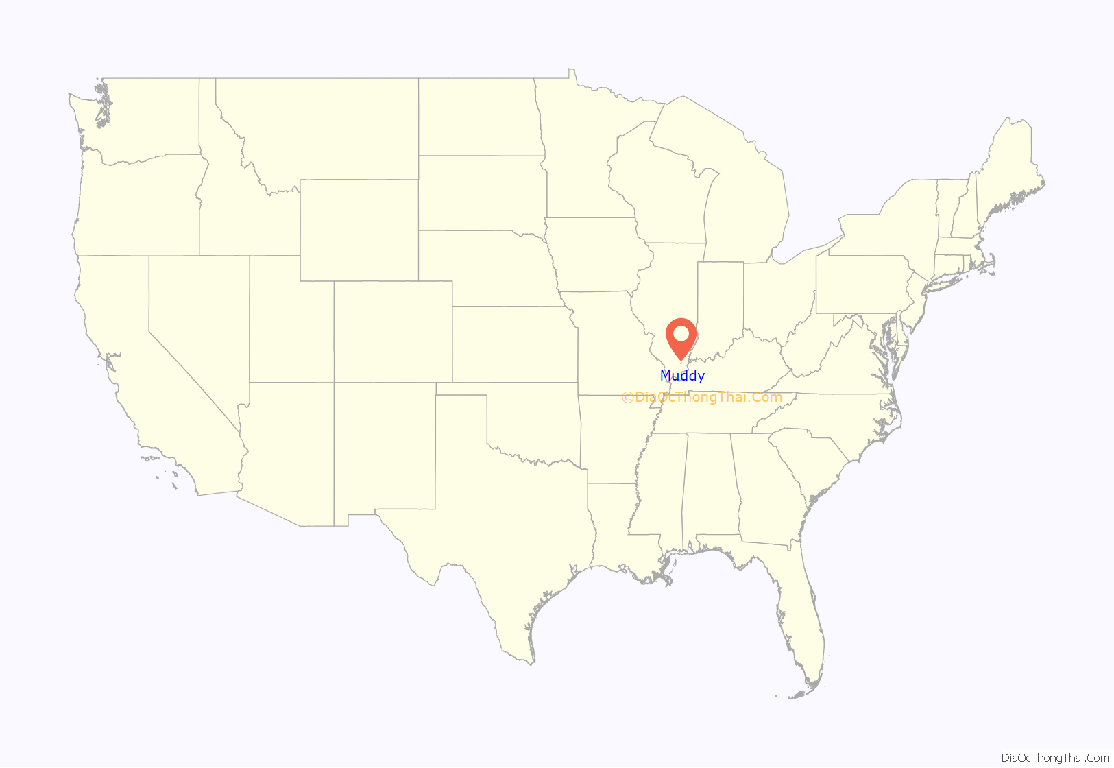
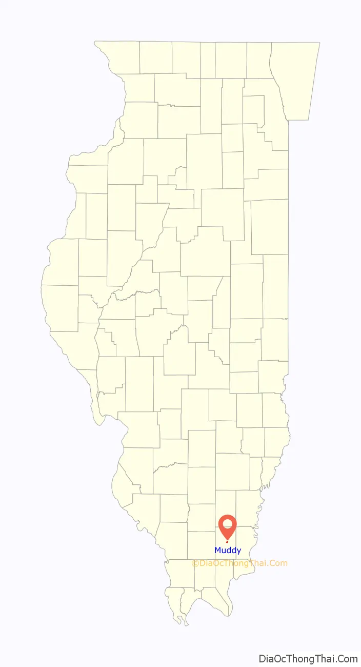
Muddy location map. Where is Muddy village?
History
During the 19th century, the site of Muddy was home to a small settlement known as Robinson’s Ford, which was among the communities considered for the seat of Saline County after the county’s creation in the 1840s. The modern village of Muddy had its start as a mining settlement established by the Harrisburg Big Muddy Coal Company, for which it was named, in 1903. The mine was sold to the larger O’Gara Coal Company in 1906.
The disused St. Ioasaph Orthodox Church in Muddy, built in 1913, is dedicated to Ioasaph of Belgorod. The church is located on South St. at 37°45′56″N 88°31′21″W / 37.76559°N 88.52243°W / 37.76559; -88.52243. This church was attended by eastern European immigrants, including Russians, Slovaks, Poles, and Rusyns,
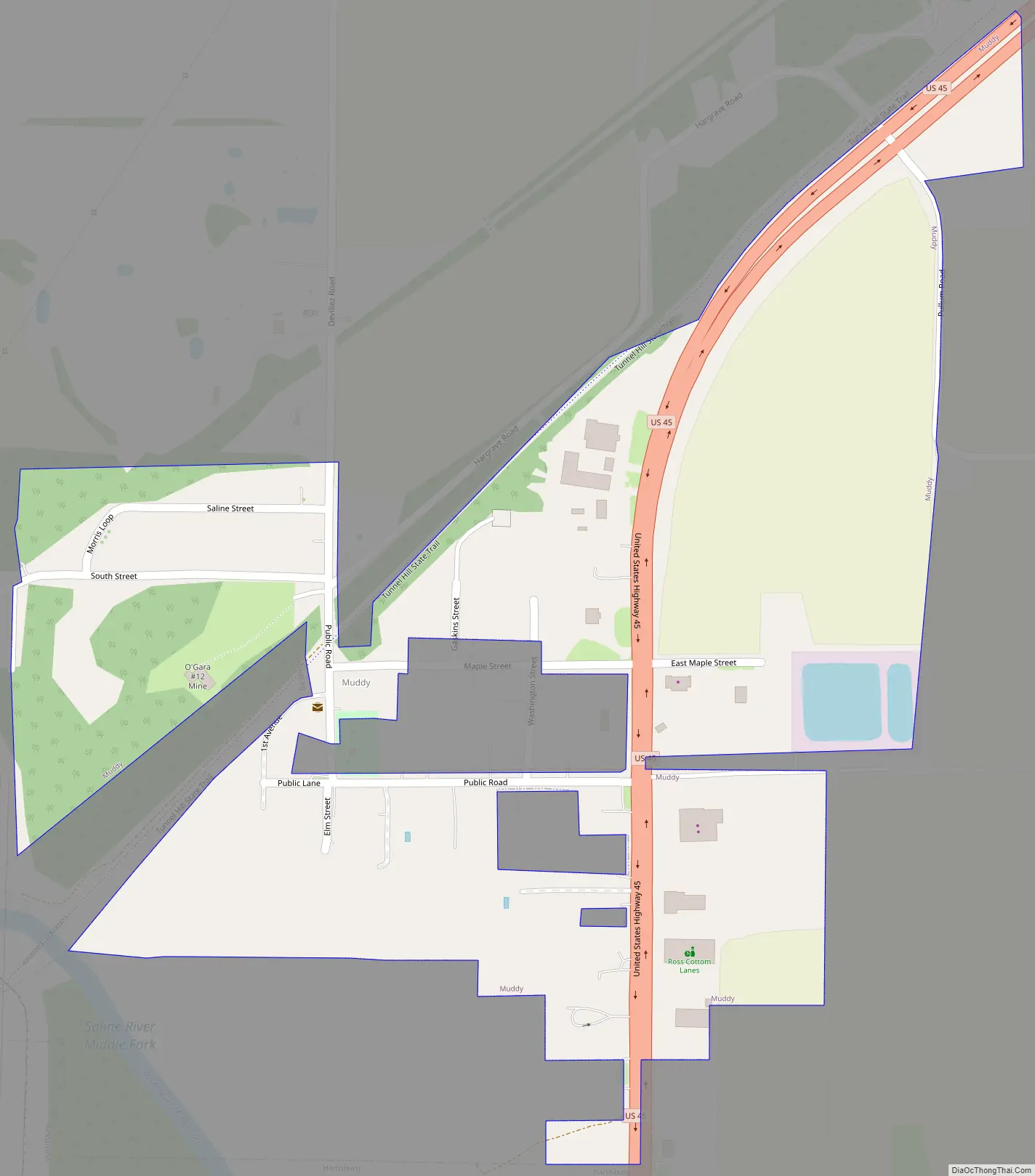
Muddy Road Map
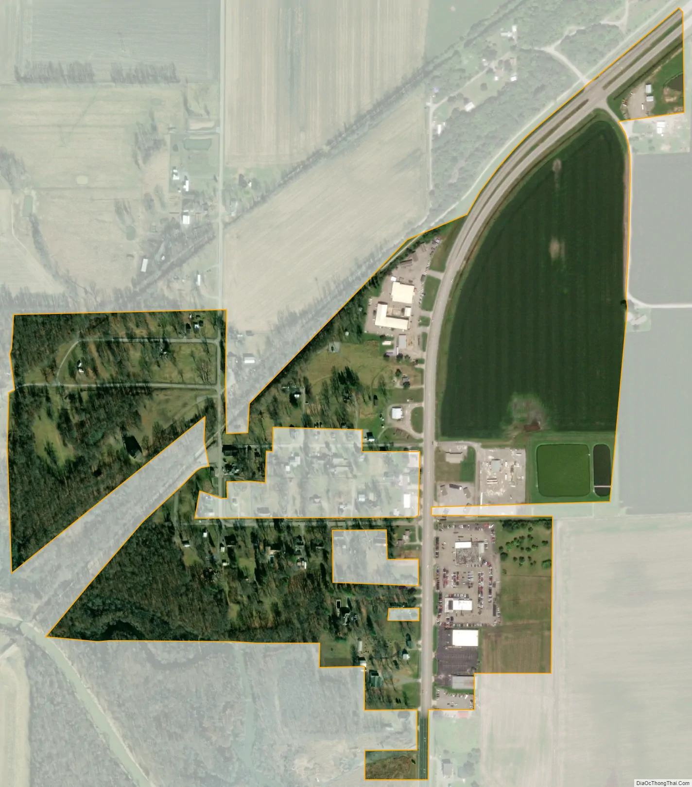
Muddy city Satellite Map
Geography
Muddy is located at 37°45′51″N 88°30′52″W / 37.76417°N 88.51444°W / 37.76417; -88.51444 (37.764086, -88.514469). The village lies along U.S. Route 45 northeast of Harrisburg and southwest of Eldorado. The Middle Fork of the Saline River flows just southwest of Muddy. The Tunnel Hill State Trail, a 45-mile (72 km) rail trail, passes through the village.
According to the 2010 census, Muddy has a total area of 0.301 square miles (0.78 km), of which 0.3 square miles (0.78 km) (or 99.67%) is land and 0.001 square miles (0.00 km) (or 0.33%) is water.
See also
Map of Illinois State and its subdivision:- Adams
- Alexander
- Bond
- Boone
- Brown
- Bureau
- Calhoun
- Carroll
- Cass
- Champaign
- Christian
- Clark
- Clay
- Clinton
- Coles
- Cook
- Crawford
- Cumberland
- De Kalb
- De Witt
- Douglas
- Dupage
- Edgar
- Edwards
- Effingham
- Fayette
- Ford
- Franklin
- Fulton
- Gallatin
- Greene
- Grundy
- Hamilton
- Hancock
- Hardin
- Henderson
- Henry
- Iroquois
- Jackson
- Jasper
- Jefferson
- Jersey
- Jo Daviess
- Johnson
- Kane
- Kankakee
- Kendall
- Knox
- La Salle
- Lake
- Lake Michigan
- Lawrence
- Lee
- Livingston
- Logan
- Macon
- Macoupin
- Madison
- Marion
- Marshall
- Mason
- Massac
- McDonough
- McHenry
- McLean
- Menard
- Mercer
- Monroe
- Montgomery
- Morgan
- Moultrie
- Ogle
- Peoria
- Perry
- Piatt
- Pike
- Pope
- Pulaski
- Putnam
- Randolph
- Richland
- Rock Island
- Saint Clair
- Saline
- Sangamon
- Schuyler
- Scott
- Shelby
- Stark
- Stephenson
- Tazewell
- Union
- Vermilion
- Wabash
- Warren
- Washington
- Wayne
- White
- Whiteside
- Will
- Williamson
- Winnebago
- Woodford
- Alabama
- Alaska
- Arizona
- Arkansas
- California
- Colorado
- Connecticut
- Delaware
- District of Columbia
- Florida
- Georgia
- Hawaii
- Idaho
- Illinois
- Indiana
- Iowa
- Kansas
- Kentucky
- Louisiana
- Maine
- Maryland
- Massachusetts
- Michigan
- Minnesota
- Mississippi
- Missouri
- Montana
- Nebraska
- Nevada
- New Hampshire
- New Jersey
- New Mexico
- New York
- North Carolina
- North Dakota
- Ohio
- Oklahoma
- Oregon
- Pennsylvania
- Rhode Island
- South Carolina
- South Dakota
- Tennessee
- Texas
- Utah
- Vermont
- Virginia
- Washington
- West Virginia
- Wisconsin
- Wyoming