Neoga is a city in Cumberland County, Illinois, United States. The population was 1,398 at the 2020 census, down from 1,636 at the 2010 census. It is part of the Charleston–Mattoon Micropolitan Statistical Area. The current mayor of Neoga is Marty Hartke.
Neoga was incorporated in 1856. Neoga means “deer” in the Kickapoo language.
| Name: | Neoga city |
|---|---|
| LSAD Code: | 25 |
| LSAD Description: | city (suffix) |
| State: | Illinois |
| County: | Cumberland County |
| Founded: | 1856 |
| Elevation: | 659 ft (201 m) |
| Total Area: | 1.39 sq mi (3.60 km²) |
| Land Area: | 1.39 sq mi (3.60 km²) |
| Water Area: | 0.00 sq mi (0.00 km²) |
| Total Population: | 1,398 |
| Population Density: | 1,005.76/sq mi (388.25/km²) |
| Area code: | 217 |
| FIPS code: | 1751986 |
| Website: | www.neoga.org |
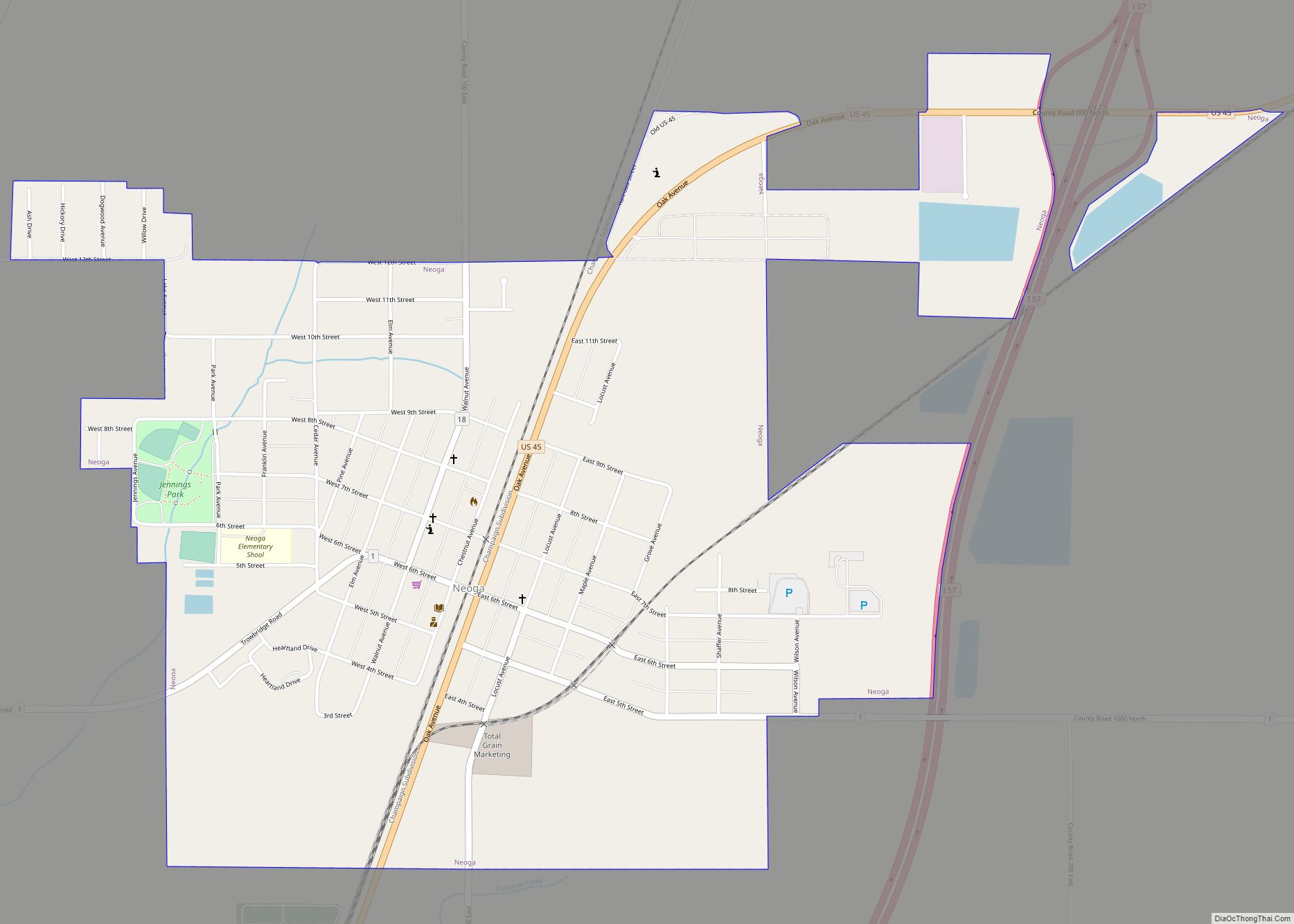
Online Interactive Map
Click on ![]() to view map in "full screen" mode.
to view map in "full screen" mode.
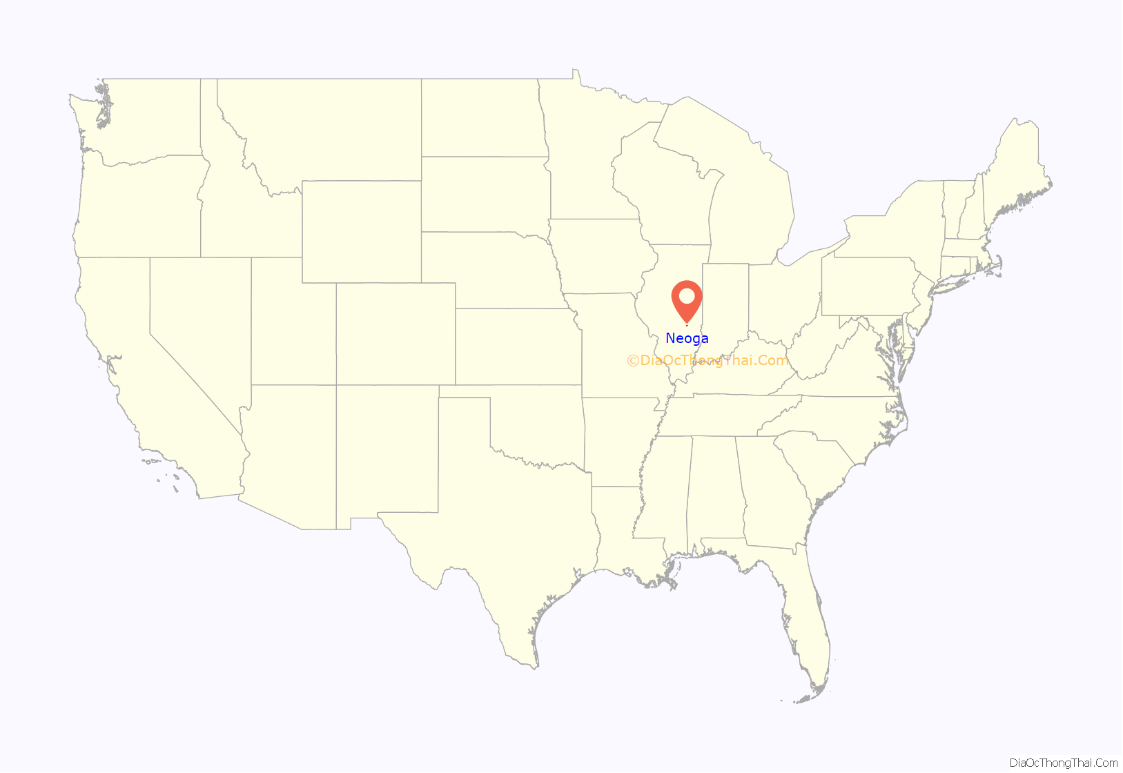
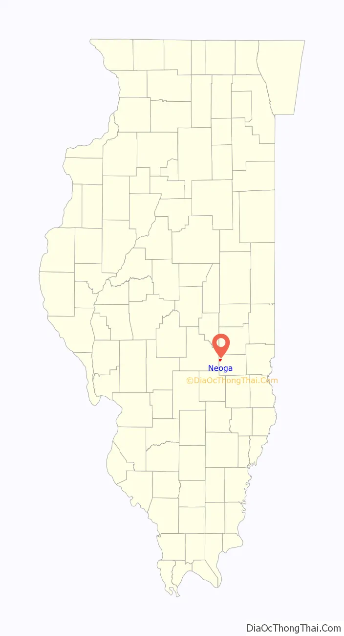
Neoga location map. Where is Neoga city?
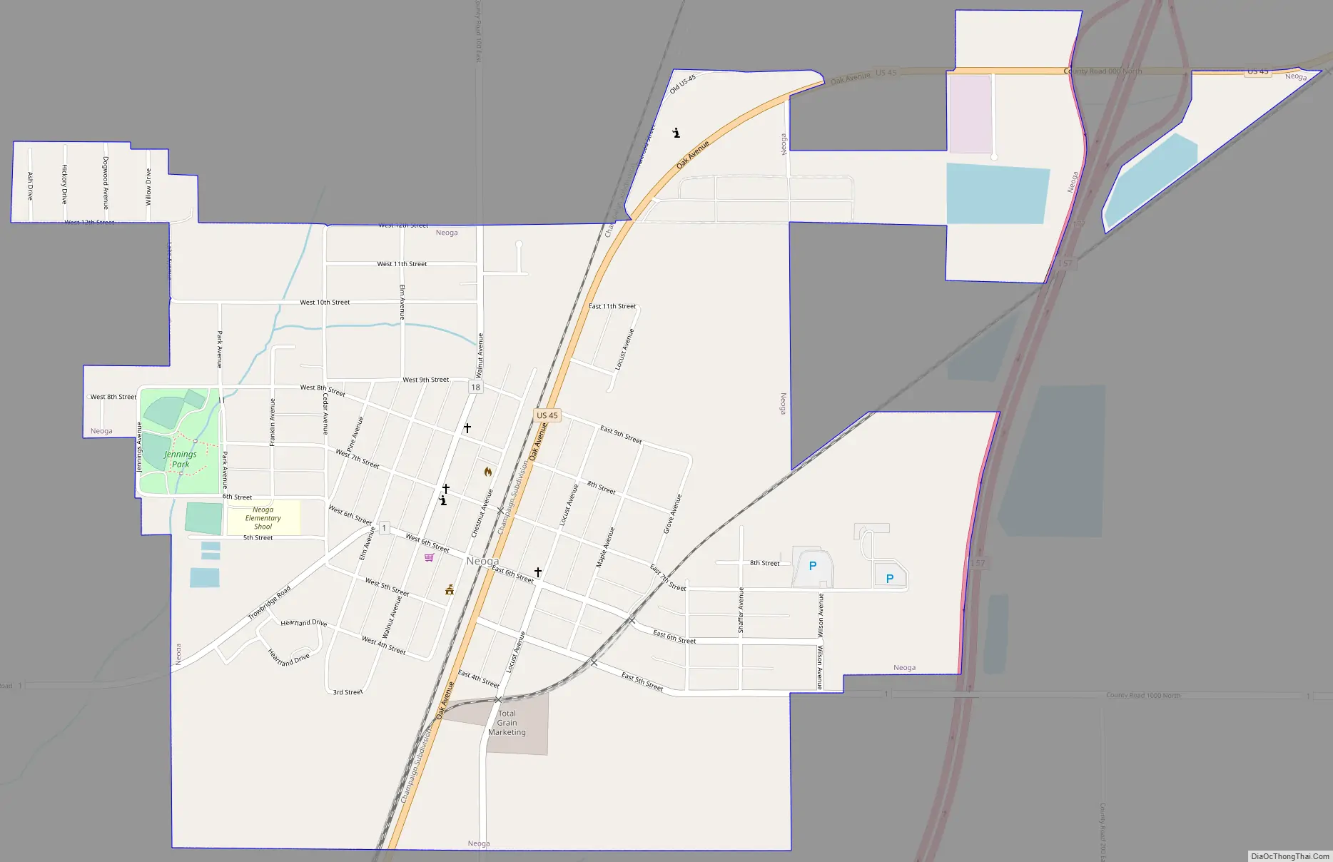
Neoga Road Map
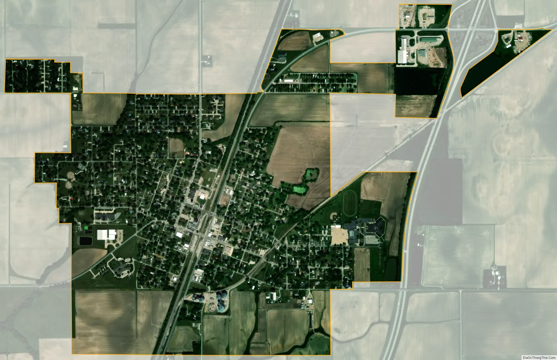
Neoga city Satellite Map
Geography
Neoga is located in northwestern Cumberland County at 39°19′18″N 88°27′8″W / 39.32167°N 88.45222°W / 39.32167; -88.45222 (39.321769, -88.452109). U.S. Route 45 runs through the center of town as Oak Avenue, and Interstate 57 crosses the eastern side of town, with access from Exit 177, where it crosses US 45. Effingham is 14 miles (23 km) to the south, and Mattoon is 13 miles (21 km) to the north.
According to the 2021 census gazetteer files, Neoga has a total area of 1.39 square miles (3.60 km), all land.
See also
Map of Illinois State and its subdivision:- Adams
- Alexander
- Bond
- Boone
- Brown
- Bureau
- Calhoun
- Carroll
- Cass
- Champaign
- Christian
- Clark
- Clay
- Clinton
- Coles
- Cook
- Crawford
- Cumberland
- De Kalb
- De Witt
- Douglas
- Dupage
- Edgar
- Edwards
- Effingham
- Fayette
- Ford
- Franklin
- Fulton
- Gallatin
- Greene
- Grundy
- Hamilton
- Hancock
- Hardin
- Henderson
- Henry
- Iroquois
- Jackson
- Jasper
- Jefferson
- Jersey
- Jo Daviess
- Johnson
- Kane
- Kankakee
- Kendall
- Knox
- La Salle
- Lake
- Lake Michigan
- Lawrence
- Lee
- Livingston
- Logan
- Macon
- Macoupin
- Madison
- Marion
- Marshall
- Mason
- Massac
- McDonough
- McHenry
- McLean
- Menard
- Mercer
- Monroe
- Montgomery
- Morgan
- Moultrie
- Ogle
- Peoria
- Perry
- Piatt
- Pike
- Pope
- Pulaski
- Putnam
- Randolph
- Richland
- Rock Island
- Saint Clair
- Saline
- Sangamon
- Schuyler
- Scott
- Shelby
- Stark
- Stephenson
- Tazewell
- Union
- Vermilion
- Wabash
- Warren
- Washington
- Wayne
- White
- Whiteside
- Will
- Williamson
- Winnebago
- Woodford
- Alabama
- Alaska
- Arizona
- Arkansas
- California
- Colorado
- Connecticut
- Delaware
- District of Columbia
- Florida
- Georgia
- Hawaii
- Idaho
- Illinois
- Indiana
- Iowa
- Kansas
- Kentucky
- Louisiana
- Maine
- Maryland
- Massachusetts
- Michigan
- Minnesota
- Mississippi
- Missouri
- Montana
- Nebraska
- Nevada
- New Hampshire
- New Jersey
- New Mexico
- New York
- North Carolina
- North Dakota
- Ohio
- Oklahoma
- Oregon
- Pennsylvania
- Rhode Island
- South Carolina
- South Dakota
- Tennessee
- Texas
- Utah
- Vermont
- Virginia
- Washington
- West Virginia
- Wisconsin
- Wyoming