New Boston is a city in Mercer County, Illinois, United States on the Mississippi River. The population was 613 at the 2020 census, down from 683 in 2010.
| Name: | New Boston city |
|---|---|
| LSAD Code: | 25 |
| LSAD Description: | city (suffix) |
| State: | Illinois |
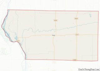
| County: | Mercer County |
| Elevation: | 562 ft (171 m) |
| Total Area: | 1.40 sq mi (3.64 km²) |
| Land Area: | 0.94 sq mi (2.44 km²) |
| Water Area: | 0.46 sq mi (1.20 km²) |
| Total Population: | 613 |
| Population Density: | 651.43/sq mi (251.50/km²) |
| ZIP code: | 61272 |
| Area code: | 309 |
| FIPS code: | 1752220 |
| Website: | cityofnewbostonil.com |
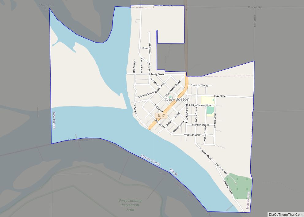
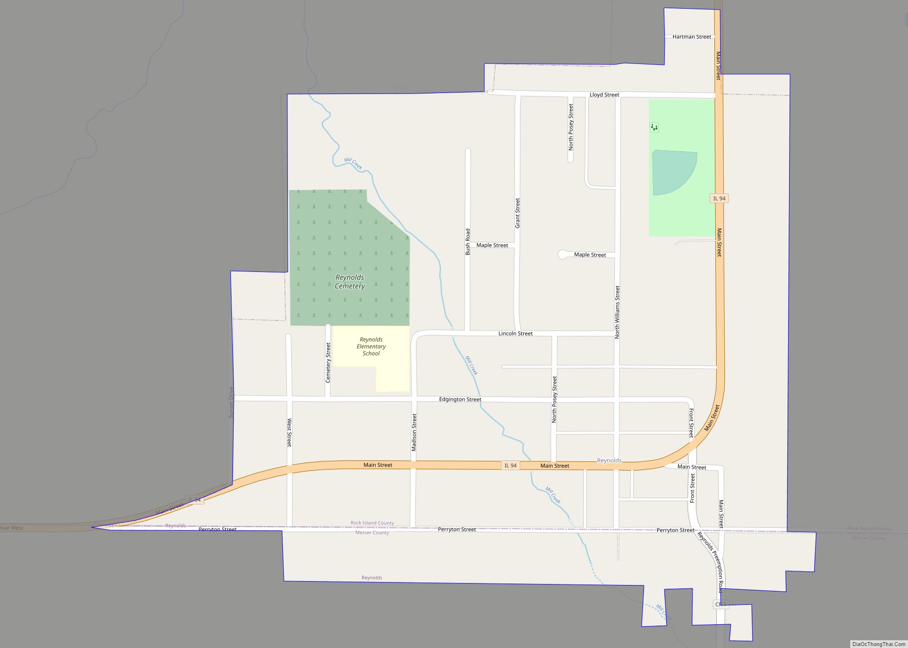
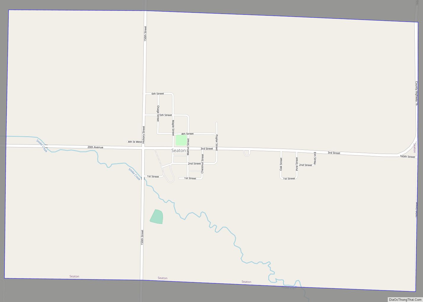
Online Interactive Map
Click on ![]() to view map in "full screen" mode.
to view map in "full screen" mode.
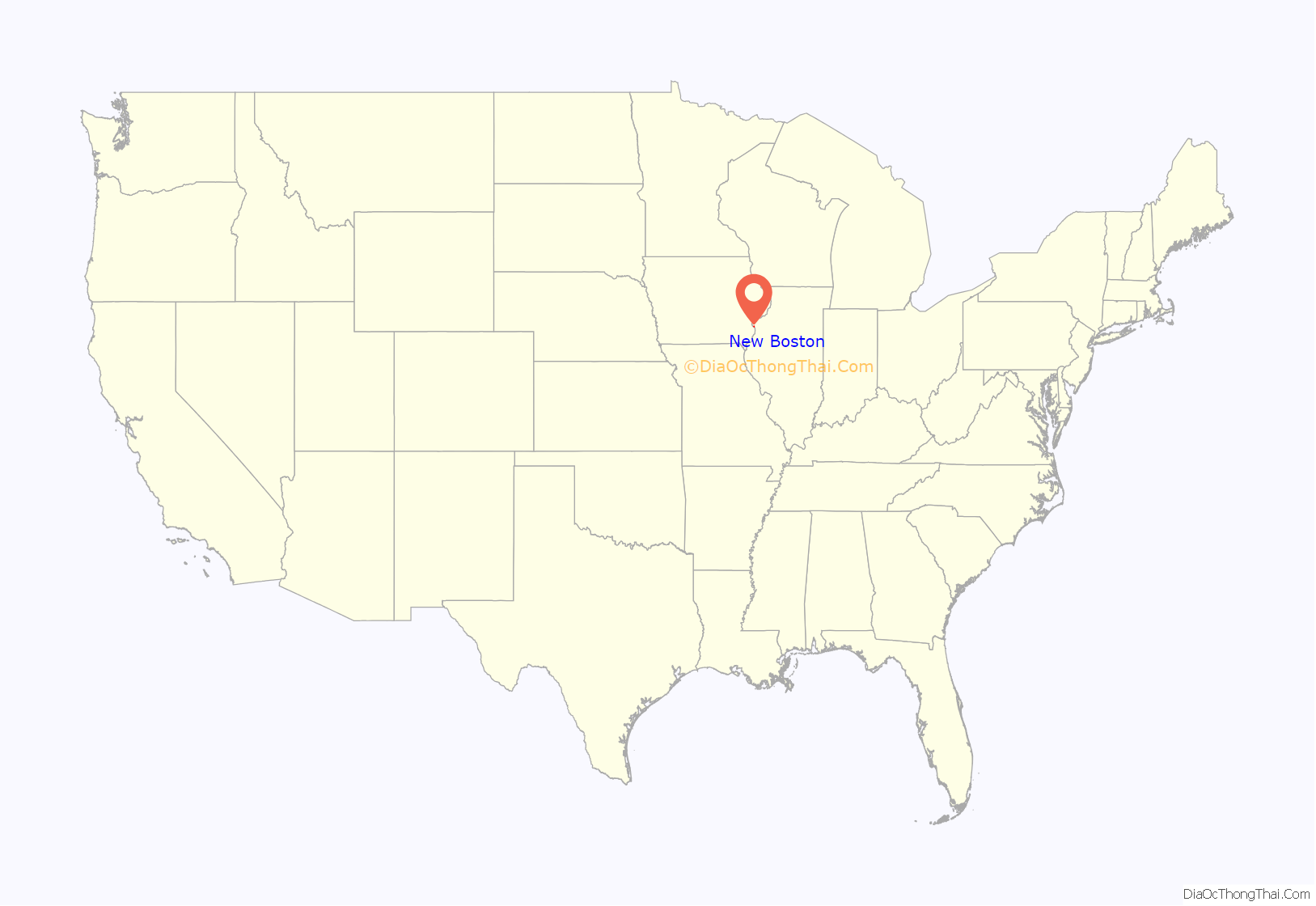
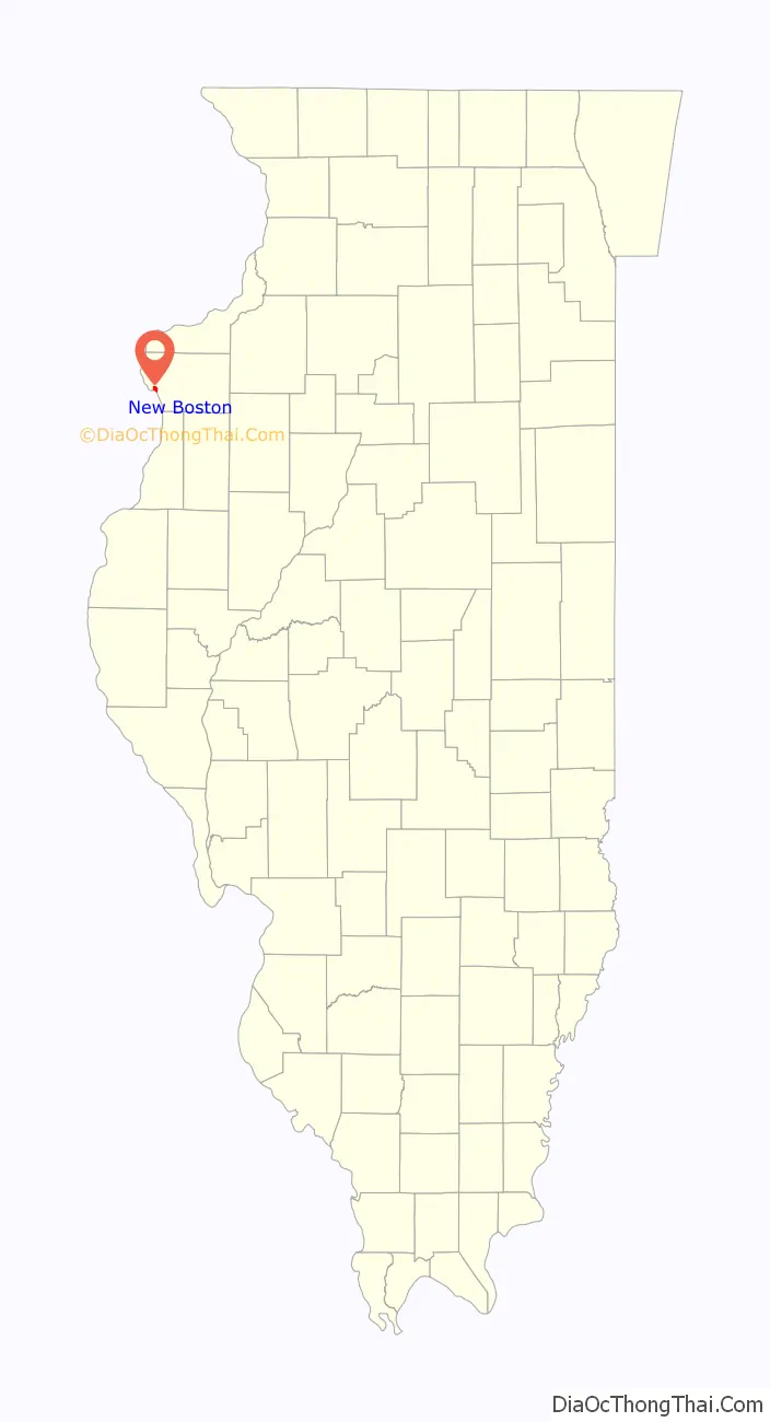
New Boston location map. Where is New Boston city?
History
New Boston was settled in the 1830s by “Yankee” migrants from Massachusetts.
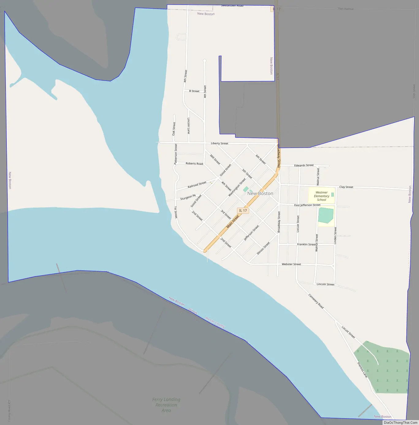
New Boston Road Map
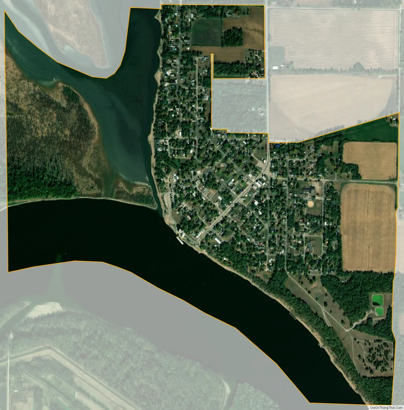
New Boston city Satellite Map
Geography
New Boston is located on the western edge of Mercer County and the state of Illinois at 41°10′10″N 90°59′48″W / 41.16944°N 90.99667°W / 41.16944; -90.99667 (41.169570, -90.996709). It sits on the east bank of the Mississippi River, at the mouth of Boston Bay and its inflow, Eliza Creek. Across the river is the state of Iowa and the mouth of the Iowa River, while 5 miles (8 km) upstream on the Mississippi is Lock and Dam No. 17.
Illinois Route 17 has its western terminus in New Boston and leads east 14 miles (23 km) to Aledo, the Mercer county seat. The closest road crossing of the Mississippi is 19 miles (31 km) to the north at Muscatine, Iowa.
According to the U.S. Census Bureau, New Boston has a total area of 1.40 square miles (3.63 km), of which 0.94 square miles (2.43 km) are land and 0.46 square miles (1.19 km), or 32.98%, are water.
Much of the natural area surrounding New Boston is part of the Port Louisa National Wildlife Refuge. The river valley at New Boston is surrounded on both sides by gently rolling bluffs interspersed with rich parcels of wetlands that provide critical wildlife habitat, especially for migratory birds.
See also
Map of Illinois State and its subdivision:- Adams
- Alexander
- Bond
- Boone
- Brown
- Bureau
- Calhoun
- Carroll
- Cass
- Champaign
- Christian
- Clark
- Clay
- Clinton
- Coles
- Cook
- Crawford
- Cumberland
- De Kalb
- De Witt
- Douglas
- Dupage
- Edgar
- Edwards
- Effingham
- Fayette
- Ford
- Franklin
- Fulton
- Gallatin
- Greene
- Grundy
- Hamilton
- Hancock
- Hardin
- Henderson
- Henry
- Iroquois
- Jackson
- Jasper
- Jefferson
- Jersey
- Jo Daviess
- Johnson
- Kane
- Kankakee
- Kendall
- Knox
- La Salle
- Lake
- Lake Michigan
- Lawrence
- Lee
- Livingston
- Logan
- Macon
- Macoupin
- Madison
- Marion
- Marshall
- Mason
- Massac
- McDonough
- McHenry
- McLean
- Menard
- Mercer
- Monroe
- Montgomery
- Morgan
- Moultrie
- Ogle
- Peoria
- Perry
- Piatt
- Pike
- Pope
- Pulaski
- Putnam
- Randolph
- Richland
- Rock Island
- Saint Clair
- Saline
- Sangamon
- Schuyler
- Scott
- Shelby
- Stark
- Stephenson
- Tazewell
- Union
- Vermilion
- Wabash
- Warren
- Washington
- Wayne
- White
- Whiteside
- Will
- Williamson
- Winnebago
- Woodford
- Alabama
- Alaska
- Arizona
- Arkansas
- California
- Colorado
- Connecticut
- Delaware
- District of Columbia
- Florida
- Georgia
- Hawaii
- Idaho
- Illinois
- Indiana
- Iowa
- Kansas
- Kentucky
- Louisiana
- Maine
- Maryland
- Massachusetts
- Michigan
- Minnesota
- Mississippi
- Missouri
- Montana
- Nebraska
- Nevada
- New Hampshire
- New Jersey
- New Mexico
- New York
- North Carolina
- North Dakota
- Ohio
- Oklahoma
- Oregon
- Pennsylvania
- Rhode Island
- South Carolina
- South Dakota
- Tennessee
- Texas
- Utah
- Vermont
- Virginia
- Washington
- West Virginia
- Wisconsin
- Wyoming