North City is a village in Franklin County, Illinois, United States. As of the 2020 census, the population was 509. North City is also known as “Coello”. The current mayor is Curtis Overton.
| Name: | North City village |
|---|---|
| LSAD Code: | 47 |
| LSAD Description: | village (suffix) |
| State: | Illinois |
| County: | Franklin County |
| Elevation: | 456 ft (139 m) |
| Total Area: | 2.23 sq mi (5.77 km²) |
| Land Area: | 2.17 sq mi (5.62 km²) |
| Water Area: | 0.06 sq mi (0.15 km²) |
| Total Population: | 509 |
| Population Density: | 234.45/sq mi (90.53/km²) |
| Area code: | 618 |
| FIPS code: | 1753585 |
| GNISfeature ID: | 2399513 |
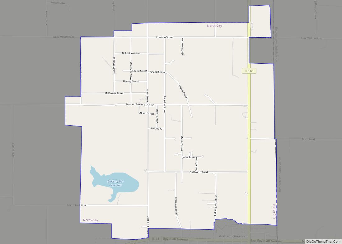
Online Interactive Map
Click on ![]() to view map in "full screen" mode.
to view map in "full screen" mode.
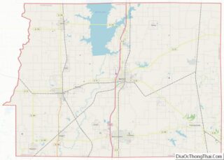
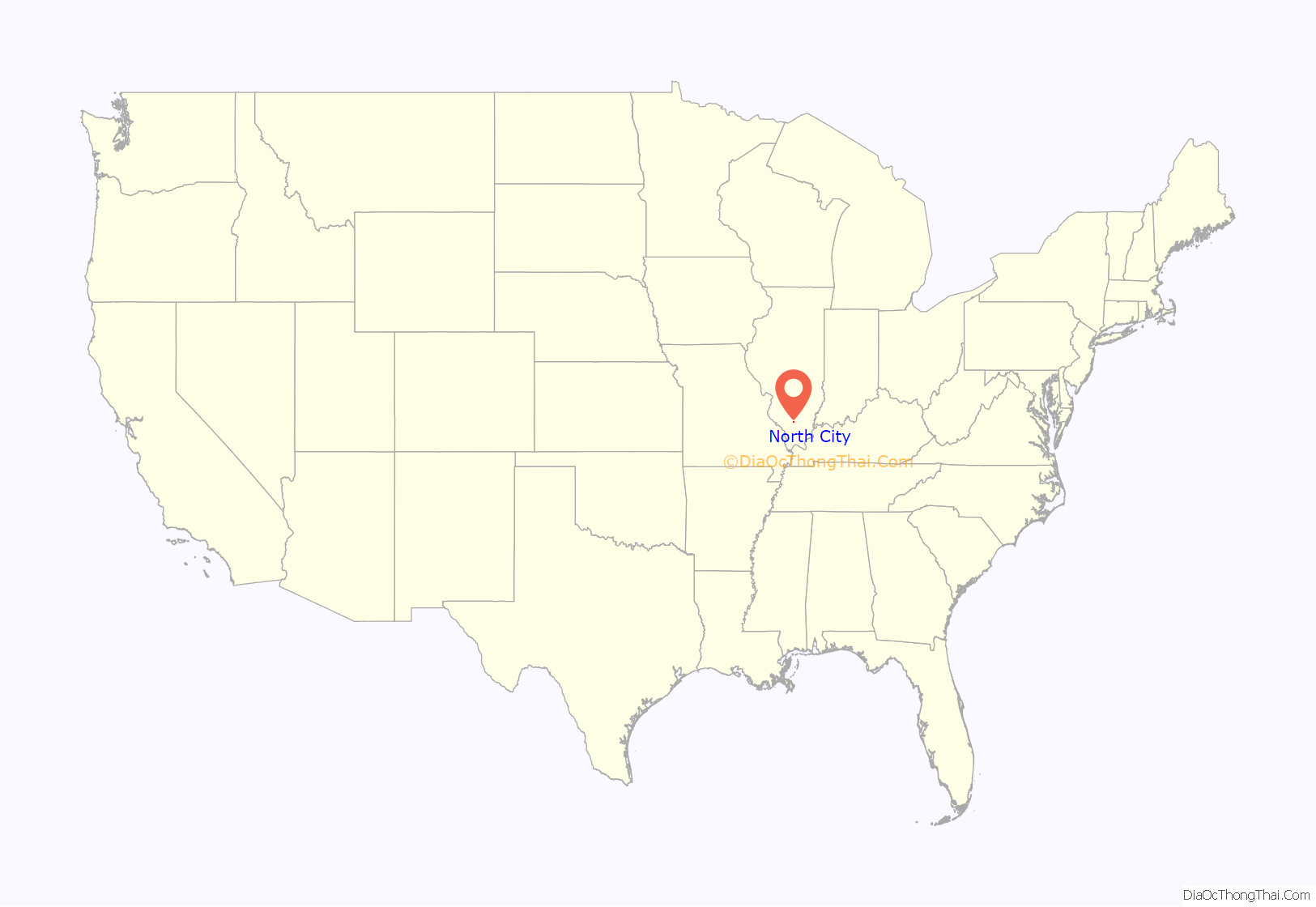
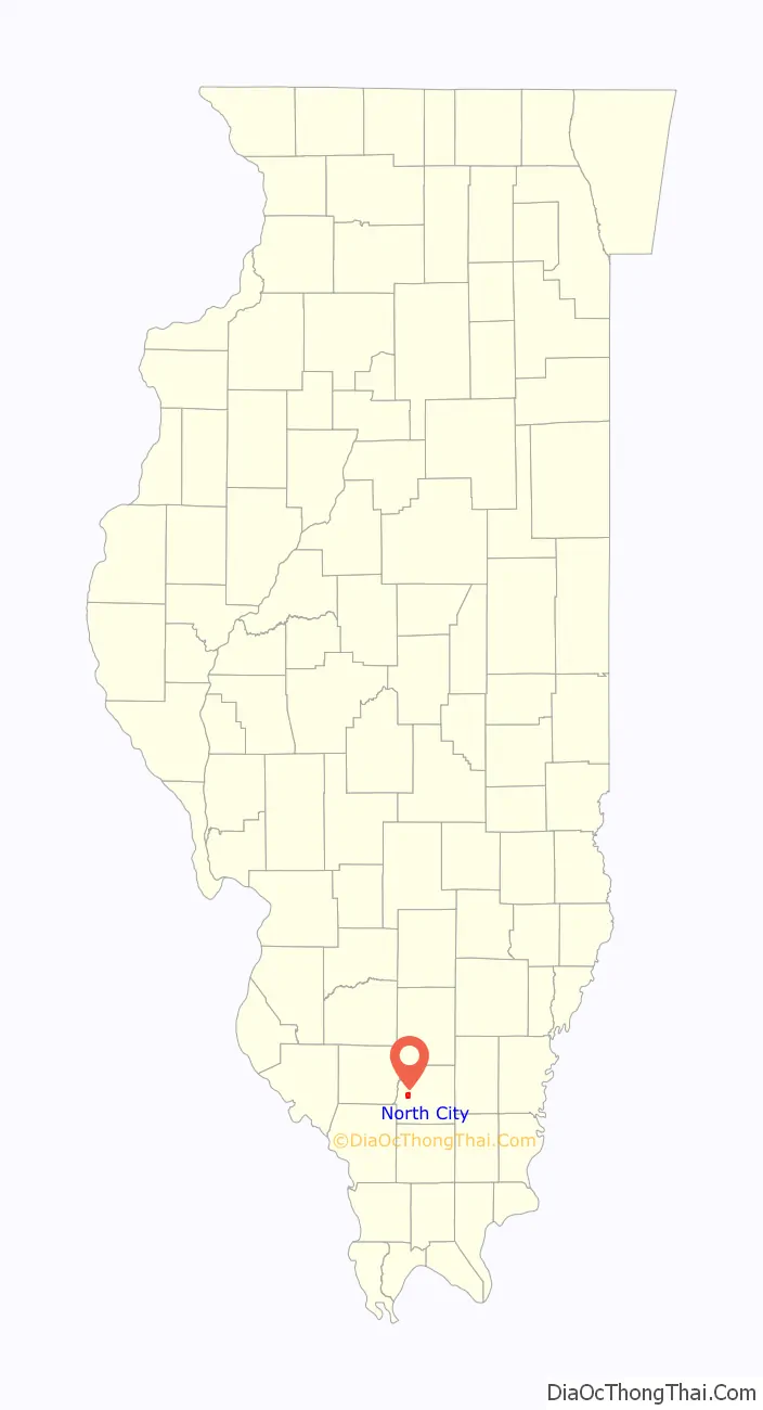
North City location map. Where is North City village?
History
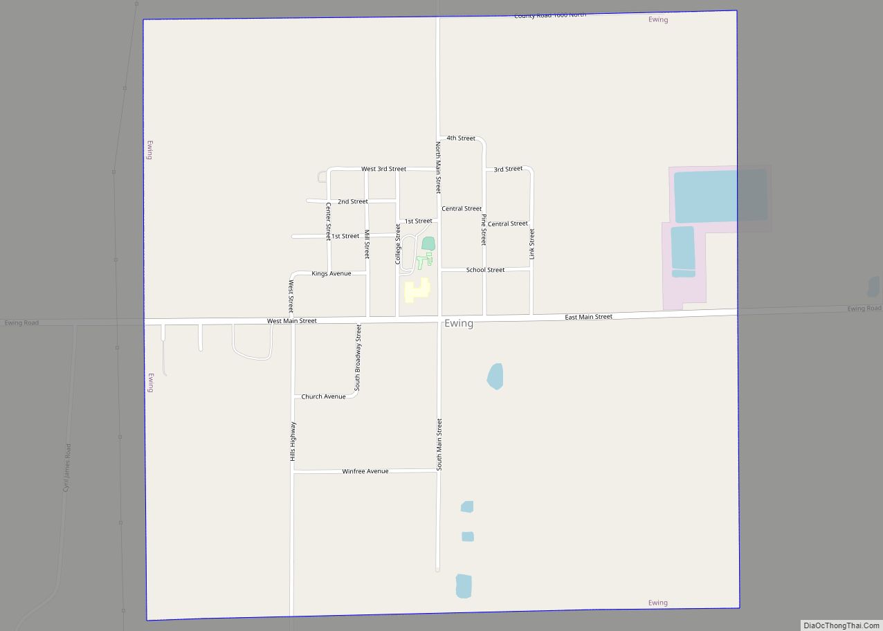
North City incorporated in 1915. Its name comes from two nearby coal mines which were nicknamed “New North” and “Old North.” A post office, known as “Coello” after its first postmaster, Pete Coello, opened in 1918. Both “North City” and “Coello” are commonly used in the village.
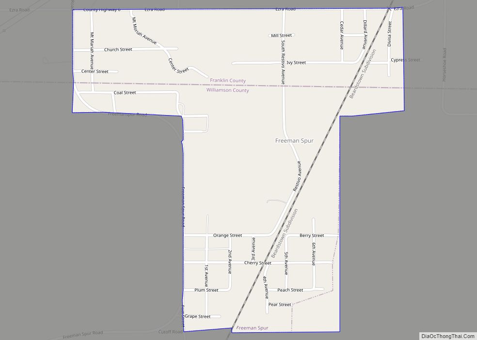
North City Road Map
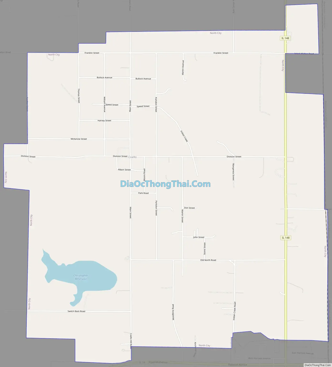
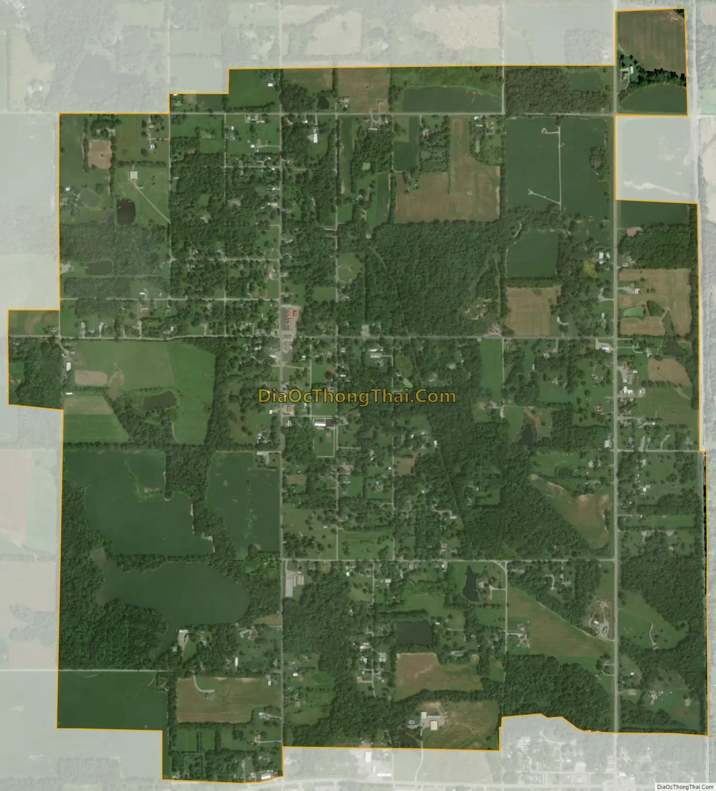
North City city Satellite Map
Geography
North City is located in western Franklin County at 37°59′35″N 89°3′56″W / 37.99306°N 89.06556°W / 37.99306; -89.06556 (37.993129, -89.065547). It is bordered to the south by the city of Christopher. Illinois Route 148 passes through the eastern side of the village, leading north 2.5 miles (4.0 km) to Valier, north 7 miles (11 km) to Sesser, and south through Christopher 7 miles (11 km) to Zeigler. Illinois Route 14 runs just south of North City, leading east 7.5 miles (12.1 km) to Benton, the Franklin County seat, and west 12 miles (19 km) to Du Quoin.
According to the 2010 census, North City has a total area of 2.236 square miles (5.79 km), of which 2.18 square miles (5.65 km) (or 97.5%) is land and 0.056 square miles (0.15 km) (or 2.5%) is water.
See also
Map of Illinois State and its subdivision:- Adams
- Alexander
- Bond
- Boone
- Brown
- Bureau
- Calhoun
- Carroll
- Cass
- Champaign
- Christian
- Clark
- Clay
- Clinton
- Coles
- Cook
- Crawford
- Cumberland
- De Kalb
- De Witt
- Douglas
- Dupage
- Edgar
- Edwards
- Effingham
- Fayette
- Ford
- Franklin
- Fulton
- Gallatin
- Greene
- Grundy
- Hamilton
- Hancock
- Hardin
- Henderson
- Henry
- Iroquois
- Jackson
- Jasper
- Jefferson
- Jersey
- Jo Daviess
- Johnson
- Kane
- Kankakee
- Kendall
- Knox
- La Salle
- Lake
- Lake Michigan
- Lawrence
- Lee
- Livingston
- Logan
- Macon
- Macoupin
- Madison
- Marion
- Marshall
- Mason
- Massac
- McDonough
- McHenry
- McLean
- Menard
- Mercer
- Monroe
- Montgomery
- Morgan
- Moultrie
- Ogle
- Peoria
- Perry
- Piatt
- Pike
- Pope
- Pulaski
- Putnam
- Randolph
- Richland
- Rock Island
- Saint Clair
- Saline
- Sangamon
- Schuyler
- Scott
- Shelby
- Stark
- Stephenson
- Tazewell
- Union
- Vermilion
- Wabash
- Warren
- Washington
- Wayne
- White
- Whiteside
- Will
- Williamson
- Winnebago
- Woodford
- Alabama
- Alaska
- Arizona
- Arkansas
- California
- Colorado
- Connecticut
- Delaware
- District of Columbia
- Florida
- Georgia
- Hawaii
- Idaho
- Illinois
- Indiana
- Iowa
- Kansas
- Kentucky
- Louisiana
- Maine
- Maryland
- Massachusetts
- Michigan
- Minnesota
- Mississippi
- Missouri
- Montana
- Nebraska
- Nevada
- New Hampshire
- New Jersey
- New Mexico
- New York
- North Carolina
- North Dakota
- Ohio
- Oklahoma
- Oregon
- Pennsylvania
- Rhode Island
- South Carolina
- South Dakota
- Tennessee
- Texas
- Utah
- Vermont
- Virginia
- Washington
- West Virginia
- Wisconsin
- Wyoming