Northbrook is a suburb of Chicago, located at the northern edge of Cook County, Illinois, United States, on the border of Lake County. Per the 2020 census, the population was 35,222.
When incorporated in 1901, the village was known as Shermerville in honor of Frederick Schermer, who donated the land for its first train station. The village changed its name to Northbrook in 1923 as an effort to improve its public image. The name was chosen because the West Fork of the North Branch of the Chicago River runs through the village.
Glenbrook North High School, founded in 1952 as Glenbrook High School, is located in Northbrook. The village is also home to the Northbrook Park District, the Northbrook Court shopping mall, the Ed Rudolph Velodrome, the Chicago Curling Club, and the Northbrook Public Library.
| Name: | Northbrook village |
|---|---|
| LSAD Code: | 47 |
| LSAD Description: | village (suffix) |
| State: | Illinois |
| County: | Cook County |
| Incorporated: | 1901 |
| Elevation: | 646 ft (197 m) |
| Total Area: | 13.30 sq mi (34.46 km²) |
| Land Area: | 13.24 sq mi (34.29 km²) |
| Water Area: | 0.07 sq mi (0.17 km²) 0.45% |
| Total Population: | 35,222 |
| Population Density: | 2,660.27/sq mi (1,027.12/km²) |
| Area code: | 847/224 |
| FIPS code: | 1753481 |
| Website: | www.northbrook.il.us |
Online Interactive Map
Click on ![]() to view map in "full screen" mode.
to view map in "full screen" mode.
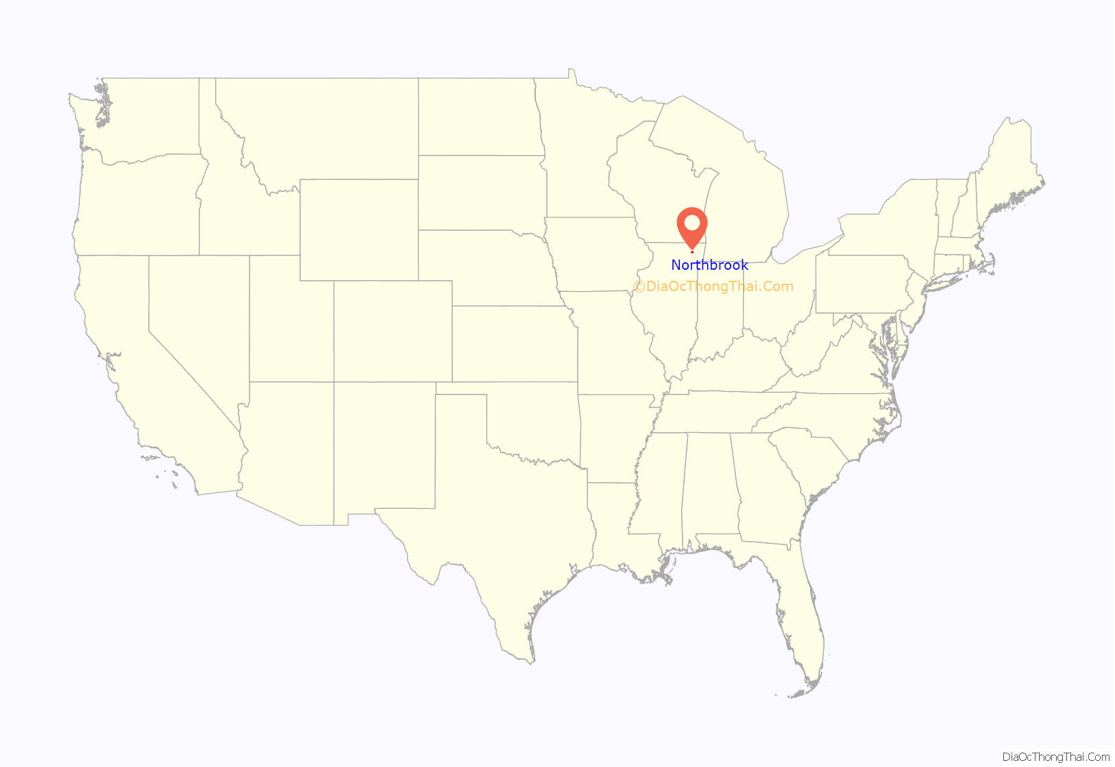
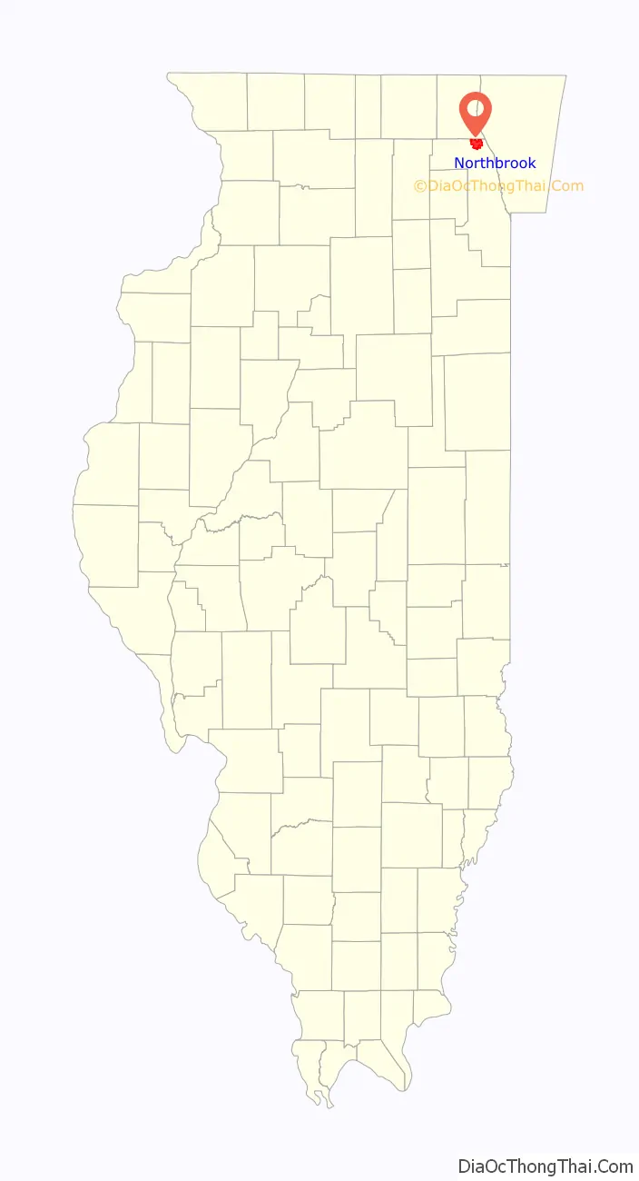
Northbrook location map. Where is Northbrook village?
History
Members of the Potawatomi tribe were the earliest recorded residents of the Northbrook area. After signing the 1833 Treaty of Chicago, the Potawatomi ceded their Illinois lands and moved to a place near Council Bluffs, Iowa. Afterward, Joel Sterling Sherman moved from Connecticut with his family and bought 159 acres (64 ha) of land in the northwest quarter of Section 10 for $1.25 per acre; as of 2010, Northbrook’s downtown is located on this site. A German immigrant named Frederick Schermer donated a portion of the land he bought from Sherman to be used for the town’s first railroad station, which was named after him. By the 1870s, Shermerville (which also took its name from Shermer) was a farming community. In 1901 the community was incorporated as the Village of Shermerville after a close referendum for incorporation. At the time of incorporation, it had 311 residents and 60 houses. In these early years, Shermerville became notorious for rowdy gatherings at its five saloons; by 1921, therefore, residents believed that the name “Shermerville” had a negative reputation and sought to change it. A renaming contest was held, and the name “Northbrook” was submitted by the US postmaster (and then President of the National Rural Letter Carriers’ Association) Edward Landwehr. Edward Landwehr was the son of Herman and Anna Helene Landwehr, both German immigrants and early settlers in the community and for whose family Landwehr Road in Northbrook is named. In 1923 “Northbrook”, the winning name, was adopted. At the time, Northbrook had 500 residents. Later on, after the end of World War II, Northbrook’s population began to rapidly increase. In 1997, President Bill Clinton visited Northbrook to congratulate the 8th-grade students of Northfield Township (which is mainly Northbrook) for getting the highest score on a world science test, and for getting the second-highest score on a world math test. Between 1950 and 1980, the town’s population rose from 3,319 to 30,735. Northbrook was the first community not bordering Lake Michigan to filter Lake Michigan water for public use. Owing to the suburbanization of the community, the last working farm in Northbrook, the Wayside Farm, was sold and closed in 1987.
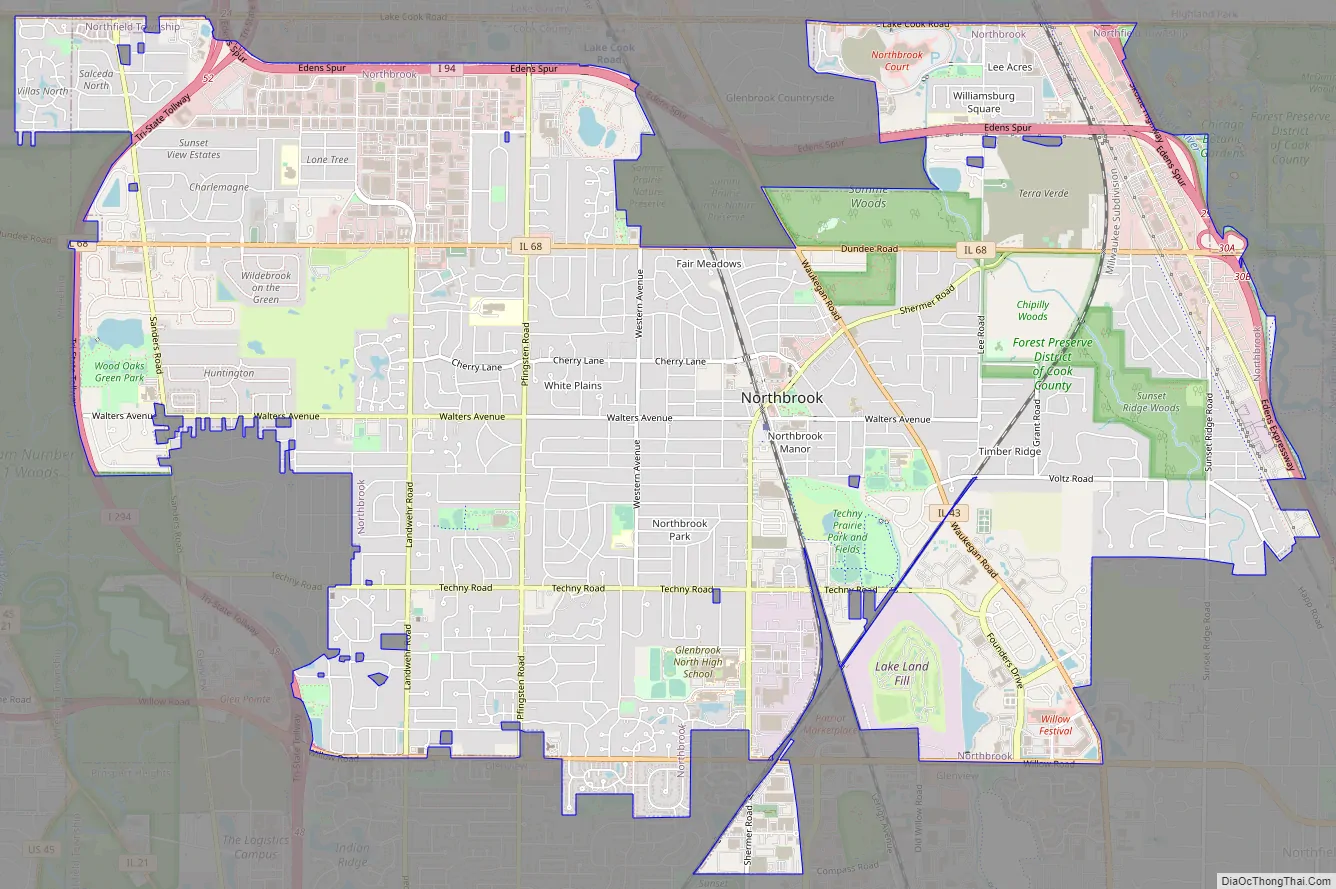
Northbrook Road Map
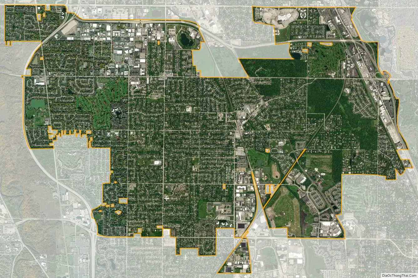
Northbrook city Satellite Map
Geography
Northbrook is located at 42°7′45″N 87°50′27″W / 42.12917°N 87.84083°W / 42.12917; -87.84083 (42.129226, −87.840715).
According to the 2021 census gazetteer files, Northbrook has a total area of 13.31 square miles (34.47 km), of which 13.24 square miles (34.29 km) (or 99.51%) is land and 0.07 square miles (0.18 km) (or 0.49%) is water.
Northbrook is generally considered to be a part of the Chicago North Shore.
See also
Map of Illinois State and its subdivision:- Adams
- Alexander
- Bond
- Boone
- Brown
- Bureau
- Calhoun
- Carroll
- Cass
- Champaign
- Christian
- Clark
- Clay
- Clinton
- Coles
- Cook
- Crawford
- Cumberland
- De Kalb
- De Witt
- Douglas
- Dupage
- Edgar
- Edwards
- Effingham
- Fayette
- Ford
- Franklin
- Fulton
- Gallatin
- Greene
- Grundy
- Hamilton
- Hancock
- Hardin
- Henderson
- Henry
- Iroquois
- Jackson
- Jasper
- Jefferson
- Jersey
- Jo Daviess
- Johnson
- Kane
- Kankakee
- Kendall
- Knox
- La Salle
- Lake
- Lake Michigan
- Lawrence
- Lee
- Livingston
- Logan
- Macon
- Macoupin
- Madison
- Marion
- Marshall
- Mason
- Massac
- McDonough
- McHenry
- McLean
- Menard
- Mercer
- Monroe
- Montgomery
- Morgan
- Moultrie
- Ogle
- Peoria
- Perry
- Piatt
- Pike
- Pope
- Pulaski
- Putnam
- Randolph
- Richland
- Rock Island
- Saint Clair
- Saline
- Sangamon
- Schuyler
- Scott
- Shelby
- Stark
- Stephenson
- Tazewell
- Union
- Vermilion
- Wabash
- Warren
- Washington
- Wayne
- White
- Whiteside
- Will
- Williamson
- Winnebago
- Woodford
- Alabama
- Alaska
- Arizona
- Arkansas
- California
- Colorado
- Connecticut
- Delaware
- District of Columbia
- Florida
- Georgia
- Hawaii
- Idaho
- Illinois
- Indiana
- Iowa
- Kansas
- Kentucky
- Louisiana
- Maine
- Maryland
- Massachusetts
- Michigan
- Minnesota
- Mississippi
- Missouri
- Montana
- Nebraska
- Nevada
- New Hampshire
- New Jersey
- New Mexico
- New York
- North Carolina
- North Dakota
- Ohio
- Oklahoma
- Oregon
- Pennsylvania
- Rhode Island
- South Carolina
- South Dakota
- Tennessee
- Texas
- Utah
- Vermont
- Virginia
- Washington
- West Virginia
- Wisconsin
- Wyoming


